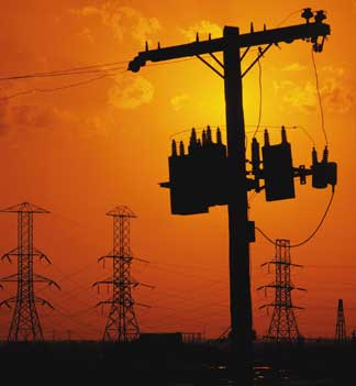
The Sun Also Surprises. Most of take the solar-certainty of the sun for granted. It's always there - it always shines (even though we may not be able to see it). And yet scientists tell us about major storms on the sun, mercifully rare. The last big solar storm was in 1921, before the national power grid was streaming electricity into every U.S. household. A similar solar storm might produce as much as $2 trillion worth of damage today, and take years for the electrical grid to recover. One precaution that could mitigate much of the damage: surge protectors for every one of nearly 5,000 transformers across North America, to the tune of $50,000 a pop. Estimated cost to insure against blackouts that could last for months: $250 million. Bills are in front of Congress to do just that - after reading this story in the New York Times I'm starting to think this might be a worthy insurance policy. By the way - the next solar maximum is forecast to arrive in late 2012.
 Lucky Shooting Stars. Have you seen the Perseids yet? We are in the middle of what may be the most prolific and potentially spectacular meteor shower of the entire year. Amateur astronomer Henry Jun Wa Lee captured some some amazing timelapse video clips of the Perseids in this clip - be sure to click on the HD button to see this full-screen. The next couple of nights will bring perfect viewing conditions: great visibility, far less water and haze in the air - nearly unlimited visibility. Give it a shot.
 Pakistan Flooding From Space. More than 16" of rain fell on northwestern Pakistan in late July, the result was the worst flooding in at least 80 years. Nearly a fifth of the country remains submerged underwater - this high-resolution NASA "Terra" satellite image shows the Indus River out of its banks in the town of Sukkur, Pakistan.
 Tornado In Unlikely Places, Part IV. Tornadoes in Europe are rare, but not so this summer. This YouTube video shows a tornado that ripped across Germany, in the Baltic region near the border with Poland (very close to the area where Werner Von Braun developed his V2 rockets). Truly an amazing sight.
____________________________________________
Paul's SC Times Outlook for St. Cloud and all of central Minnesota
Today: Bright sun, cool breeze - more like late September out there. Winds: NW 10-20+ High: 71
Wednesday night: Clear and chilly, light jacket weather late. Low: 46 (low 40s in some of the outlying suburbs).
Thursday: Day #1 of the Minnesota State Fair. Blue sky, a bit milder (less wind). High: 77
Friday: Mostly sunny, feels like summer again. High: 82
Saturday: Hazy sun, sticky and dry - feels like mid July. Winds: S 15-25+ High: 87
Sunday: Partly sunny, still muggy - T-storms over far northern/western MN. High: 86
Monday: Unsettled with showers and T-storms rumbling into town. High: 83
Tuesday: Showers and storms linger as front stalls nearby, locally heavy rain. High: 81
____________________________________________
Now this is more like it! Turn the A/C off and leave it off for the next 24-36 hours. Canada is leaking fresh air and it will look and feel more like the third week of September out there today: a brilliant blue sky, a fresh breeze, dew points in the 40s (meaning HALF as much water vapor floating over our heads as we experienced back on Monday). Temperatures will just barely break through the 70-degree mark, about 5-10 degrees cooler than average statewide. Light jackets will be needed up north early today, again first thing Thursday morning. But keep the shorts handy - you'll need them again by the weekend as temperatures soar into the 80s on gusty south winds.
It's hard to believe that the Minnesota State Fair kicks off tomorrow, the 12 best days of summer, another milestone in our year, a great tradition for so many families in Minnesota (and all over the Upper Midwest for that matter). That's one of the things I really appreciate about Minnesota: the events that help to define us, everything from the Fishing Opener to Aquatennial to the State Fair, Renaissance Festival and Deer Hunting Opener. Growing up out east we just didn't have these outdoor celebrations - we had "flea markets" and farmers markets, but nothing on this scale, nothing approaching the variety, pomp and ceremony of Minnesota's defining events. There was no such thing as going "up north." A few times a summer we loaded up the station wagon and drove 2-3 hours to the Jersey Shore, where we often had to dodge jellyfish, syringes and occasional hurricanes. It really puts things in perspective for me. No, I don't take the whole up-north experience for granted. The State Fair is another marker, another way we measure the passage of time. We don't remember all the details of every day, but most of us remember what we did at the fair on a given year, who we were with, the FOOD we tried, the bands we saw, the amazing people-watching (only Las Vegas has better people-watching than the Minnesota State Fair). Don't believe me? Just sit on a bench for 15 minutes and watch the people wander by. It's a spectacle alright. More deep-fried memories are imminent...
It's nice to be able to exhale here in the weather department, not to run over to the Doppler every few minutes in search of rotation "sheer markers", tip-offs of severe, rotating thunderstorms capable of tornadoes. It's been that kind of summer - but this week we all get a well-deserved break. A bubble of high pressure passes right over Minnesota today, winds ease up (a little), but strong jet stream winds blowing relatively close to the ground will still whip up some 20 mph. gusts this afternoon. Winds turn around to the south Thursday and Friday, gusting from 15-30 mph. at times - pumping warmer, hazier, stickier air back into the state. Yes, it will feel like summer again as early as Friday, and yet another lake-friendly weekend is shaping up for Minnesota, highs well up into the 80s, a gusty south wind whipping up a little chop on your favorite northern lake. 90 is not out of the question, especially Sunday. Don't underestimate the potential to work up a little late-August sweat.
An eastbound cool front shoves T-storms back into Minnesota by Monday of next week, the front may (temporarily) stall nearby, prolonging heavy showers and assorted storms into Tuesday before we cool down again the latter half of next week. Severe weather? Too early to say, but I wouldn't rule it out early next week. I doubt we've seen the last of the severe storms this year, based on recent trends, but no weather worries, no atmospheric hassles looking out through Sunday. 6 dry days in a row? That hasn't happened in a long, long time...

 National Weather Service at the Fair. If you're looking for something to do (in-between the various food booths) at this year's fair: consider checking out the interactive booth put on by the National Weather Service in Chanhassen. It includes a tornado simulator (!) and a lightning globe. If you have a child interested in meteorology you might want to pay them a visit. Nothing like hands-on demonstrations to ignite a passion in a budding soon-to-be meteorologist. More on the upcoming displays here.
 Tsunami Threat Looms Over Pacific Northwest. You often hear about the San Andreas fault slicing across California, but the northwestern USA has it's own matrix of faults. Specifically the Cascadia subduction zone shakes, on average, every few hundred years. Quakes centered offshore are often followed by massive tsunamis, tidal waves reaching as high as 15 feet. Records show that 20 earthquake-triggered tsunamis have struck in the last 1,000 years, an average of one major tsunami every 500 years. The last one? January 26, 1700. The region is due for a major shake - and some communities are considering building concrete-reinforced structures, tsunami evacuation centers, which could house as many as 1,000 local residents in the event of a major tremor and subsequent tsunami. The story at Discovery News is here.
 Hurricane Danielle. I know I'm going to sound like an enormously deranged weather geek - but there is something hauntingly beautiful about a hurricane - at least from space. It looks like some sort of sprawling alien organism, almost as if it was a breathing, mutating creature from the Great Beyond (I think I need to get more sleep, maybe cut back on my sugar intake). Not sure, but after checking out this satellite loop I hope you see (a glimmer) of what I'm talking about. This is from the GOES-15 weather satellite in "rapid scan mode", sort of like a satellite loop on steroids. What's the number for 911 again?
 Why Pakistan Monsoons Support Evidence of Global Warming. This is an opinion piece from Lord Julian Hunt, who is connecting the dots, examining the longterm climatology of India and Pakistan and ardently believes that the record monsoons that have swept across this region in recent years are not a coincidence. Even climate skeptics acknowledge a 4% increase in water vapor worldwide in the last 30 years. There is simply more water floating overhead, which loads the dice in favor of more extreme flooding events around the planet.

Katrina: A Satellite Retrospective. Weather satellites have revolutionized the detection, tracking and forecasting of hurricanes; the technology has come a long way since the first (Tiros-1) grainy, black and white satellite image was taken in 1961. Click here to read a story about how meteorologists rely on a constellation of high-orbiting and low-orbiting satellites to assess the severity of hurricanes - new sensors can allow them to literally peer through the canopy of thunderheads and estimate everything from wind speeds to rainfall rates in 3-D.
 Crews Working to Battle Southern Idaho Wildfire. Fire season is here - already flames have scorched a 510-square-mile section of southern Idaho, roughly the size of greater L.A. The story is here.
 Weather Wars. Why do so many TV meteorologists continue to deny anthropogenic (man-made) global warming? Mistrust in computers? True, we've all been burned by computer models over the years - but it's something more than that, it seems. TV meteorologists are the local science ambassadors in each city - they should be representing mainstream science and taking their cues from professional climate scientists who study long-term atmospheric trends. But instead of deferring to a cadre of climate Phd's they often substitute personal opinion and recycled talk-radio ideology for science - which baffles me. If 97% of all doctors have pretty much the same diagnosis odds are I'm going to agree with their reasoned opinion. But since everyone experiences "weather" everyone has an opinion about climate. And that's the problem: too many opinions and conspiracy theories - ideology has replaced sound science. That's one reason why we've gotten into the mess we're in. So much disinformation and misinformation out there right now - it's hard for the average clear-minded, rational consumer to know what's really going on. Check out this short video which sums up the very real divide between some TV meteorologists and climate scientists, in this case one of the world's foremost experts on hurricanes, MIT's Kerry Emanual. (note: not too many Twin Cities TV meteorologists are speaking out about climate change, and those that have are "skeptical....believe it's all politics, etc etc." This is going to be one of the 2 or 3 biggest stories of the 21st century, along with terrorism and weaning ourselves off of fossil fuels. We HAVE to start talking about this, acknowledging that the atmosphere is warming, extreme weather events are spiking worldwide - and figuring out the most cost-effective, rational way to deal with this. Politicians can only hide for so long - at some point, fairly soon, there will be a day of reckoning, a moment of truth, a climate calamity that rivals the financial meltdown of 2008. It's coming - and we are not even close to being prepared for that day. I hope I'm wrong. But this summer's endless litany of weather and climate disasters has been a preview of coming attractions - this is the tip of the [melting] iceberg).
No comments:
Post a Comment