71 F. average high on May 24.
82 F. high on May 24, 2015.
.27" rain fell at KSTC yesterday. Eau Claire reported .70" of rain.
May 24, 1925: After seeing a high of 99 degrees two days earlier, the Twin Cities picked up a tenth (.10) of an inch of snow.
May 24, 1908: Tornadoes hit the counties of Martin and Blue Earth. Source: MPX National Weather Service.

Paying Our Respects
Saturday our pontoon wouldn't start, a stiff wind blowing us across the lake. No AAA to save us. A boater puttered over and gave us a tow - a good Samaritan, happy to help. "Lake rules" he laughed, accepting compensation in the form of cold beer.
We love the water - but we've had rotten luck with boats. A 33-footer sank in 2010, another pontoon swept off its lift, drifting for days before the sheriff returned it to our dock.
"Dad, please don't repeat these stories. I'm in the Navy. It's embarrassing" my Naval Academy grad groaned. Sorry son. My life is a cautionary tale.
When you have a child in the military you watch the news very differently. Suddenly Iraq, Iran and the South China Sea are too close for comfort. You flinch when your phone rings late at night.
Take time to thank enlisted, veterans and their families today. Take nothing for granted, especially our freedom.
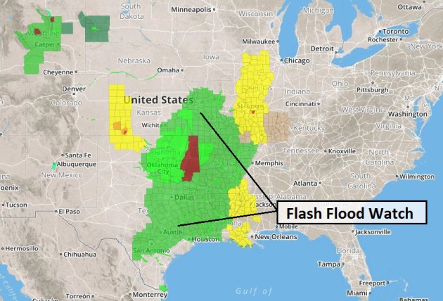
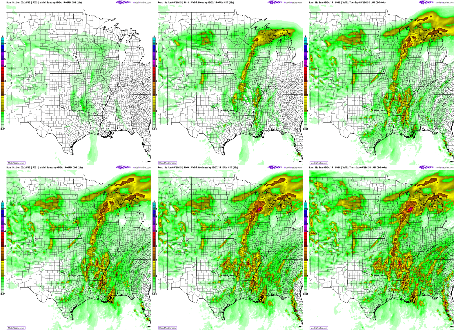
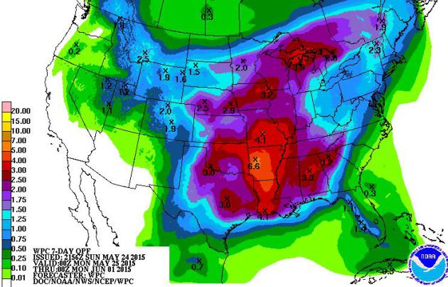
Showers & T-storms linger into Tuesday; more drought-busting rains. The timing could have been better but we do need this moisture.
The boundary separating steamy from comfortable hovers overhead into next week, sparking more waves of thunderstorms as the drought eases.
Have a terrific Memorial Day.
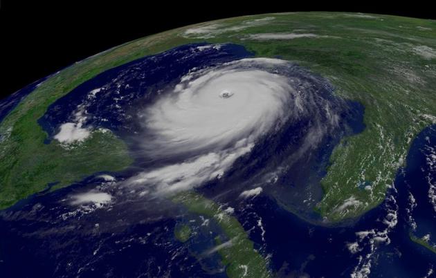
Decade After Katrina, Pointing Finger More Firmly At Army Corp.
As is usually the case in a massive disaster, there was no one smoking
gun, but rather a cascade of events, only some of which could have been
anticipated in advance. Here's the intro to a story at The New York Times: "Nearly 10 years on, one might assume that the case of Hurricane Katrina
is closed. That the catastrophic flooding of this city was caused not
merely by a powerful storm but primarily by fatal engineering flaws in
the city’s flood protection system has been proved by experts,
acknowledged by the United States Army Corps of Engineers and underscored by residents here to anyone who might suggest otherwise..." (Image: NOAA).
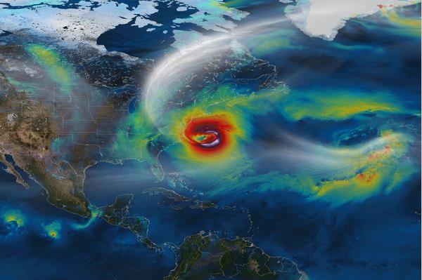
Hurricane Expert: "New England Really Gets It In The Teeth" As Climate Warms.
Will warmer ocean and a continued northward shift in weather patterns
impact hurricane frequency or intensit over New England? Forbes has an interesting article and interview; here's an excerpt: "...Instead
of using weather observations from the field, researchers can
substitute conditions predicted by global climate models—wind conditions
and thermodynamic conditions of the sea and air in a hypothetical
climate warmed by greenhouse gas emissions. And that has empowered
Emanuel to predict in some detail how hurricanes may behave in a warmer
climate. If the models prove correct—a big if—New England faces a stormy ride as the climate warms this century...." (Image: NASA).
Last year was the hottest since 1850, according to the World Meteorological Organisation (WMO), part of what it said is a continuing trend.
According to the US National Oceanic and Atmospheric Administration (NOAA), May 2014 to April 2015 is the joint-warmest 12-month period in 136 years.
Those figures could rise further if the weather phenomenon known as El Nino continues to intensify, as scientists RTCC has spoken to believe it will.
- See more at: http://www.rtcc.org/2015/05/21/el-nino-likely-to-ensure-2015-breaks-warming-records/#sthash.ALmaQ1Uu.dpuf

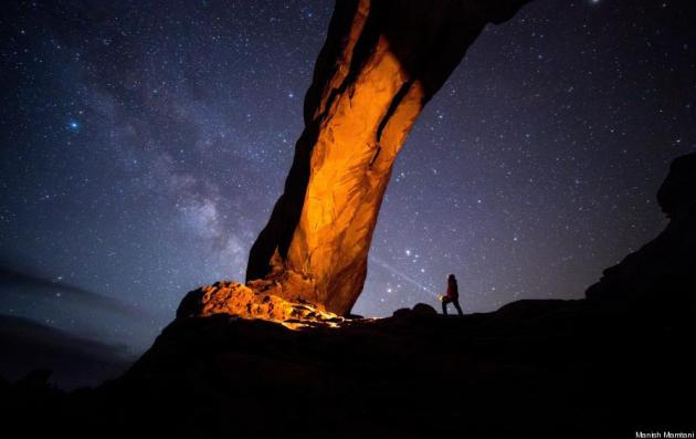
Photo credit above: "I was out in the Arches National Park to take night pictures, but the clouds moved in. I waited for about two hours in the car and finally the sky cleared and I got this image." Photograph and caption by Manish Mamtani/National Geographic Traveler Photo Contest.


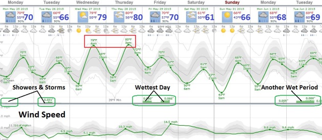
MEMORIAL DAY: A few showers and T-storms likely, damp most of the day. Winds: SW 15. High: 68
MONDAY NIGHT: Showers begin to taper. Low; 57
TUESDAY: Sunny start, PM T-storm possible, especially up north. High: 72
WEDNESDAY: More sun, feels like summer again. Wake-up: 59. High: 80
THURSDAY: Sticky sunshine, a taste of July. Dew point: 62. Wake-up: 62. High: 82
FRIDAY: Showers and T-storms likely. Wake-up: 60. High: 72
SATURDAY: Partly sunny, cooler, less humid. Wake-up: 53. High: 66
SUNDAY: Plenty of sun, quite pleasant. Wake-up: 47. High: near 70
Climate Stories...

No comments:
Post a Comment