47 F. morning low at St. Cloud Tuesday.
73 F. afternoon high yesterday at KSTC.
78 F. average high on August 25.
77 F. high on August 25, 2014.
August 25, 1976: Roy Lake Fire. 2,600 acres burned during drought.
August 25, 1875: Tornado strikes near Hutchinson.
Weather Perfection"Paul,
don't editorialize about the weather, just give me the forecast!" Good
weather is in the eye of the beholder, I guess. What pleases a farmer
might irritate a golfer, boater or commuter. It's hard keeping all the
people happy all the time.
But I think we can agree that today's
postcard-perfect sky and fresh breeze is something to be celebrated.
Even your cranky uncle may crack a smile as temperatures plateau in the
mid-70s with unlimited visibility and a September-like dew point that
will beckon you outside for a 2-hour lunch.
Go for it.
Clouds increase
tomorrow;
a southerly flow on the backside of today's magical high-pressure
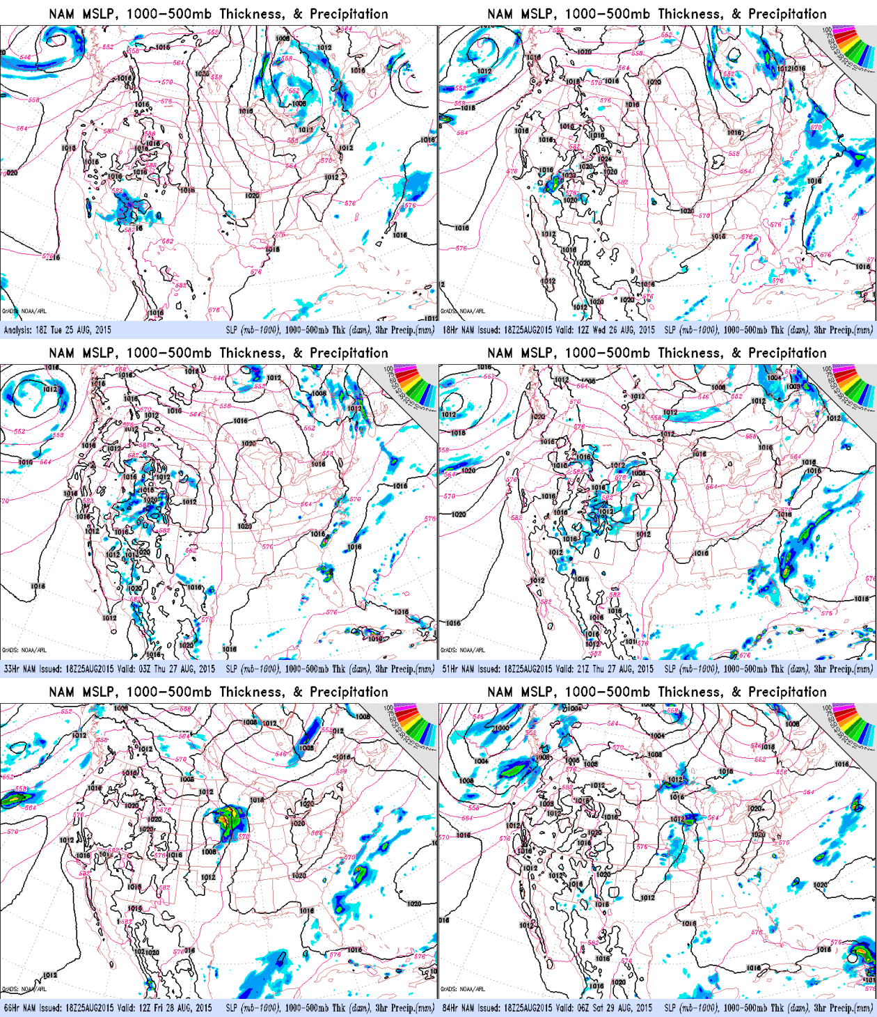
bubble will pump moisture north; the NAM model prints out 2-3 inches of
rain
Friday.
Normally I'd be suspicious, but the way this summer is going, with
strong hints of June in August, anything goes.
Have a Plan B
Friday but
Saturday should be sunny and comfortable at the Minnesota State Fair. By
Sunday it will feel like August again, with mid-80s.
The Mixed-Up Summer of '15 spills over into September; I still see a few 90-degree days from
September 3-8 as the heat wave that's been suffocating the west migrates eastward.
Sweat-on-a-stick! Yum.
 Heavy Rain Event on Friday?
NOAA's 12 KM NAM and the higher-resolution 4 KM WRF bring in a swirl of
convection late Thursday night into Friday, the northern edge of the
heaviest rain bands lining up with the deformation zone, possibly
prolonging heavy showers and T-storms into much of Friday. Not sure
we'll see 2-3" of rain, but it may be a fairly soggy day. Skies should
clear in time for fair activities on Saturday.
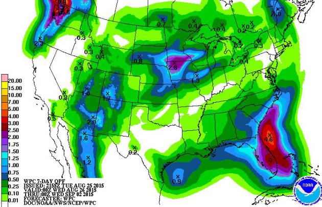
 7-Day Rainfall Potential.
Tropical rains associated with Tropical Storm Erika may approach the
southeast coast of the USA within 5-7 days, although there is still a
high level of uncertainty about inevitable track and intensity. Friday's
rainfall event is forecast to be heaviest over northern Iowa and
southern Minnesota, where a few inches of rain can't be ruled out.
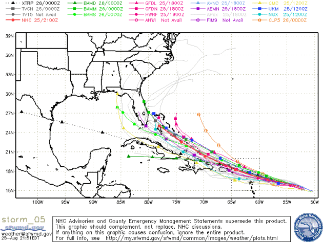
 Erika's Projected Path.
The models are in fairly good, tight alignment taking Erika toward the
west-northwest, on a track which should take the storm just north of
Puerto Rico and Cuba, possibly threatening the Bahamas as a Category 1
storm within 6-7 days. Stay tuned.
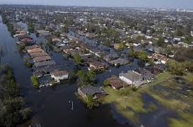
Flood Damage After Katrina Could Have Been Prevented, S&T Expert Says. Hindsight is always 20/20 but hubris and overconfidence often has tragic consequences. Here's an excerpt from
Missouri S&T News and Events: "...
The
journal article focuses on the U. S. Army Corps of Engineers and its
lack of external peer reviews that allowed for faulty flood walls to be
installed in the city. It pinpoints the key factors that led to the
walls’ failure and the actions taken years before the disaster that
allowed the engineering oversights to occur. “As more information has
emerged from the time of the disaster and its prior decision-making
processes, new details allow us to have a better idea of the situation
and what led to the various levee failures,” says Rogers. “This article
is meant to put the record straight about the conclusions people drew
from the disaster, many of which were based on incorrect information...”
10 Years After Katrina Louisiana Is Becoming a Model for Climate Resilience.
Huffington Post has the story; here's the intro: "
A
decade after Hurricane Katrina devastated coastal Louisiana, forcing
1.5 million residents to evacuate and causing $100 billion in damage,
the region is becoming a model for climate change adaptation planning --
even if some people in the state still don't want to say the "c" word.
Louisiana's governor, long-shot Republican presidential candidate Bobby
Jindal, has been non-committal on climate change. He'll acknowledge it's happening, but
says he's uncertain how much humans are to blame. Nevertheless,
Louisiana officials have been planning for rising temperatures and the
cascading impacts climate change will have on the state, from rising
seas to potentially more dangerous storms..."
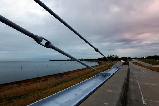
Photo credit above:
Gerald Herbert/Associated Press. "This Nov. 26, 2012, photo shows a flood wall and floodgate along Lakeshore Drive and Lake Pontchartrain in New Orleans."
10 Life Lessons We Learn To Late. A few nuggets of wisdom in this post at Next Avenue; here's an excerpt:
1. Time passes much more quickly than you realize.
2. If you don’t take care of your body early then it won’t take care of you later. Your world becomes smaller each day as you lose mobility, continence and sight.
3. Sex and beauty may fade, but intimacy and friendship only grow.
4.
People are far more important than any other thing in your life. No
hobby, interest, book, work is going to be as important to you as the
people you spend time with as you get older....
NASA Debunks Asteroid Strike Rumors. Well that's a relief. Gizmag has details: "It
turns out there's no need to worry about an asteroid impact
interrupting your plans next month. Responding to recent rumors that an
asteroid will crash near the island of Puerto Rico between September 15
and 28, NASA has issued a statement categorically stating that this will
not happen. "There is no scientific basis – not one shred of evidence –
that an asteroid or any other celestial object will impact Earth on
those dates," says Paul Chodas, manager of NASA's Near-Earth Object
office at the Jet Propulsion Laboratory in Pasadena, California..."
TODAY: Sunny. Too nice to work. Winds: N 5-10. High: 75
TONIGHT: Clear and cool. Low: 56
THURSDAY: Clouds increase, late thunder? High: 78
FRIDAY: Wettest day in sight. Showers and T-storms, some heavy. Wake-up: 61. High: 72
SATURDAY: More comfortable day of the weekend. Partly sunny, good fair weather. Wake-up: 58. High: 77
SUNDAY: Sunny and warmer. DP: 61. Wake-up: 60. High: 83
MONDAY: Hot and sticky. Feels like August again. Wake-up: 63. High: 85
TUESDAY: Some sun, few T-showers pop up. Wake-up: 64. High: 86
Climate Stories...
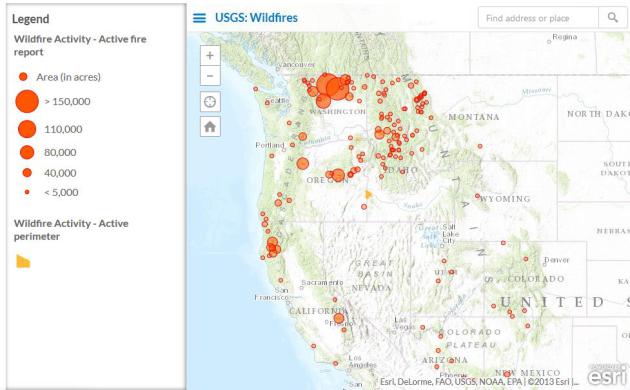
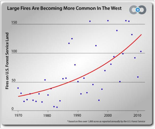
Climate Change and Western Wildfires. Here's an excerpt from
Climate Nexus: "
There
are 72 large wildfires currently burning in the continental U.S. More
than 90 percent of these fires are clustered in the Northwest. The
region has experienced persistent high temperatures and low
precipitation all year - a combination that has fueled an extreme
wildfire season. A growing and persuasive body of research draws a
compelling link between wildfire trends and climate change, and the
risks are especially severe in western North America..."
When Firefighters Speak Out on Climate Change, We Ought To Listen Up. Here's a snippet from a
Guardian post: "...
The
sooner that firefighting agencies, public officials, policymakers and
citizens acknowledge the impact that climate change is having on the
frequency, intensity, duration and behavior of fire, the sooner that
they will begin to develop new responses to wildland fire in the US
west. Doing so will mean admitting that climate change is also
disrupting the capacity of firefighting organizations to respond. They
were created to snuff out fires based on what were perceived to be
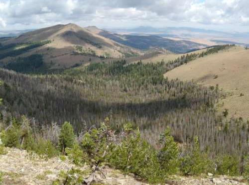
static weather patterns – the old normal..." (Graphic: Climate Central).
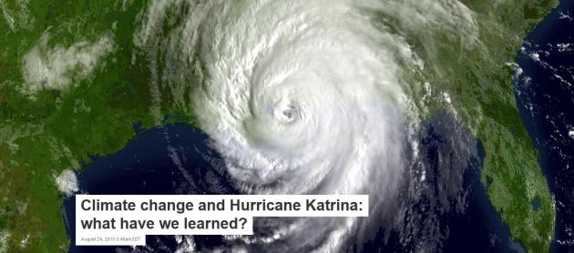
Climate Change and Hurricane Katrina: What Have We Learned? Here's an excerpt of a story at
The Conversation, written by MIT Professor of Atmospheric Science, Kerry Emanuel: "...
An
obvious point is that slowly rising sea levels increase the probability
of storm-induced surges even when the statistics of the storms, such as
top wind speed, themselves remain stable. Storm surges are physically
the same thing as tsunamis but driven by wind and atmospheric pressure
rather than the shaking seafloor, and they typically arrive near the
peak of the storm’s fury. As with Katrina and Sandy, they are often the
most destructive aspects of hurricanes. Had Sandy struck New York a
century ago, there would have been substantially less flooding, as sea
level was then roughly a foot lower. As sea level increases at an accelerating pace, we can expect more devastating coastal flooding from storms..."
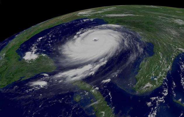
Hurricane Katrina Showed What "Adapting to Climate Change" Looks Like. Here's a clip from a Dave Roberts story at
Vox: "...
First
is the fact that people are extremely bad at envisioning inclement
circumstances they haven't experienced or witnessed. We are generally
familiar with natural disasters as rare and extraordinary one-offs. This
leads people intuitively to underplay both the severity of the damages
climate change threatens and the effort and expense required to prepare
for them. In fact, if climate change remains unchecked, there will be
multiple simultaneous disasters: heat waves, droughts in key
agricultural areas, rising sea levels and more frequent floods, food
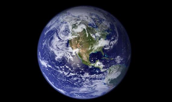
shortages, resource conflicts, and mass migrations..." (Image: NOAA, NASA).
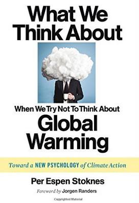
How Do We Get People To Care About Climate Change? BillMoyers.com
has an interesting article that delves into the human psyche and how we
process information (we don't like). The easiest response is denial -
explaining much of the push-back we see out there today. Here's an
excerpt: "...
The question that really drives me and that fuels my
research is: Is humanity up to the task, or are we inevitably short-term
thinkers? Or to put it a bit more constructively, what are the
conditions under which humans will begin to think and act for the long
term as far as the climate is concerned? Is it possible to pinpoint the
mechanisms or functions in the human psyche that would enable us to act
for the long term? And if so, what are they and how can they be
strengthened?..."
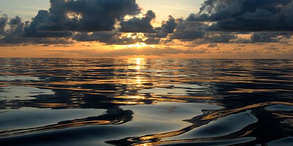
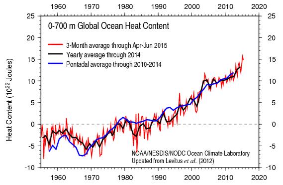
Global Ocean Heat Content. The oceans are warming - that's not a model, that's based on actual observations. Here's an excerpt from NOAA's
National Centers for Environmental Information: "
Data
distribution figures for temperature and salinity observations,
temperature and salinity anomaly fields for depths 0-2000m, heat content
and steric sea level (thermosteric, halosteric, total). Temperature
anomalies and heat content fields are detailed in World Ocean Heat Content and Thermosteric Sea Level change (0-2000 m), 1955-2010."




No comments:
Post a Comment