64 F. high temperature in St. Cloud yesterday.
65 F. average high on September 28.
72 F. high on September 28, 2015.
September 29, 1876: An abnormally cool day occurs, with a high of 45 in the Twin Cities (normally the high should be 65 this time of year).
A Chamber of Commerce-Worthy 5-Day Forecast
And here I thought a "Ryder Cup" was something male athletes wore to prevent grievous injury. My bad. I'll stick to weather, which looks miraculously pleasant into the weekend. A case of rare good timing, as the eyes of the golfing world squint in our general direction.
Once again weather patterns are falling into a holding pattern; a storm stalling over the Great Lakes will fling a few light showers into Wisconsin Saturday; otherwise our skies remain partly sunny and comfortably cool. Most of us won't see a drop of rain until Wednesday of next week. Good news for corn and soybean farmers dealing with low prices and soggy fields. Take full advantage of the next 6 days, because models hint at more puddles by the middle of next week.
Lingering warmth and a longer growing season has pushed peak fall color back 1-2 weeks. Our first frost and freeze will be delayed. The average first 32F low in the metro comes during the first week of October. Not this year.
Meanwhile residents from Florida to Maine are monitoring "Matthew". A few models bring a major hurricane up the east coast next week.
Tropical Storm Matthew. Packing 65 mph winds Tropical Storm Matthew is expected to strengthen into a hurricane in the coming days, possibly a major hurricane. Latest coordinates and official track from NOAA NHC. Satellite image courtesy of Aeris Maps Platform.
ECMWF - EPS Cyclone Locations Next 15 Days. You can see why confidence levels are still exceptionally low with Matthew. From a potential track into the Gulf of Mexico to a strike on Florida, or even veering off into the Atlantic, missing the USA altogether, I'm hoping for more clarity in the coming days.
"We have determined that the automated tipping bucket at the Waseca Airport is in error, especially the reading of 4 inches in one hour. The U of M Waseca manual gauge is about 1/2 mile away and has readings more representative of the area and what was seen on radar. The official gauge at the U of M Waseca site was 2.52 for the 21st and 7.64 inches on the 22nd for two-day total of 10.16 inches.
This event was not classified as a "mega" rain event because it only had about 300-500 square miles of six inches or more.
We did have two mega-rains in Minnesota for 2016.
July 11-12 http://www.dnr.state.mn.us/
and August 10-11 http://images.dnr.state.mn.us/
Yes, this is the first time we have seen two "mega" rains in one year, there may have been other "mega" rains before 1973 that we have not been able to document. The two events from 1866 and 1867 likely exceeded the "mega" rains that we saw this year."
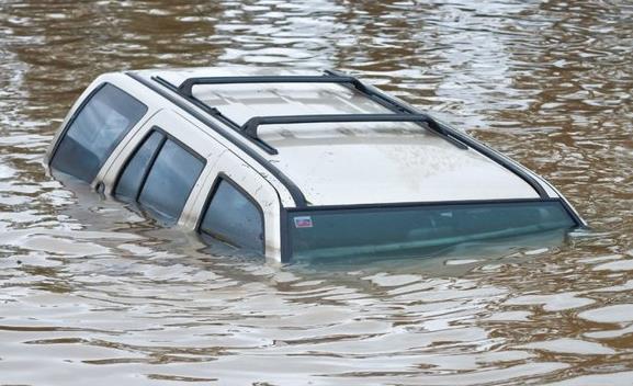
Weather-Wise, It Was a Summer of Extremes. Here's an excerpt of a summary at The Washington Post: "...Summer
featured floods that killed hundreds of people and caused more than $50
billion in losses around the globe, from Louisiana to China, India,
Europe and the Sudan. Meanwhile, droughts parched croplands and
wildfires burned in California, Canada and India. Toss in record heat
that went on and on. From June to August, there were at least 10 weather
disasters that each caused more than $1 billion in losses, according to
insurance industry tallies. With summer weather now seemingly
stretching from May to September, extreme weather in that span killed
more than 2,000 people. And that’s without a major hurricane hitting a
big U.S. city, although the Pacific had its share of deadly and costly
storms. “We’ve experienced an increasing number and a disturbing number
of weather extremes this summer,” U.S. National Weather Service Director
Louis Uccellini said..."
Photo credit: "Danny
and Alys Messenger paddle a canoe away August 16 from their flooded
home in Prairieville, Louisiana. The flooding was part of a summer that
saw a lot of extreme weather." (Max Becherer/AP).
Exclusive: This Law Could Stem The Rising Costs of Flooding. TIME has the story; here's an excerpt: "...Now a bipartisan pair of congressional representatives have introduced legislation,
shared exclusively with TIME, that is aimed at restoring the program’s
solvency—or at least bringing it closer. The legislation, called the
Repeatedly Flooded Communities Preparation Act, would require local
communities to identify properties likely to experience frequent
flooding and implement plans to reduce that risk. Those plans could take
the form of anything from voluntary buyouts—paying people to leave
their flood-vulnerable properties—to reviewing development plans to
ensure that new homes and buildings aren’t built in a flood danger zone.
Properties that experience repeated losses—flooding at least twice in a
ten-year period—have cost the federal government more than $12 billion
since 1978, according to a Pew Charitable Trusts report..." (File image: Wikipedia Commons).
Drought Dries Up Profits - Water Worries Flood Companies, Big Investors. The most precious natural resource of the 21st century? Clean water. Here's an excerpt from Forbes: "Corporate
water strategy is undergoing a major business model shift. Previously
seen as a simple regulatory hurdle, a heightened level of global water
risk combined with an increase in stakeholder transparency and more
socially and environmentally responsible consumers have corporations
turning to water stewardship.
“You can’t do anything without water, so regardless of what you
manufacture, you need water,” Will Sarni, Director and Practice Leader
of Water Strategy and Social Impact Practice at Deloitte Consulting LLP, says..."
Photo credit: Creative Commons.
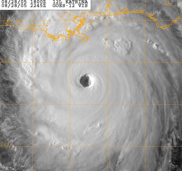
High-Tech Future Early Warning System for Hurricanes, Tornadoes and Volcanic Eruptions. Let's see if this holds up over time, but I found an article at phy.org potentially promising: "...We
essentially verified many of the results from a long-term study by the
U.S. National Oceanic and Atmospheric Administration (NOAA) - but we
substituted a ring laser in place of microphones," said Robert Dunn,
professor of physics at Hendrix College. The group's ring laser wasa
able to "clearly show the frequency spectrum of the infrasound," he
said. Specifically, they were able to detect infrasound from tornadoes
30 minutes before the tornado funnel was on the ground. The group also
determined that infrasound from a tornado can travel 1,000 kilometers -
which confirms earlier studies by NOAA..."
File image: Hurricane Katrina, NOAA.
How Those Wireless Emergency Alerts Find You. Here's an excerpt of an interesting story at The New York Times: "...The Wireless Emergency Alerts system, which allows government authorities — like local law enforcement or the Federal Emergency Management Agency
— to push out public safety warnings to mobile devices, can be
restricted to certain geographic locations. Once officials have decided
the range of the emergency zone, the alert is broadcast from the cell
towers in that designated area..."
Senate Weather Bill That Supports Forecast Improvement Can Benefit All Americans. Here's an excerpt of an Op-Ed at Capital Weather Gang: "Despite
living in a world of intense political differences, nearly everyone can
agree that timely, reliable and accurate weather information has great
value. Proposed legislation in Congress would support important advances
in weather prediction that would have enormous societal benefit. Sen.
John Thune (R-S.D.) has sponsored a “Seasonal Forecasting Improvement
Act” (S.1331), a bill that would complement the Weather Research and
Forecasting Innovation Act of 2015 (H.R.1551) already passed by the
House and sent to the Senate for consideration..."
"We
essentially verified many of the results from a long-term study by the
U.S. National Oceanic and Atmospheric Administration (NOAA)—but we
substituted a ring laser in place of microphones," said Robert Dunn,
professor of physics at Hendrix College.
The group's ring laser was able to "clearly show the frequency spectrum of the infrasound," he said. Specifically, they were able to detect infrasound from tornadoes 30 minutes before the tornado funnel was on the ground. The group also determined that infrasound from a tornado can travel 1,000 kilometers—which confirms earlier studies by NOAA.
Read more at: http://phys.org/news/2016-09-high-tech-future-early-hurricanes-tornados.html#jCp
A Complete Run-Down Of All The Times Summer 2016's Weather Turned Weird and Violent. Here's an excerpt from Wunderblog: "...45 U.S. cities saw their hottest summers on record,
according to the Southeast Regional Climate Center, and 53 additional
cities barely missed their record-hottest summer. Including U.S.
territories, the United States broke more than 8,800 daily hot nighttime
temperature records from May to September. In addition, more than 6,300
record warm minimum temperatures were tied during that same period.
Numerous cities, including Atlanta and Nashville, neared or broke records for the longest period of time spent above 70 degrees. In July, Kuwait and Iraq set new all-time temperature records for the Eastern Hemisphere; temperatures soared to a high of 129 degrees Fahrenheit..."
File Photo: August 13 Louisiana flooding, courtesy of Max Becherer, AP.
The Deepwater Horizon Spill May Have Caused "Irreversible" Damage to Gulf Coast Marshes. The Washington Post reports: "The
2010 Deepwater Horizon oil spill has been called one of the worst
environmental disasters in American history — and more than six years
later, scientists are still investigating how much damage it actually
caused. Now, a new study suggests the spill may have permanently marred
one of the Gulf shore’s most important ecosystems. The
study, published Tuesday in the journal Scientific Reports, finds the
oil spill caused widespread erosion in the salt marshes along the coasts
of Louisiana, Alabama and Mississippi. And the researchers say there’s a
chance these marshes might never completely grow back..."
Photo credit: "Oil
from the Deepwater Horizon spill floats on the water in 2010 as the sky
is reflected in sheen on Barataria Bay, off the coast of Louisiana." (AP Photo/Charlie Riedel, File.
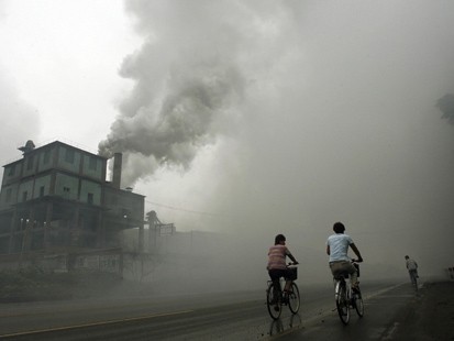
Unsafe Air Pollution Levels Affect 9 in 10 People Globally, Report Says. Here's an excerpt from TIME: "More than 90% of the world’s population lives in areas with unsafe pollution levels, according to a new report.
The research, conducted by the World Health Organization (WHO),
underscores the growing risk that air pollution poses to virtually every
demographic group across the globe. More than 6 million people died in 2012 from ailments related to air pollution, according to the WHO. “Air pollution continues take a toll on the health
of the most vulnerable populations — women, children and the older
adults,” said Flavia Bustreo, WHO assistant director general, in a
statement. “For people to be healthy, they must breathe clean air from their first breath to their last...” (File image: National Park Service).
Photo credit: "A home near Wrightwood, Calif., that was damaged when a wildfire swept through an area east of Los Angeles in August." Photo: Will Lester/The Sun/Associated Press.
The Extraordinary Decoupling Between GDP and Carbon Emissions. Quartz takes a look at some very encouraging trends: "...Because
most of our energy has historically come from fossil fuels, rising
economic growth has gone hand in hand with higher carbon emissions. But
in 2014, something extraordinary happened. Globally, carbon emissions decoupled from GDP growth.
According to the International Energy Agency, energy-related CO2
emissions were flat that year, despite an increase of around 3% in
global GDP. “This is the first time in at least 40 years that a halt or
reduction in emissions has not been tied to an economic crisis,” the IEA
said at the time..."
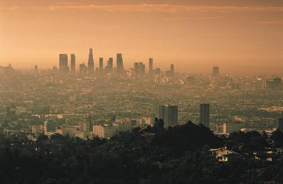
Transportation is Overtaking Electricity Generation as the Largest Source of U.S. CO2 Emissions. Here's an excerpt from The University of Michigan Energy Institute: "The
average rate at which CO2 is emitted from vehicle tailpipes and other
mobile sources has exceeded the rate of CO2 emissions from electric
power plants over seven of the past eight months. These trends indicate
that transportation will overtake electricity as the nation's largest
source of CO2 emissions this year. Electric sector CO2 emissions have
dropped greatly in recent years, declining at an average rate of 2.8
percent per year over 2007-2015. This reduction is due to the
displacement of coal by natural gas, wind and solar for power production
as well as energy efficiency gains..."
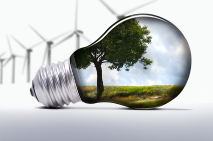
Q&A: A Venture Capitalist's View on the Clean-Tech Economy. Here's an excerpt from Midwest Energy News: "Nancy
Pfund and the Silicon Valley venture capital firm she founded take a
different approach than many of her peers. When she and her colleagues
decide whether to invest in a firm, they look not only at the underlying
market conditions, but whether the company might change the world in a
positive way. As managing partner of DBL Venture Partners in
San Francisco, Pfund helped fund such groundbreaking companies as
SolarCity, Tesla, SpaceX and Pandora. The firm is especially interested
in clean technology and sustainable products and services, ranging from
investments in solar supply-chain producers to storage companies..."

TODAY: Partly sunny, pleasant. Winds: NE 7-12. High: 67
THURSDAY NIGHT: Mostly clear and cool. Low: 49
FRIDAY: Holding pattern, comfortable sunshine. Winds: NE 5-10. High: 69
SATURDAY: AM sun, patchy PM clouds. Winds: E 5-10. Wake-up: 52. High: 68
SUNDAY: Mix of clouds and sun, probably dry. Winds: E 5-10. Wake-up: 53. High: 67
MONDAY: Partly sunny, milder breeze kicks in. Winds: SE 10-15. Wake-up: 53. High: 72
TUESDAY: Fading sun, windy and warm. Winds: SE 15-25. Wake-up: 57. High: 77
WEDNESDAY: Showers, possible thunder. Winds: SW 10-15. Wake-up: 59. High: 68
Climate Stories....
NASA Is Sinking Into the Ocean. Here's a clip from a story at Gizmodo: "...But a glorious future of bigger
and badder rockets is by no means assured. In fact, that future is
gravely threatened, not by the budget cuts that NASA speaks speaks often and candidly
about, but by climate change. If humans keep putting carbon in the
atmosphere, eventually, Kennedy won’t be sending anybody into space.
It’ll be underwater. “We are acutely aware that, in the long-term sense,
the viability of our presence at Space Coast is in question,” says Kim
Toufectis, a facilities planner in NASA’s Office of Strategic
Infrastructure..."
Photo credit: "The biggest threat to NASA is the ocean. Kennedy Space Center." Photo Courtesy NASA.
Can Religion Trump the Climate Change Deniers? Meet the Inter-Faith Environmentalists. Here's an excerpt from NewStatesman: "...But there is perhaps also another, less direct, way that religion is helping. Christian evangelicals in the US have been more likely
to be climate sceptics. Yet in inter-religious contexts, the
multiplicity of interpretations can also be an invitation to a deeper
interrogation - of the very way we form assumptions about the world.
Just look at how many takes there have been on the Noah story within
Christianity alone. Mike Hulme at Kings College London points to an
American Christian evangelical coalition which supports fossil
fuels for their ability to provide cheap energy for the poor. Others have claimed that
God’s promise to Noah not to drastically alter the earth again means
that the impact of climate change will be softened. In contrast, others
read floods as a punishment for human sin..."
Climate Change is Here: Inside the Summer of Hell and High Water. Here's an excerpt from Rolling Stone: "...As
California was gripped by fire, the hottest August in recorded history
unleashed extreme weather events in every corner of the United States.
Hawaii braced for an unprecedented "double hurricane," back-to-back
systems that barreled down on the Big Island before passing just
offshore. Then Hermine, the first hurricane to hit the Florida capital
of Tallahassee since 1985, sent tropical-storm warnings north into New
England. In Louisiana, an unnamed superstorm – a windless hurricane –
dumped up to 30 inches of rain, killing at least 13 people and
inundating more than 60,000 homes in dozens of parishes. A "weather
autopsy" led by scientists at the National Oceanic and Atmospheric
Administration linked the superstorm to climate change..."
Photo credit: "Firefighters build a fire line during the Blue Cut Fire in California's San Bernardino County in August." Patrick T. Fallon/Zuma.
Global Warming is Real, but 13 Degrees? Not So Fast. NatGeo has details: "New
research suggesting that the planet might already be committed to
vastly greater warming than previously thought is being dismissed as
deeply flawed by prominent climate scientists. A study published today
in one of the world's top science journals, Nature, offers the most
complete reconstruction to date of global sea-surface temperatures for
the past two million years—a valuable addition to the climate record,
scientists say. But the conclusions the study's author drew from that
research—that even preventing any further increase of greenhouse gases
in the atmosphere could still leave the Earth doomed to a catastrophic
temperature rise of up to 7 degrees Celsius (about 13 degrees
Fahrenheit)—isn't supported by the data, several top scientists said..."
Photo credit: "Greenland
is among the regions of the Earth that are experiencing the most rapid
changes from global warming. If a new study is correct, all of the
planet's ice could melt in the coming centuries." Photograph by Diane Cook and Len Jenshel, National Geographic Creative.
No comments:
Post a Comment