Saturday's September Sky
Wow! What a day Saturday, huh? Although it was a little on the chilly side, bright sunshine and comfortable dewpoints made for a wonderful early/mid September day. The cold front that pushed through PM Friday helped to scour out the higher levels of humidity. It appears that dewpoints will remain low on Sunday, but could approach 60F again on Monday ahead of another cold front that will drop temperatures even more on Tuesday and Wednesday.
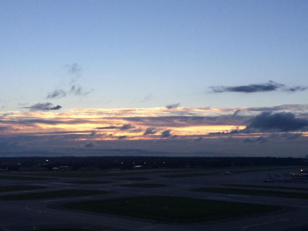
(Image below courtesy: Lake Superior Marine Museum @LSMMA1)


Saturday's Sunshine
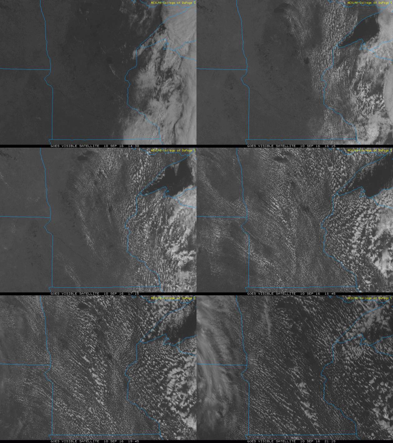
Much of the region experienced sunshine on Saturday, however, note the fair weather cumulus clouds that developed across the state during the midday hours. These clouds formed in the cooler air in the wake of the cold front that moved through on Friday. Some of the clouds even produced a few light sprinkles!
Below Average Temperatures on Saturday
In the wake of a cool front that moved through Friday, high temperatures on Saturday were running nearly 5F cooler than average across much of the Upper Midwest. It appears that another cold front will slide through the region on Monday, dropping temps to even cooler levels on Tuesday and Wednesday!
Even Cooler Tuesday and Wednesday!
If you thought Saturday's temperatures were cool, wait until we hit Tuesday and Wednesday. This secondary batch of even cooler air will arrive after a secondary cold front pushes through on Monday. High temperatures on Tuesday will be running nearly 10F to 15F below average, while highs on Wednesday will be running nearly 5F to 10F below average!
Highs From Average on Tuesday, September 13th
Highs From Average on Wednesday, September 14th
Coldest Temps Since May 18th?
Ok - here's an interesting stat! According to the National Weather Service, we have not dipped below 50F in the Twin Cities since May 18th! That will be the 2nd longest stretch on record since 1872! It appears that we will break that streak as low temperatures dip into the mid 40s on Wednesday morning. Interestingly, 7 of the top 10 stretches of 50F+ temperatures have occurred since 2001!
Low Temps AM Wednesday
By the way, here's a preview of low temperatures expected Wednesday morning. Note that there appears to be several locations across the northern part of the state that look to dip into the 30s! Honestly, I wouldn't be surprised to see some of the normal cold spots like Embarrass or Tower dip to the frosty mark of 32F!
Frost WAY up north!
How about this? This is from the National Weather Service in Fairbanks Alaska, where temperatures on Saturday morning dipped to frosty levels.
"Another frosty morning in Fairbanks and the Interior. Temperatures are in the 20s and 30s again. This may seem cold but frost is not uncommon in early September. #akwx #fairbanks"
Average First Frost in the Twin Cities
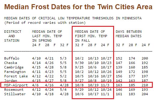
Here's a list of average dates of first minimum temps around the Twin Cities. Note that the average first frost (32F) for the Twin Cities is October 8th and the average first hard freeze (28F) in the Twin Cities is October 19th... In all reality, we are only about 1 month away from these dates!
____________________________________________________
Fall Colors Starting to Show...
Fall Color Update - MN DNR
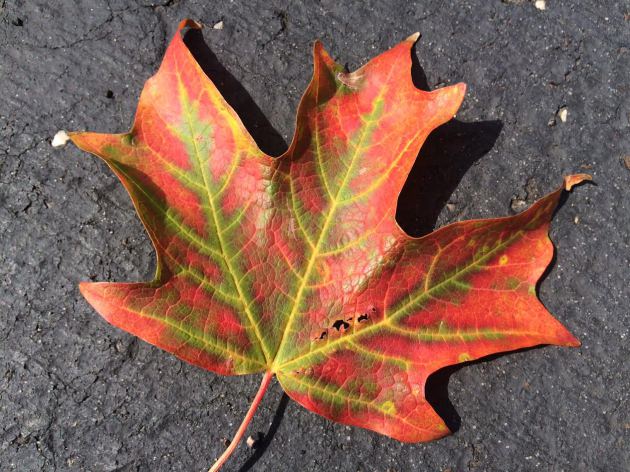
This is always a fun map to drag out around this time of the year! According to the MN DNR, there are already a few locations that are at 10 - 25% color, mainly across central and northern Minnesota. Keep an eye out for gradually changing fall foliage over the next several weeks. It's interesting that when at/past peak occurs, the leaves seem to drop VERY rapidly, so don't blink!
Average Peak Color
According to the MN DNR, the typical peak color across the state is as advertised in the graphic below. Note that peak color is as early as mid-late September across the far northern part of the state to as late as early-mid October across the southern part of the state. The Twin Cities usually starts to peak around late September to mid October.
What Causes Fall Color?
Here's a neat article from the MN DNR on what causes fall color:
"The chemicals"
"Four main groups of biochemicals are responsible for the various yellows, oranges, reds and browns that we see in the fall:
Chlorophyll
Carotenoids
Anthocyanins
Tannins
Carotenoids
Anthocyanins
Tannins
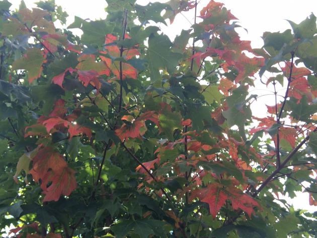
Each has its own color and chemistry. As the amount of these chemicals vary, they will cause subtle variations in color from one leaf to the next, or even from tree to tree."
___________________________________________________
Soggy Start to September
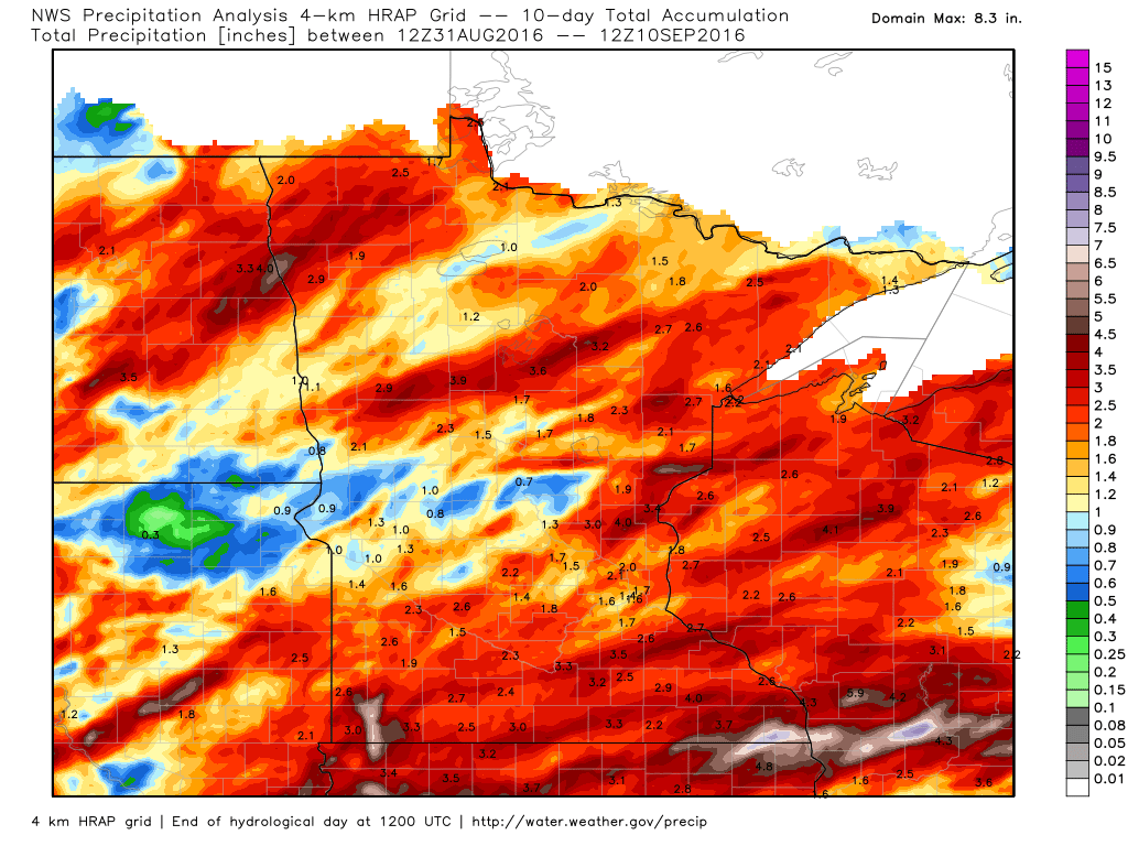
Thanks to Mark Seeley from the MN Climate office for compiling some of the numbers below. September is off to a fairly wet start for some, which is adding to an already very wet past several weeks, take a look.
"After a wetter than normal July and August, September is following trend and beginning wetter than normal for many areas of the state thanks in large part to some strong thunderstorms that crossed the state over September 4-7. Several areas of the state have reported over 2 inches of rainfall so far this month. Many climate stations are already reporting rainfall totals which are near the monthly average for September, and some locations have already surpassed the monthly normal rainfall values. A partial list of these locations:"
Mabel (Fillmore County) 5.54"
Caledonia (Houston County) 4.69"
Spring Valley (Fillmore County) 4.14"
Spring Grove (Houston County) 4.03"
Lanesboro (Fillmore County) 3.40"
Worthington (Nobles County) 2.86"
Wright (Carlton County) 3.93"
Brainerd (Crow Wing County) 2.90"
Ottertail (Otter Tail County) 2.52"
Eveleth (St Lous County) 3.20"
Pokegama Dam (Itasca County) 3.52"
Ada (Norman County) 2.97"
Roseau (Roseau County) 2.65"
Some of these thunderstorms produced new daily rainfall records for many observers. Some of these new record values included:
For September 5th: 1.03" at Amboy, 1.92" at Redwood Falls, 2.65" at Roseau, 1.41" at Floodwood, 2.02" at Argyle, 1.42" at Isabella, and 1.37" at Thief River Falls.
For September 6th: 2.78" at Pokegama Dam, 1.96" at Eveleth, and 0.89" at Grand Portage
For September 7th: 4.41" at Caledonia, 2.95" at Harmony, 3.35" at Spring Valley, 2.00" at Theilman, 1.47" at Grand Rapids, 1.27" at Zumbrota, 1.20" at Owatonna, 3.89" at Spring Grove, and 2.32" at Houston.
Rainfall First 10 Days of September
______________________________________________
Weather Associated with the Record State Fair Attendance:
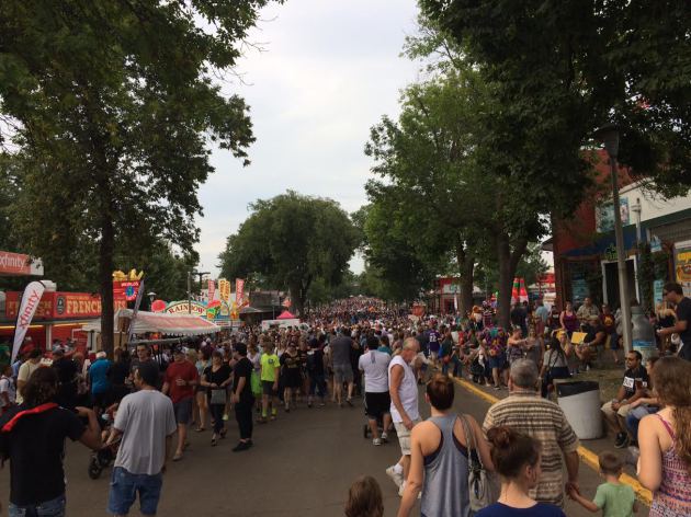
The12-day run of the Minnesota State Fair (August 25-September 5) set a new attendance record this year with 1,943,719.
Three dates brought record daily attendance: Friday, August 26; Friday, September 2nd; and Saturday, September 3rd (all-time daily attendance record set with 260,374). So what was the weather like and did it help promote this record attendance? Yes, likely.
Here is the daily attendance and associated weather description for each day of the State Fair
(* denotes record attendance for the day):
Thursday, August 25, 111,902, cooler than normal and breezy
Friday, August 26, 141,023*, cooler than normal, with low relative humidity
Saturday, August 27, 180,567, cloudy and humid day
Sunday, August 28, 177,906, warm and humid day, afternoon temperatures in the mid-80s F
Monday, August 29, 119,522, warm and humid with Heat Index near 90F, and rain at night
Tuesday, August 30, 126,354, early morning rain, cloudy
Wednesday, August 31, 118,042, near normal weather, partly cloudy
Thursday, September 1, 133,773, near normal weather
Friday, September 2, 182,926*, very sunny, with low relative humidity, pleasant temperatures
Saturday, September 3, 260,374*, sunny, breezy, and low relative humidity
Sunday, September 4, 233,303, cloudy and breezy
Monday, September 5, 158,027, early morning rain, very humid, warm and cloudy

___________________________________________________
Winds of change and coldest Since May 18th
"You don't need a weatherman to tell you which way the wind blows", but it sure would be nice, especially at this time of the year!
Those were the famous lyrics written by Bob Dylan who apparently wasn't too worried about Fall-like wardrobe choices. As cold fronts start making more frequent passes through the Upper Midwest over the coming weeks, the probability of going from shorts and t-shirts one day to pants and sweatshirts the next becomes increasingly higher. In fact, one of these fronts approaches Monday!
Sunshine and a warmer south wind will bring temperatures to near 80 degrees across southern Minnesota today, but temperatures drop into the 60s post-front Tuesday and Wednesday, which will be nearly 10- 15 degrees below average. Low temps Wednesday morning will dip below 50 degrees in the Twin Cities, which will be the first time since May 18th! That will end the second longest stretch of days we've stayed at 50 degrees or warmer since 1872. A few spots up north will likely dip into the 30s and perhaps even near the frosty mark!
____________________________________________________
Extended Weather Outlook
SATURDAY NIGHT: Mostly clear and cool. Winds: W 5. Low: 54
SUNDAY: Sunny, breezy and warmer. Winds: SSW 10-20. High: 78
SUNDAY NIGHT: Mostly clear and comfortable. Winds: S 10. Low: 60
MONDAY: Dry start, late day rumble possible. Winds: S to NW 5-10. High: 74
TUESDAY: More PM sun. Feels like early October. Winds: NNW 5-15. Wake-up: 56. High: 66
WEDNESDAY: Coldest start since May 18th. Sunny. Winds: SSW 5-10. Wake-up: 47. High: 67
THURSDAY: Spotty showers and storms later. Winds: S 10-15. Wake-up: 52. High: 71
FRIDAY: Mostly cloudy, scattered t-showers. Winds: SSW 5-10. Wake-up: 56. High: 72.
SATURDAY: AM puddles, gradual clearing. Winds: WNW 5-15. Wake-up: 57. High: 73.
_______________________________
_______________________________
This Day in Weather History
September 11th
September 11th
1980: 3.35 inches of rain fall in St. Cloud.
1942: A line of thunderstorms races across Minnesota at 70 mph, producing severe winds that would destroy 651 barns in a 30 mile wide, 180 mile long path.
1931: The daytime high in St. Cloud was 96 degrees.
1931: Summer still has its grip on Minnesota, with a high of 111 degrees at Beardsley.
1900: The soggy remains of the Galveston Hurricane bring 6.65 inches of rain to St. Paul over two days.
1807: Thick smoky weather is noted at Pembina.
________________________________
________________________________
Average High/Low for Minneapolis
September 11th
September 11th
Average High: 74F (Record: 96F set in 1931)
Average Low: 55F (Record: 35F set in 1962)
_________________________________
Average Low: 55F (Record: 35F set in 1962)
_________________________________
Sunrise/Sunset Times for Minneapolis
September 11th
September 11th
Sunrise: 6:47am
Sunset: 7:30pm
Sunset: 7:30pm
*Daylight Lost Since Yesterday: ~3mins & 4sec
*Daylight Lost Since Summer Solstice: ~2hours and 53mins
__________________________________
*Daylight Lost Since Summer Solstice: ~2hours and 53mins
__________________________________
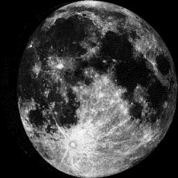
Moon Phase for September 11th at Midnight
2.8 Days Since First Quarter
2.8 Days Since First Quarter
___________________________________
Weather Outlook Sunday
An approaching cool front will allow temperatures to jump back into the upper 70s to near 80F across much of the Upper Midwest on Sunday. The breezy winds out of the WNW on Saturday will switch around to the south and help to drag milder and slightly more humid conditions. Even though, dewpoints will climb back into the low/mid 50s, it'll still be very comfortable on Sunday.
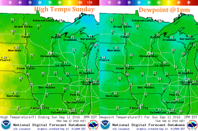
Weather Outlook Sunday
Winds ahead of the approaching cool front will be a little breezy, especially during the midday hours. SSW winds will range anywhere from 10-20mph with gusts up to 25mph across the southern part of the state. This will be a little warmer wind than what we experienced on Saturday.
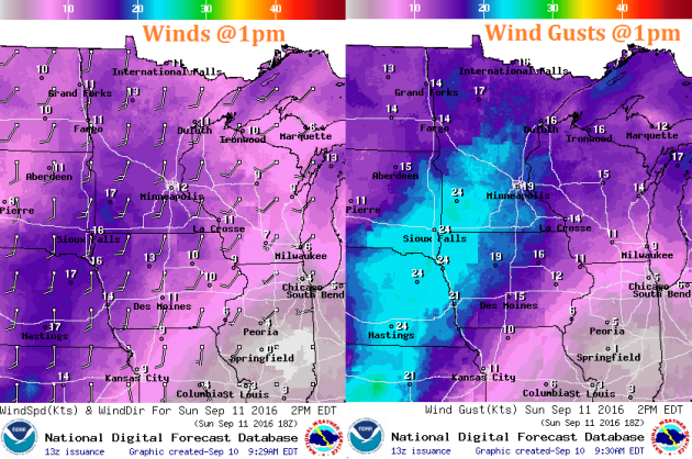
Weather Outlook Sunday
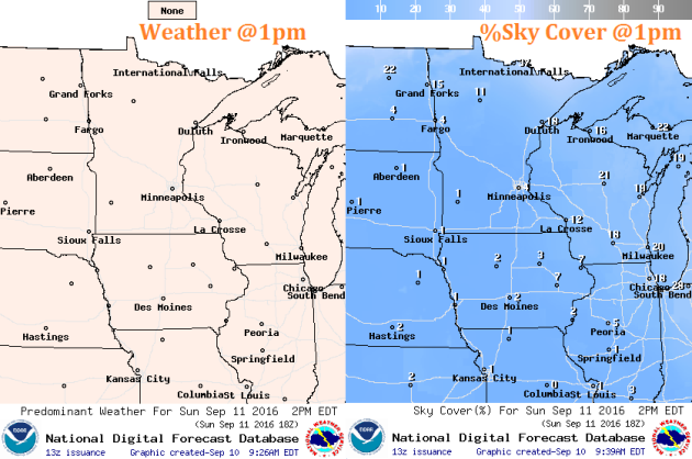
The nice thing about Sunday is that we should have another day of wall to wall sunshine. Keep in mind that the sun is still fairly strong as the UV index is considered to be mod/high. That mean that it'll only take 45mins or less to burn exposed skin around midday.
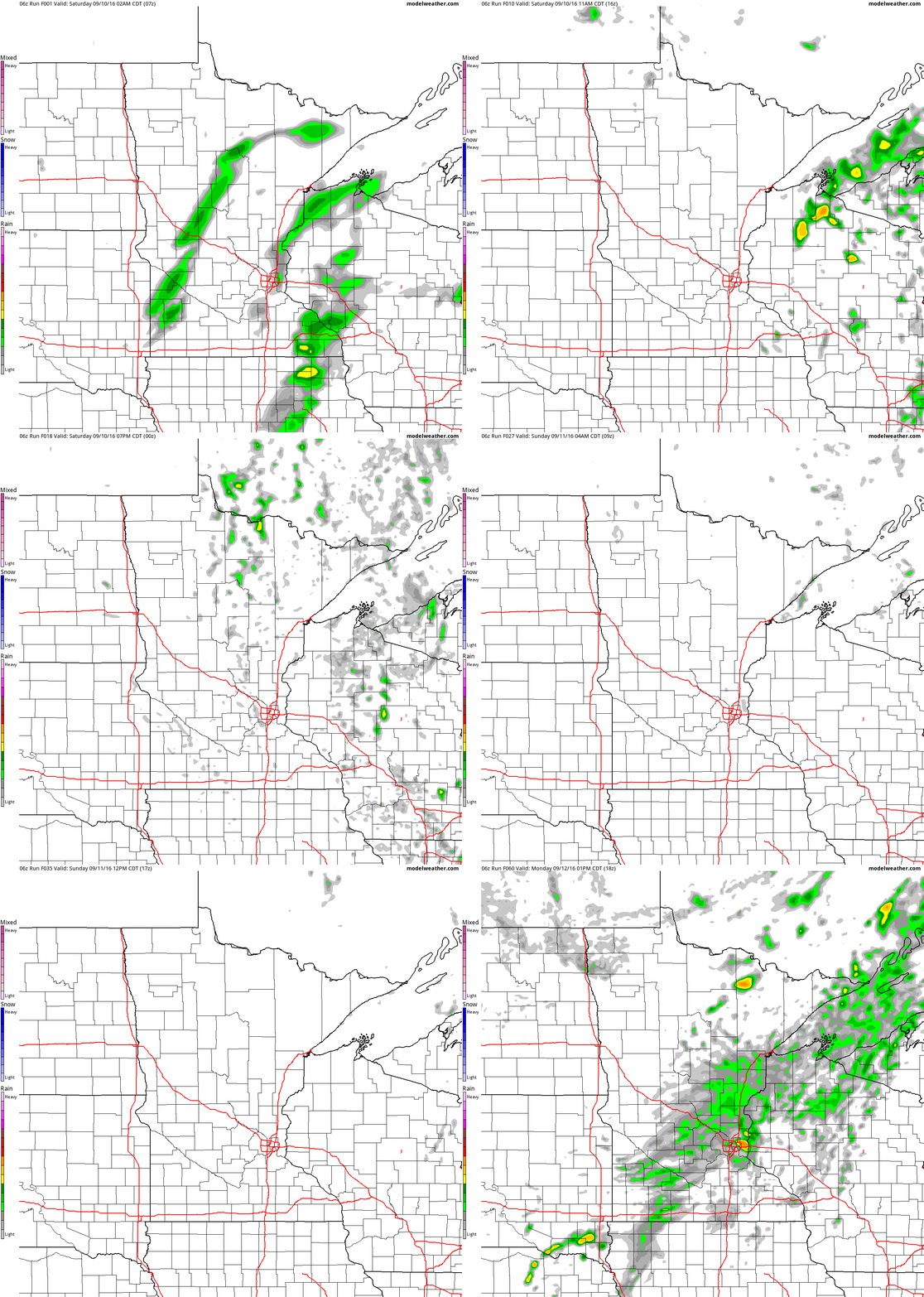
Simulated Radar
The simulated radar from AM Saturday to PM Monday suggests that weather our wetter weather conditions on Friday will improve on Saturday and Sunday. Note that lingering showers seem to persist through early Saturday across parts of Wisconsin and northeastern MN, but most locations should remain dry for much of the weekend.
Rainfall Potential
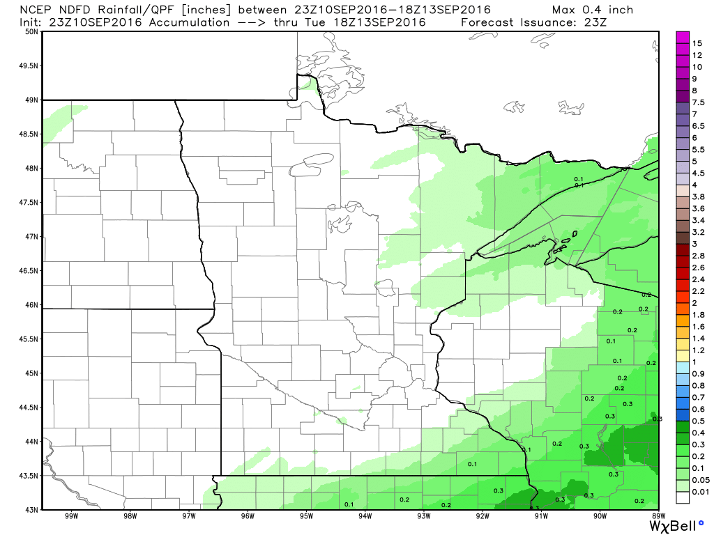
Here's the rainfall potential through midday Tuesday, which suggests mostly dry weather continuing on Sunday and early Monday, but a few spotty showers and storms may develop late Monday and bring a few areas light accumulations.
__________________________________________
7 Day Rainfall Outlook
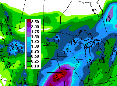
According to NOAA's WPC, the 7 day rainfall forecast suggests heavier rainfall potential again returning to the Upper Midwest on Thursday and Friday as another system slowly moves into the region with steadier showers/storms. Note that some of the rainfall could be appreciative with some spots nearing 0.50" to 1"+.
Extended Weather Outlook
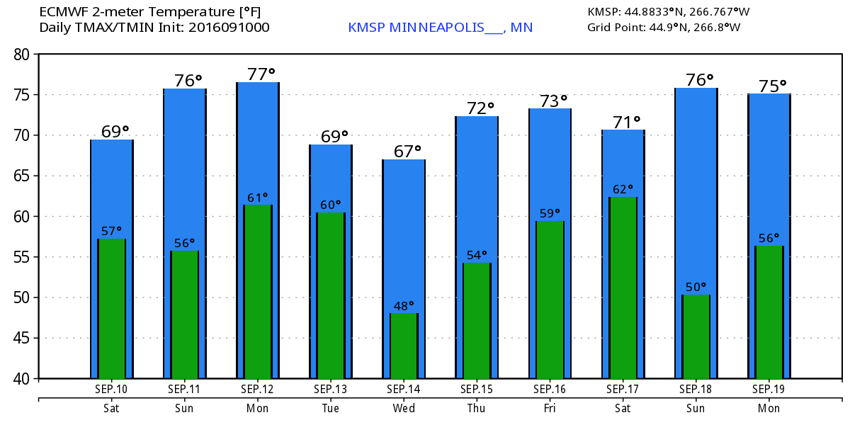
The extended temperature outlook through mid September suggests near average conditions continuing throughout much of next week, however, note the 60s sprinkled in there through the middle part of next week! These days will feel more like late September/early October.
6 to 10 Day Temp Outlook
According to NOAA's CPC, the 6 to 10 day temperature outlook suggests above normal temperatures returning to the Upper Midwest from September 16th - September 20th. This will come after cooler than average temperatures settle into the region for a few days next week.
6 to 10 Day Temp Outlook
The national temperature outlook suggests that warmer than average temperatures will be found across much of the nation, while cooler than average temperatures will be found in the Southwest.
National Weather Outlook
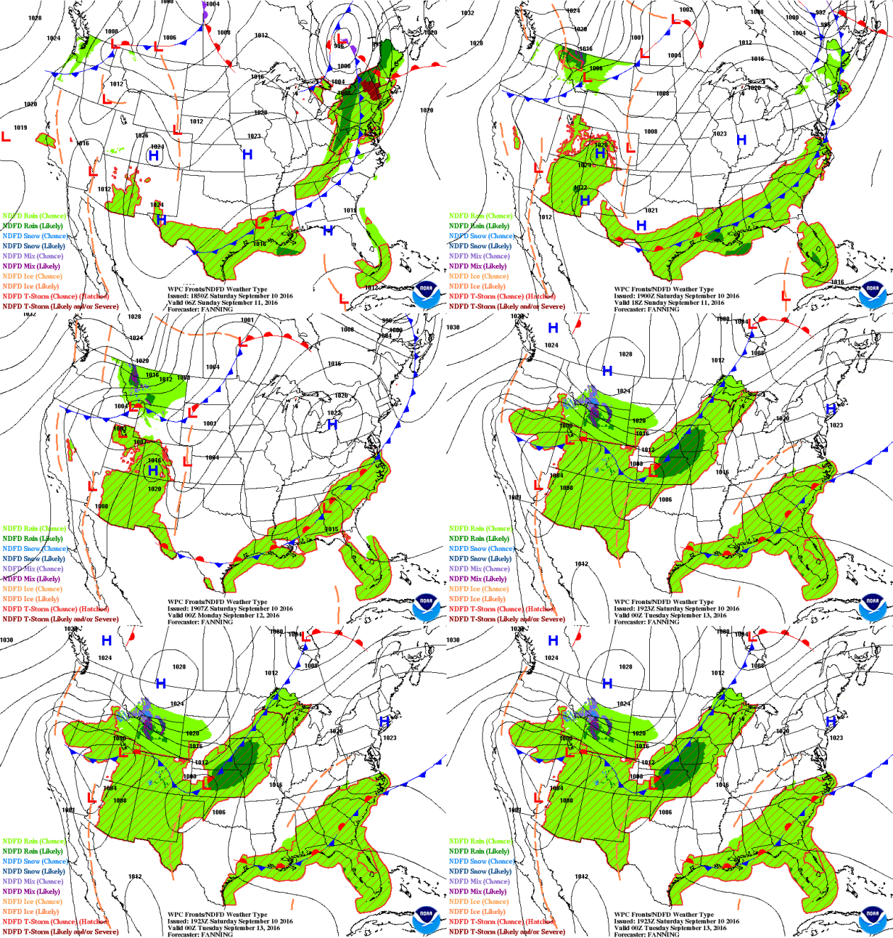
A slow moving front responsible for scattered thunderstorms and heavy rain in the Central U.S. over the course of the week was also responsible for a few severe storms in the Eastern Great Lakes and the Ohio Valley on Saturday afternoon/evening. By Sunday, the front looks to lose steam stall over the Mid-Atlantic States and Gulf Coast states with a few scattered storms. Note that in the wake of the front, a big bubble of high pressure settles in over the Great Lakes and Ohio Valley, which will bring sunshine along with cooler and drier weather through early next week. The next front will already be pushing into the Lower 48 in the Upper Midwest. This is the next front that will bring a few showers and storms to the Central U.S. and then a fresh batch of even cooler air by the middle and end of the week.
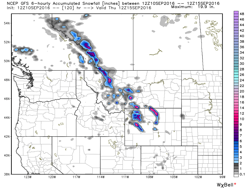
Northwest Snowfall Potential
As colder air and moisture work into the higher elevations of the Northern and Canadian Rockies, snow will begin to develop. Here's a look at the 5 day snowfall potential, which shows some decent accumulations, mainly in the highest peaks... Yes, it's getting to be about that time of the year!
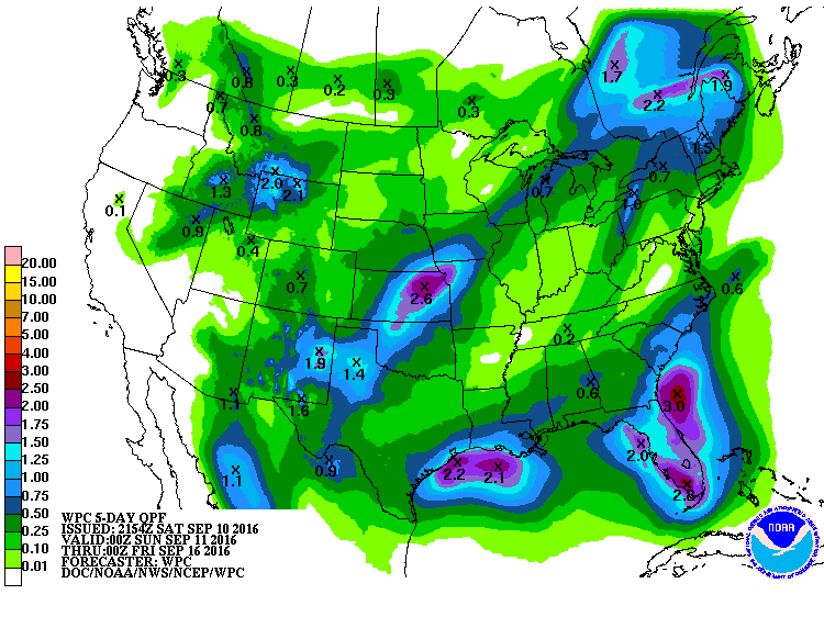
Precipitation Outlook
According to NOAA's WPC, the 5 day forecast suggests heavy rains shifting south across the Gulf Coast States with some 1" to 3" tallies possible through the end of the week. The next front will help to produce some 1" to 2"+ tallies from the Southern Plains to the Gulf Coast States.
__________________________________________
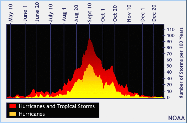
Peak of Atlantic Hurricane Season
Here's an interesting note; while the Atlantic Hurricane Season runs from June 1st to November 30th, the peak of the season is actually September 10th! There tend to me more active tropical systems on this date than any other day of the year!
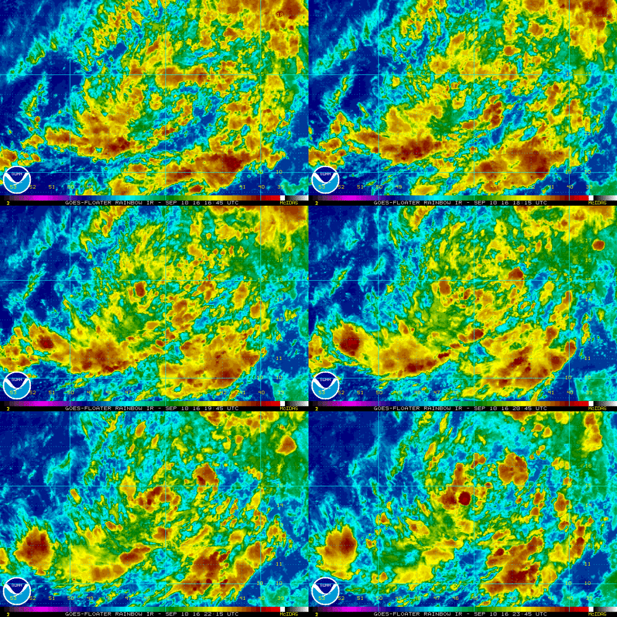
Tropical Outlook
This particular blob of showers and storms below doesn't look like much, but currently holds a HIGH probability of tropical formation within the 5 day. This is located in the central Atlantic and is tracking toward the Northwest.
Atlantic Outlook
According to NOAA's NHC, there are 3 separate areas of interest, one in particular (in red below) has a HIGH probability of tropical formation within the next 5 days. The other 2 are closer to the U.S., but have a low probability of tropical formation during that time.
Eastern Pacific Update
The National Hurricane Center is also watching a wave of energy in the Eastern Pacific that currently has a HIGH probability of tropical formation. This has developed on the heels of NEWTON that eventually moved into Arizona and New Mexico with gusty winds and heavy rain.
__________________________________________
State pheasant index up 29 percent from last year!!
Here's a promising statistic from the MN DNR about Minnesota Pheasants. Although the recent pheasant index is still 14% below the 10-year average, this year is up 29% compared to last year!
"Another mild winter, good nesting season conditions and a slight increase in grassland habitat in the pheasant range all combined to increase Minnesota’s roadside pheasant index by 29 percent compared to last year, according to the Department of Natural Resources. “Grassland habitat is critically important to pheasant populations,” said Nicole Davros, a DNR research scientist who oversees the August roadside survey. “Over the past two years we have had weather that benefited pheasant numbers, but in the long term we’re still looking at a downward trend in habitat and that drives the population trends.” The 2016 pheasant index is still 14 percent below the 10-year average and 48 percent below the long-term average. Loss of Conservation Reserve Program (CRP) acres statewide remains a concern, as Minnesota may lose about 393,000 acres of CRP land by 2018 because of reduced spending on the program at the national level."

______________________________________
Flocking Birds on Radar
Did you know that radar doesn't just detect precipitation, but it can detect dust, bugs and even birds! The National Weather Service out of Grand Forks, ND has a great example of birds taking flight early in the morning from earlier this week. You can see the "rings" being formed as the birds fly away.
_________________________________________________
Camp Ripley Tornado
Scattered showers and storms developed along a cool front that pushed through the state on Wednesday. Interestingly, a tornado touched down late in the evening at Camp Riley! The National Weather Service conducted and completed their storm survey, here are their findings:
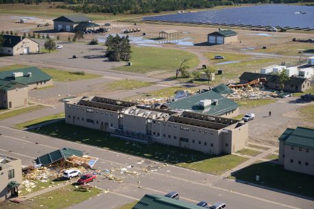
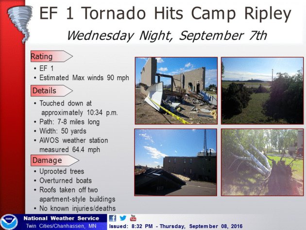
"...NWS DAMAGE SURVEY FOR 09/07/16 CAMP RIPLEY TORNADO... An EF-1 tornado impacted Camp Ripley in Morrison County on the night of September 7. The tornado touched down 4.5 miles southwest of Camp Ripley around 10:30 PM and impacted Camp Ripley itself around 10:34 pm. The tornado continued off to the northeast, crossing the Mississippi River, before lifting around 10:40 pm for a total path length of 7.3 miles. The tornado uprooted trees, overturned boats, and tore the roof off of two apartment-style buildings at Camp Ripley. No injuries or deaths were reported."
Rating: EF-1 Estimated peak wind: 90 mph
Path length /Statute/: 7.3 miles
Path width /Maximum/: 50 yards
Start date: 09/07/2016
Start time: 10:30 PM CDT
Start location: 4.5 miles SW Camp Ripley
End date: 09/07/2016 End time: 10:40 PM CDT
End location: 1.5 miles NE Camp Ripley
__________________________________________________
"Smartphone study on weather and pain reveals early data"
"A study looking at how the weather affects chronic pain has released some early, surprising results. People across three UK cities reported less time in severe pain as the weather warmed up from February to April - but pain then increased again in June. Researchers are collecting the data via a smartphone app and hope to shed scientific light on the idea that we can "feel the weather in our bones". They presented a project update at the British Science Festival in Swansea. Eventually, the "Cloudy with a Chance of Pain" project will match up individual responses with local weather patterns, based on GPS data from the participants' phones. Because the app also asks people about their mood, this more detailed analysis will also reveal whether the weather has an affect beyond simply making people happier. For the moment, however, even a preliminary month-by-month overview of the combined pain data from Leeds, Norwich and London - alongside the general weather pattern for those cities - shows that there is more to this much-discussed interaction than we might expect."
___________________________________________________
"US Open health scares see WTA urged to change rules on heat breaks"
"The tennis authorities were urged to revisit their rules on heat breaks last night following a wave of health scares at the US Open, culminating in Jo Konta’s on-court collapse. The opening week of the year’s final grand slam has been plagued by high temperatures and humidity, with players complaining of breathing problems and dizziness during matches. The potential scale of the problem was laid bare on Wednesdaywhen British No 1 Konta collapsed during her second-round encounter as a result of blurred vision, breathing issues and an increased heart-rate. The 13th seed was struck down while leading 6-2, 5-6 against Bulgaria’s Tsvetana Pironkova, and although she recovered to win 6-2, 5-7, 6-2, her health scare was the major talking point of the match. Konta would have been entitled to a 10-minute break at the end of the second set if something known as the heat stress index – a combined measurement of temperature and humidity – on court reached 30.1C. However, the 25-year-old did not make it that far before collapsing."
"In A Changing Climate, We Need Nature To Save Us From Ourselves"
"If you lived in Honolulu and suddenly relocated to Minneapolis, it’s fair to say you would need to make a few lifestyle adjustments. You would have to buy warmer clothes, learn how to drive in icy conditions, and perhaps even trade in your surfboard for cross-country skis. In short, you would have to adapt to an unfamiliar climate. These days, you don’t need to move somewhere far away to experience a different climate: a new climate is moving to you. In today’s warming world, adapting to climate change is a necessity facing every family, community, industry and nation. Climate change is already affecting where and how we grow our food, how much water we have to drink, and which places are safest to build our homes. We must rethink all of the implications climate change has on our daily lives and if we’re equipped to manage situations we haven’t experienced before. For example, how will we fight longer and more intense forest fire seasons, manage outbreaks of new diseases and repair homes and property continually damaged by increasingly frequent extreme weather events? Adapting to climate change is perhaps the greatest test that humankind has ever faced. And, we must use every tool at our disposal to address this global challenge."
________________________________________________________
"Climate Change Is Making "1,000-Year" Floods Like Louisiana's More And More Common"
"In Louisiana, the record rainfall that killed at least 11 people and flooded tens of thousands of buildings has been called a "1,000-year" event in some areas, meaning something like this only happens once a millennium. In other parts of the state, experts have called it a 500-year flood. But those names probably don’t make sense in an era of climate change.Just like climate change makes wildfires and drought more likely in California—and may make it more likely for viruses like Zika to spread—it also makes extreme rainfall and devastating flooding more common. "Warm air holds more water vapor than cold air, and we're warming up both the air temperature and we're warming up the oceans," says David Titley, a meteorology professor and the director of the Center for Solutions to Weather and Climate Risk at Penn State University. "Welcome to the future."Extreme weather is becoming more common overall, and it's also possible to link specific events to climate change. In a National Academies of Sciences report published earlier this year, Titley and other researchers explained howindividual weather events can be attributed to climate change."
________________________________________________
Thanks for checking in and have a great rest of your weekend and week ahead!
Don't forget to follow me on Twitter @TNelsonWX
Don't forget to follow me on Twitter @TNelsonWX

No comments:
Post a Comment