
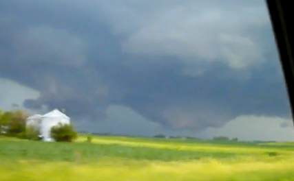
 "Large Cone Tornado". More footage from last Thursday's historic tornado outbreak in Minnesota - this tornado crossed the Iowa border, dropping multiple twisters from near Kiester to Albert Lea. The YouTube video clip is here. Some eye-opening tornado facts (and myths) can be found here.
What a Sunday. What a Father's Day! We did it - we actually experienced a fairly nice weekend, in spite of a gray start Saturday morning/midday the torrential rains held off, nothing severe (except maybe a sunburn) with lake-worthy temperatures and reasonable humidity levels. Not bad at all.
 What a Father's Day! Under a mostly sunny sky the mercury peaked at a respectable 76 in Duluth, 82 in St. Cloud and the Twin Cities, 83 at Redwood Falls. Rochester picked up .09" rain since midnight Saturday night.
Summer officially kicked off at 6:28 AM central time as the sun's rays fell directly on the Tropic of Cancer, as high in the sky as it ever gets over the northern hemisphere. Yes, in theory, today is the best day of the year to get a tan (or a painful burn), the longest daylight of the entire year. For the record the amount of daylight today will be 1 minute less than yesterday, when the sun rose at 5:26 AM and set at 9:03 PM. Today the sun rose at 5:27 AM. Not sure how to explain that, but there must be a reasonable explanation.
If you look at the warmest 90 day period of the year, on average, "meteorological summer" really began closer to June 1. There is a built-in lag in the atmosphere: even though the sun is highest in the sky today, our hottest weather usually doesn't arrive until mid or late July. The reason? Water takes longer to heat up than land. June temperatures are running .4 F above average in St. Cloud, we've had a fairly comfortable June, at least so far. That may be about to change - models are hinting at upper 80s, even some low 90s over parts of central and southern MN by the end of the week with dew point surging into the 60s to near 70. Yes, plan on hearing a lot of griping about the (dreaded) dew point by Friday and Saturday, but no Minnesotan (in their right mind) is about to complain about summer heat. More incentive to evacuate to the lake, or the pool. Next weekend will TRULY look and feel like summer, an early taste of July.
 Strong/Severe T-storms? Here is the NAM model valid at 6 pm this evening, hinting at some very strong, potentially severe storms across central and southern MN. The risk will increase the farther south you go, toward the Iowa border. A few isolated "supercell" thunderstorms may produce hail, damaging straight-line winds, even an isolated tornado, especially south/west of the MN River.
The fickle front separating steamy, summerlike air just to our south from relatively comfortable, Canadian air over the Upper Midwest will shift north again today, setting the stage for more strong to severe T-storms, especially over the southern third of Minnesota (under a "slight risk" of severe storms, according to SPC, the Storm Prediction Center). Timing these storms is tricky, but the greatest risk of hail, damaging straight-line winds, even an isolated tornado, will come south/west of the Minnesota River Valley. I don't expect an outbreak to rival what we endured last Thursday, but there may be just enough instability, wind shear and low-level moisture to fuel a few "supercell" thunderstorms south of Willmar and Mankato - even a few heavy thunderstorms reaching St. Cloud and the Twin Cities. Models print out .50 to 1" of rain today, but amounts will be highly variable, a few hundredths of an inch in Town A, while 10 miles down the road Town B gets drenched with over an inch of rain (in a couple of hours).
 Hold Off On Watering. The models are in fairly good agreement at significant rain today, another chance Wednesday, still another risk Friday night into Saturday morning as 90 degree air approaches from Iowa. Many lawns and fields will pick up .5 to 1.5" or more of rain this week.
Thundery, unsettled weather lingers into Wednesday, but as upper level jet stream winds shift gears and blow from the southwest, this noisy front will finally lift northward, allowing most of MN to break out into the "warm sector" by Thursday and Friday. That should translate into highs well up into the 80s to near 90 by Friday, and there's a good chance the heat will spill over into at least Saturday. T-storms? Yes. But I suspect storms will be most concentrated over far northern MN, from the Red River Valley to the MN Arrowhead, closer to the frontal boundary. Right now it looks like the best chance of rain (and thunder/lightning) will come today, again Wednesday.
We'll keep an eye on the severe storm threat, update the blog (and videos) as needed. Check in later today for an update. In the meantime enjoy the first day of summer, what I hope will be a long, memorable (slow-motion) summer for all of us...
 Approaching Derecho. Check out the amazing time-lapse YouTube clip showing a line of severe storms moving into Chicago. A derecho is a long-lasting line of severe storms that is usually accompanied by violent, straight-line winds, sometimes blowing in excess of 80-100 mph, capable of tornado-like damage. More on derechos here.
 Derecho Aftermath. The line of severe storms that ripped into Chicago last Friday produced winds estimated at over 70-80 mph, strong enough to blow windows out of the Willis Tower (the old Sears Tower). More on the damage in Chicago here.
 China Floods. At least 88 dead, over a million have evacuated rising waters. What is going on? Are we really seeing a genuine uptick in flooding worldwide, or just doing a better job finding and reporting on flooding (that's always been there?) Personally, I think it's a little of both: flooding IS increasing, but with an always-on, wired world we're doing a better job of seeing natural disasters in real-time. The story from the N.Y. Times is here.
 Disaster in the Gulf. Here is a good summary of the mess in the Gulf from the NRDC, the National Resources Defense Council.
 BP Oil Disaster: How Much Oil is Left? According to the Christian Science Monitor the reservoir under the Deepwater Horizon well still has 94 to 97% of its oil left - in a worse case scenario oil could continue to gush into the Gulf of Mexico for another 1-2 years before being totally depleted. Let's pray that doesn't happen - the article is here.
* Perspective on the Spill (before it began). The story is here. It's easy to point a finger of blame at BP (which seems to have been truly negligent in the Gulf of Mexico, strongly favoring speed and profits over anything resembling safety. And yet it would be hypocritical not to see that all the major oil companies are simply giving us what we want, what we all CRAVE. Our economy is built on access to cheap oil. What is it going to take for all of us to break our addiction? I have no idea. I just know that every time I fill up at BP I'm contributing to the problem. Maybe our kids will figure this out (although it seems unfair to dump this oily mess in their laps). I fear it's going to take a series of calamities, wars or man-made disasters to shake us up and get us on the right path. No easy answers to this one...
 Loving Our Lakes to Death. Sunday's (print) Star Tribune had an excellent story, the first article in a 3-part series, examining our love affair with our 10,000+ lakes, and how construction standards have been eased during the recession, with a very real adverse impact on the bodies of water we hold so dear. More on the series here.
 Is Your Favorite Lake Polluted? If you haven't already done so now might be a good time to click over the checkmylake.org, sponsored by Conservation Minnesota and the MN Freshwater Society. Plug in your lake and see (instantly) if mercury levels pose any danger to kids and pregnant women (most vulnerable). I got a rude awakening when I checked my lake - hope you get some better results.
Paul's SC Times Outlook for St. Cloud and all of central Minnesota
Today: (first day of summer!) Unsettled with T-storms likely, some heavy, even severe (best chance of hail and damaging winds south/west of the MN River). Winds: SE 10-20. High: near 80
Monday night: A few lingering T-storms, humid. Low: 64
Tuesday: Partly sunny, a stray T-storm or two. High: 82
Wednesday: More numerous showers and T-storms, some heavy. High: 83
Thursday: A mix of clouds and sunshine, feels like summer! High: 85
Friday: Partly sunny, sticky with a risk of thunder (especially northern MN). High: 88
Saturday: Sticky and steamy with plenty of hazy sun. Best chance of T-storms up north. High: near 90
Sunday: Partly sunny, slight drop in humidity - passing shower or T-storm can't be ruled out (most of the day should be dry). High: 85
No comments:
Post a Comment