
Happy Veterans Day. The older I get the less and less I take for granted. Today we salute the millions of veterans who have allowed us to live our lives (in total freedom). Thank you doesn't seem quite enough, but I'm proud of all the men and women in the Armed Services, including my youngest son, Brett, who is a Second Class (Junior) at the U.S. Naval Academy in Annapolis.
This is still Winter Hazard Awareness Week in Minnesota. Today's reminders from the DNR:
Carbon Monoxide Facts
- Carbon monoxide is a colorless, odorless, tasteless gas. It results from the incomplete burning of natural gas, oil, wood, kerosene, charcoal and other fuels, under conditions where there is not enough oxygen present
- Exposure to low levels of carbon monoxide can cause flu-like symptoms such as headaches, nausea, dizziness, drowsiness, weakness and shortness of breath. Higher levels can result in unconsciousness or death
- Carbon monoxide is most likely to accumulate inside homes during winter, when the heating system is in use and the home has been sealed and insulated against the cold
- Carbon monoxide can accumulate from wood stoves, fireplaces or charcoal grills, furnaces, water heaters, boilers, gas cooking stoves and clothes dryers, gas or kerosene space heaters and automobile exhaust
- Make sure your heating system and all fuel burning appliances are adequately vented and maintained
- Make sure your furnace has an adequate air supply
- Do not use gas stoves, ovens or portable camping equipment to heat living areas
- Have a qualified technician install and check furnaces and all fuel burning appliances
- Install a UL-listed carbon monoxide detector; one which sounds an alarm. This is in addition to a working smoke alarm
- Mold exposure can be a special problem during winter when homes are sealed up. Enough mold spores can contribute to asthma, allergies and other health problems
- Molds need an ample supply of moisture. Your home may be at risk if you've had flooding, a leaky roof, ice dams, a damp basement, a backed-up sewer, or chronic plumbing leaks
- Radon can sometimes enter homes from the surrounding soil and accumulate in living areas, especially during the winter. The Minnesota Department of Health recommends that all homes be tested, as long-term exposure to radon can contribute to many long-term health problems, including lung cancer. When testing, use equipment that can take average readings over a long period of time
- If asbestos-containing material is disturbed by remodeling, something often done during the winter, tiny fibers can be released to the surrounding air. Some products contained asbestos up to the mid 1980s. Repair or encapsulate the damaged material using hardware supplies. If you hire a contractor to do the work, that contractor must be licensed by the Minnesota Department of Health

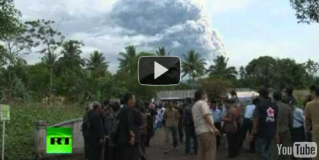
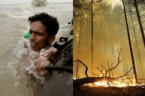
Lightning Bolt Kills TV Giraffe. From South Africa comes a sad, and somewhat bizarre story about a TV giraffe killed by a recent lightning strike.
Paul's SC Times Outlook for the Twin Cities and all of Minnesota:
TODAY: Partly sunny, cool wind, feels a bit more like November. Winds: SW 10-20. High: 49
THURSDAY NIGHT: Partly cloudy and seasonably cool. Low: 34
FRIDAY: Cloudy and cool, drizzle possible late in the day. High: 41 (looks soggy for Friday evening football games - but just rain/drizzle).
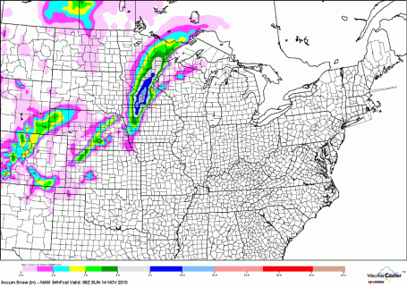
* SATURDAY: Wet snow, potentially heavy at times - travel may become difficult by afternoon/evening. High: 36 (potential for some 5-10" amounts close to home - I do expect the NWS to issue a Winter Storm Watch, possibly a Warning by Friday).
SATURDAY NIGHT: Wet snow slowly tapers - roads may be very slippery, especially west metro. Low: 26
SUNDAY: Sun returns, much better travel statewide. High: 38
MONDAY: Intervals of sun, seasonably cool. High: 41
TUESDAY: Mostly cloudy with a few rain/snow showers (better chance central and northern MN). High: 37
WEDNESDAY: Gusty, cold - few flurries expected (probably no accumulation). High: 35
First Snow of Winter?
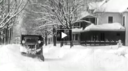
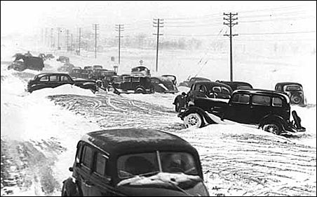
Tonight on Channel 2 Mary Lahammer tackles "Minnesota's Greatest Blizzards", focusing on the Armistice Day Blizzard which claimed 154 lives on Nov. 11, 1940. 60 mph winds carved out 10 foot drifts, temperatures dropped 30 degrees in a few hours, catching thousands of duck hunters unprepared; some had to fight for their lives. The surprise blizzard prompted the National Weather Service to open up a local office (not rely on forecasts coming out of Chicago).
MnDOT had nowhere to push the snow, some streets remained blocked for weeks. One lesson: major highways are elevated, giving the snow somewhere to go.
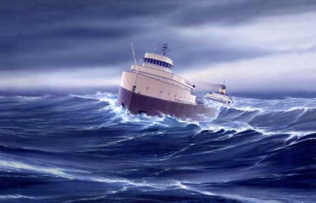
Wild storms can spin up in November, drawing on huge north-south temperature extremes. The super-storm that sank the Edmund Fitzgerald on Lake Superior 35 years ago whipped up 100 mph winds!
Wave goodbye to Indian Summer - we cool down 15-20 degrees today, a cold rain likely late Friday into Saturday as a storm intensifies over the Great Lakes. Models keep a cold rain falling on the metro, over 1" possible. But just west a changeover to snow MAY produce a "plowable" accumulation of 4-8" or more from St. Cloud to Mankato. Good news: no big Thanksgiving week storms in sight.
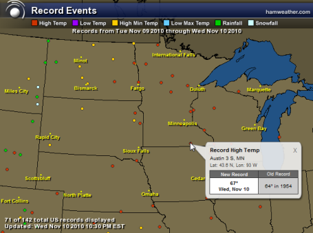
Only in Minnesota is it possible to go from a record 63 on a Wednesday (complete with thunder/lightning as close at the Twin Cities) to heavy, wet snow 60 hours later. Atmospheric ingredients are converging, and what appears to be the first bonafied snowstorm of the season is shaping up for much of central and southern MN from late Friday night into Saturday. A secondary storm rippling north along an eastbound cold front will be able to tap significant moisture from the Gulf of Mexico and a fresh supply of cold, Canadian air. Right now the models print out 1" of liquid precipitation. If that were to fall as ALL SNOW it would be 10-12". There, take a moment ot exhale. Right now it looks like enough warm air will be in place (temperatures at or just above freezing throughout the lowest mile of the atmosphere) for mostly rain from MSP south/east toward Eau Claire and Rochester, but a band of as much as 5-10" may set up over much of central MN, including St. Cloud.
1). The heaviest snow bands are predicted to set up within 50 miles of St. Cloud - heaviest snow coming Saturday and Saturday night. Early guestimate: 5-10" of heavy, wet, slushy snow.
2). No travel problems Friday (roads will just be wet with drizzle - air temperatures close to 40 mid afternoon - slowly falling through the 30s Friday night).
3). I expect all rain for Wisconsin and far southeastern MN - here in the metro we may see a cold rain mixing with, and even changing over to wet snow during the day on Saturday as temperatures aloft continue to cool. My hunch: 1-3" immediate metro, less than an inch east of St. Paul, but more than 4" western suburbs.
Again, the honest answer: it's too early to know - all we can tell you is that a SIGNIFICANT winter storm is brewing, the best chance of a "plowable" snow seems to be setting up over central and south central MN, where some 5-10" amounts are quite possible by Saturday night. If you've been putting off staking the driveway, or putting on your snow tires - you may want to get serious about taking care of that by Friday evening.
Sunday looks better, much better for travel with peeks of sun, highs near 40, and (potentially) some serious snow-shoveling aerobics just west of the cities. A slight eastward jog in the storm track could bring that band of heavy snow into the metro - we haven't ruled that out. Stay tuned for more updates, hopefully things will crystalize a little more over the next 24 hours.
"Understanding the reinsurance industry can be counter-intuitive. One might think that they want to avoid big disasters, because that means that claims must be paid. To some degree this is true. But the reality is that the industry needs disasters to thrive, after all that is what its business is all about. Presently, the industry is awash in capital due to a dearth of disasters, putting pressure on premiums and share prices."
Is Global Warming Responsible For Wild Weather? Yes, but not as much as you might think. Is there such a thing as normal weather? The atmosphere has always been extreme, but just how much are we "loading the dice" in favor of more frequent/extreme weather events? Newsweek has an interesting story here.
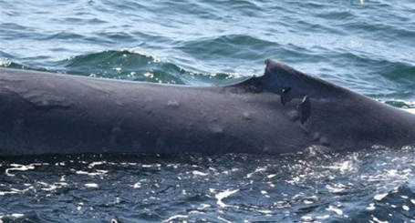
Sunburned Whales Blamed On Thinning Ozone Layer. Ozone is harmful at ground-level, where it combines with sunlight to produce "smog". But ozone is essential in the stratosphere, 30-60 miles above the ground, where it filters out the sun's harmful UV rays. Man-made chemicals began to eat away at the ozone layer (especially over the South Pole), and since those chemicals were banned in the 70s we've seen some recovery in stratospheric ozone. Even so, there's still a problem - reports of sunburned whales, which may be the result of repeated exposure to less ozone high overhead. A baffling story here.
* Scientists Scramble To Close The Uncertainty Gap In Climate Science. What do we know vs. what is pure climate speculation? There is a lot of back and forth right now (and a lot of financial incentive for these questions to be kicked down the road for a few more years - plenty of people happy to keep a cloud of confusion and antipathy regarding climate science. The New York Times has an interesting article on the topic here.
No comments:
Post a Comment