* Snow likely overnight, roads get more slushy and slippery as the night goes on, especially if you're driving north/west, away from St. Cloud
* Around 1-2" slush expected by daybreak (with a breakfast temperature of 27). Some previously wet/slushy roads will be turning icy.
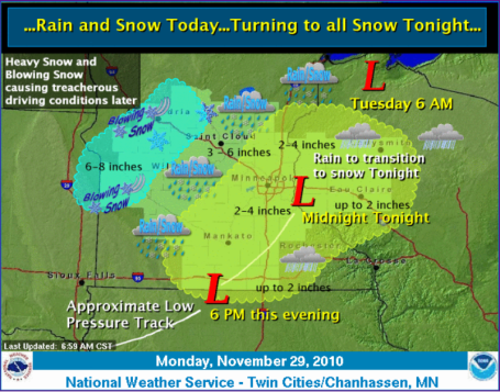
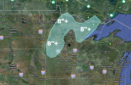
* 2-4" expected Tuesday for St. Cloud area with as much as 5-8" from Detroit Lakes and Alexandria to Bemidji and Duluth area by Tuesday night
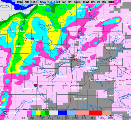
Dopper Update. 5:30 pm. Expect wet roads in the immediate metro area through the evening hours, a changeover to wet snow possible after 8 or 9 pm. Just about the time it's cold enough for snow a surge of dry air aloft (the dreaded "dry tongue") will cut off the bulk of the precipitation. We should see a few dribs and drabs of snow - but rush hour Tuesday morning may still be slippery and slow as temperatures fall through the 20s. Amounts should be barely "plowable" in the metro, an inch, maybe 2" far western suburbs, but 2-4" is still expected near Willmar and St. Cloud, over 6-8" from Alexandria and Detroit Lakes to Bemidji and the Duluth area by Tuesday night.
Paul's SC Times Outlook for St. Cloud and all of central Minnesota:
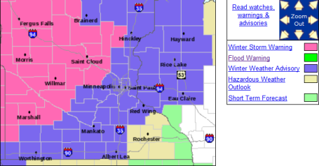
MONDAY NIGHT: Winter Weather Advisory. Periods of snow slow, slushy travel expected with 1-2" snow possible by daybreak. Low: 27
TUESDAY: Winter Storm Warning West of St. Cloud (Warnings central/north/west). Snow gradually tapers to flurries, windy and colder. Wet/slushy roads will turn to ice. 2-4" metro. 5-10" far north/west MN. Turning colder as the day goes on.
7 am: 26
Noon: 22
5 pm: 18
WEDNESDAY: Sun returns, chilly start to December. High: 19
THURSDAY: Mix of clouds/sun - chilly. Good travel conditions. High: 18
FRIDAY: Clouds increase, probably dry. High: 22
SATURDAY: Light snow, coating - 1" possible. High: near 30
SUNDAY: Cold wind, flurries linger. Little or no accumulation. high: 27
MONDAY: Sun returns, bitter cold. High: 17
Dreaded "Dry Tongue"
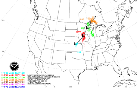
I know, it sounds like something out of a bad deli. Storms are complicated affairs; heavy snow requires a perfect balance of cold air and southern moisture. Too much of either ruins the recipe. But dry air inevitably gets tangled up into a mature storm; a surge of dusty air from the Desert Southwest that invariably cuts down on precipitation amounts. The latest models bring this dry surge right over the metro, meaning a "nuisance snow." A waste of good moisture? Had it been 2-3 degrees colder Monday's third of an inch of rain would have fallen as 2-4" snow in St. Cloud. While the St. Cloud metro sees 2-3", maybe 4" in a few spots north and west of town, the farther north/west you travel, away from the metro, the worse conditions will be on the highways. Warnings are posted over much of western and northern MN for 5-8" of snow by Tuesday night.
We may dodge a snowy bullet here in the St. Cloud metro, but much of Minnesota will be transformed into a winter wonderland. A cold week is on tap, not as bitter as Thanksgiving. Temperatures run 10 degrees below average. A thaw is possible this upcoming weekend. After today's close encounter with snow I don't see any big stormy headaches looking out 7-10 days or so. A typical November brings 10" snow at STC. We'll come close this year.

No comments:
Post a Comment