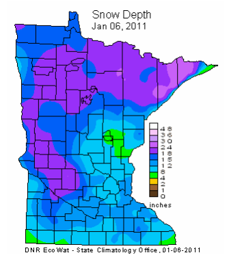
Unusual For First Half of November. With the exception of 1991 we haven't seen this much snow this early in the season in a long time. On average our first 1" of snowcover doesn't arrive until November 22. Ground temperatures are still relatively mild - that, coupled with highs in the upper 30s to near 40 means that MOST of the snow in your yard will probably be gone by Wednesday or Thursday. More from NOAA's National Snow Analyses site here.


As Glaciers Melt, Science Seeks Data On Rising Seas. Sunday's New York Times had an excellent story on what's happening in Greenland and Antarctica. The rate of melting has increased in recent years, and scientists are growing increasingly worried about the rate of change - far beyond what the supercomputer simulations were predicting. The truth: we're in uncharted waters when it comes to the turbulent changes taking place in the Arctic and Antarctic. A limited data set, and some of the satellites we rely on to monitor what's happening are going dark - not to be replaced anytime soon. The latest consensus: a sea level rise of at least 3 feet by the end of the century, which could threaten tens of millions of people living near sea level, including large portions of New Orleans, Florida and the Carolinas.
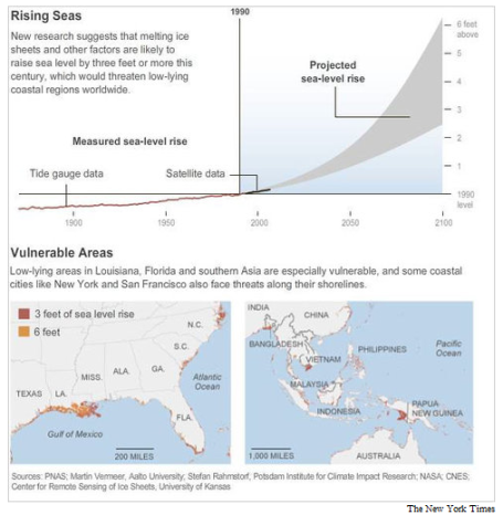
Rising Seas. As water warms, it increases in volume. Melting ice in the Arctic region doesn't add to sea level increases, but land-based melting over Greenland and Antarctica is a factor. As I tell my friends in Florida: don't buy any beachfront property. Buy something 3 blocks inland - and be patient.
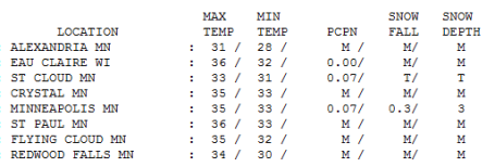
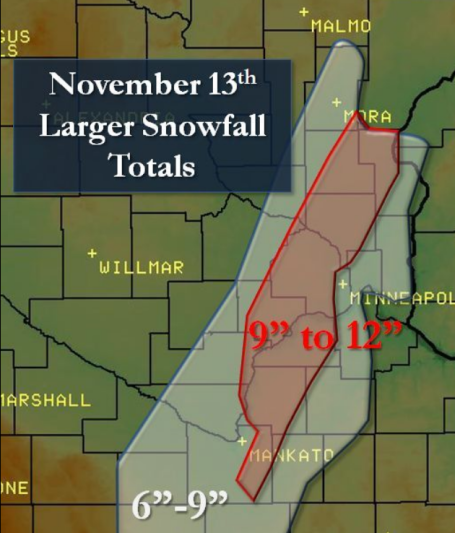
Gray Sunday. The day after the big (narrow) snow-blitz was murky and cloudy - a few flurries just to reminder you that it's still November (and Indian Summer is nowhere in sight). The 7.9" snow that fell in the Twin Cities officially shrank to 3" of slush on the ground by 7 pm yesterday. Highs ranged from 31 at Alexandia and 33 in St. Cloud to 35 in the Twin Cities, about 5 degrees cooler than average.
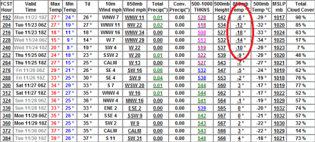
Paul's SC Times Outlook for St. Cloud and all of central Minnesota:
MONDAY: More clouds than sun, brisk. Winds: SW 7-12. High: 36
MONDAY NIGHT: Clouds increase - flurries possible late. Low: 24
TUESDAY: Mostly cloudy - a few passing flurries. High: 35
WEDNESDAY: Mostly cloudy, cool & damp. High: 37
THURSDAY: Fading sun, stiff breeze. High: 35
FRIDAY: Partly sunny, temperatures closer to "average". High: 39
SATURDAY: Clouds increase, late flurries? High: 36
SUNDAY: Periods of light snow, coating - 1" possible. High: 32
The Big Melt
"It figures, we finally get a big pile of snow and most of it melts before I can get outside and romp in it," a friend commented yesterday, disgusted at the (slushy/nasty) state of our snowpack. I feel your pain, but such are the perils of an early-season snowfall. Four days above 60 last week sealed our fate: on Friday soil temperatures were still in the mid 40s. In retrospect I'm amazed ANY snow actually stuck to the ground.
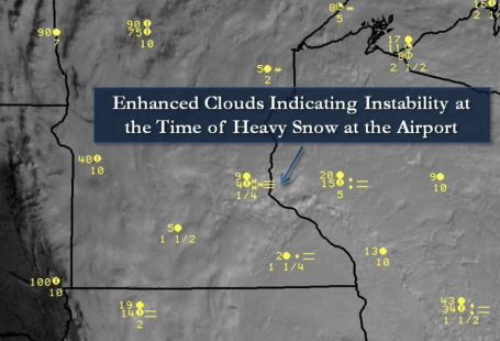
Every storm is different with its own meteorological baggage & eccentricities. Saturday's slushy blast was only 100 miles wide. Maple Grove got buried under a foot, while St. Cloud picks up an inch? And you wonder why meteorologists have gray hairs and pet ulcers.
Maybe it's an omen. On average MSP picks up its first inch of snow cover November 22. If you like snow it's an encouraging start; snow aficionados have had little to cheer about since 66" fell in 2003-2004.
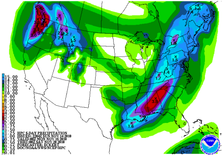
We got our ration of excitement for the month. No more big, headline-grabbing storms are brewing through Thanksgiving. A chilly week is on tap, a few spits of snow every now and then (but no accumulation until next Sunday, when a slushy coating is possible). Turkey-day highs: 32-37 F.

No comments:
Post a Comment