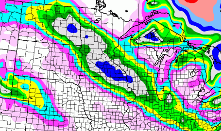
Confidence Increases - Winter Storm Warning Issued. The upgrade from "watch" to "warning" is analogous to a summer thunderstorm scenario - it means the confidence of "problematic weather" has increased to a sufficient threshold where the local NWS has pulled the trigger on a warning - meaning it's imminent, it's coming. The warning does include the Twin Cities, Mankato, St. Cloud, Willmar and Morris and a sliver of western Wisconsin. The greatest chance of 5-8" amounts will come SOUTH of St. Cloud Friday night and early Saturday.
Minnesota Powder. Unlike a few weeks ago, this will NOT be a heavy, wet, slushy, cement-like snowfall. It will be the kind of snow you might see at Vail or Snowmass - light, powdery - perfect for winter weather sports (Saturday should be a phenomenal day to get out and play in the snow). I'm still leaning toward 3-6" for much of the St. Cloud metro, with as much as 5-8" to the south, toward Willmar and Hutchinson, less than 2" for Little Falls - still enough to shovel and plow (and slow down traffic Friday night and first thing Saturday morning).


No comments:
Post a Comment