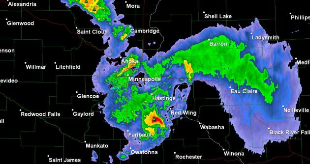
Storms Move Out Of Metro. Doppler radar as of 1:21 pm shows a heavy storm (below severe criteria) over Cottage Grove and Hastings - it should continue to weaken as it drifts into southwestern Wisconsin).
* Severe storm reports from the local NWS office can be found here.
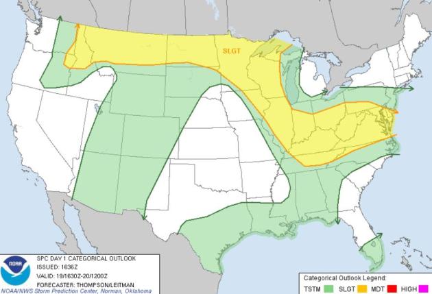
Nagging Severe Risk. SPC has much of Minnesota and Wisconsin in a "slight risk" today. The immediate threat has passed - but strong/severe storms may redevelop later today, especially north and east of the metro area.
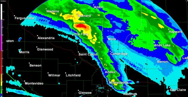
Doppler Rainfall Estimates. Some 3"+ rainfall reports were calculated, using Doppler radar algorithms - the supercell storm that dived southeast into the metro dropped some 1-1.5" rainfall amounts locally.
No comments:
Post a Comment