Todd's SCTIMES Outlook for St. Cloud and all of Central Minnesota
In an effort to follow keep the blog updated through the night, I am updating earlier and keeping the Tuesday night forecast in. I'll have another update during the day Wednesday.
In an effort to follow keep the blog updated through the night, I am updating earlier and keeping the Tuesday night forecast in. I'll have another update during the day Wednesday.
WEDNESDAY: Transitioning to snow through the early AM hours. 1"-2" more snow possible, mainly morning hours. High: 34.
THURSDAY: Sunny start, clouds late. Low: 20. High: 34
FRIDAY: Small chance of snow (the brunt of the storm probably passes east of Minnesota). Low: 22. High: 33
SATURDAY: Mostly cloudy, few flurries possible. Low: 19. High:29
SUNDAY: Another clipper - flakes in the air. Low: 13. High: 27
MONDAY: More sun, warming up again. Low: 20. High: 38
Winter Storm Continues Into Wednesday
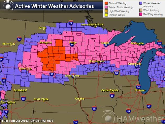
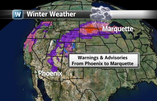
It's A Big Storm
Look at what this system is doing. It has prompted winter warnings and advisories from Phoenix, AZ to Marquette, MI
Timing the Precipitation
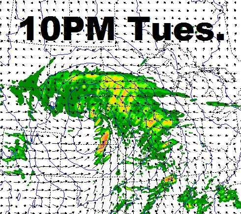
Now that the system has starting spitting out precipitation close to home, here's a look at the timing of the precipitation.
10pm Tuesday
The main surge of moisture will have set up over the Twin Cities and central Minnesota, mainly rain with snow setting up across central Minnesota (mixing with sleet at timesat times)
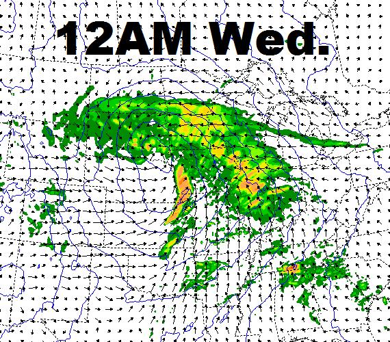
12AM Wednesday
Rain continues for the southern third of the state (maybe even a little thunder). Snow, heavy at times, across central Minnesota and the western tip of Lake Superior will begin to really add up.
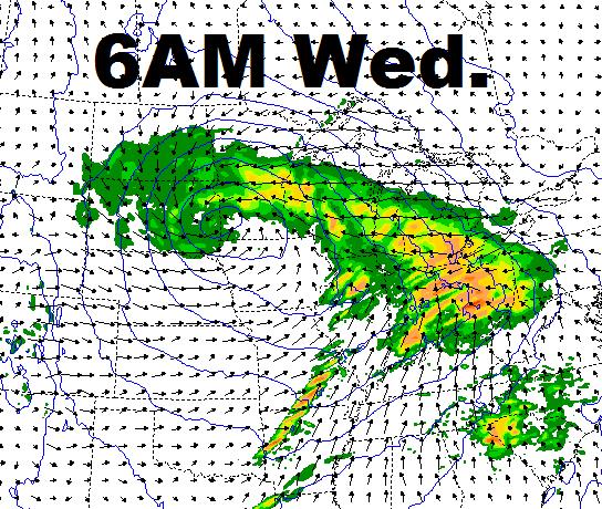
6AM Wednesday
We should start making the transition back to snow as colder air begins wrapping in. This is when we should start seeing some of the snow start accumulating across the Twin Cities.
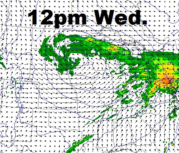
12pm Wednesday
snow will become lighter across much of the state, but could continue at moderate levels near Duluth.
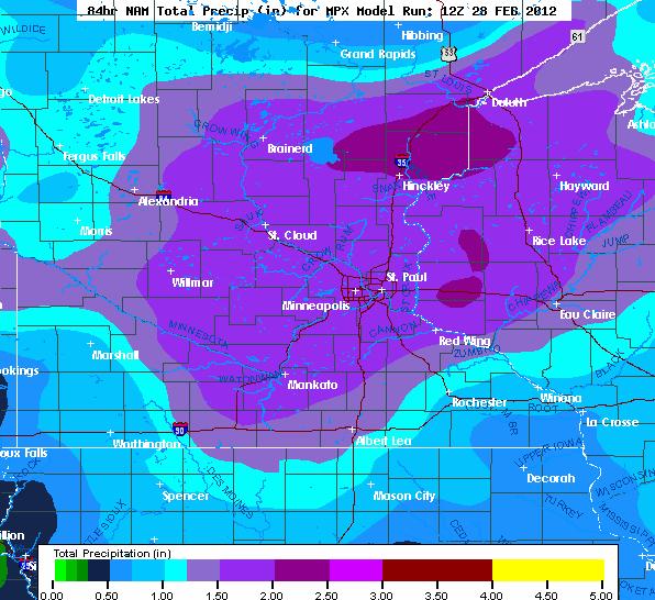
Total Precipitation
This is going to be a wet night ahead, models are still hinting at the potential of 1" to 2" of liquid in spots.
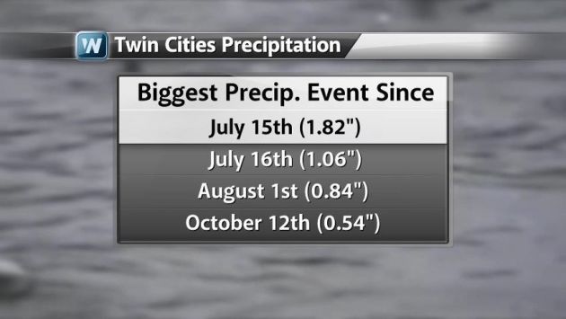
Could Be The Biggest Precipitation Event Since Late Last Summer
The Twin Cities is on the brink of the heaviest precipitation event in quite some time. This is a look at some of the benchmarks, note that the last time we had at least 1" of liquid in a single day was last summer (nearly 7months ago).
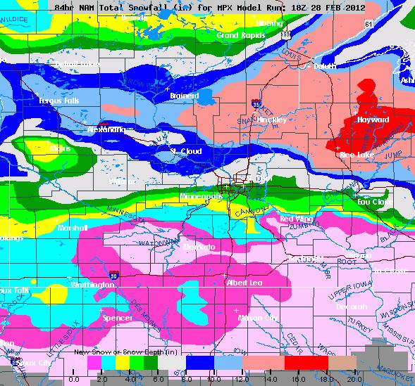
Nam Snowfall
The 18Z NAM actually shifted south just a bit! The heaviest is still expected to be across central MN, but some communities on the northern side of the metro could actually be shoveling on Wednesday!
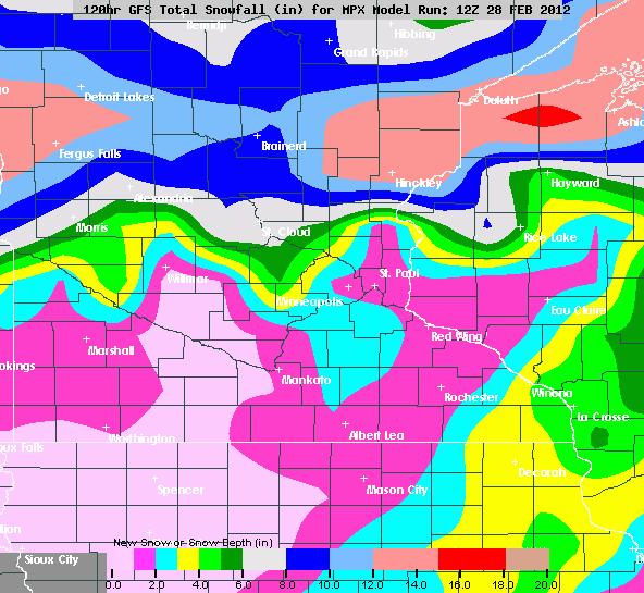
GFS Snowfall
The GFS keeps the heaviest snow across central Minnesota.
Don't forget to follow me on Twitter @TNelsonWNTV
-Meteorologist Todd Nelson-

No comments:
Post a Comment