26 F. high in St. Cloud Tuesday.
22 F. average high on December 29.
10 F. high on December 29, 2014.
December 30, 2005:
A large swath of snowfall in the 6 to 8 inch range falls approximately
north of a line from Madison to Redwood Falls through Glencoe and
Woodbury. Even heavier snowfall occurred west of a Granite Falls to
Willmar line, where reports of between 8 and 11 inches were recorded. In
Willmar, several vehicles were reported stuck in ditches. A semi-truck
also rolled onto its side.
December 30, 1996:
6 to 7 inches of snow falls in Willmar. The new snowfall, in addition
to previous heavy snowfall, caused a portion of the historical society's
roof to collapse.
December 30, 1980: A 'heat wave' develops across Minnesota. Redwood Falls hits 51.
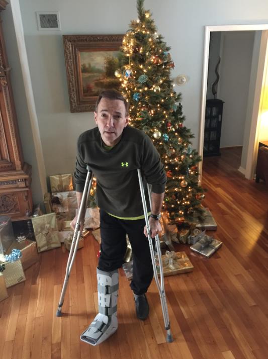 Watch for Ice: Take it From Personal Experience
My crutches are hanging next to the Christmas tree, a giant boot on my newly broken right ankle. Happy New Year!
I'm
a little hazy on what happened. It might have been from lifting a 4 ton
truck off a helpless bystander. Wait, I was skiing a double black
diamond run at Jackson Hole when an eagle landed on my shoulder,
distracting me on the mogul run.
Truth? It was a severe dog-walking accident, slipping on glaze ice, landing hard on my ankle. Tragically funny.
Second
only to motor vehicle accidents, slip and fall accidents account for 15
percent of all accidental deaths in the USA; 8 million emergency room
visits every year. "Look at the situation as the universe
telling/forcing you to slow down" a friend e-mailed.
Be careful out there; your life can change in a few milliseconds.
South metro picked up 5-6 inches, less north - more south of MSP. Respectable, but hardly Snowmageddon.
No more drama, just a chilly New Year's Eve with a shot at freezing from
Saturday into early next week; no storms for at least a week.
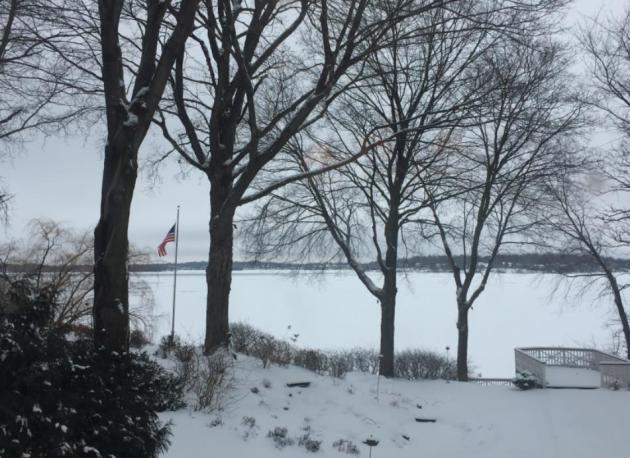
No white Christmas this year, but 2016 will arrive on a cold, crystalline note.
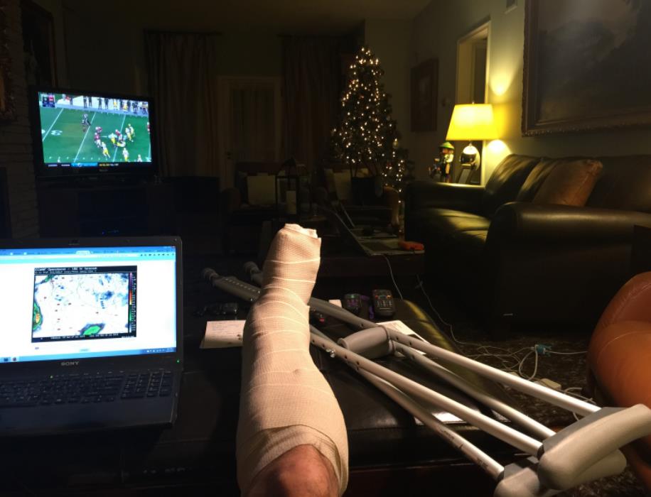 Managing Slip and Fall Injuries
. Since it's top of mind (for me) I wanted to share an excerpt of an eye-opening post at
Culture of Safety. Chances are someone you know, a friend or family member, will take a nasty tumble with serious implications: "...
Slips
and falls are consistently one of the leading causes of injuries
affecting workers in every industry. Slips and falls can range from
minor to severe and can affect people of all age groups. The United
States Occupation Safety and Health Administration (OSHA) recently
conducted a study on slips and falls in the workplace and made the
following discoveries:
- Injuries from slips and falls are the most common work related injury
- 25,000 slip and fall injuries per day
- 35% of all work-related injuries are from slips and falls
- 65% of all work days lost are from slips and falls
- The total annual cost of slip and fall injuries in the United States is over $60 billion annually..."
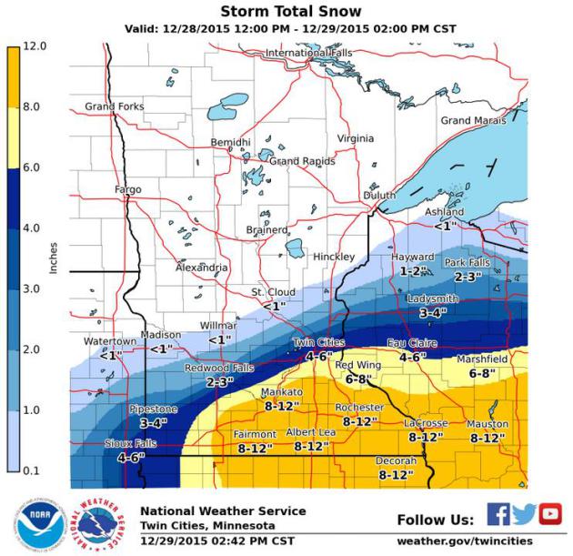
Snowfall Totals.
The GFS had the right idea after all, steering the heaviest snow bands
south and east of MSP. No, the ECMWF doesn't always win the forecasting
battle (although more times than not it has the right idea). About 4-5"
fell across southern suburbs, 2-3" northern suburbs, with 8-10" amounts
as close as Mankato and Rochester, a whopping 12.5" reported at
Mapleton. Here's a partial rundown from
NOAA:
PUBLIC INFORMATION STATEMENT...CORRECTED
NATIONAL WEATHER SERVICE TWIN CITIES/CHANHASSEN MN
1149 AM CST TUE DEC 29 2015

...SNOWFALL REPORTS PAST 24 HOURS ...

LOCATION                     AMOUNT    TIME/DATE
MAPLETON                     12.5 IN   0924 AM 12/29
FAIRMONT                     11.5 IN   1030 AM 12/29
WINNEBAGO                    9.6 IN    0800 AM 12/29
1 N ALBERT LEA               8.5 IN    1012 AM 12/29
MANKATO                      8.5 IN    1146 AM 12/29
SAINT CLAIR                  8.0 IN    0932 AM 12/29
SAINT CLAIR                  8.0 IN    0932 AM 12/29
FARIBAULT                    8.0 IN    0700 AM 12/29
JANESVILLE                   8.0 IN    0915 AM 12/29
JANESVILLE                   8.0 IN    0915 AM 12/29
2 SW LAKEVILLE               7.7 IN    0937 AM 12/29
3 NE TRIMONT                 7.5 IN    1110 AM 12/29
1 S MENOMONIE                7.5 IN    1030 AM 12/29
1 N MINNESOTA LAKE           7.4 IN    0941 AM 12/29
MANKATO 4 E                  7.2 IN    0700 AM 12/29
WELLS                        7.0 IN    0900 AM 12/29
OWATONNA                     7.0 IN    0800 AM 12/29
AMBOY                        7.0 IN    0603 AM 12/29
OWATONNA                     7.0 IN    0800 AM 12/29
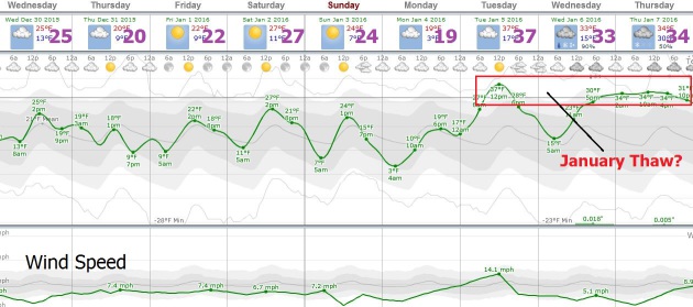 Quiet Spell.
After Monday night's plowable "near-miss" things settle down for the
next week or so, only a slight chance of wet snow or a light mix by the
middle of next week. The next 5 days should be dry with seasonable
temperatures for late December and early Janaury; guidance hinting at a
few days above 32F next week.
Top 5 Weather Events of 2015 in Minnesota. Thanks to Pete Boulay, the State Climate Office and the
Minnesota DNR for passing this along; here's an excerpt: "
Here are the candidates for the top five weather events of 2015 from the Minnesota State Climatology Office. Please visit us on Facebook
and post your top five weather events for Minnesota. Looking back over
the past year there have been a few weather events that stand out
against the rest. From the states second warmest Autumn ever, to smoke
filled skies in July, this years top five events offer the weather
variety Minnesotans are accustomed to.
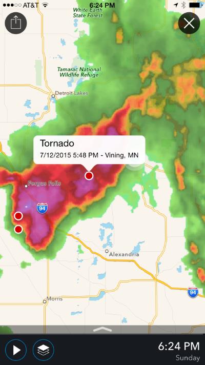
#4 Straight Line Winds Wreck Havoc in the Brainerd Lakes Area: July 12, 2015
The
most damaging severe storm event of the year came in the form of a line
of severe thunderstorms that brought winds from 70 to 95 mph in an area
just south of Wadena eastward to the Pillsbury State Forest where winds
were in excess of 100mph in places. Significant damage was done to
resorts on Gull and North Long Lake as well as the grandstand at the
Brainerd International Raceway..."
Screenshot credit:
Aeris Pulse.
Historic Storm Set to Slam Iceland, Northern UK with Hurricane-Force Winds. Andrew Freedman at
Mashable
has a good overview of a wild storm bringing the prospect of more wind,
wave and flood damage - and record warmth for the North Pole; here's
the intro: "
One of the strongest storms on record to form in the
North Atlantic is set to rock Iceland with winds above hurricane force
by Wednesday. It's also expected to drive a new batch of rain and wind
to flood-weary areas of the UK. The storm could even set an all-time
record for the strongest storm to develop in this part of the North
Atlantic. The storm will be a meteorological marvel, intensifying so
rapidly that the term "bombogenesis" is perhaps an understatement to
describe its intensification. Aiding its explosive development is a jet
stream on steroids, with winds of 230 miles per hour roaring across the
North Atlantic at aircraft cruising altitudes..." (Image:
earth.nullschool.net)
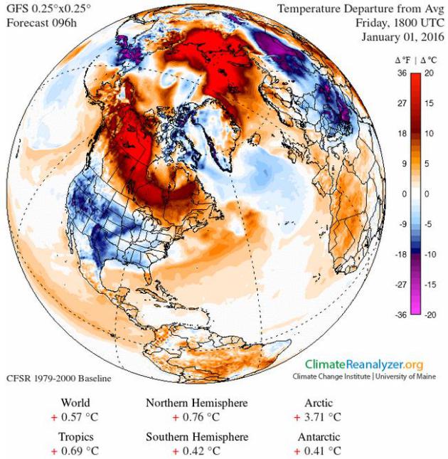
In Canada's Far North, Warm Weather Threatens Vital Ice Road. Here's an excerpt from
Reuters: "...
To
climate scientists, this year's late freeze could be a harbinger of
winters to come. It also raises the alarming prospect of thawing
permafrost - the frozen layer of soil covering nearly half of Canada's
landmass - which traps methane, a greenhouse gas, which would only
hasten warming. This year's warmer
temperatures may be connected to the El Nino climate phenomenon, a
periodic warming of Pacific Ocean waters that has far-reaching effects.
It is Yellowknife's second
warmest December on record, said David Phillips, a senior climatologist
at Environment Canada, Canada's national weather service. So far, the
average temperature for this December is just above -15 Celsius,
marginally cooler than the -13 Celsius for December 2005, but well above
the mean of around -22 Celsius..."
Map credit: GFS temperature anomalies valid 18z January 1 courtesy of Climate Reanalyzer.
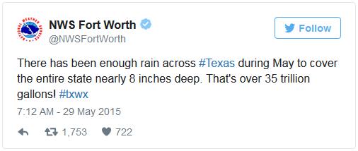
10 of the Wildest Weather Stories of 2015.
You'll remember many of these jaw-dropping moments, highlighted by
Boston's mega-snows and historic flooding across the Deep South; here's
an excerpt from wisc.com and Sinclair Broadcast Group: "...Texas and Oklahoma faced their wettest month on record in May 2015, with both states far exceeding their previous records
for total rainfall. According to the National Weather Service, Texas
was hit with enough rain to cover the entire state in 8 inches of water.
The worst of the rainstorms around
Memorial Day delivered fatal floods in Texas, Oklahoma, and Arkansas.
Flooding earlier in the month caused an estimated $210 million in damage
in Nebraska. In total, at least 40 deaths were blamed on southern
flooding in May, according to the Weather Channel. President Obama declared a major disaster as storms bore down on Texas, causing evacuations, damage, and death..."
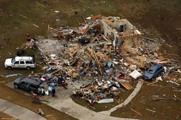
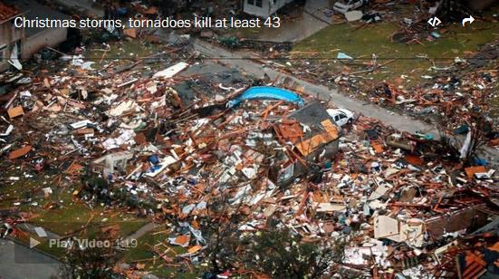
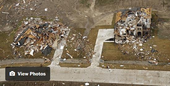
Why Forecasting Tornadoes is so Difficult.
CNBC
takes a look at the implications of the worst tornado death toll in
December since 1953 in the United States, long before Doppler and
split-second warnings: "...
While there are some days that we know
are going to produce storms ... there are other days where conditions
that are favorable for a tornado to form come together so briefly — for a
few hours and over a very small area," he said. "You really have to be
incredibly diligent and never assume that it can't happen today because
conditions don't look favorable. All it takes is one relatively small
change in how the atmosphere is structured or how it is behaving, and
that can make an incredible difference in the outcome." That means that
the National Weather Service often has little time to issue a proper
warning — sometimes only a few minutes — before a storm hits..."
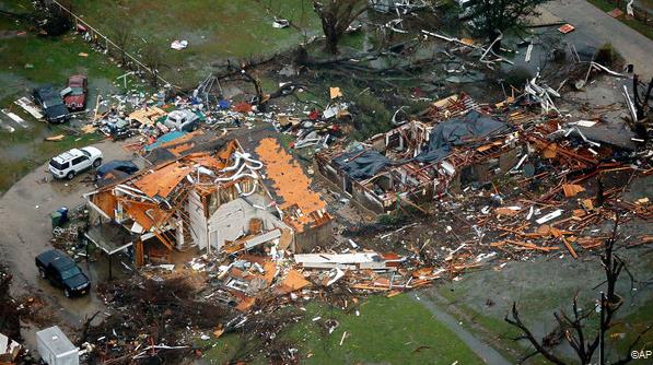
Photo credit above: "
This
aerial photo shows a damaged home after a tornado ripped through the
area, Monday, Dec. 28, 2015 in Texas. Residents surveyed the destruction
from deadly tornadoes in North Texas as the same storm system brought
winter woes to the Midwest on Monday, amplifying flooding that's blamed
for more than a dozen deaths and prompting hundreds of flight
cancellations. At least 11 people died and dozens were injured in the
tornadoes that swept through the Dallas area Saturday and caused
substantial damage." (G.J. McCarthy/The Dallas Morning News via AP)
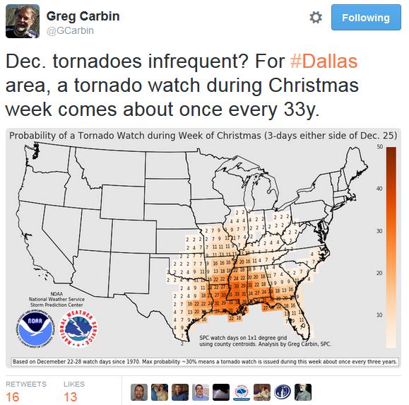
This Month Is Now the Deadliest December for Tornadoes in 60 Years.
Killer tornadoes in December are unusual, but not unprecedented,
especially during strong El Nino events, which tend to strengthen the
southerly branch of the jet stream, increasing wind shear and the
potential for violent supercells. Here's a clip from
The Capital Weather Gang: "
Up
until Christmas week, 2015 was looking really good for tornado safety
and was on track to become the least-deadly tornado year on record since
the late 1800s. But multiple holiday severe weather
outbreaks — including two deadly tornado days — pushed the year well
beyond its near-record, and made this month the deadliest December on
record for tornadoes in over 60 years. Through Dec. 22, just 10 people
had died in tornadoes in 2015. While it’s true that even a single life
lost is one too many, 10 tornado deaths in an entire year is
exceptionally low..."
Photo credit above: "
Holiday storms cut a path of death and destruction across the country, killing dozens of people and leaving many homeless." (Reuters).
*
Winds estimated close to 200 mph from an EF-4 tornado near Dallas swept
vehicles off of Interstate 30, killing at least 8 people. The New York Times provides more context.
The Meteorology That Led to the Deadly Late-December Tornado Outbreaks.
The Capital Weather Gang
sets up the synoptic pattern that resulted in a swarm of tornadoes,
including a rare December EF-4 near Dallas; here's an excerpt: "...
The
synoptic weather chart from Dec. 26 shows the key atmospheric players.
The strong Bermuda high parked over the Atlantic Ocean circulated warm,
moist, unstable air northward, feeding into the warm sector of a surface
low pressure system. Meanwhile, fast winds coursed along a pronounced
dip in the jet stream, the trough, while sub-freezing air filtered
southward into northern Texas. Some of the cold air aloft overlapped
warm air at low levels in the cyclone’s warm sector, creating an
explosively unstable atmosphere. The core of fast winds developed both
directional turning and increase in speed with altitude (wind shear), an
ideal configuration for supercell thunderstorms that spawn nearly all
violent tornadoes..."
* Early estimates of tornado-related damage in Texas:
$1.2 billion.
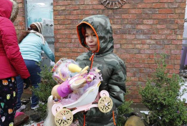
5 Tips for Helping Kids With Tornado Fears.
Surviving a tornado brings on a weather-related form of PTSD, it really
is a form of trauma and should be treated as such. Here's an excerpt
from
The Dallas Morning News: "...
Children
of all ages may need and benefit from repeated reassurance. Although
you can’t promise that tornadoes won’t return, you can reassure them
that tornadoes are rare. Multiple conversations may be necessary,
especially when children return to school and hear classmates say things
that may need clarification. Maintaining typical schedules and routines
can be comforting. Parents should stick to regular bedtimes, mealtimes
and playtime. Preschool and elementary school age children might ask to
sleep with parents. This is OK in the short term, with the understanding
that it’s temporary until a set future date. For those directly
affected by the tornadoes, parents should attempt to provide as much
consistency and routine as possible at the shelters..."
Photo credit above: David Woo/Staff Photographer. "Hitel
Rodriguez, 8, carries toys from his uncle's home in the 300 block of
Mesa Drive in Glenn Heights on Monday, December 28, 2015. The tornado
killed 11 people across North Texas on Saturday, December 26, 2015."
Bizarre December Weather Continues.
EF-4 tornadoes in late December, extreme flooding from Mississippi to
Paraguay to the U.K. Is this normal? Here's an excerpt from Danny
Satterfield's blog at
AGU Blogosphere: "...
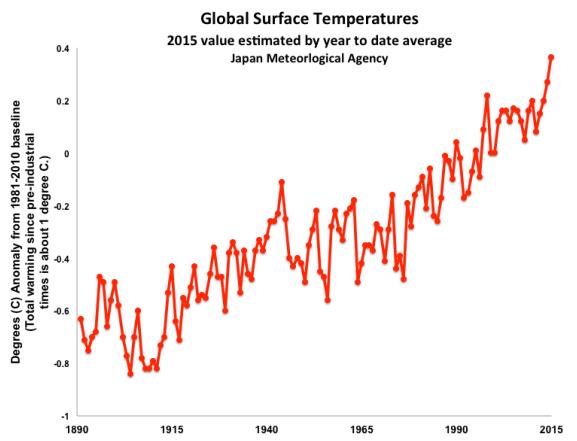
The warming oceans are
making this El Nino event even stronger and it’s far from over. This
year globally was the hottest ever recorded, and it beat the previous
record set just last year. It may have been the hottest in several
thousand years and I’ve heard talk that it may be the warmest since the
ice age ended. Yes, really.
The weather pattern is changing as we head into the new year, but it
may not bring much relief from the floods and severe storms. It will
bring colder air and snow to the Eastern U.S., and with the record
warmth of the water off the East Coast, there will be plenty of moisture
for heavy snow. You can blame that on El Nino and “clean coal” as well..."
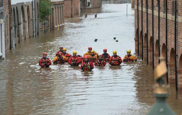
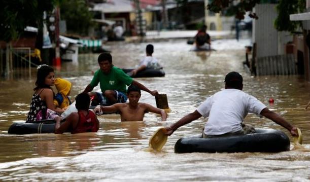
Photo credit above: "Members
of the Mountain Rescue team wade through floodwater in Skeldergate,
York. England, Monday, Dec. 28, 2015. British Prime Minister David
Cameron sent hundreds more troops into northern England on Sunday to
help exhausted residents and emergency workers fight back rising river
waters that have inundated towns and cities after weeks of heavy rain." (Anna Gowthorpe/PA via AP).
* Flood threat on the Lower Mississippi River could rival 2008 and 2001, potentially impacting thousands of people. Details
here.
El Nino and Climate Change to Blame for Extreme Weather in Five Continents.
Raw Story and AFP has an update; here's an excerpt: "...
This
year’s El Nino is the most powerful ever measured, surpassing the one
in 1997-98, both in terms of ocean surface temperature — up by more than
3C (5.4F) — and the surface area affected, said Lecou. As was true in
1998, this year’s super El Nino will have contributed to making 2015 the
warmest on record, worldwide. But the reverse may also be true, with
climate change boosting the power of cyclical El Nino events. “If you
add the background global warming to natural weather phenomena, there’s a
tendency to break records left and right,” Le Treut told AFP..."
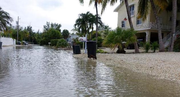
Photo credit above: "
Adams Drive in Key Largo, Florida has been flooded for nearly a month, after high tides were exacerbated by a super moon." (AFP Photo/Kerry Sheridan).
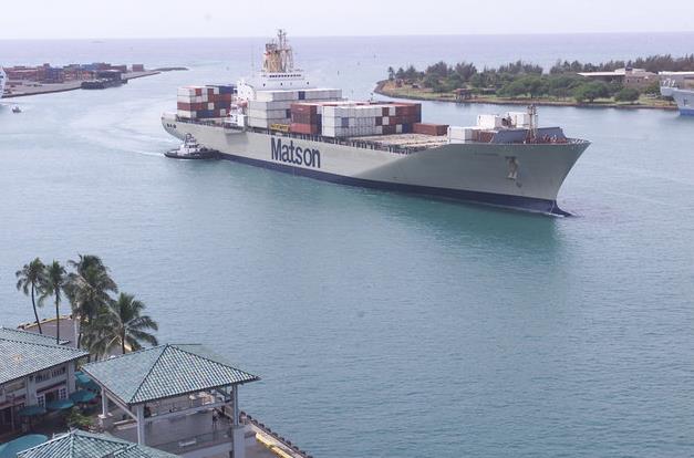
Scientists Cleverly Use Cargo Ships for New Tsunami Warning System.
Huffington Post reports; here's an excerpt: "...
By using GPS
systems and satellite communications, the newly outfitted ships form a
network of open ocean tide gauges. In the deep ocean, a tsunami wave may only be a few inches high.
But with the additional data points, researchers will be able to
generate more accurate predictions and models -- and at a fraction of
the price of a network of fixed sensors. “Our approach offers a new,
cost-effective way of acquiring many more observations to augment the
current detection networks,” co-investigator Todd Ericksen said in the statement..." (File photo: AP).
For the Wealthiest, a Private Tax System That Saves Them Billions.
The New York Times has a story that may leave you smoldering; here's an excerpt: "...
With
inequality at its highest levels in nearly a century and public debate
rising over whether the government should respond to it through higher
taxes on the wealthy, the very richest Americans have financed a
sophisticated and astonishingly effective apparatus for shielding their
fortunes. Some call it the “income defense industry,” consisting of a
high-priced phalanx of lawyers, estate planners, lobbyists and anti-tax
activists who exploit and defend a dizzying array of tax maneuvers,
virtually none of them available to taxpayers of more modest means..."
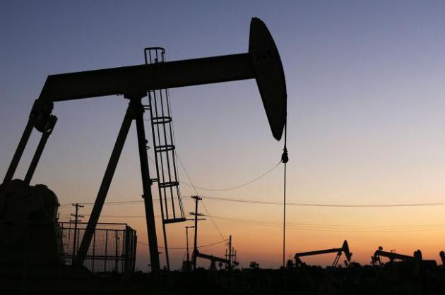
Why Big Oil Should Kill Itself. An Op-Ed from Anatole Kaletsky is Chief Economist and Co-Chairman of Gavekal Dragonomics got my attention at
Project-Syndicate; here's an excerpt: "
Mark Carney, Governor of the Bank of England, has warned
that the stranded-asset problem could threaten global financial
stability if the “carbon budgets” implied by global and regional climate
deals render worthless fossil-fuel reserves that oil companies’ balance
sheets currently value at trillions of dollars. This environmental
pressure is now interacting with technological progress, reducing prices
for solar energy to near-parity with fossil fuels. As technology
continues to improve and environmental restrictions tighten, it seems
inevitable that much of the world’s proven oil reserves will be left
where they are, like most of the world’s coal. Sheikh Zaki Yamani, the
longtime Saudi oil minister, knew this back in the 1980s. “The Stone Age
did not end,” he warned his compatriots, “because the cavemen ran out
of stone.” OPEC seems finally to have absorbed this message and realized
that the Oil Age is ending. Western oil companies need to wake up to
the same reality, stop exploring, and either innovate or liquidate."

Elon Musk is Right About the Threat of AI; But He's Dangerously Wrong About Why. Well now I'm cheered up. Where's Arnold Schwarzenegger when you need him? Cue the theme from SkyNet. Here's an excerpt from
Quartz: "
Elon
Musk and Stephen Hawking are right: AI is dangerous. But they are
dangerously wrong about why. I see two fairly likely futures: Future
one: AI destroys itself, humanity, and most or all life on earth,
probably a lot sooner than within 1000 years. Future two: Humanity
radically restructures its institutions to empower individuals, probably
via trans-humanist modification that effectively merges us with AI. We
go to the stars..."
The True Story of Roland the Farter, and How the Internet Killed Professional Flatulence.
Hey, I don't make the news, I just report it, even news of the bizarre.
Here's another reason why highly intelligent aliens have thus far
bypassed planet Earth, reported by
Atlas Obscura: "
Roland, court minstrel to 12th
century English king Henry II, probably had many talents. But history
has recorded only one. Referred to variously Rowland le Sarcere, Roland
le Fartere, Roland le Petour, and Roland the Farter, Roland really had
one job in the court: Every Christmas, during the court’s riotous
pageant, he performed a dance that ended with “one jump, one whistle,
and one fart”, executed simultaneously. For this, Roland was gifted a
manor house in Hemingstone, Suffolk, and more than 100 acres of land. For farting on cue..."
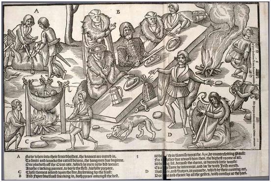
Image credit above: "
A
plate originally from The Image of Irelande, by John Derrick, published
in 1581. Note the flatulentists on the right side (h/t the Lavatory Reader)." (Photo: Public domain)
TODAY: Chilly, few flakes but little or no accumulation. Winds: NW 5-10. high: 25
WEDNESDAY NIGHT: Mostly cloudy. Low: 14
NEW YEAR'S EVE: Mostly cloudy, feels like 5-10F. Winds: W 10-15. Wake-up: 14. High: 20
NEW YEAR'S DAY: Cold start, few hours of sun. Winds: NW 8-13. Wake-up: 8. High: 26
SATURDAY: Intervals of sun, a bit milder. Winds: W 10-15. Wake-up: 14. High: 32
SUNDAY: Blue sky, light winds, above average. No problem getting home. Winds: SW 5-10. Wake-up: 16. High: near 30
MONDAY: Intervals of sun, still quiet. Wake-up: 18. High: 33
TUESDAY: Passing rain shower, fleeting thaw. Wake-up: 28. High: 37
Climate Stories...
"...
I
think if we were truly confronted with the humanitarian consequences of
climate change, only a tiny proportion of individual humans would
accept the risk and suffering entailed by inaction. Yet, despite
acknowledging the data on this, nations continue to squabble over
negligible reductions in carbon emissions. Individual humans have the
foresight and global perspective to appreciate that this is a disaster,
but our organizations are structured to deny that perspective precisely
because it undermines their success in short-term competition..."
- from a Quartz essay on the perils and promise of AI,
available here.
 Highlights of Climate Change Research in 2015
.
Greg Laden takes a look at some of the biggest headlines of the year related to climate science; here's the intro: "
The
following is a list of posts on this blog that report new climate
change research, usually but not always from the peer reviewed
literature, or posts that are longer essays intended to give context to
ongoing climate change research. The first few posts are from December
2014, which addresses the fact that “year end summaries” tend to be
written during December, or even before, so December of any given year
gets the shaft.
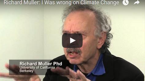
2015 Review: Richard Muller "I Was Wrong on Climate Change". Here's an excerpt of a post and video from
Peter Sinclair: "
For
those that don’t remember, Richard Muller is the UC Berkeley physicist,
who became, briefly, a darling of climate denialdom, after saying a
bunch of nasty things about climate scientists and their research. With
money from the Koch Brothers, Muller formed a new research team,
determined, he said, to get to the truth of the temp record. Funny
thing, he confirmed what all those crazy climate scientists had been
saying all along..."
2015 in Review: The Year Environmental and Climate Issues Left Their Silos. Here's a clip from
Environmental Health News: "..
.Scientists,
too, are connecting more dots among different environmental topics. In
July and November, Stanford University professor Paul Ehrlich and
University of California, Berkeley, Professor John Harte published two
pieces on food security and the intertwined nature of ecological and
social systems. "An enormous number of conditions have to be met if
humankind is to thrive sustainably," Ehrlich and Harte wrote in the International Journal of Environmental Studies this summer.
They added: "The basic dilemma facing humanity is how to solve enough
of these problems, many if not most acting synergistically, to avoid a
disastrous decline in general health, cognitive ability, and social
order..." (File photo credit: Brian Weed, Shutterstock).
This is Why Scientists Have Hope For The Climate. Here's an excerpt of an interview at
Climate Central. David Titley, director of Penn State's Center for Solutoins to Weather and Climate Risk says:
"...
Paris,
of course, but more substantively for the U.S. domestic movement is the
sense more and more different groups are seeing climate change as an
issue within their domain: big business, insurance and finance, multiple
major religions, the divestment movement, health, national security,
movies, and the media, as well as the traditional science and
environmental communities. Ultimately, we have to have enough people
care enough to get Congress to engage constructively and move both
policies and money to transition our energy systems to non-carbon based
forms as quickly as possible. Huge task, but if we’re focused we can do
this..." (File photo: NASA).
 Man-Made Warming Blamed for Exceptional Weather Conditions.
 Is
the ongoing warming, especially of the world's oceans, a significant
contributing factor? How much can be attributed to this vs. El Nino?
Here's an excerpt from
Financial Times: "
Record
December warmth is affecting large areas of the northern hemisphere,
including most of Europe and the eastern US, while severe flooding hits
places from Paraguay to the north of England.
Climate scientists pin responsibility for the exceptional weather on
man-made warming, combined with random variability and El Niño, the
natural heating of the tropical Pacific Ocean that occurs every few
years. David Rooke, an expert on flooding and deputy chief executive of
the UK Environment Agency, said on Monday that flood preparations
required a “complete rethink” as a result of climate change. “We are in a
period of known extremes and we are moving into a period of unknown
extremes,” he told BBC Radio..."
Photo credit above: "
Damage left after Saturday's tornado in Garland, Texas." Associated Press.
The 8 Biggest Climate Storylines of the Year. Climate Central takes a shot at the biggest climate headlines of 2015; here's the intro: "
We’re
coming to the end of arguably the most influential year ever when it
comes to climate change. The agreements struck at the Paris climate talks
gave the world hope that nations could finally get their acts together
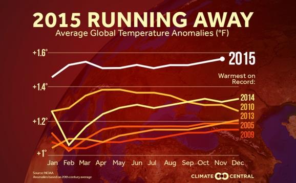
to cut carbon emissions and with them, the risks climate change poses. And talk about a good timing. On top of being the hottest year on record, 2015 also saw a significant carbon dioxide milestone passed, sea level rise projections raised and one of the strongest El Niño’s on record.
Next year will be a new chapter in the evolving story of our
relationship with climate change. But here are the main storylines that
developed in 2015..."
Weather, Climate Change and Related Matters in 2015.
Greg Laden takes a look at some of the big themes and memes of 2015,
with extreme flooding topping his list. How much of this is "natural"
vs. enhanced by rising temperatures and water vapor levels? Here's an
excerpt of
his post: "...
There
are probably two or three reasons for increased flooding, which of
course is caused by increased and concentrated rainfall along with other
factors such as land use changes that cause rainfall to result in more
flooding. One is the simple fact that a warmer atmosphere, due to global
warming, contains more water, and thus, we get more rain. How much
more? Not a lot, but enough to make a difference. If you put together a
bunch of weather data and plot the annual precipitation rate over the
last century or so, and fit a line to the data, the line will look flat.
It isn’t really flat, and in fact, a properly fitted line on good data
will show a statistically significant upslope. But still, the total
amount of extra precipitation is a small percentage of the usual amount
of precipitation, so the slope is not impressive unless you draw it out
using heavy-handed graphing methods..." (File photo: EPA).

No comments:
Post a Comment