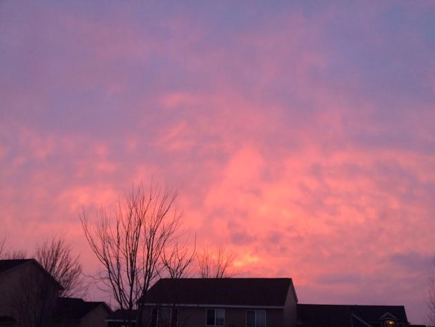
The sunset on Thursday evening was pretty spectacular. Even though it was breezy, there was still a slight hint of spring in the air with temperatures hovering around 40F.
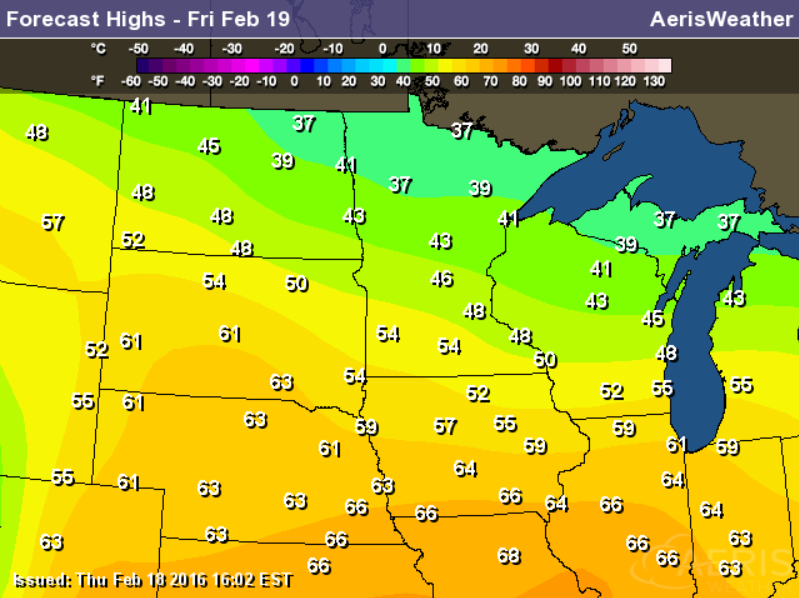
50s in February?
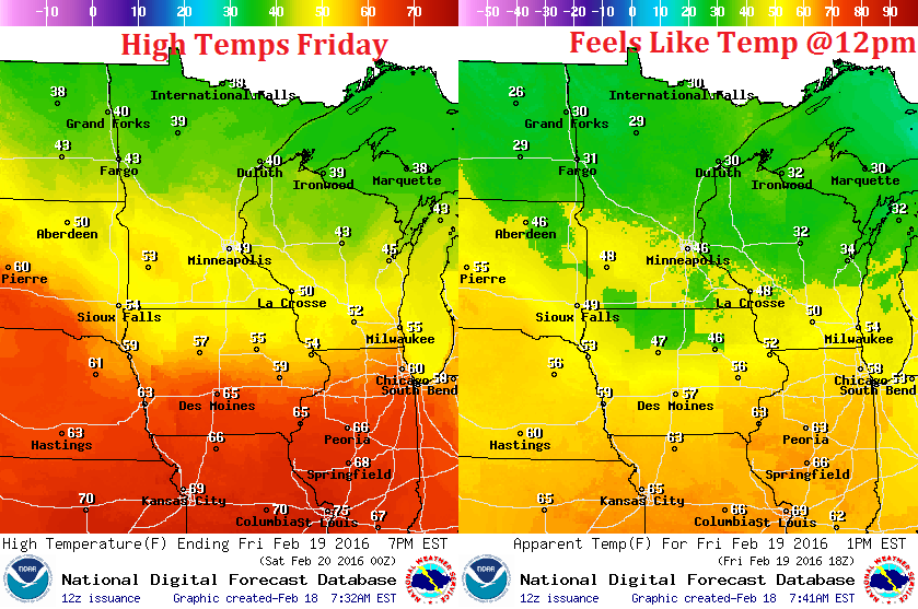
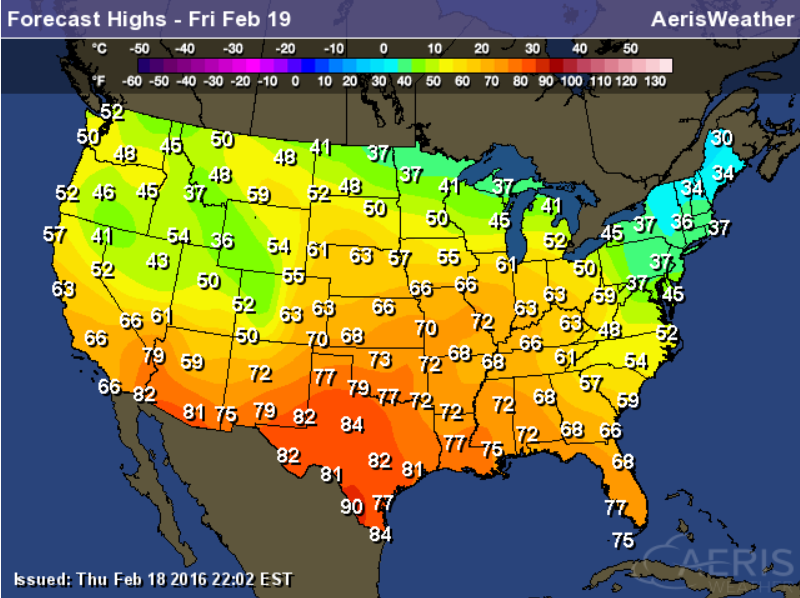
Here's the high temperature map across the Midwest for Friday. Note that highs near the Twin Cities could be close to 50F!!
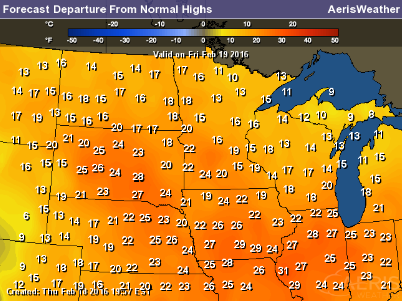
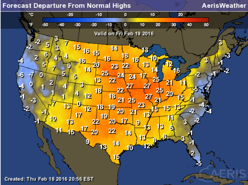
Highs From Average Friday
March-like temperatures will invade much of the Midwest with daytime highs nearly 10F to 25F above average on Friday.
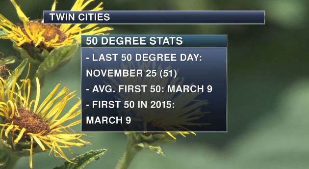
Last 50F Day in Minneapolis?
Check
this out... when was the last time the Twin Cities hit 50F?? It was
nearly 3 months ago that the Twin Cities had a 50F reading. Last year
the first time we hit 50F was on March 9th, which turns out to be the
average first 50F of the season.
Daydreaming of 2016: A Long Look Ahead
By Paul Douglas
The extended outlook is never black or white but some nebulous shade of gray. The weather never repeats - but sometimes it rhymes.
We're coming out of the most intense El Nino on record, similar to 1998. My confidence level is low to moderate, but I'd wager a stale bagel that 2016 will trend warmer than average, overall. Spring will should come earlier; ice coming off area lakes sooner than average. With less snow on the ground the risk of extensive spring river flooding has lessened but I'm betting on more hail & severe T-storms than previous springs.
The risk of drought is small, but models suggest a pivot to La Nina, which could spark drier conditions by late summer and fall. Then again it never works out exactly the way you think it will.
Rain showers arrive Friday; 40s into Saturday before cooling off a little. The last weekend of February may bring 50 degrees; a mild, Pacific-flavored westerly flow spilling into early March.
What did Yogi Berra say? "It's tough to make predictions, especially about the future." Yep. Ask any stockbroker, economist or politician.
________________________________
Extended Forecast
THURSDAY NIGHT: Cloudy and breezy with a slight chance of rain. Winds: SSE 15-25. Low: 37.
FRIDAY: Hello March. Few rain showers. Winds: SSW 20-35. High: 48.
FRIDAY NIGHT: Partly cloudy. Winds: 15-30. Low: 35.
SATURDAY: Partly sunny, hints of spring. Winds: WNW 10-15. Wake-up: 35. High: 45
SUNDAY: Cooler, few flurries in the air. Winds: NNW 5-10. Wake-up: 30. High: 38
MONDAY: Partly sunny, closer to average. Winds: N 5. Wake-up: 23. High: 34.
TUESDAY:Patchy clouds, a bit milder. Winds: SW 5-10. Wake-up: 26. High: 40.
WEDNESDAY: Mix of clouds and sun, light winds. Winds: NW 5-10. Wake-up: 28. High: 41.
THURSDAY: Lots of clouds, feels like March. Wake-up: 30. High: 42.
________________________________
This Day in Weather History
February 19th
1928: A dust storm moves across Minnesota, causing lights to be turned on in the daytime in the Twin Cities.
________________________________
Average High/Low for Minneapolis
February 19th
Average High: 30F (Record: 57F set in 1981)
Average Low: 14F (Record: -20 set in 1941)
________________________________
Sunrise/Sunset Times for Minneapolis
February 19th
Sunrise: 7:08am
Sunset: 5:46pm
*Daylight gained since yesterday: ~2mins & 58secs
*Daylight gained since winter solstice: ~1hr & 51mins
_________________________________
Moon Phase for February 19th at Midnight
2.5 Days Until Full (Snow) Moon

____________________________________
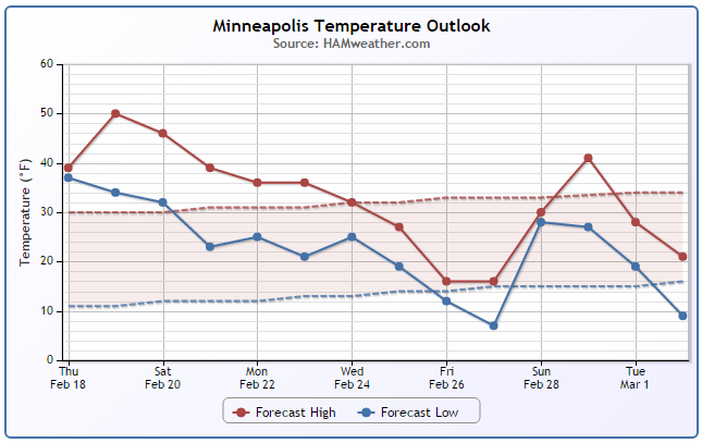
Minneapolis Temperature Trend
Well above average temperatures continue through the next several days with the warmest day being Friday as we are nearly 20F above average. The extended forecast suggests readings falling back to near average by the middle part of next week.
Friday Weather Outlook
High temperatures on Friday will be well into the 30s and 40s across the state, however there will likely be some 50s across the southern part of the state.
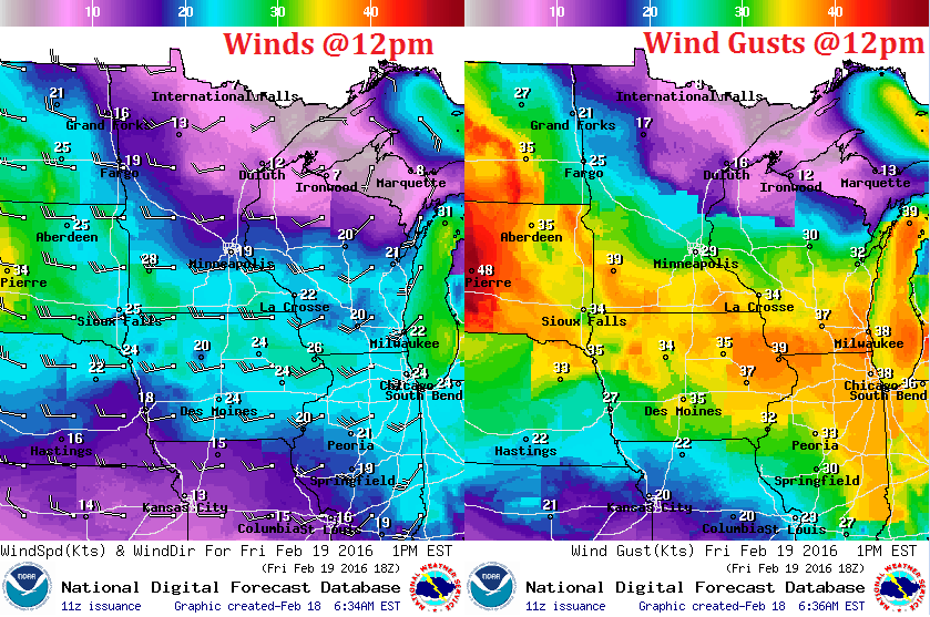
Friday Weather Outlook
Strong winds will be present across parts of the Midwest with gusts possibly up to 30mph+
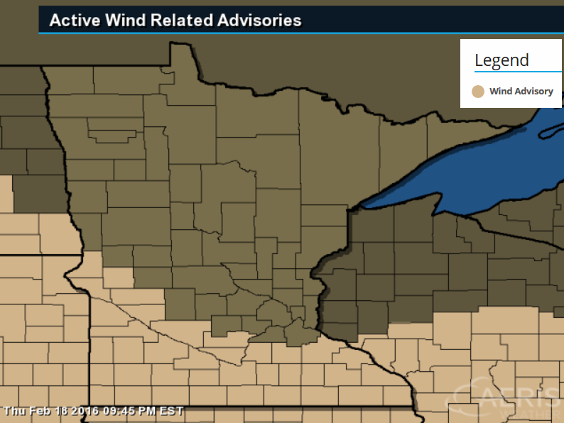
Wind Advisory
...WIND ADVISORY IN EFFECT FROM 3 AM TO 6 PM CST FRIDAY...

THE NATIONAL WEATHER SERVICE IN TWIN CITIES/CHANHASSEN HAS ISSUED
A WIND ADVISORY...WHICH IS IN EFFECT FROM 3 AM TO 6 PM CST
FRIDAY.
* TIMING...3 AM TO 6 PM CST FRIDAY.
* WINDS...GUSTS 40 TO 50 MPH.
* IMPACTS...DIFFICULT TRAVEL FOR HIGH PROFILE VEHICLES.
Friday Weather Outlook
Weather conditions will be somewhat inclement across the region as our storm system moves through. Areas of rain on Friday look to transition back to wintry precipitation through the weekend.
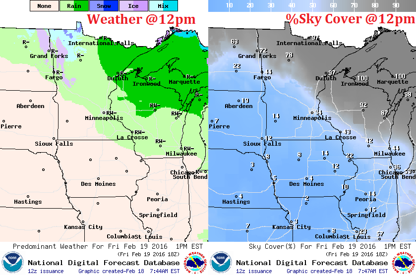
Simulated Radar
Areas of rain on Friday will give way to wintry precipitation through the weekend. The heaviest precipitation will be found along the international border.
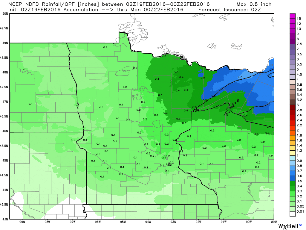
Precipitation Outlook
The precipitation outlook through PM Sunday suggests the heaviest precipitation across the Arrowhead of Minnesota with lighter amounts near farther south.
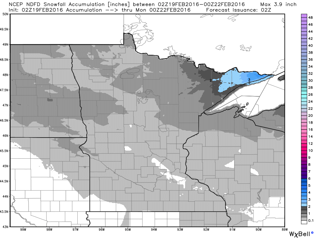
Snowfall Outlook
Snowfall potential through PM Sunday suggests light snowfall accumulations possible across the northern half of the state. The heaviest will be found across the Arrowhead.
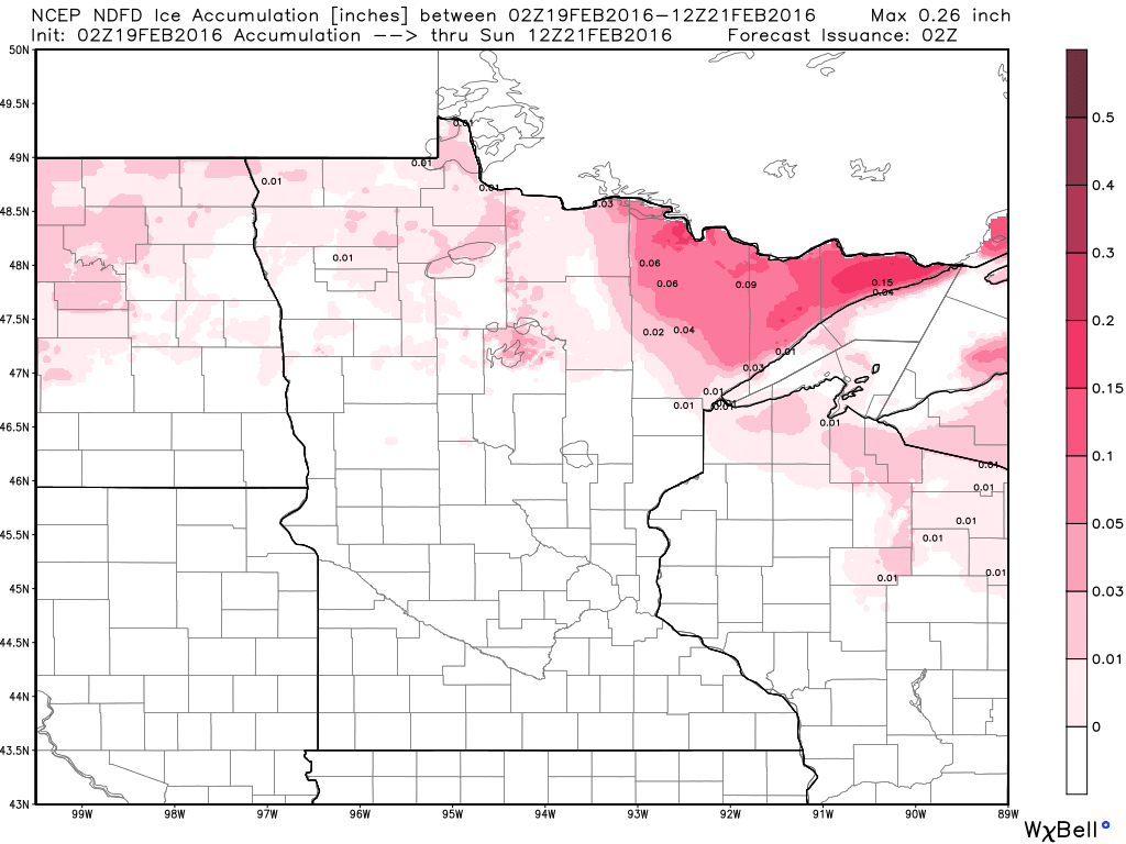
Icing Potential
Icing potential will be found mainly across the northern tier of the nation. The heaviest potential appears to be across the Arrowhead.
______________________________________
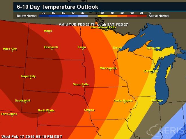
6 to 10 Day Temperature Outlook
According to NOAA's CPC, the 6 to 10 day temperature outlook, there is a good chance of warmer than average temperature continuing into next week.
_________________________________
National Weather Outlook
Active weather in the Western U.S. will continue to progress east through the nation, but will mainly impact the northern tier of the nation.
5 Day Precipitation
After a recent soggy weather in the Western U.S., things will begin to calm down in the Southwest. The heaviest precipitation will shift northern along the northern tier of the nation. However, there appears to be a bigger chance of moisture across the Gulf Coast States by early next week as showers and thunderstorms develop.
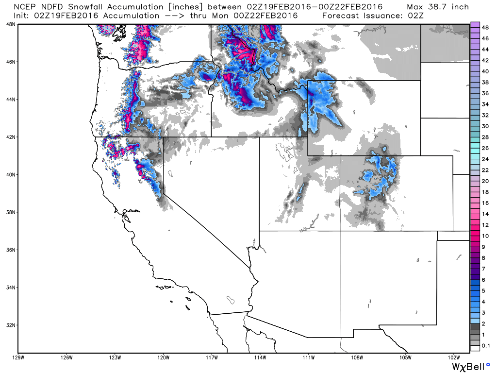
Western Snowfall Potential
The heaviest snowfall tallies will begin to fade across the Sierra Nevada Range, but will continue across the Cascade Range and into the Northern Rockies.
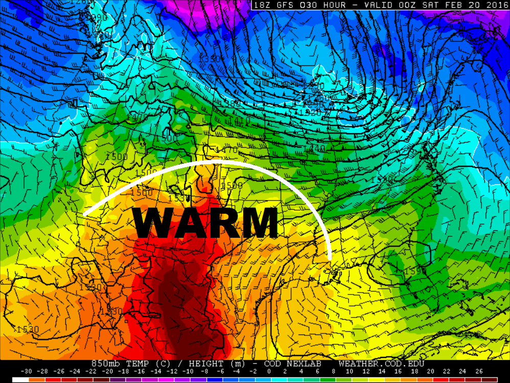
Warm Temps Continue
Record warmth that was found in the Western U.S. earlier this week and into the Central Plains mid week will get squashed a little on Friday. However, well above average temperatures continue.
High Temperatures Friday
Highs From Average Friday
Thanks for checking in and have a great rest of your week and weekend ahead!
@TNelsonWX

No comments:
Post a Comment