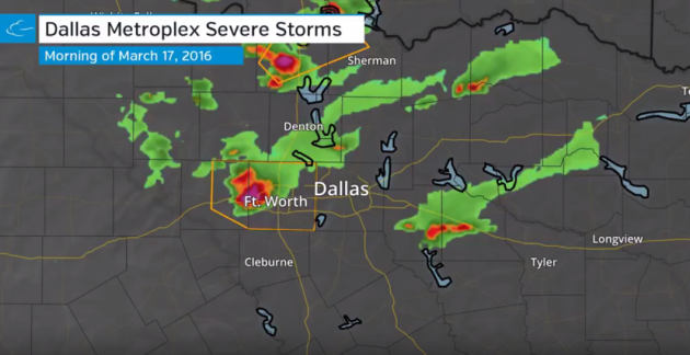
Here's the radar loop from AM Thursday from the Dallas/Ft. Worth area., which shows strong/severe storms rolling through the area with large hail.
See the full video HERE:
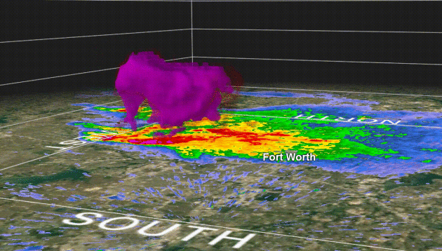
Large Hail Core Near Fort Worth, TX - AM Thursday
Severe thunderstorms rolled across parts of Texas Thursday morning with several large hail reports. The animation below shows the severe thunderstorm with a large hail core as it moved across Fort Worth, TX. A few of the reports showed 2" to near 2.5" diameter!
Large Hail in Texas
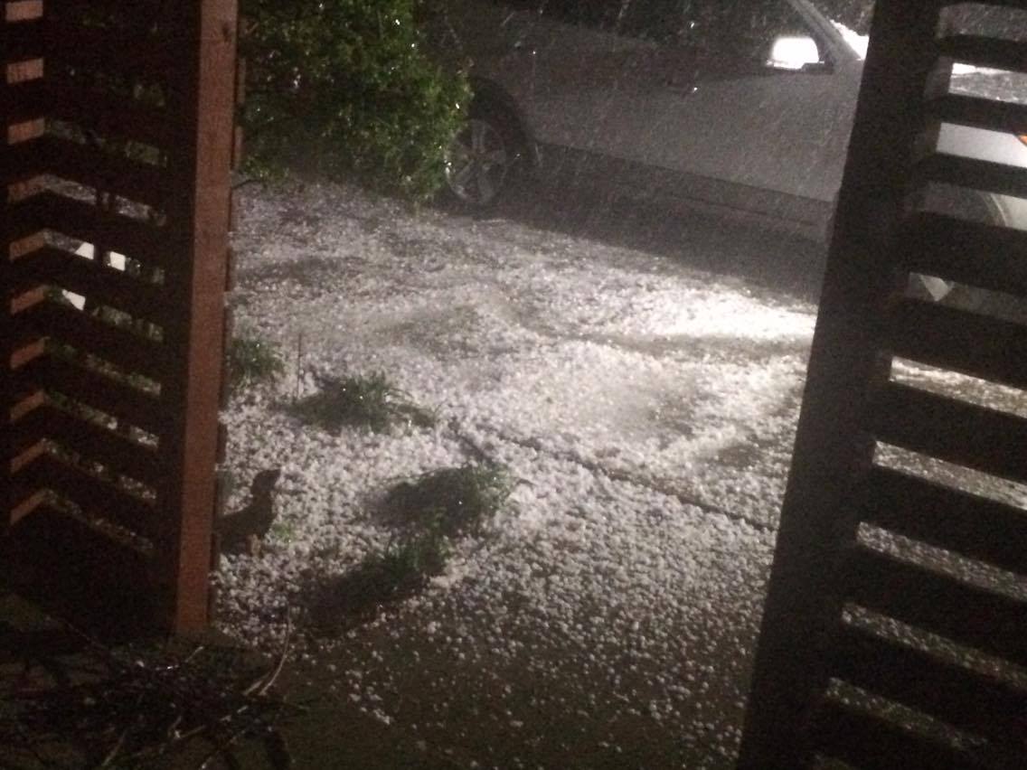
Thanks to my good friend Meghan Gehrke for this picture near Fort Worth, TX. The hail from early Thursday morning looks more like accumulating snow than hail, doesn't it?
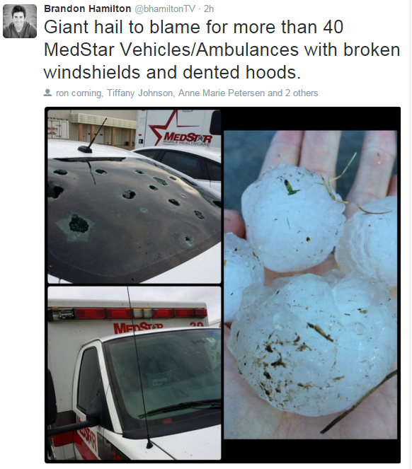
Here are more pictures from @bhamiltonTV that show how destructive large hail can be!
__________________________________
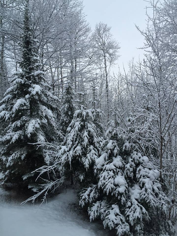
March Snow in Duluth
Thanks to my good friend Wanda Brandt for the picture below from Duluth, MN. This was the view from Thursday morning as wet, heavy snow draped across the northern MN landscape.
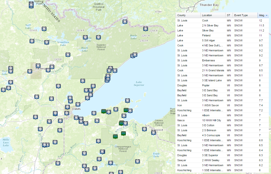
Snow Reports
Snowfall reports from Wednesday to AM Thursday showed several near 12" reports across parts of northern MN and northern WI.
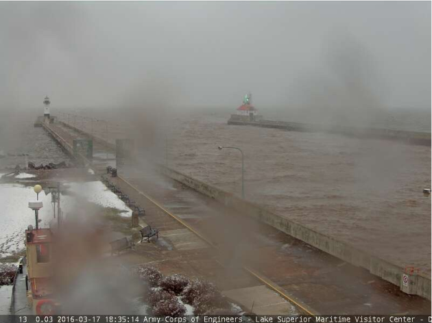
Lake Superior Influence
Interestingly, the water temperature of Lake Superior had a major influence on precipitation type in downtown Duluth, where the predominate precipitation was heavy rain, which lead to flooding. Just a few miles away and an elevation difference of 800ft., it was all snow "Over the hill".
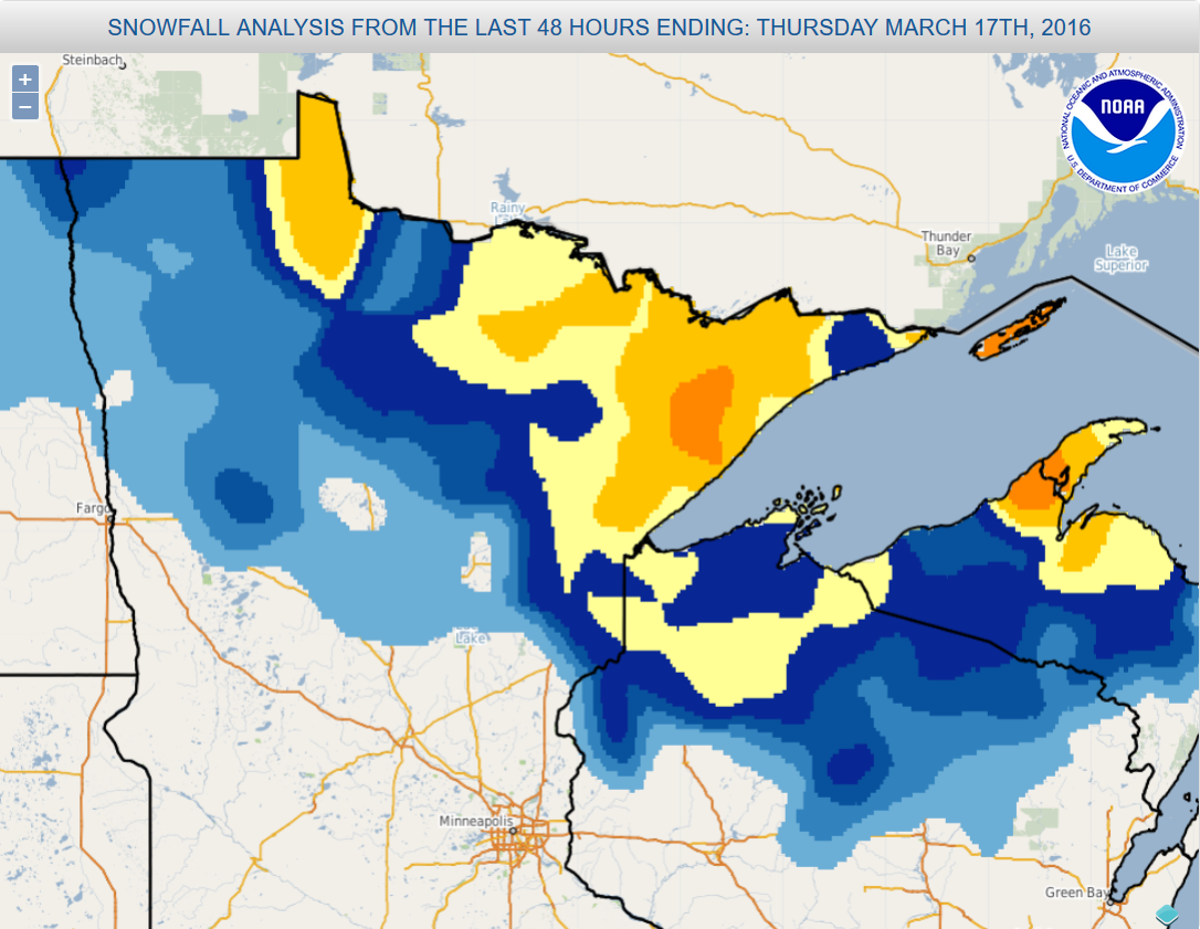
Snowfall Analysis
Here's the snowfall analysis from earlier this week, which shows several 6"+ snowfall tallies (in yellow) with some areas along the north shore seeing nearly 12" (in orange).
Mild Signal Lingers - More Signs of Spring
By Paul Douglas
Even the cold fronts are warmer this winter. Which is no great surprise, considering record warmth observed at the top of the world; arctic temperatures as much as 10-20F warmer than average. NOAA says it was the warmest meteorological winter (December thru February) for the planet on record, surpassing last winter's previous record by half a degree F.
We saw a few feeble outbreaks of numbing air in mid-January and mid-February, but it's been more rain than snow so far in March. If you're keeping score: 31 inches of snow at MSP, 17 inches less than average, to date. Pretty tame, all things considered.
As much as 2-4 inches of rain falling on the headwaters of the Mississippi River earlier this week has resulted in flood watches at Aitkin and Wabasha. The pattern isn't ripe for any big storms into early April. A coating of flurries is possible into Saturday with mellowing temperatures next week; a few degrees above average. GFS guidance hints at 60s by the end of the month.
People in Duluth, digging out from 8" of snow, might beg to differ, but spring is coming early this year.
_______________________________
Extended Forecast
THURSDAY NIGHT: Light rain/snow mix possible. Winds: WNW 5-10. Low: 31
FRIDAY: Some sun, coating late? Winds: NE 5-10. High: 40
FRIDAY NIGHT: Mostly cloudy, slight chance of snow. Winds: NE 5-10. Low: 28.
SATURDAY: Nagging clouds and flurries. Winds: NE 5. High: 40
SUNDAY: Intervals of sun, a little nicer. Winds: NW 8-13. Wake-up: 27. High: 43
MONDAY: Fading sun, milder breeze. Winds: ENE 5-10. Wake-up: 30. High: 45
TUESDAY:Springy, passing rain shower. Winds: W 10-15. Wake-up: 36. High: 53
WEDNESDAY: Overcast, chance of rain. Winds: NE 10-15. Wake-up: 36. High: 40.THURSDAY: Peeks of sun, drying out. Winds: NW 8-13. Wake-up: 29. High: 41.
________________________________
This Day in Weather History
March 18th
1968: The earliest tornado to hit Minnesota. No one was hurt when it hit Watonwan County.
_______________________________
Average High/Low for Minneapolis
March 18th
Average High: 42F (Record: 61F set in 2012)
Average Low: 25F (Record: -8F set in 1923)
_______________________________
Sunrise/Sunset Times for Minneapolis
March 18th
Sunrise: 7:19am
Sunset: 7:23pm
*Daylight Gained Since Yesterday: ~3mins & 9secs
*Daylight Gained Since Winter Solstice (Dec. 21st): ~3hours & 18mins
________________________________
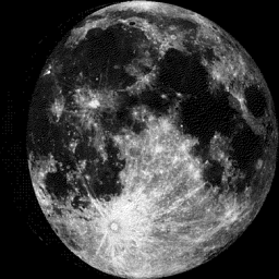
Moon Phase for March 18th at Midnight
3.6 Days Since First Quarter
__________________________________
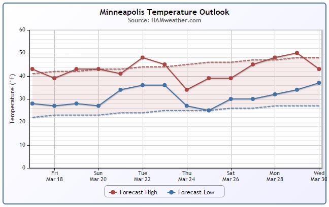
Minneapolis Temperature Trend
Here's the extended temperature forecast, which shows near average temperatures continuing over the next several days with no big warm spells or cold blasts moving through anytime soon.
__________________________________________
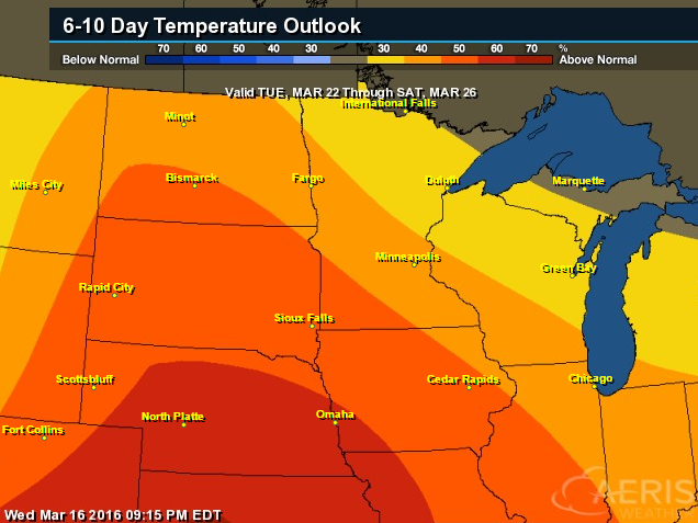
6 to 10 Day Temperature Outlook
According to NOAA's CPC, the 6 to 10 day temperature outlook suggests warmer than average temperatures moving in as we head into next week.
___________________________________
Friday Weather Outlook
High temperatures on Friday look a little more reasonable for March standards with readings in the 30s and 40s across the state. However, feels like temps will only be in the 10s and 20s across the state.

Friday Weather Outlook
Thankfully, winds across the state will be much lighter on Friday. That means feel like temperatures won't be quite as raw as they were on Thursday.
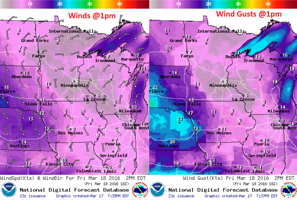
Friday Weather Outlook
Any additional precipitation will be light across the region, but coudl still be in a light snow fasion by midday Friday.
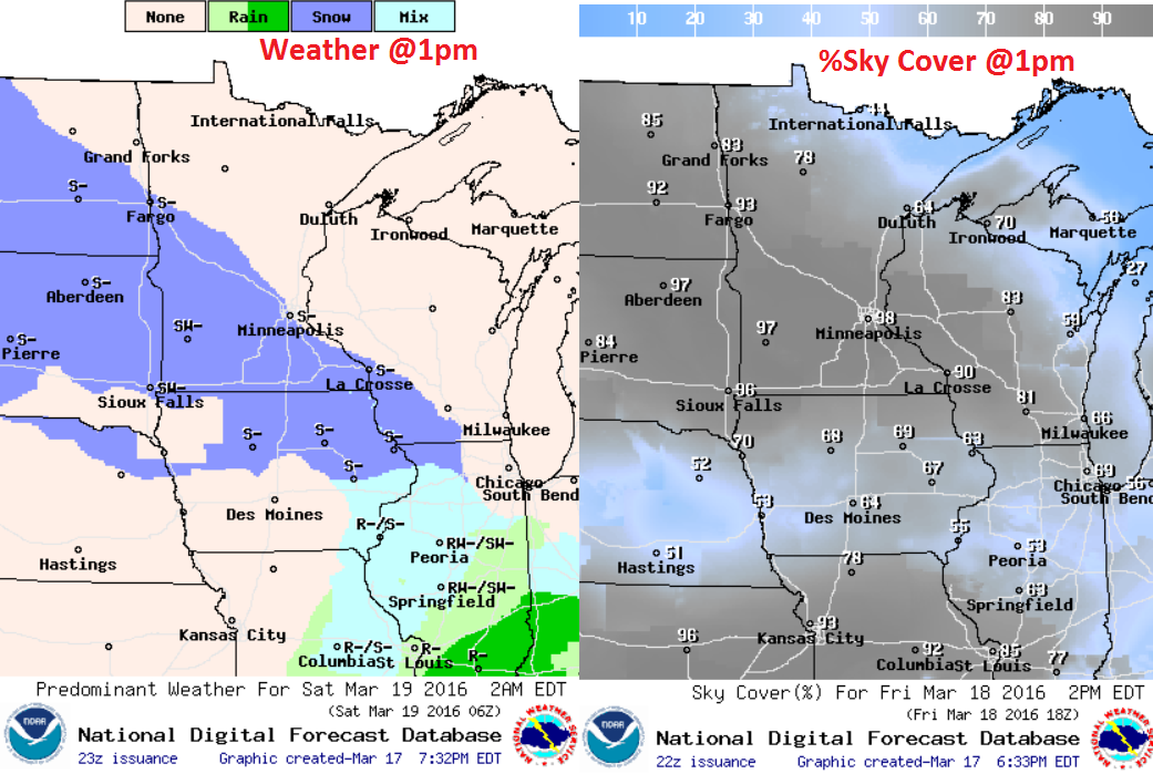
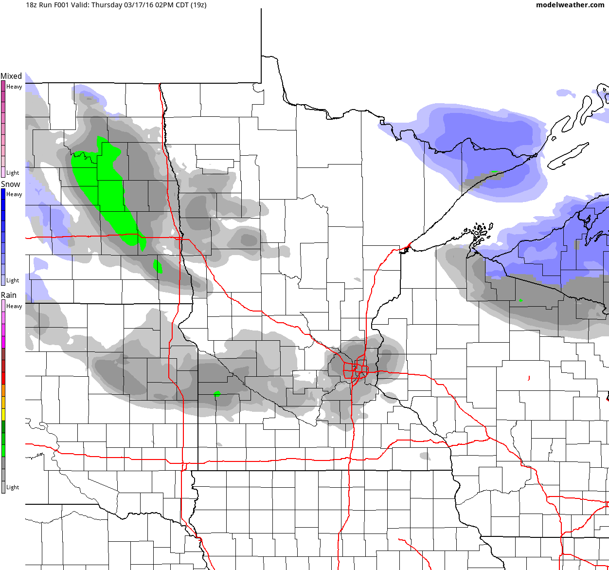
Simulated Radar
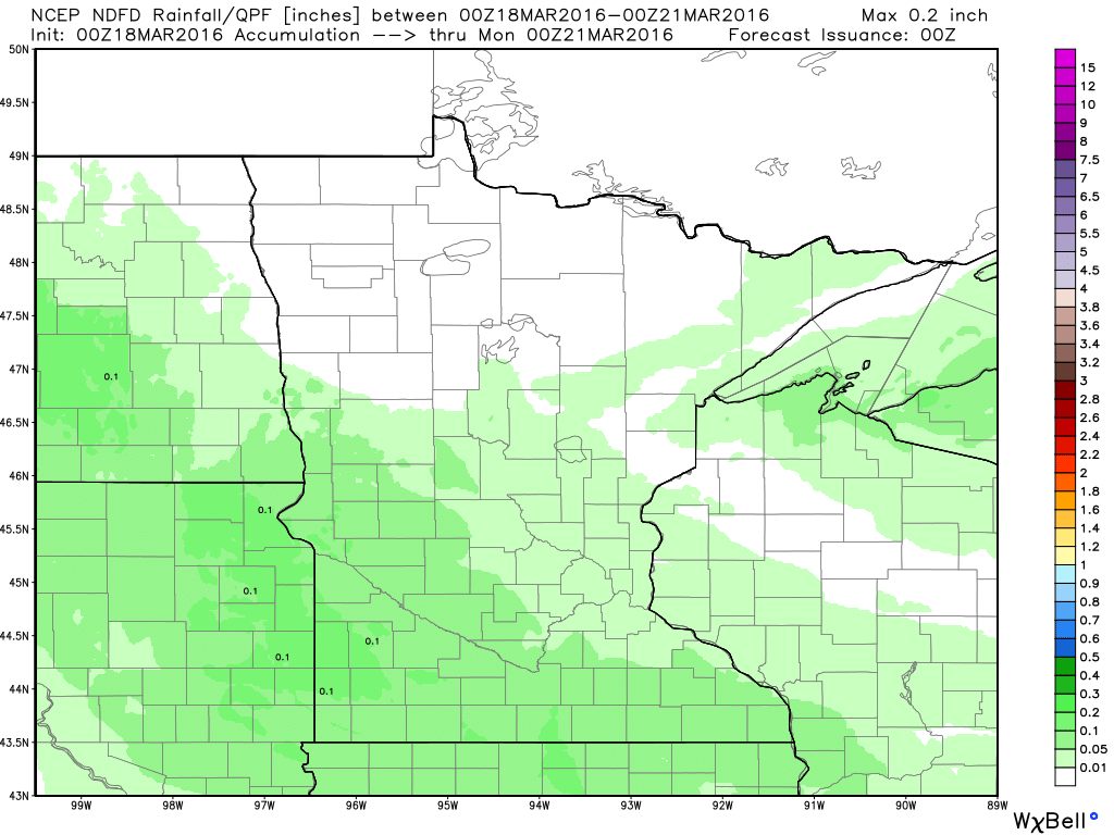
Minnesota Precipitation Potential
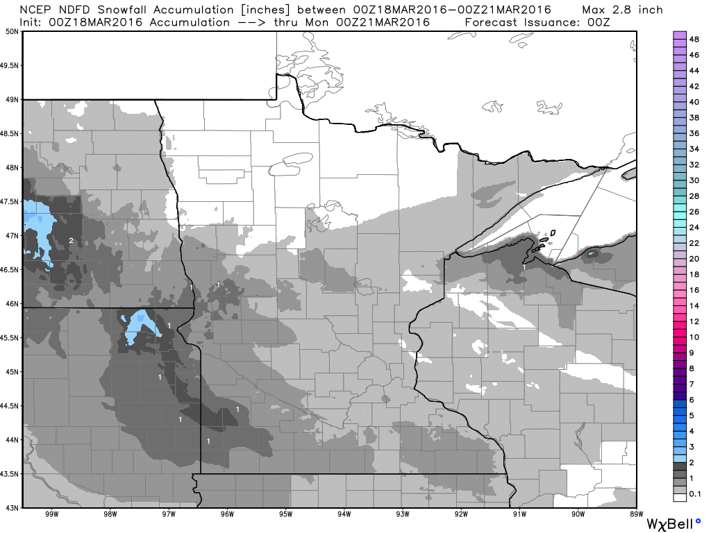
Snowfall Potential
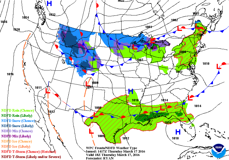
National Weather Outlook
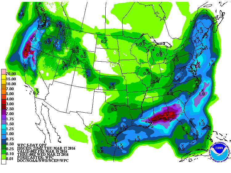
5 Day Precipitation Forecast
_____________________________________________
"How the World Has Changed Since Paris Climate Pact"
"National leaders have yet to sign a new United Nations climate pact, but developments during the three months since the Paris Agreement was finalized have been feverish. The fate of electricity rules underpinning U.S. commitments under the pact has been thrown into doubt, new data suggests China may have already hit its targets, and Europe has been embroiled in a debate over whether its climate commitments are sufficiently aggressive. The recent developments suggest momentum is still building in many places toward a meaningful global solution to global warming. Meanwhile, searing new temperature records demonstrated the increasing urgency of the problem."
Read the full story from ClimateCentral.org HERE:

Thanks for checking in and have a great weekend ahead! Don't forget to follow me on Twitter @TNelsonWX

No comments:
Post a Comment