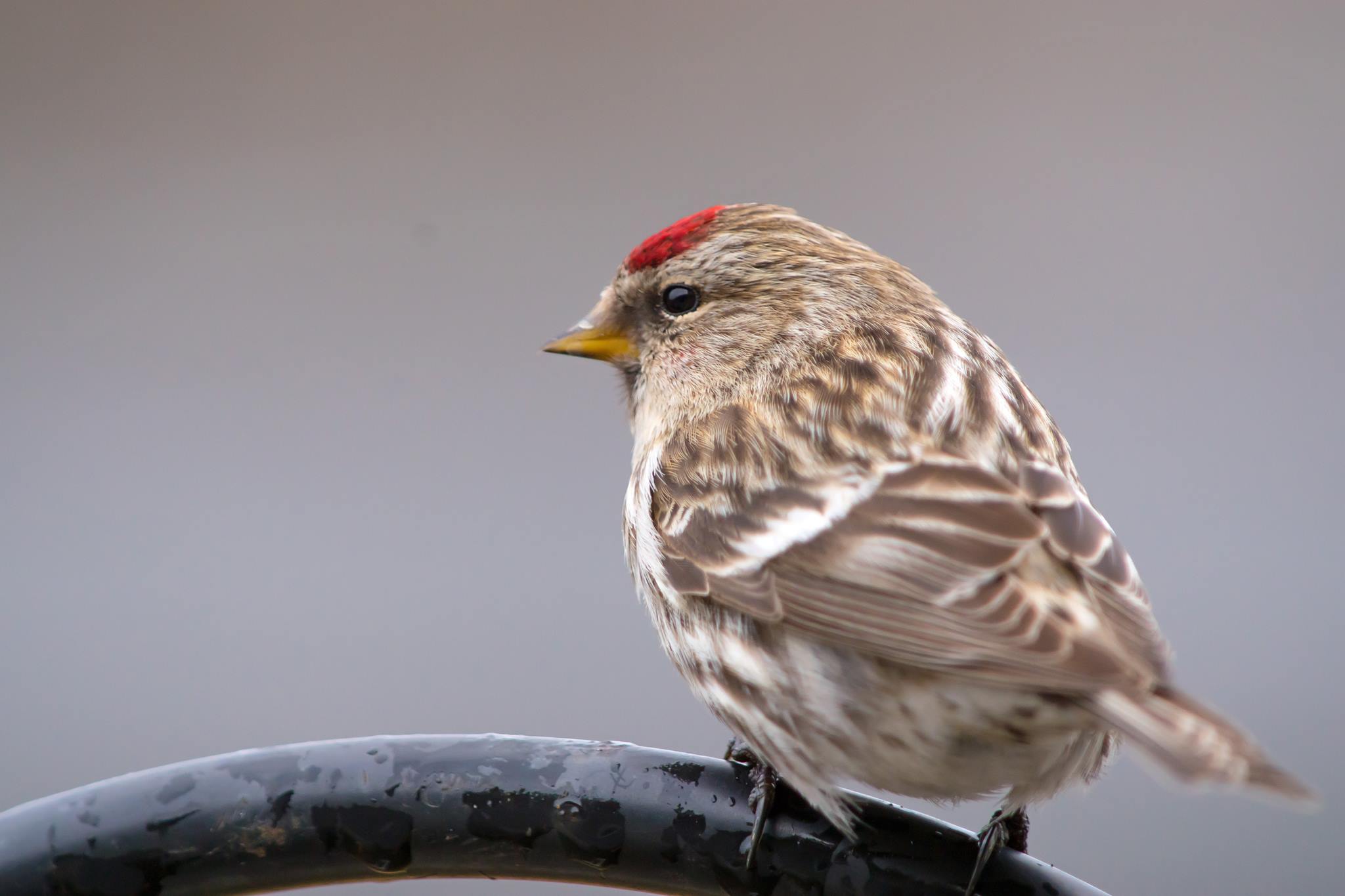
Redpoll
Thanks
to my good friend Donna Maxie for this great picture of a Redpoll. It
is of the finch family and has a distinct red marking on its head.
Interestingly, this bird lives in the Arctic during the summer and
migrates south into Canada and the Lower 48 during the winter. Donna
says the Redpolls have moved on and are on their way back north! Thanks
Donna, nice picture!
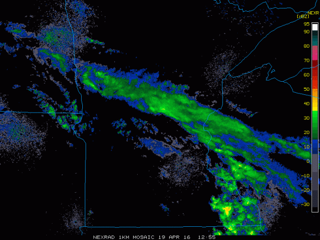
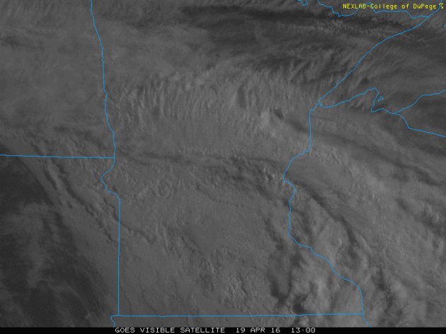
Somewhat Soggy Tuesday
It
was a mostly cloudy and somewhat soggy Tuesday as light rain showers
drifted through the region. The rain wasn't all that heavy, but it made
for a fairly lazy day. The loops show the radar and visible satellite
from earlier Tuesday.
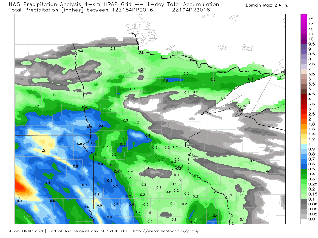
Rainfall From 7am April, 18th to 7am April, 19th
Here's
a look at rainfall tallies across the region from AM Monday to AM
Tuesday. Note that the heaviest amounts of more than 1" were found
mainly in South Dakota. Rainfall tallies dwindled significantly as the
moisture lifted northeast through the region.
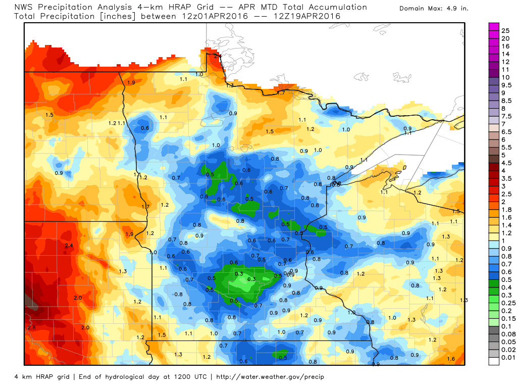
Rainfall Month To Date (Thru 7am April, 19th)
Here's
another interesting product that shows how much rain we've seen so far
this month. Note that the perimeter of Minnesota has seen nearly 1" of
rain, whereas the central part of the state hasn't seen as much. In
fact, some spots are less than 0.5".
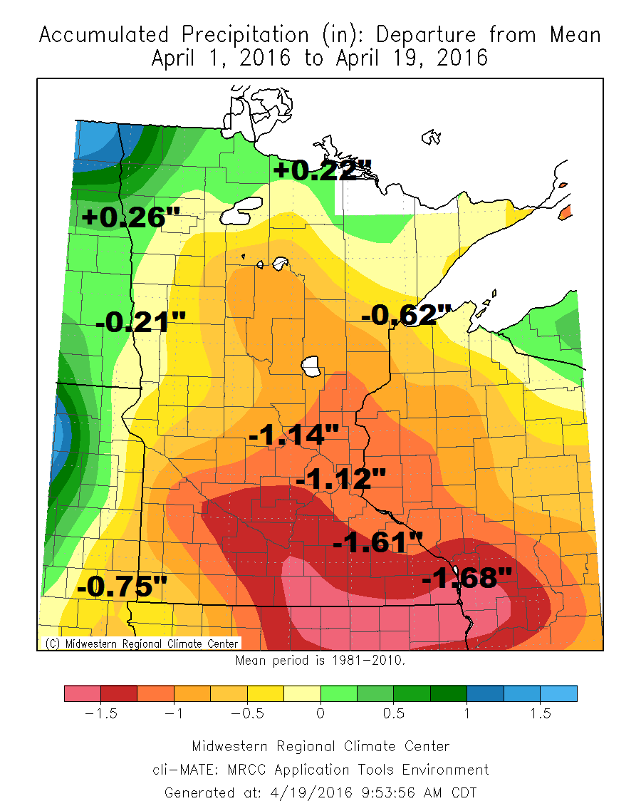
April Precipitation Departure From Average
The
departure from average for the first 18 days of the month suggests that
the southern half of the state is about 1" or more behind normal.
However, there are a few locations along the northern/northwestern part
of the state that are running a little bit better than average.
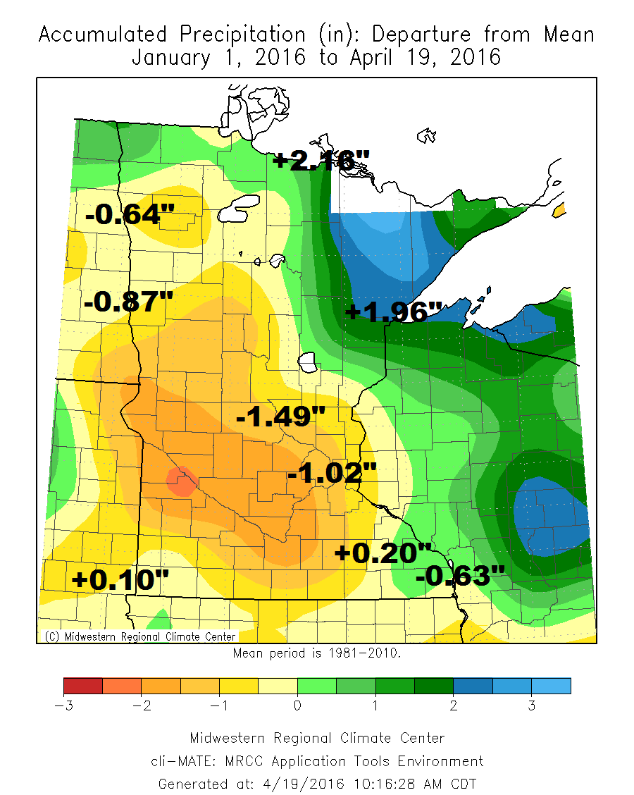
Year to Date Precipitation Departure From Average (Since January 1st)
The
year to date precipitation departure from average shows that much of
the state is dealing with deficit with the exception of areas in the
northeastern part of the state. Interestingly, areas from Duluth to
International Falls are nearly 1" to 2" above average precip for the
year!
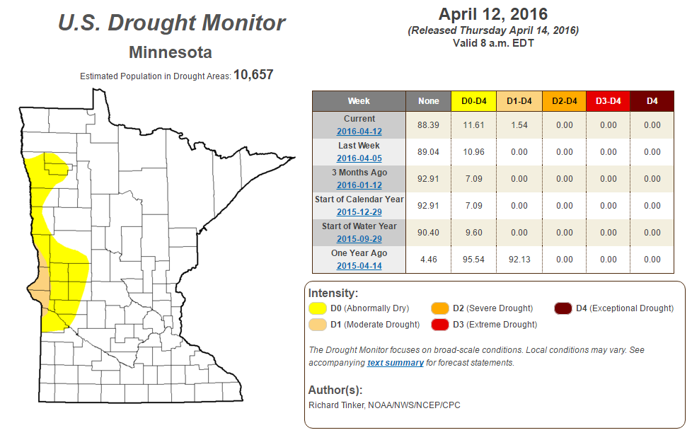
Drought Monitor
According
to the U.S. Drought Monitor nearly 12% of the state is considered to be
abnormally dry with nearly 2% of the state in a moderate drought.
Field of Extremes - 60s and Spotty Showers
By Todd Nelson, filling in for Douglas.
From
the historic rains in Houston, TX (2nd wettest day on record for that
city) to the hottest temperature Seattle, WA has ever seen during the
month of April (89 degrees), Monday was an extreme day.
The
United States is a unique place to live. It really is the Super Bowl of
weather, host to a multitude of different weather events including
devastating tornadoes and hurricanes. Speaking of which, researches at
North Carolina State University say that this year's hurricane season
will be an active one. Above average with 15 to 18 named storms, 8 to 11
of those growing into hurricanes. The Atlantic season begins June 1st.
The
stubborn upper level storm responsible for our cooler, cloudier weather
will continue to spit out a few rain showers through early Thursday.
The best chance of any soaking rains will stay in southern Minnesota.
Don't put away the jackets just yet, extended forecasts suggest highs in the 40s and 50s with lows in the 30s next week.
In the meantime, enjoy a few more shades of green!
__________________________
Extended Forecast
TUESDAY NIGHT: Cloudy. A few passing showers. Winds: ESE 5-10. Low: 50
WEDNESDAY: Cloudy with scattered showers, heavier in southern MN. Winds: ENE 5-10. High: 65
WEDNESDAY NIGHT: Mostly cloudy, a few passing showers. Winds: NE 5. Low: 51
THURSDAY: AM sprinkle, slow PM clearing and breezy. Winds: NNW 10-15. High: 67.
FRIDAY: More sun, near average temps. Winds: ESE 5-10. Wake-up: 42. High: 64
SATURDAY: Partly sunny, passing PM shower. Winds: NE 10-15. Wake-up: 48. High: 64.
SUNDAY: Dry start. Spotty late day shower. Winds: E 10-15. Wake-up: 45. High: 59.
MONDAY: Breezy with scattered showers. Winds: E 10-15. Wake-up: 42. High: 54.
TUESDAY: Cool breeze. Bright sun returns. Winds: NE 10-15. Wake-up: 40. High: 55.
_____________________________
_____________________________
This Day in Weather History
April 20th
April 20th
1970: Snow falls across much of Minnesota.
______________________________
______________________________
Average High/Low for Minneapolis
April 20th
April 20th
Average High: 60F (Record: 83F set in 1980)
Average Low: 39F (Record: 21F set in 2013)
_______________________________
Average Low: 39F (Record: 21F set in 2013)
_______________________________
Sunrise/Sunset Times for Minneapolis
April 20th
April 20th
Sunrise: 6:19am
Sunset: 8:05pm
Sunset: 8:05pm
*Daylight gained since yesterday: ~2mins & 56secs
*Daylight gained since winter solstice: ~5hours
_________________________________
*Daylight gained since winter solstice: ~5hours
_________________________________
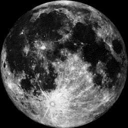
Moon Phase for April 20th at Midnight
0.9 Days Before Full (Pink) Moon
0.9 Days Before Full (Pink) Moon
____________________________________
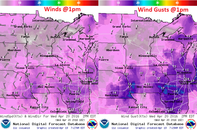
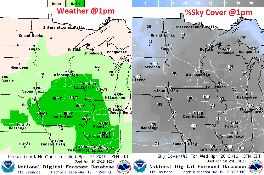
Wednesday Weather Outlook
High
temperatures on Wednesday will be in the 60s across much of the state
and while this is cooler than what we had over the weekend, this will
still be above average for mid/late April.
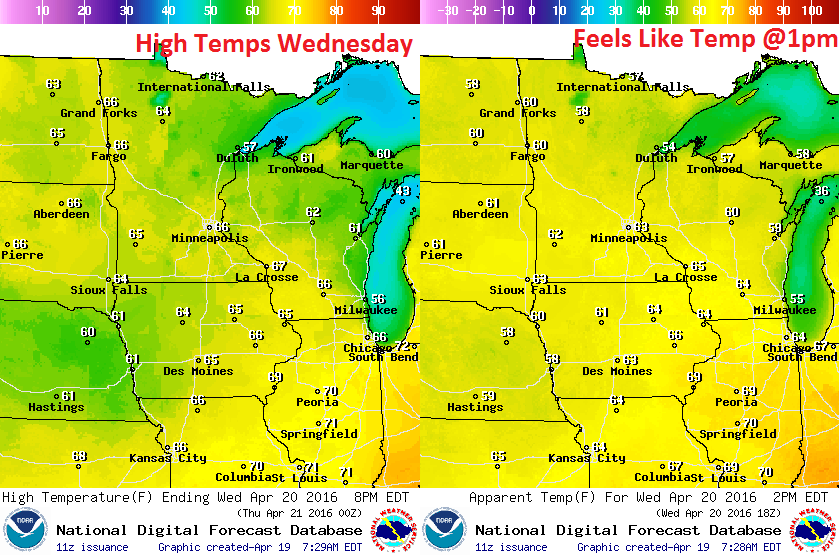
Wednesday Weather Outlook
It's
nice to see that lighter winds will be with us again on Wednesday,
however note that they are turning a little more easterly. The winds
will actually turn more northerly later this week and drawn down cooler
air by the weekend.
Wednesday Weather Outlook
As
the area of low pressure slowly slides east, scattered rain showers
will move east with it. It will take some time, but rain will finally
move out of the area by Thursday. With that said, Wednesday looks to
still feature scattered rain showers across the southern part of the
state, some of which could be a little heavier near La Crosse, WI.
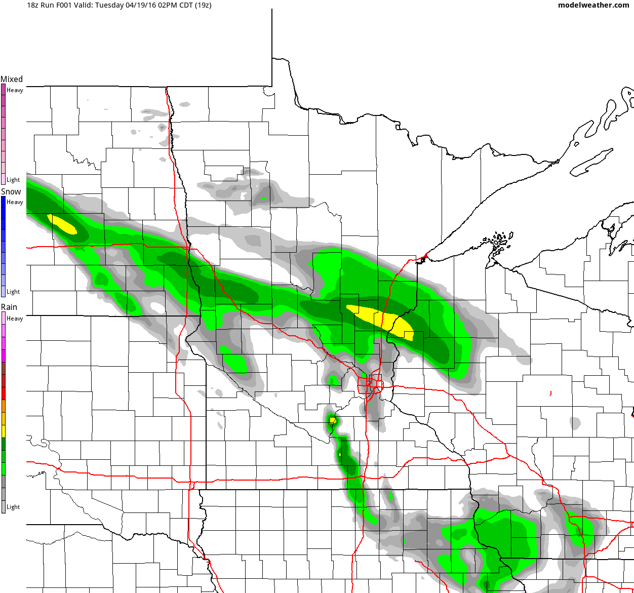
Simulated Radar
The
simulated radar from midday Tuesday to Thursday night shows spotty
showers continuing through much of that time frame, but most of the rain
will be light. However, another surge of slightly heavier moisture will
be found in southeastern Minnesota PM Wednesday into Thursday.
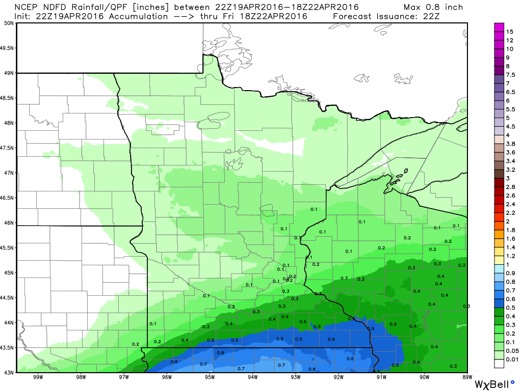
Precipitation Outlook
Additional
rainfall with this storm system looks to be dwindling significantly
with the exception of those in far southern Minnesota. Areas there could
still see an additional 0.50" through midday Friday.
_______________________________
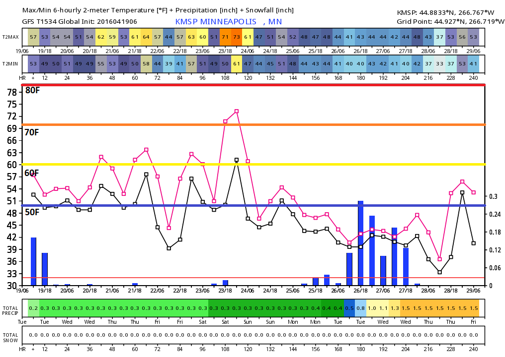
Extended Temperature Outlook
Here's
the extended forecast for Minneapolis over the next several days and
note the cooler temperatures expected for the rest of the week with
highs in the 60s. Also note the potentially even bigger cool down next
week with highs in the 40s and 50s! Might not be a bad idea to keep an
extra layer or jacket close, just in case.
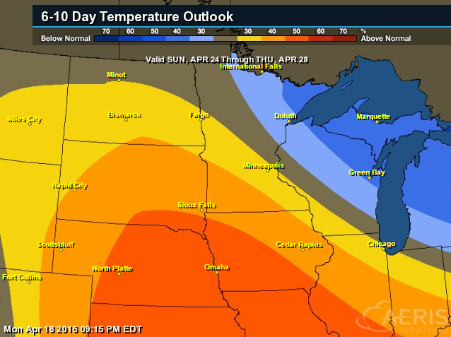
6 to 10 Day Temperature Outlook
However,
according to NOAA's CPC, the 6 to 10 day temperate outlook suggests a
good chance of warmer than average temperatures continuing across the
Central U.S. from April 24th to the 28. Also note that cooler than
average temperatures look to settle into the Great Lakes during that
time frame too...
_________________________________
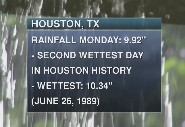
2nd Wettest Day in Houston, TX History
The
numbers are in and Houston, TX officially had their 2nd wettest day in
recorded history with 9.92" of rain on Monday, April 17th. Unbelievably,
most of this came during the first half of the day!
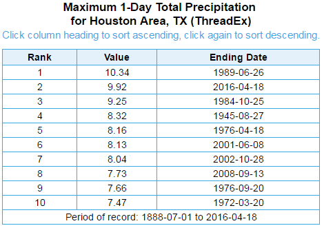
Here
are the top 10 wettest days for Houston, TX since 1888. Note that they
weren't too far away from the wettest day set on June 26th, 1989.
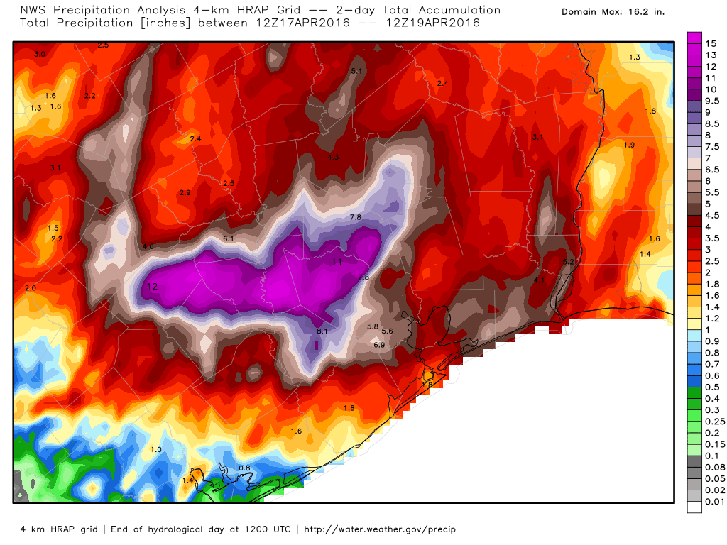
Houston 2 Day Rainfall
The
2 day rainfall across the Houston and surround areas suggests
widespread 10" to 15" of rain! An historic rainfall event for the
location, no question.
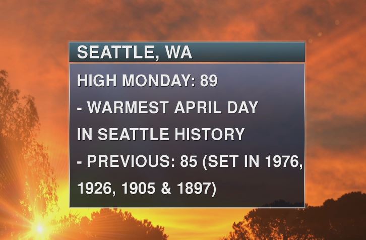
Warmest April Day in Seattle, WA History
Another
extreme that occurred on Monday was the all-time record high
temperature for the month of April in Seattle, WA at 89F. This beat the
previous warmest April high temperature of 85F set most recently in
1976.
National Weather Outlook
The
national weather outlook shows the same stubborn low pressure system
making hastier shift east by the second half of the week. That will help
to push the heaviest rain east along with it. In its wake, drier
weather in the middle U.S..
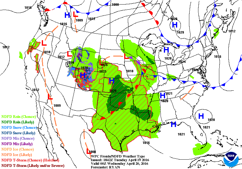
5 Day Precipitation Outlook
According
to NOAA's WPC, the 5 day rainfall forecast suggests heavier pockets of
rain the southern U.S.. Unfortunately with as much rain as we've seen
over the past few days, this additional heavy rain could lead to more
flooding.
_______________________________
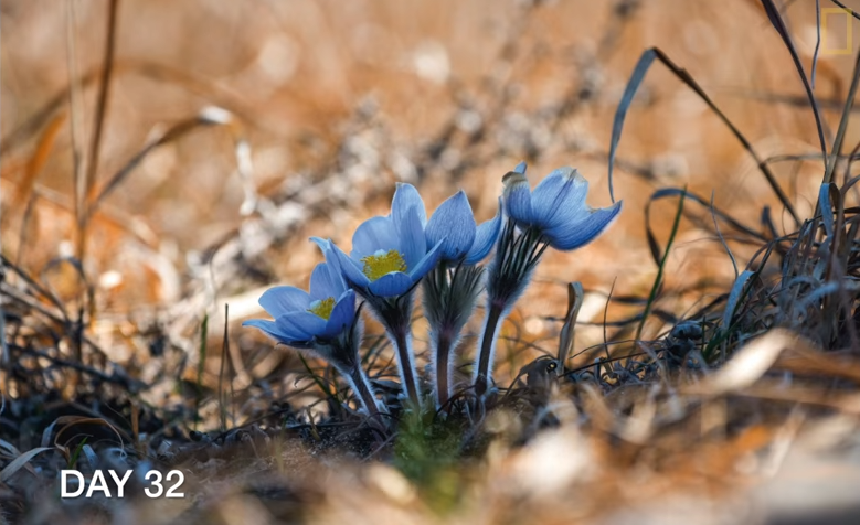
Watch Spring Bloom Before Your Eyes
I
came across this and thought I'd share. Here are some wonderful images
taken by a very Jim Brandenburg. You can watch spring bloom before your
eyes! "Photographer Jim Brandenburg takes a photograph a day as
spring arrives in his home state of Minnesota. The project began on the
2014 vernal equinox and ended on the day before summer solstice."
____________________________
"10 Unexpected Changes of Climate Change"
Here's
an interesting story from Cool Green Science that shares some of the
unexpected changes of climate change, which include the potential of
more ticks and worse allergies. "Droughts. More severe and
unpredictable storms. A decline in polar bears. You no doubt have heard
about these and other effects of climate change. But
a rapidly warming world means many other impacts, both large and small.
A changing climate will likely change your health, your sports and even
what you drink. For Earth Week, we look at some of the unexpected potential effects of climate change, for both people and wildlife."
(Photo © Jenn Forman Orth / Flickr through a Creative Commons license)

_____________________________________
Thanks for checking in and have a great rest of your week!
Follow me on Twitter @TNelsonWX
Follow me on Twitter @TNelsonWX

No comments:
Post a Comment