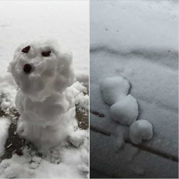
Thanks to my good friend Wanda Brandt out of Duluth, MN, who made a snow dog out of some of the fresh snow this week. The wet, heavy nature of the April snow allowed for good compaction. The second picture shows the demise of the snow dog only 1 day later due to warmer temps. Thanks Wanda!
Getting Sick of the Cold and Snow?
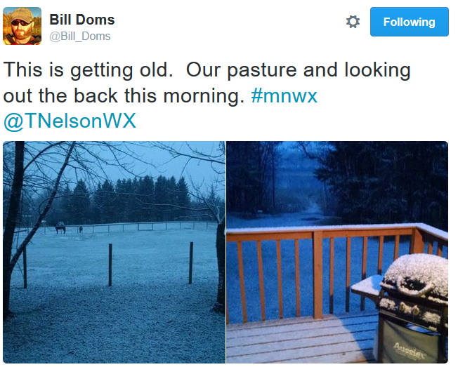
Thanks to my good friend @Bill_Doms on twitter for the pictures below... apparently Bill isn't too impressed with cold and somewhat snowy April weather. Hang in there Bill, storm chasing season is right around the corner! In fact, next week is Severe Weather Awareness Week.
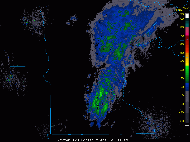
Thursday Radar
A fast moving clipper system moved through the Upper Midwest on Thursday in a wintry mixed fashion. Here is the radar from Thursday afternoon/evening, which was responsible for minor snow accumulations across parts of the state earlier Thursday.
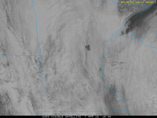
Thursday Satellite
This was the visible satellite view on Thursday, which showed mostly cloudy skies across much of the state. Note that at the beginning of the loop you can see a black spot near central Minneasota. This is an ice free Lake Mille Lacs as of Tuesday, April 5th. Note that this is nearly 2.5 weeks before the average ice out of April 25th.
Minnesotans Don't Take (Good) Weather for Granted
By Paul Douglas
My father fled communist East Germany. Growing up he told me that, unlike many Americans, he will never take his freedom for granted. That has stuck with me over the years. Our youngest son, Brett, is based in San Diego, where most people take mild, sunny weather for granted. "It never changes out here - it's boringly beautiful" he complained. Oh to have his problems.
In a state where up to 30 days a year are potentially life-threatening, where the mercury dips below zero an average of 23 nights, we don't take lukewarm weather for granted.
The last week has been irritatingly chilly & raw; hardly unusual for early April. Canadian air usually sloshes south, not all at once, but in waves, like breakers building on the beach. Today's reinforcing shot will make it feel like teens at times. Winds ease tomorrow under blue sky; a few light showers Sunday as the mercury limps into the 50s.
I see a major phase shift coming - a switch from Canadian to Pacific air. 60s return late next week, with a consecutive string of 70s within 10 days. Like a long-lost friend spring warmth is returning.
_______________________________
Extended Minneapolis Forecast
FRIDAY: What April? Feels like low 20s with more clouds than sun, gusty. Winds: NW 15-30. High: 37
FRIDAY NIGHT: Mostly clear and chilly. Winds: 5-15. Low: 25.
SATURDAY: Frosty start. Bright sun, still cool. Winds: SE 8-13. High: 42
SUNDAY: More clouds, few showers likely. Winds: SE 10-15. Wake-up: 36. High: 55
MONDAY: Mostly cloudy, colder breeze. Winds: NW 15-25. Wake-up: 35. High: 41.
TUESDAY: More sun, winds ease up. Winds: SE 7-12. Wake-up: 28. High: 44
WEDNESDAY: Some sun. Feels like April again. Winds: SE 10-20. Wake-up: 32. High: 56
THURSDAY: Mild wind, hints of early May. Winds: SE 10-20. Wake-up: 42. High: 62.
___________________________________
This Day in Weather History
April 8th
1805: John Sayer at the Snake River Fir Trading Post near present day Pine City mentions: 'The most tempestuous (stormy) day of the year. Pines and other trees fell near the fort.'
____________________________________
Average High/Low for Minneapolis
April 8th
Average High: 54F (Record: 83F set in 1931)
Average Low: 34F (Record: 9F set in 1997)
_____________________________________
Sunrise/Sunset Times for Minneapolis
April 8th
Sunrise: 6:40am
Sunset: 7:50pm
*Daylight gained since yesterday: ~3mins and 4secs
*Daylight gained since Winter Solstice (December 21st): ~4hours & 24mins _______________________________________
Moon Phase for April 8th at Midnight
1.8 Day Since New Moon

_________________________________________
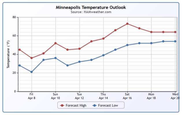
Minneapolis Temperature Trend
The first 6 days of April were running 4.6F below average in the Twin Cities with below average temperatures expected through Saturday. At or above average temperatures look to return by Sunday/early next week with above average temperatures surging in by next weekend! There are some indications that a string of several 60s will be with us by the end of next week/mid April... Stay tuned!
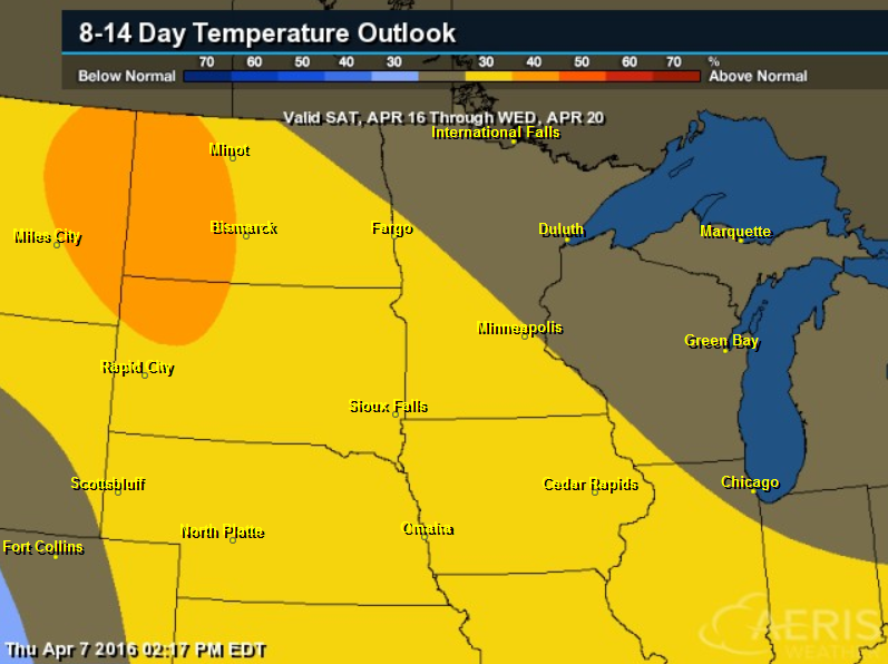
8 to 14 Day Temperature Outlook
According to NOAA's CPC, the 8 to 14 day temperature outlook suggests that warmer than average temperatures will return to parts of the Midwest from April 16th to April 20th!
__________________________________
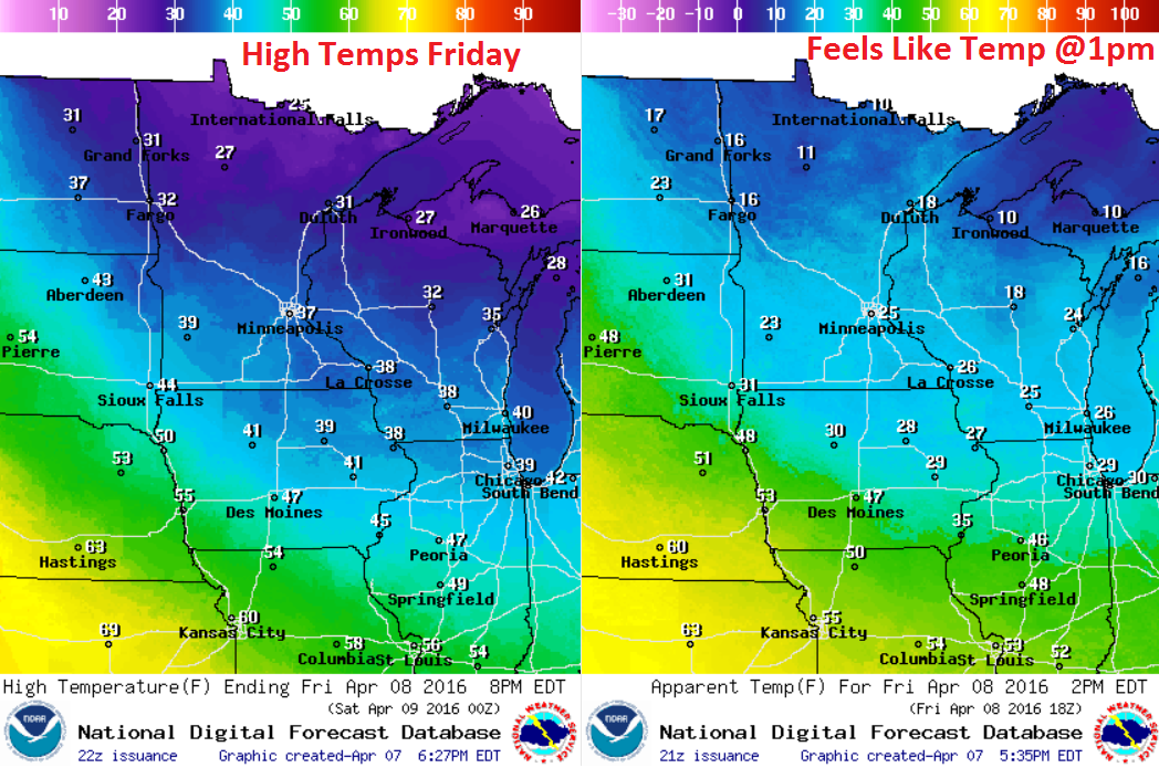
Friday Weather Outlook
Although high temperatures will warm in to the 20s and 30s across the state, it appears that a stout wind will help to keep feels like temperatures in the 10s and 20s around midday Friday. Bundle up!
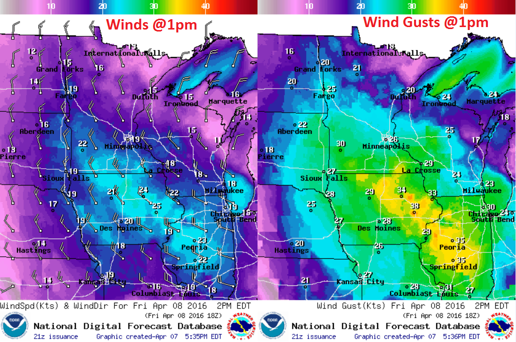
Friday Weather Outlook
Here are the winds depicted at 1pm Friday. Note that gusty winds will be found across much of the region with the strongest midday Friday occurring across southern Minnesota into Iowa and Illinois!
Friday Weather Outlook
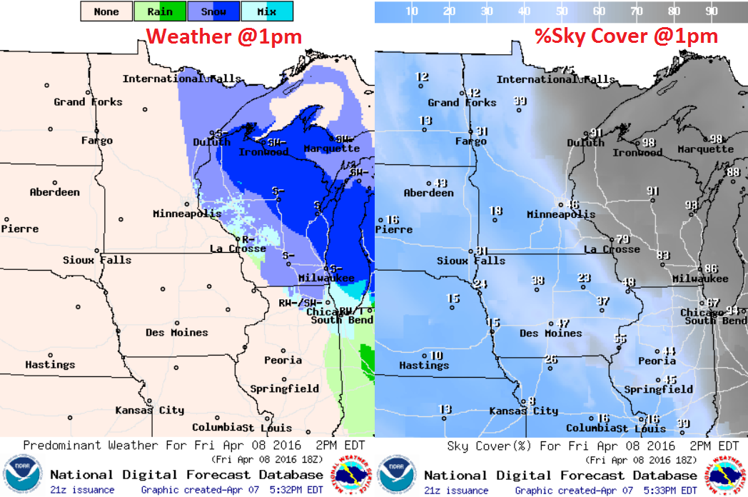
Colder temperatures and gusty winds will be associated with a clipper system responsible for more snow across the Great Lakes region. Here's the weather and percent sky cover expected around midday. Note that much of the inclement weather looks to be falling over Wisconsin and the U.P. of Michigan, while weather conditions will improve a bit a little farther west.
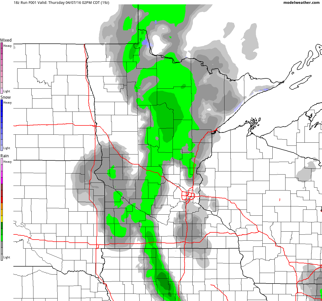
Simulated Radar
Here is the simulated radar from the afternoon hours of Thursday to late Saturday night. Note that the heaviest moved through on Thursday, but there appears to be some lingering precipitation across the northeastern parts of Minnesota into Wisconsin. There will also be another shot of moisture across the Western Great Lakes region by late Saturday night.
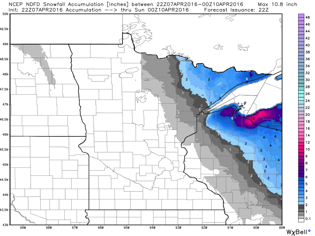
Snowfall Potential Through 7pm Saturday
According to NOAA, snowfall accumulations through 7pm Saturday suggest another few inches of slush possible over parts of the Arrowhead and northern Wisconsin with the heaviest (6"+) possible over the U.P. of Michigan.
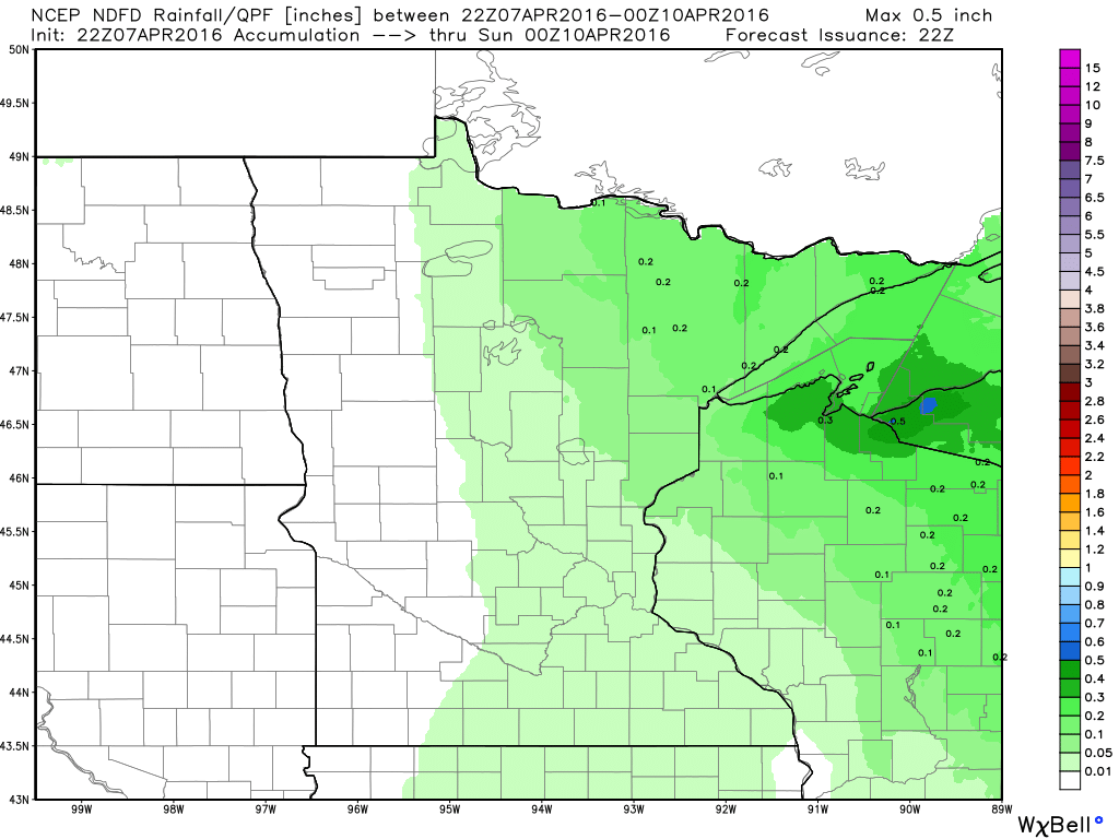
Precipitation Potential Through 7pm Saturday
Total precipitation values through 7pm Saturday don't look all that impressive across the state. The heaviest looks to fall along the south shore of Lake Superior.
__________________________________
National Weather Outlook
The national weather outlook suggests cold and snowy weather continuing in the northeastern part of the nation with a surge of Pacific moisture returning to parts of the Southwestern U.S..
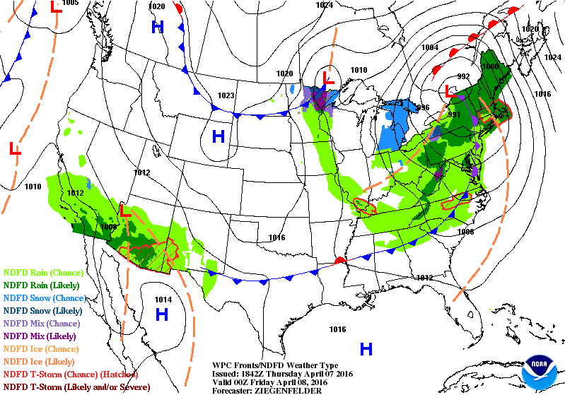
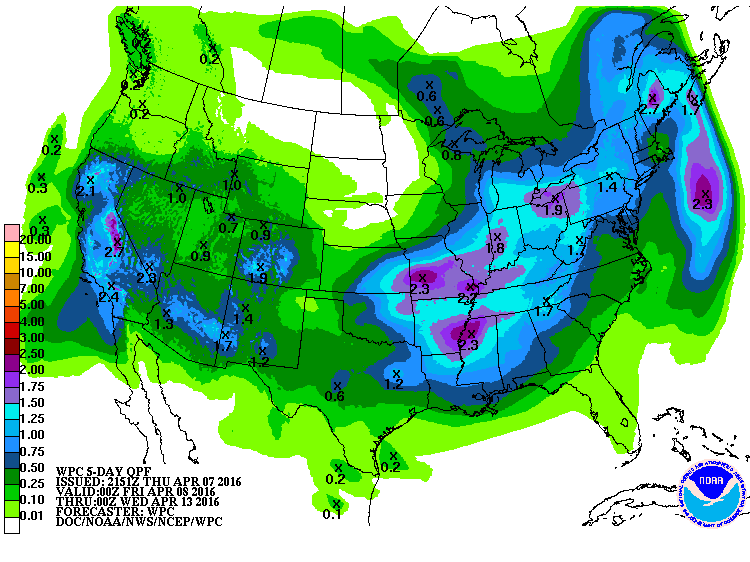
5 Day Precipitation Outlook
According to NOAA's WPC, the 5 day precipitation outlook suggests heavier rain potential moving back into the Southern U.S. by early next week along with thunderstorm that could be strong to severe. However, note that there appears to be decent moisture in the Southwest and California, where areas in the Sierra Nevada Range could see more heavy snowfall!
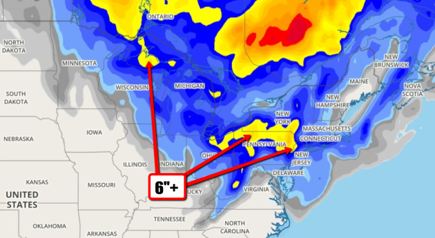
Snow in the Great Lakes
Here's a look at the snowfall potential through early next week, which suggests some sloppy 6"+ amounts (in yellow) across parts of the Great Lakes and the Northeast
National Snow Depth 2016
According to NOAA's NOHRSC, the national snow coverage as of April 7th was 11.7%. Note that much of the national snow coverage was confined to higher elevations in the Western U.S. and areas near the Great Lakes/Northeast.
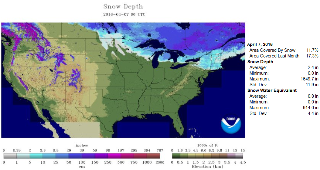
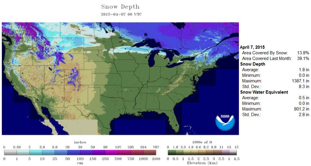
National Snow Depth 2015
According to NOAA's NOHRSC, the national snow coverage last year on April 7th, 2015 was 13.8%. At this time last year, there didn't seem to be as much snow in the Sierra Nevada Range.
______________________________________________
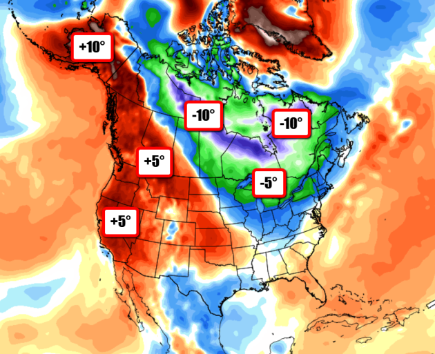
April Temperature Anomaly
Here's
a look at the temperature anomaly so far this month across the Northern
Hemisphere. Note that temperature readings in the eastern part of
Canada into the northeaster part of the U.S. are running nearly 5F to
10F degrees below average, while those in the Western U.S. and Alaska
are running nearly 5F to 10F above average!
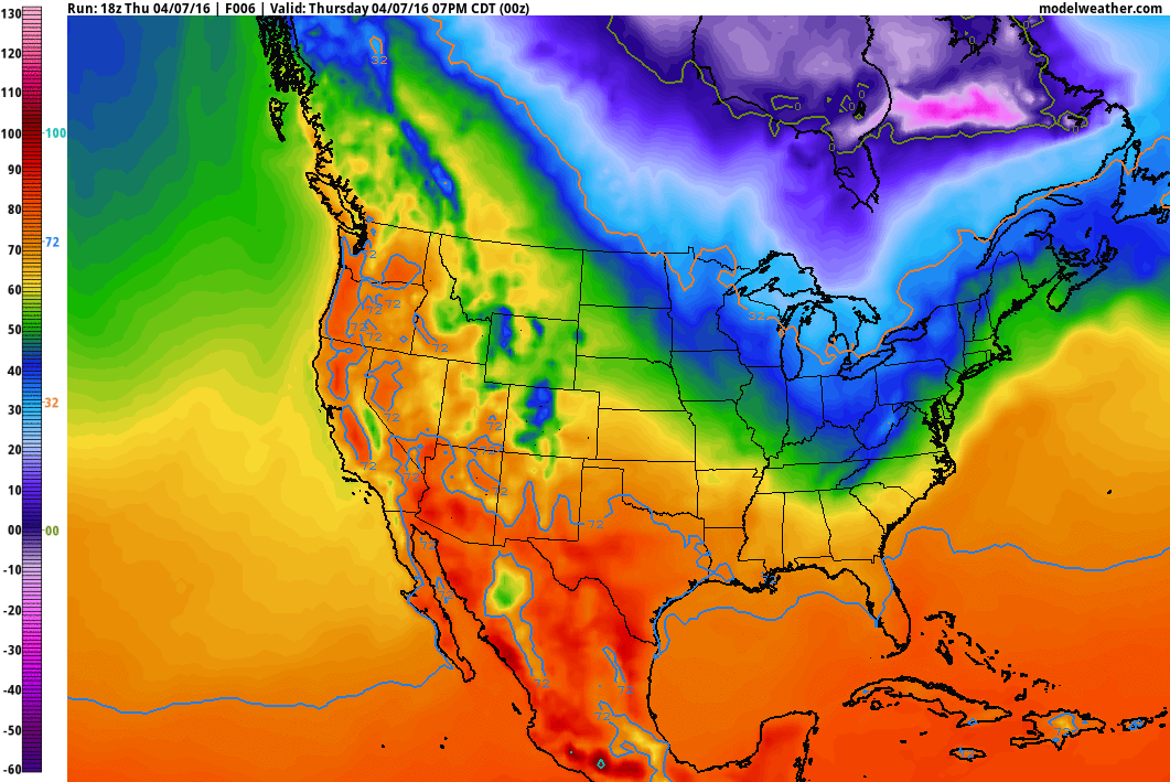
Temperature Outlook
The
temperature loop below shows continue cold across the parts of the
Northeastern U.S. with warmer temps in the Western U.S., building east
in the Plains through next week.
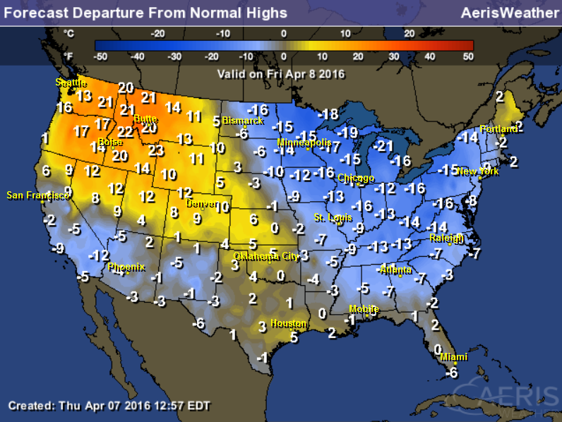
Highs From Average Friday
High
temperatures in the Eastern U.S. will be quite a bit below average,
while those in the Northwest will be well above average with some
locations nearly/exceeding record high temperatures.
____________________________________________________
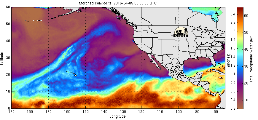
Precipitable Water Loop
The precipitable water loop from the Eastern Pacific shows a fairly decent bloom of moisture heading into the Southwestern U.S.. This will be responsible for scattered showers, some thunder and high elevation snow in the Southwest through the weekend.
Storms Early Next Week
Extended forecast models suggests a decent chance of widely scattered showers and thunderstorms over the Southern U.S. by PM Monday.
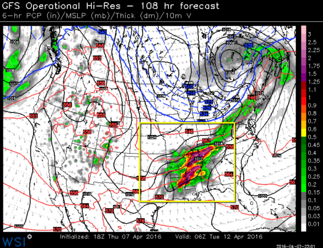
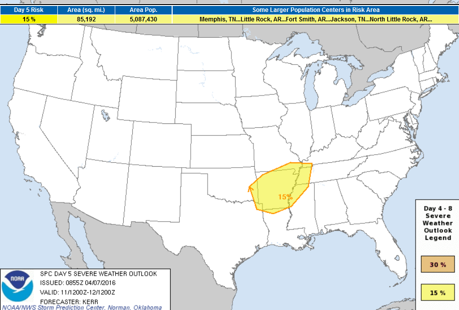
Severe Threat Monday
According to NOAA's SPC, there is a highlighted thunderstorm risk area over the Southern U.S. by Monday. As the next storm system moves through the country, strong to possible severe storms and heavy rain may be possible... Stay tuned!
________________________________________________
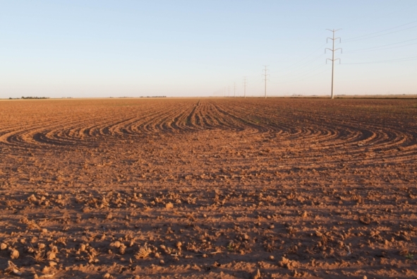
"Farmland Could Help Combat Climate Change"
"Soils could lock away carbon, helping solve global warming"
Here's an excerpt from ScientificAmerican.com about how how farmland could help combat climate change:
"The earth’s soil stores a lot of carbon from the atmosphere, and managing it with the climate in mind may be an important part of reducing greenhouse gas emissions to curb global warming, according to a paper published Wednesday in the journal Nature. “Climate-smart” soil management, primarily on land used for agriculture, can be part of an overall greenhouse gas reduction strategy that includes other efforts like carbon sequestration and reducing fossil fuel emissions, the paper’s authors said. Many scientists believe new efforts to reduce greenhouse gases in the atmosphere are needed to keep global warming to an internationally agreed-upon limit of 2°C (3.6°F)."
Read the full story HERE:
(Image courtesy: ScientificAmerican.com via Charles Henry/Flickr, CC BY 2.0)
____________________________________
Thanks for checking in and have a great rest of your week and weekend ahead! Don't forget to follow me on Twitter @TNelsonWX

No comments:
Post a Comment