58 F. high yesterday in St. Cloud.
44 F. average high on November 8.
61 F. high on November 8, 2015.
November 9, 1977: A foot of snow falls in Western Minnesota. I-94 is tied up.
November 9. 1850: The sky darkens at Ft. Snelling due to smoke from prairie fires.
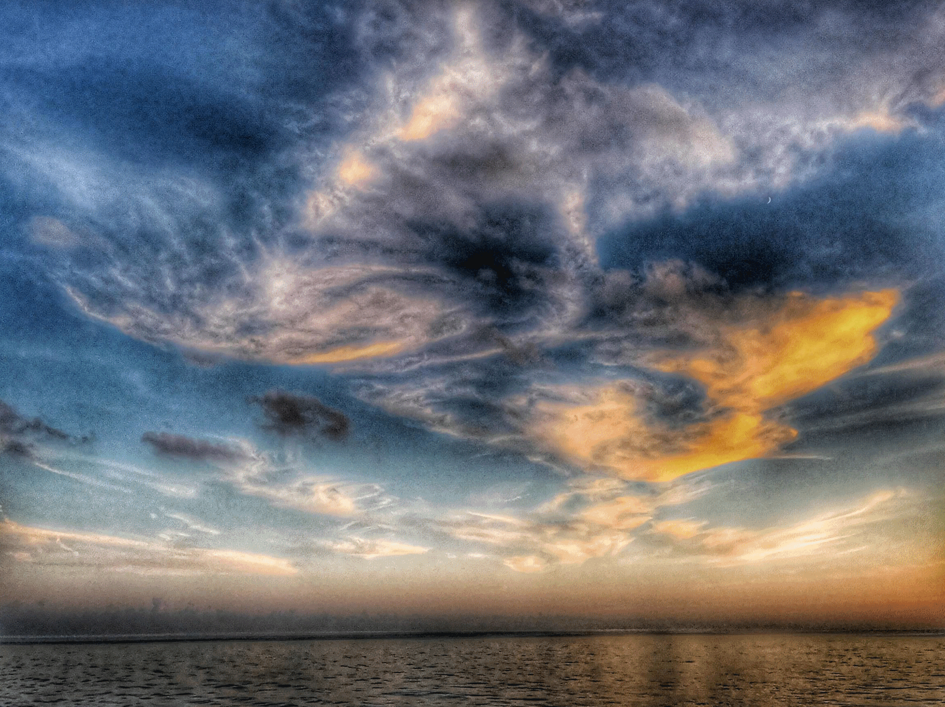
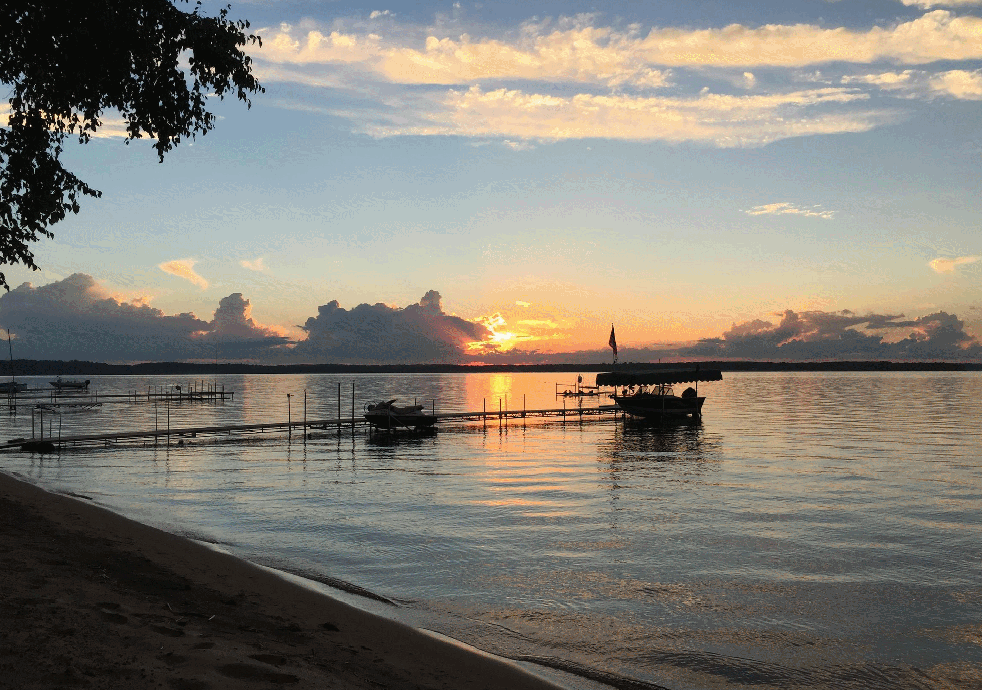
November Boating - Our Jumbo Autumn Hangs On
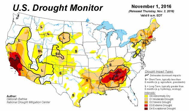
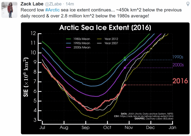
According to NOAA, so far 2016 is the second warmest since 1895, nationwide. It was also the second wettest January through October on record for both Minnesota and Wisconsin. A treadmill of storms squeezed out copious rains, especially southern counties.
We get a dry weather break into much of next week, but both GFS and ECWMF models hint at a full-latitude storm pulling moisture out of the Gulf of Mexico by late next week. The result: heavier rain a week from Friday, possibly ending as a little slushy snow up north. Until then: dry, drama-free.
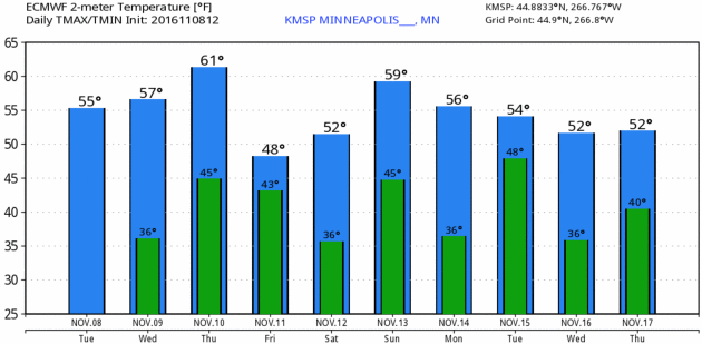
Dust off your golf clubs, maybe take one last cruise on your favorite lake in the coming days. Models hint at 60s today, Thursday, again on Sunday. Remarkable considering the sun is as high in the sky as it was back on February 2. A glancing blow of cooler air arrives Friday with a 1 in 3 chance of the first 32-degree temperature of fall early Saturday at MSP International, where the official readings are taken.
If we avoid a frost the growing season may linger another 2 weeks. Any flowers blooming in your yard? I need to mow my lawn.
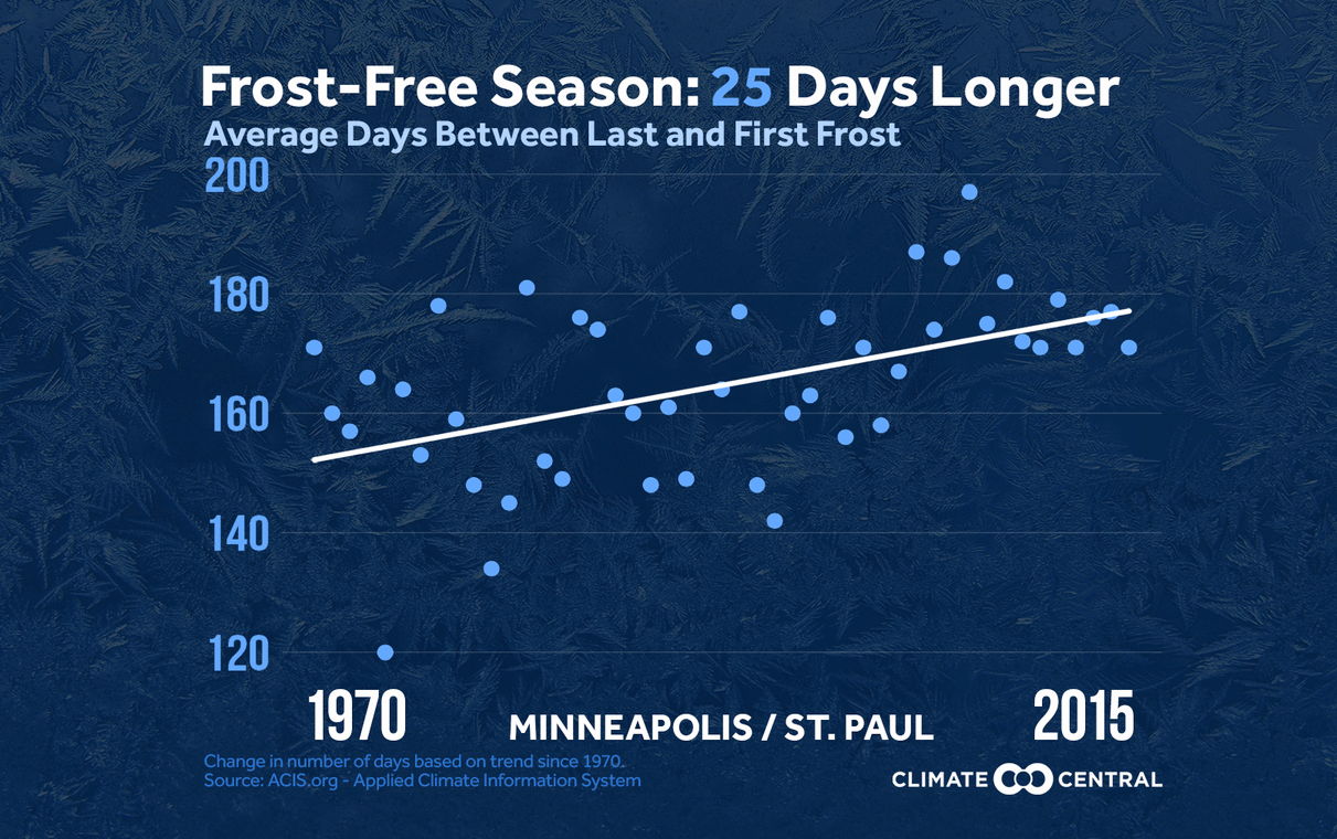
Consistently Longer Frost-Free Season in Minnesota. Details via Climate Central: "In the fall, we often expect to wake up to frost-covered windows, but a warming world is altering the average time when we first see those mornings occur. The frost-free season, defined as the stretch between the last 32°F reading in the spring and the first 32°F reading in the fall, has increased in length over the past 30 years, with both an earlier last frost in the spring and a later first frost in the fall..."
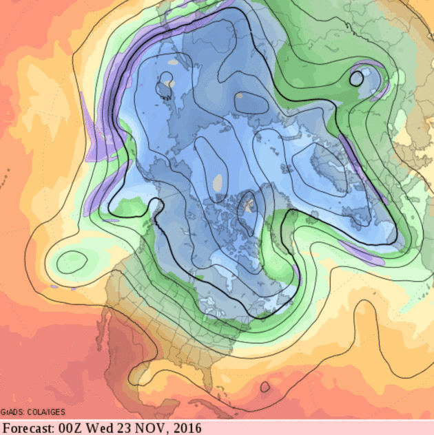

What To Expect This Winter: NOAA's 2016-2017 Winter Outlook. La Nina is one of several factors capable of nudging our weather in a specific direction this winter. Odds are it won't be as mild as last winter; beyond that the crystal ball gets murky in a hurry. Here's an excerpt of a good explainer from Mike Halpert at NOAA's Climate.gov: "...So while the southern (and especially southeastern) part of the U. S. is often wetter and colder than average during El Niño winters, La Niña generally favors below-average precipitation and above-average temperatures in those same regions. We also often see opposite patterns across the northern part of the nation, with warmer and drier conditions during El Niño winters and colder and wetter conditions during La Niña years. Before discussing the actual winter outlook, I want to remind readers that these are probabilities (% chance) for below, near, or above average seasonal climate outcomes with the maps showing only the most likely temperature or precipitation outcome (footnote 1). Because the probabilities shown are less than 100%, it means there is no guarantee you will see temperature or precipitation departures that match the color on the map..."
Map credit: "Typical impacts of La Niña on U.S. winter temperature and precipitation. Such impacts have been associated with past episodes, but all impacts aren't seen with every episode." NOAA Climate.gov drawing by Fiona Martin.
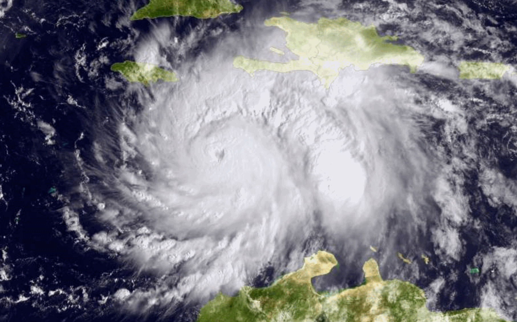
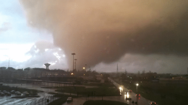
Hurricane Intensity Is Not Exaggerated To Scare People, And Here's How We Know. When data and evidence gets in the way some resort to conspiracy theories. Besides, it makes for good click-bait. Hurricane expert Brian McNoldy responds to Matt Drudge at Capital Weather Gang: "Hurricane Matthew brushed the East Coast as a Category 4 in early October. It scoured the Florida coast with a storm surge that washed out roads and flooded homes and businesses. It dumped over a foot of rain on the Carolinas and triggered deadly flooding. And before all of this, Matthew devastated Haiti and killed at least 600 people — it’s possible we’ll never know the final death toll. But the hurricane’s deadly encounter with Haiti and multibillion-dollar brush with the East Coast wasn’t bad enough for some people — mainly, Matt Drudge, a political commentator and news aggregator, who tweeted skepticism about Matthew’s actual intensity as it barreled toward Florida. Perhaps, he suggested, the National Hurricane Center was overhyping the storm’s maximum winds..." (Hurricane Matthew file photo: NOAA).
Hurricane Sandy Was a 260 Year Storm - Here's What That Means.
For the record 2012's Superstorm Sandy wasn't even (technically) a
warm-core hurricane when it struck New Jersey. But the storm was huge,
it carved out an impressive storm surge that hit at astronomical high
tide during a full moon. Here's an excerpt from Yahoo Finance: "... The
total damage to New York City was worth $19 billion and to New Jersey
$29 billion. Now, the big question is: How likely is it that a
Sandy-level storm will happen again in our lifetimes? In the past,
studies have pegged Sandy as anywhere from a 100-year storm to a 1,500
year storm. That means that in any given year there's a 1/100 to 1/1,500
chance of a storm causing Sandy-level flooding. A new paper accepted
for publication in the Journal of Geophysical Research
October 21 offers a more precise estimate: Sandy was a 260-year storm,
based on current ocean conditions. That includes tropical cyclones like
Sandy as well as winter storms like northeasters, lead author Philip
Orton, who studies ocean physics at the Stevens Institute of Technology,
told Business Insider..." (Superstorm Sandy file image: NASA).
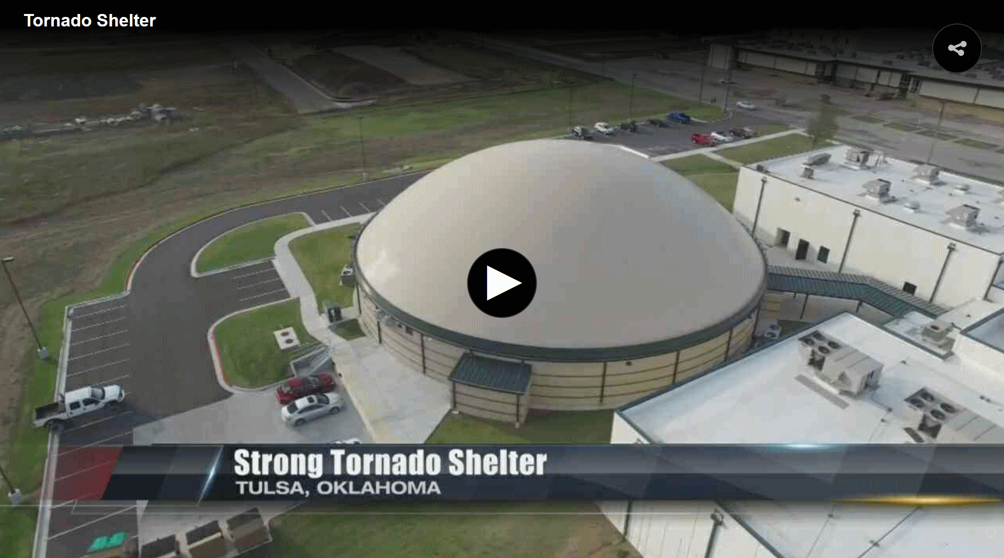
Oklahoma Storm Shelter For School Said To Withstand EF-5 Tornado. I wonder if any man-made structure can be constructed to be "tornado-proof"? I found this story from WTVY-TV to be interesting; here's a clip: "...The superintendent hopes to build more of these, one for each elementary school. The building is said to be able to withstand an F-5 tornado. It has a monolithic dome, a round roof made of reinforced steel and layer after layer of concrete, making it one of the safest places to be during a natural disaster..."

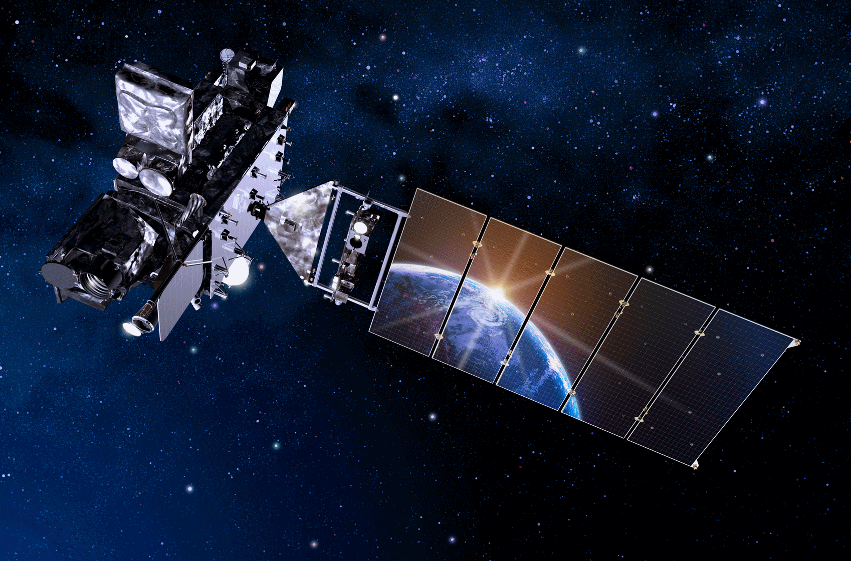
New Weather Satellite Set to "Revolutionize" The U.S. Weather Forecast.
That may be a bit strong, but there's little doubt that GOES-R is
another big step forward, giving us a much more powerful,
high-resolution eye in the sky. Details via Yahoo Finance: "...NASA
is currently preparing the launch pad at Cape Canaveral to send the
first satellite, known as GOES-R, into orbit on November 16 at 4:42 p.m.
ET. According to NOAA, the new weather station will contribute to more
accurate weather forecasts and better predictions of severe storms.
"Without a doubt, GOES-R will revolutionize weather forecasting as we
know it," Stephen Volz, assistant administrator for NOAA's Satellite and
Information Service, told reporters earlier this month. "For weather
forecasters, GOES-R is like going from black and white television to
super-high-definition TV, and for the American public GOES-R will mean
faster, more accurate weather forecasting and warning..." (Artist sketch of GOES-R: Lockheed Martin).
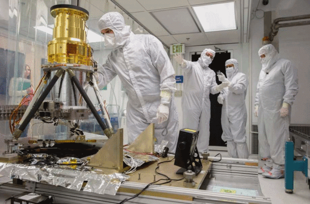
Photo credit: "Technician Clinton Maldoon checks on the Geostationary Lightning Mapper at Lockheed’s Advanced Technology Center." Santiago Mejia, The Chronicle.
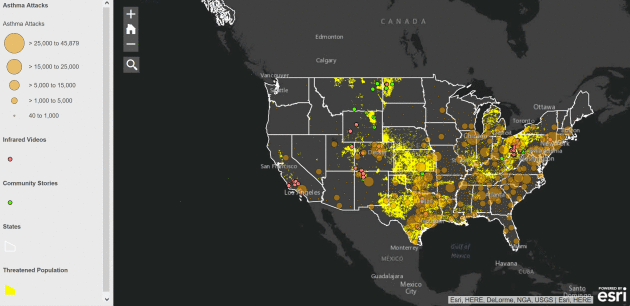
Sunshine Matters A Lot to Mental Health; Temperature, Pollution, Rain Not So Much. Almost time to put your therapist on speed-dial. Here's a fascinating nugget, courtesy of EurekAlert! Science News: "...That's one of the surprising pieces of our research," said Mark Beecher, clinical professor and licensed psychologist in BYU Counseling and Psychological Services. "On a rainy day, or a more polluted day, people assume that they'd have more distress. But we didn't see that. We looked at solar irradiance, or the amount of sunlight that actually hits the ground. We tried to take into account cloudy days, rainy days, pollution . . . but they washed out. The one thing that was really significant was the amount of time between sunrise and sunset."Therapists should be aware that winter months will be a time of high demand for their services. With fewer sun time hours, clients will be particularly vulnerable to emotional distress. Preventative measures should be implemented on a case-by-case basis...."
Does The Switch to Daylight Saving Time Increase Risk of Depression? Here's an excerpt of an interesting article focusing on new studies, courtesy of The Washington Post: "...One possible explanation is that the sudden advancement of sunset from 6 p.m. to 5 p.m . . . which in Denmark marks the coming of a long period of very short days, has a negative psychological impact on individuals prone to depression, and pushes them over the threshold to develop manifest depression,” the authors write. We know, for instance, that long days and ample sunshine are protective against depressive symptoms. The shift to standard time essentially steals an hour of daylight from the evening, when most of us are awake, and tacks it on to the early morning hours, when many of us are not. The net effect is that many of us lose an hour of daylight..."

Photo credit: "A near-Earth object on course to hit the planet would require nationwide or global coordination to minimize threat." (NASA/JPL-Caltech)
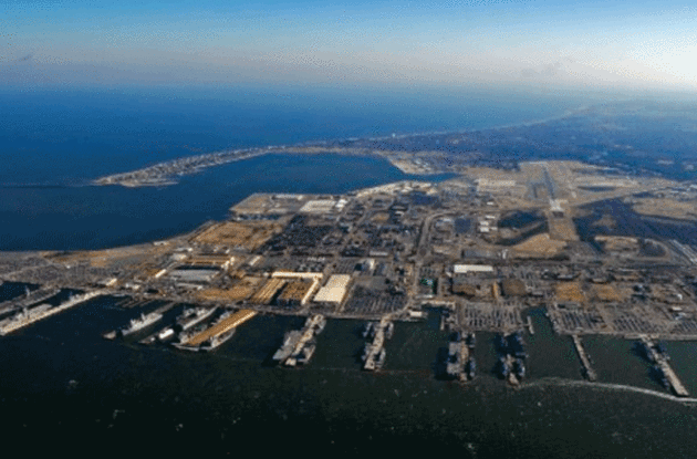
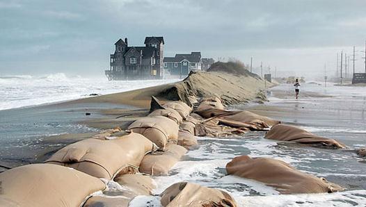
Photo credit: Andrew Demp, Yale.
Photo credit: REUTERS/Adnan Abid.
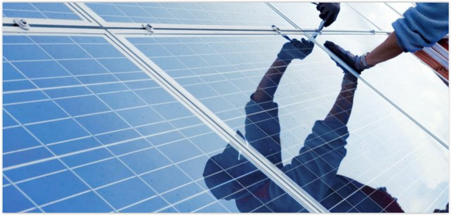
Red Lake Band of Minnesota Plans For All-Solar Electric Generation.
Why? Because it'll help clean up the air AND save them money over the
long haul - there's a significant ROI. Here's more information from The Star Tribune: "The
Red Lake Band of Chippewa in northern Minnesota intends to build enough
solar energy capability on tribal lands over the next several years to
free itself from electricity generated from fossil fuels. And, thanks to
outside investors who can tap a variety of tax credits, depreciation
and deductions, it should cost the tribe very little to eventually
become owners of the solar arrays, power-storage units and related
equipment..." (File photo: Utility Dive).
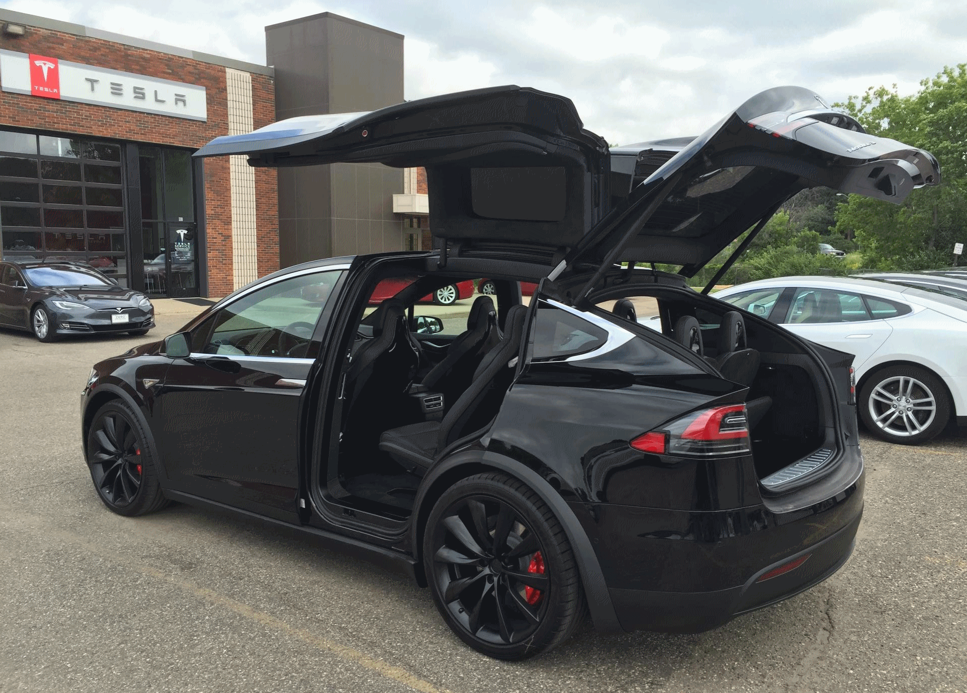
Oil Industry's New Threat? The Global Growth of Electric Cars. Odds are our kids and grandkids won't think twice about driving an electric vehicle. Here's an excerpt from The New York Times: "...Could
the world’s transportation system be on the verge of a disruption, one
that could slow the growth of oil demand and eventually reverse it? That
question is not just profound, it is urgent. Nations have pledged to
fight global warming,
which means sharply paring emissions of carbon dioxide and other
greenhouse gases by midcentury, just over three decades away. If that is
to be achieved, some studies suggest, there will be no place for cars
burning gasoline or diesel. They will have to run on electricity, or
possibly another alternative fuel, and the electric system itself will
have to become much cleaner..."
TODAY: Good and sunny. Hints of September. Winds: SW 7-12. High: 62
WEDNESDAY NIGHT: Partly cloudy and mild for November. Low: 43
THURSDAY: Balmy start, then cooler PM wind. Winds: SW/NW 10-15. High: 65
FRIDAY: Blue sky, a bit cooler. Winds: N 8-13. Wake-up: 40. High: 52
SATURDAY: Frosty start. Sunny and pleasant. Winds: SW 10-20. Wake-up: 26. High: 57
SUNDAY: Pinch me. Is it really November 13? Partly sunny skies. Winds: W 8-13. Wake-up: 41. High: near 60
MONDAY: Partly sunny and cooler, still above average. Winds: W 5-10. Wake-up: 40. high: 55
TUESDAY: More clouds, risk of a (rain) shower. Winds: NW 10-15. Wake-up: 46. High: 54
Climate Stories. Because weather and climate are flip-sides of the same coin.

In this free evening conversation, you’ll learn:
- Why Christians should lead the charge for caring for God’s creation.
- How climate change goes beyond politics and affects the health, economy, and stability of future generations.
- Tips to help your family and those around you care for the earth..."

Pentagon Report: U.S. Military Considers Climate Change a "Threat Multiplier" That Could Exacerbate Terrorism. Here's an excerpt from Newsweek: "A
report released Monday indicates the Department of Defense has
dramatically shifted its views towards climate change, and has already
begun to treat the phenomenon as a significant threat to national
security. Climate change, the Pentagon writes, requires immediate action
on the part of the U.S. Military. The report
is a “roadmap” of the Department’s future needs and actions to
effectively respond to climate change, including anticipating that
climate change may require more frequent military intervention within
the country to respond to natural disasters, as well as internationally
to respond to “extremist ideologies” that may arise in regions where
governments are destabilized due to climate-related stressors..."
No comments:
Post a Comment