Inaugural Weather
The National Weather Service has a wonderful write up about past inaugural weather. From averages to extremes dating all the way back to 1800s. There really are some interesting stats from President Taft dealing with 10" of snow in 1909 to President Harrison catching pneumonia and dying 1 month later.
1817 = First outdoor inauguration. President James Monroe was sworn into office.
1873 = Coldest March 4th inauguration. Noon temperature was only 16°F with a record low temperature for March of only 4°F. Sunshine was no help as the wind made it bitterly cold. President Ulysses S. Grant was sworn into office for his second term.
1909 = Most snow with 9.8 inches. Also very strong winds. President William H. Taft was sworn into office.
1913 = Warmest March 4th inauguration. Noon temperature was 55°F.
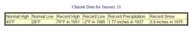
1937 = First inauguration held on January 20th.
1937 = Record rainfall. It was President Franklin D. Roosevelt's second inauguration. A total rainfall of 1.77 inches fell that cold day. Between 11 am and 1 pm, 0.69 inches of rain fell with a noon temperature of 33°F.
1961 = Eight (8) inches of fresh snow laid on the ground for President John F. Kennedy's inauguration.
1981 = Warmest January inauguration. Noon temperature was 55°F. It was Ronald Reagan's first inauguration and would greatly contrast his second inauguration listed below.
1985 = Coldest January inauguration (Jan. 21). Noon temperature was only 7°F. The morning low temperature was -4°F and the afternoon high was only 17°F. Wind chill temperatures in the afternoon were in the -10 to -20°F range. It was Ronald Reagan's second inauguration ceremony.
1873 = Coldest March 4th inauguration. Noon temperature was only 16°F with a record low temperature for March of only 4°F. Sunshine was no help as the wind made it bitterly cold. President Ulysses S. Grant was sworn into office for his second term.
1909 = Most snow with 9.8 inches. Also very strong winds. President William H. Taft was sworn into office.
1913 = Warmest March 4th inauguration. Noon temperature was 55°F.
1937 = First inauguration held on January 20th.
1937 = Record rainfall. It was President Franklin D. Roosevelt's second inauguration. A total rainfall of 1.77 inches fell that cold day. Between 11 am and 1 pm, 0.69 inches of rain fell with a noon temperature of 33°F.
1961 = Eight (8) inches of fresh snow laid on the ground for President John F. Kennedy's inauguration.
1981 = Warmest January inauguration. Noon temperature was 55°F. It was Ronald Reagan's first inauguration and would greatly contrast his second inauguration listed below.
1985 = Coldest January inauguration (Jan. 21). Noon temperature was only 7°F. The morning low temperature was -4°F and the afternoon high was only 17°F. Wind chill temperatures in the afternoon were in the -10 to -20°F range. It was Ronald Reagan's second inauguration ceremony.
 Oh, So Close...
Wednesday was fairly sunny across the Twin Cities metro, but areas of dense fog developed across the region. The fog was so thick that a flight from Chicago, IL to Sioux Falls, SD had to divert back to Chicago, IL right before landing. Here's @BrianKirkWX's tweet showing the flight path of the unfortunate flight.

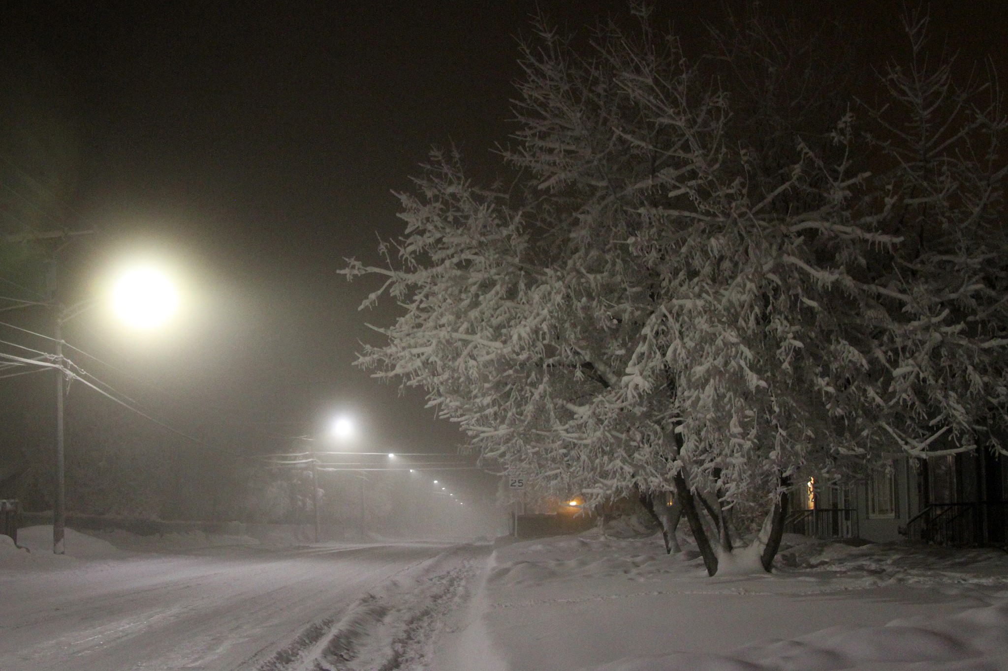
Fairbanks, AK: First -50F Since 2012
Thanks to my good friend Jane Taffe for this picture out of Fairbanks, Alaska where the temperature dipped to -50F for the first time since 2012. Jane said that there was an eerie glow at 50 below...
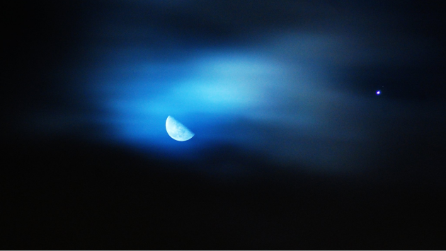
Quarter Moon and Jupiter
Thanks to the @NWSSeattle for this beautiful picture of the moon and Jupiter early Thursday morning.
_________________________________________________________________________
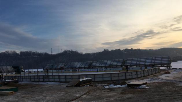
Hockey Day In Minnesota - Saturday, January 21st
One of my favorite days of the year is coming up this weekend! Weather conditions for Hockey Day in Minnesota over the years have ranged from brutally cold with frigid wind chills to picture perfect with light snow. This year's event will be held in Stillwater, located along the beautiful St. Croix River and while the setting couldn't be any more beautiful... unfortunately, the weather this Saturday looks a little ugly. High temperatures are expected to be in the low/mid 40s with a chance of a little light rain.
Here's an excerpt from NHL.com/wild/news in regards to the event being held in Stillwater this year.
"Building an outdoor hockey rink in any location is a unique blend of meteorology, technology, craftsmanship, and blue-collar labor. But putting a hockey rink on a river bank in a park famous for being an idyllic summer location for picnics, weddings, and jogging has created numerous challenges. Novalany and the Stillwater community have worked closely with an assortment of companies such as Ice Rink Events, Xcel Energy and Raleigh Trucking to build the rink in the unique location. It has been a mix of hard hats, modern hockey rink construction supplies, and, of course, looking at the volatile Minnesota winter forecast. "All of the work has been weather dependent," Novalany said with a sigh and chuckle."
(Image below courtesy NHL.com/wild/news)
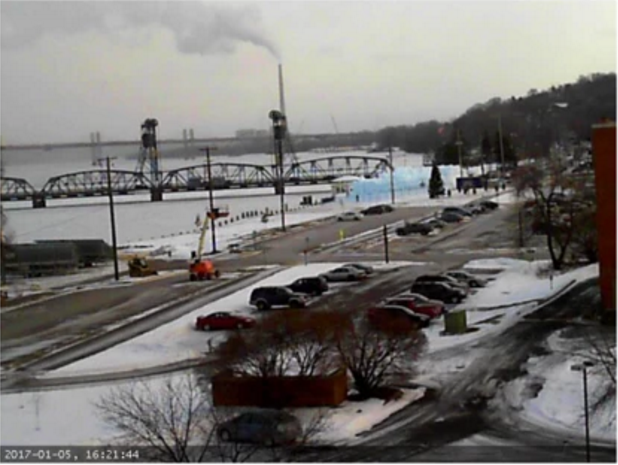
Stillwater, MN Webcam
If you're interested in what's happening in downtown Stillwater, here's a LIVE webcam from Stillwater.com showing the the hockey rink and ice castle in Stillwater’s Lowell Park.
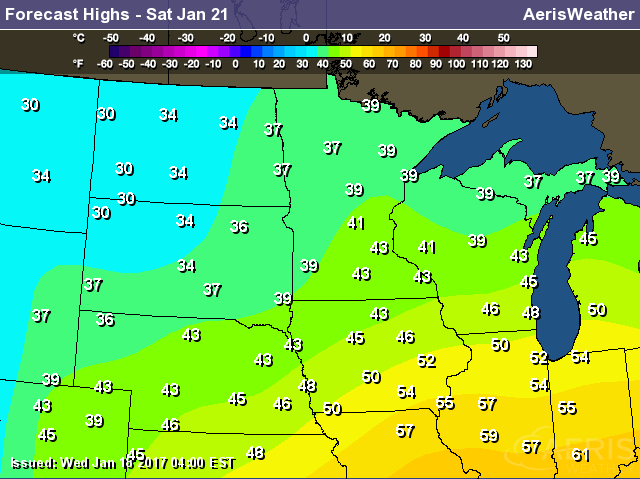
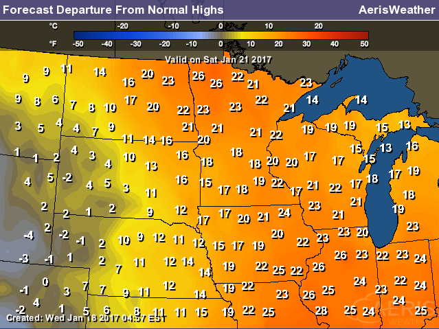
Temperature Outlook Saturday
Here's the temperature outlook for Saturday, which shows high temperatures across the southern half of Minnesota in the low/mid 40s, which nearly 20F above average! High temperatures like this are more typical of mid March!
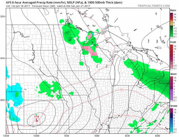
Weather Outlook for Saturday
Here's the weather outlook from Friday night to Saturday night, which shows scattered light rain showers rotating through the region. The storm system responsible for this somewhat soggy weather will also be responsible for temperatures in the low/mid 40s, which will be nearly 20F above average for mid/late January.
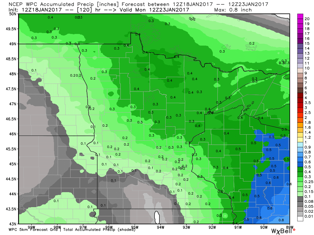
Precipitation Potential
Here's the precipitation potential through AM Monday, which shows up to 0.4" liquid possible across parts of northern Minnesota and Wisconsin. Note that temperatures will be warm enough for mostly rain. Although rainfall tallies don't appear to be too terribly heavy, warm temperatures and rain will make any outdoor winter activities unfavorable. In the case for Saturday's Hockey Day in Minnesota, ice conditions will likely be warm, soft, slow and possibly even wet.
 ______________________________________________________________________________
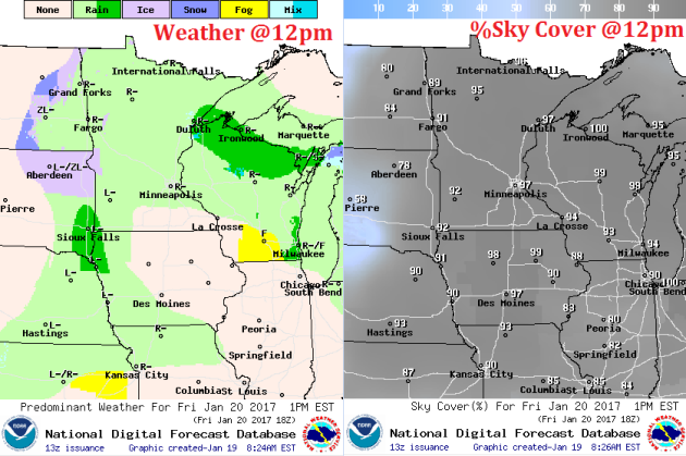
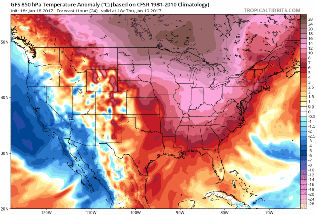
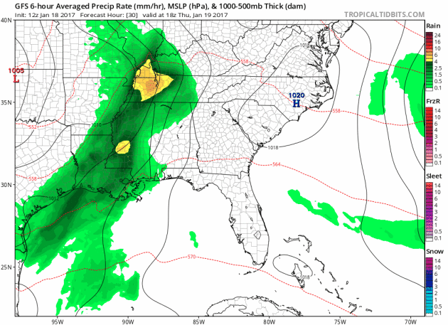
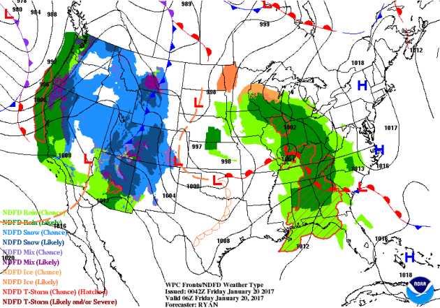
Soggy Inauguration in D.C. - Soggy Weekend in MN
It's an important day in D.C. today as President-elect Donald Trump will be sworn into office. Interestingly, this could be one of the warmest and wettest January inaugurations on record. Note that prior to 1937, inaugurations were held in March. With that said, in the 20 January inaugurations, temps have only warmed to at or above 45 degrees 4 of those times and precipitation was recorded only 6 of those times.
According to the NWS, 1909 had the worst weather as it took nearly 6,000 men and 500 wagons to clear 10 inches of snow along William H. Taft's parade route.
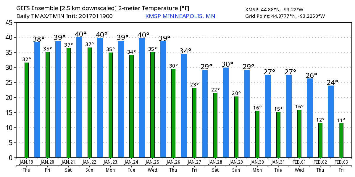
Closer to home, we settle into a somewhat soggy weather pattern with scattered light rain showers over the next few days. There may be a few wet snowflakes mixing in, but with highs flirting with 40 degrees through the weekend, streets remain mainly wet.
The extended forecast gets a little more interesting next week as a plowable snow event may develop. Don't get too excited yet. While one model brings the snow through the region, another keeps it well south of us.
___________________________________________________________________________
___________________________________________________________________________
Extended Forecast:
THURSDAY NIGHT: Cloudy. Chance of light rain and sprinkles. Winds: SE 5. Low: 34
FRIDAY: Cloudy and mild with a little light rain. Winds: SE 5. High: 39
FRIDAY NIGHT: Chance of light rain mixing with a few wet flakes. Winds: ESE 5. Low: 34.
SATURDAY: Murky skies and showers. Wet mix overnight. Winds: E 5. High: 42.
SUNDAY: Cloudy. Leftover sprinkles of flurries. Winds: NW 5. Wake-up: 34. High: 40.
MONDAY: Mostly cloudy. Still warm for January. Winds: W 5. Wake-up: 32. High: 39.
TUESDAY: Cooler. Chance of snow. Winds: ENE 10-15. Wake-up: 31. High: 36.
WEDNESDAY: Chilly wind. Lingering light snow. Winds: NW 10-20. Wake-up: 29. High: 35.
THURSDAY: Mostly cloudy and cooler. Stray flurries. Winds: WNW 5-15. Wake-up: 22. High: 30.
_______________________________________________________________________________
_______________________________________________________________________________
This Day in Weather History
January 20th
January 20th
1982: Just over 17 inches of snow falls in the Twin Cities. Amazingly, it was to be outdone two days later.
1917: 16 inches of snow falls in the Twin Cities.
_______________________________________________________________________________
_______________________________________________________________________________
Average High/Low for Minneapolis
January 20th
January 20th
Average High: 24F (Record: 52F set in 1908)
Average: Low: 7F (Record: -32F set in 1888)
Average: Low: 7F (Record: -32F set in 1888)
*Record Snowfall: 17.1" set in 1982
_______________________________________________________________________________
_______________________________________________________________________________
Sunrise Sunset Times For Minneapolis
January 20th
January 20th
Sunrise: 7:44am
Sunset: 5:05pm
Sunset: 5:05pm
*Daylight Gained Since Yesterday: ~2 minutes & 5 seconds
*Daylight Gained Since Winter Solstice (December 21st): ~35 minutes
________________________________________________________________________________
*Daylight Gained Since Winter Solstice (December 21st): ~35 minutes
________________________________________________________________________________
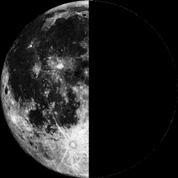
Moon Phase for January 18th at Midnight
0.4 Days After Last Quarter
0.4 Days After Last Quarter
_______________________________________________________________________
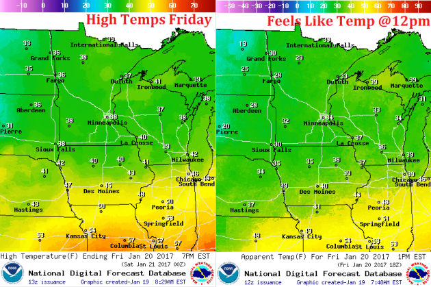
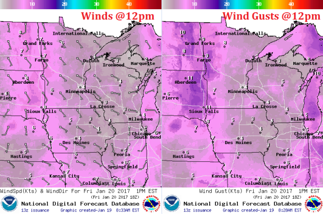
Weather Outlook For Friday
Warm temps continue into Friday with highs warming into the upper 30s to near 40F. This will be nearly 15F to 20F above average once again.
Weather Outlook For Friday
Winds will still be fairly light, but will continue out of a southerly direction, which will help to keep warm temperatures in place through the weekend ahead.
Here's the temperature outlook through early February, which shows a VERY mild trend heading into the weekend and into early next week with highs in the 30s and 40s! With several days above freezing, our snow pack will likely take a big hit... we may also have a fog concerns with melting snow and added moisture in the lower levels of the atmosphere. By the end of the month and early February, temperature should return to near normal levels.
___________________________________________________________________________________
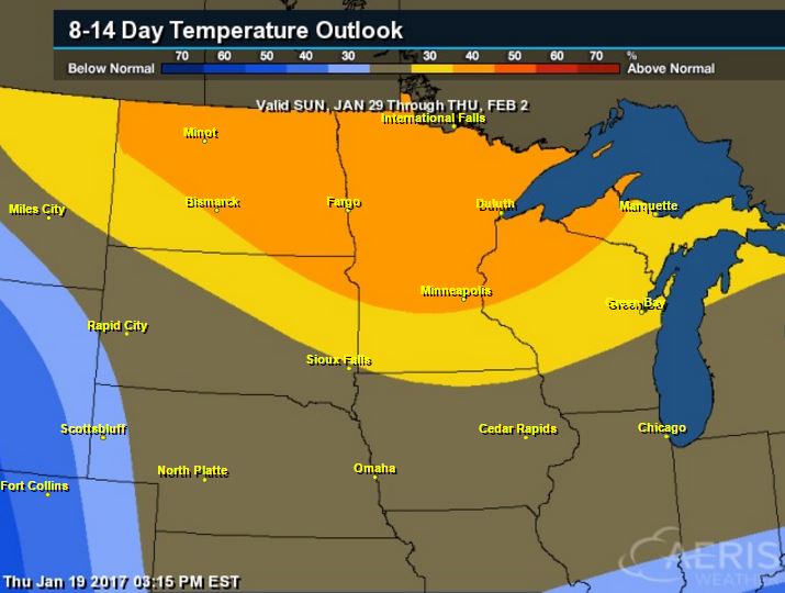
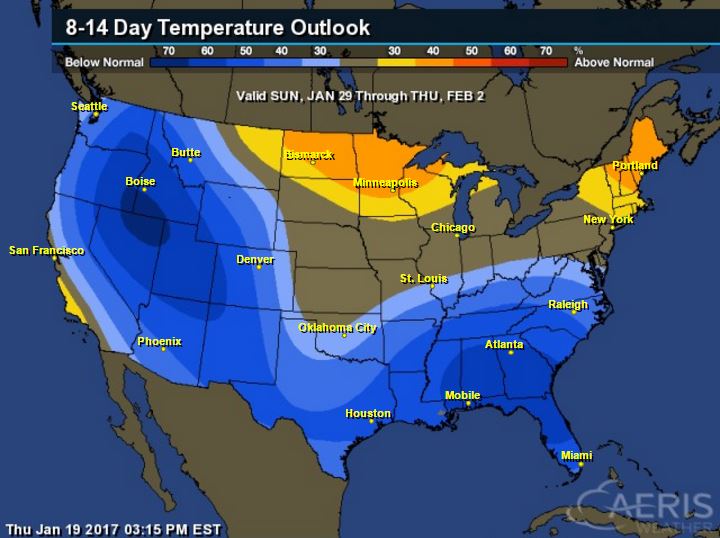
8 to 14 Day Temperature Outlook
According to NOAA's CPC, the 8 to 14 day temperature outlook suggests warmer than average temperatures continuing across much of the Upper Midwest from January 29th to February 2nd. With that said, extended models are suggesting temperatures returning to near normal levels by the end of the month. Looking ahead, there doesn't appear to be any major cold snaps brewing over the next couple of weeks.
_________________________________________________________________________________
Temperature Outlook
National Temp Outlook
Take a look at the temperature anomaly through Thursday, January 26th. Note that the Eastern half of the country looks to stay warmer than average through much of that time period, but colder than average temps begin moving into the Western & Central U.S. by nearly next week.
________________________________________________________________________________
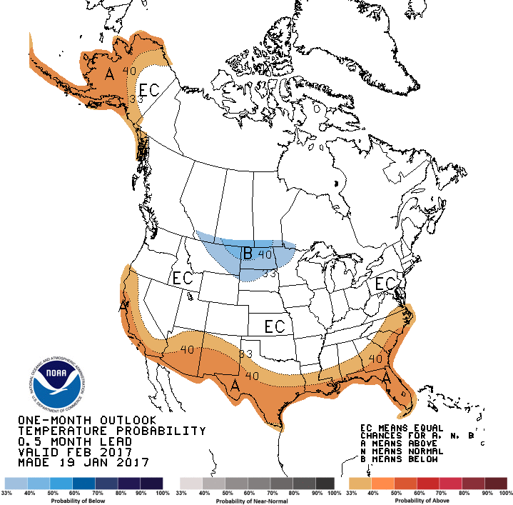
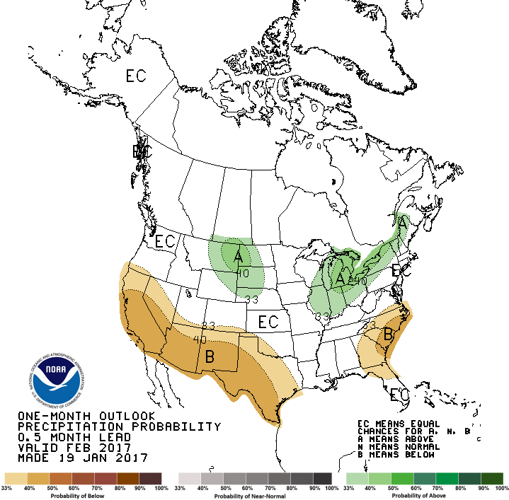
February Outlook
NOAA's CPC released their February outlook, which shows that much of the will have equal chances of above and below normal temperatures with the exception of Alaska and the southern tier of the nation. The only spot that looks to be below average is the High Plains and Upper Midwest. Note that above average temperatures look to be found across the northern tier of the nation, while below average precipitation looks to be found along the southern tier of the nation.
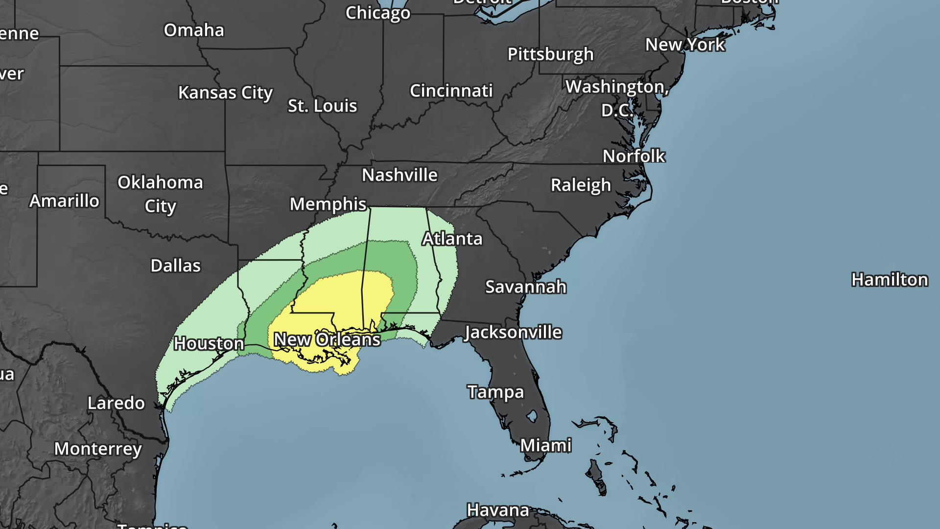
Thundery Outlook In the Southeast Through The Weekend
Heres' the simulated radar from Thursday to Monday morning, which shows ongoing showers and storms across parts of the Gulf Coast States. Note that an even more impressive storm develops over the weekend with more showers and storm across the Gulf Coast. This may be responsible for isolated severe storms and locally heavy rainfall.
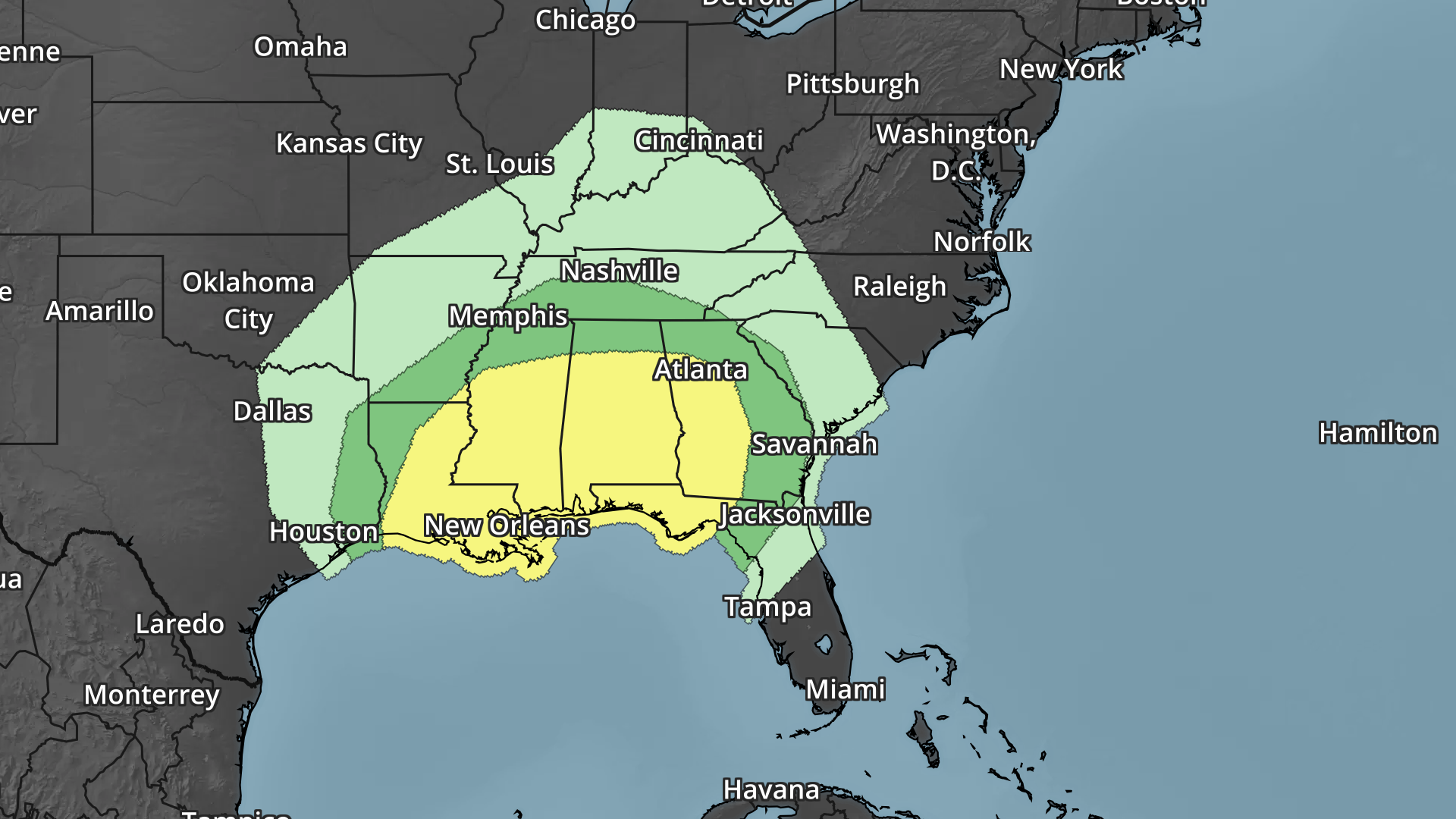
Severe Weather Concerns Ahead
Here's the severe weather outlook from Friday to Sunday, which shows a several day severe weather concern across parts of the Southeastern U.S.. Strong to severe storms and locally heavy rainfall could impact some of the same areas through the end of the week and weekend ahead.
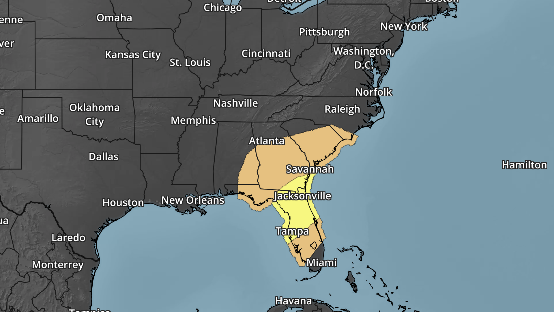
Heavy Rain Threat Ahead
With scattered showers and storms ongoing across the southeastern U.S. over the next several days, heavy rainfall potential will follow. The rainfall potential through early next week suggests widespread 2" to 4" amounts with some isolated 5" to 6"+ amounts possible, which may lead to flooding.
 _____________________________________________________________________________
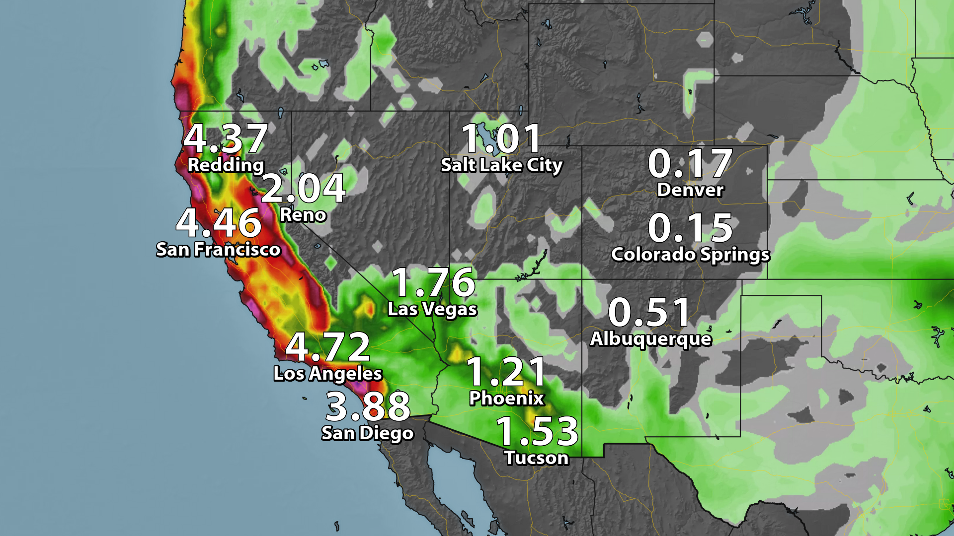
Heavy precipitation has been falling across the Western U.S. due to rivers of Pacific moisture plowing into the region. Note the deep plumes of Pacific moisture that seems to be directed right toward the West Coast, these are the Atmospheric Rivers that are responsible for the extensive precipitation.
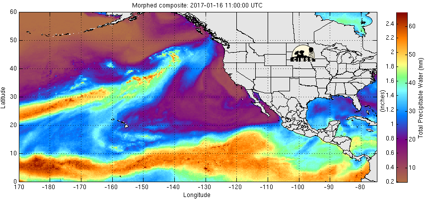
Waves of Pacific Moisture in the Western U.S.
Even after the heavy rainfall across parts of the region during the middle part of the week. More heavy moisture will be possible late week and late weekend. Heavy rain along the coast and heavy snow in the high elevations will be possible.
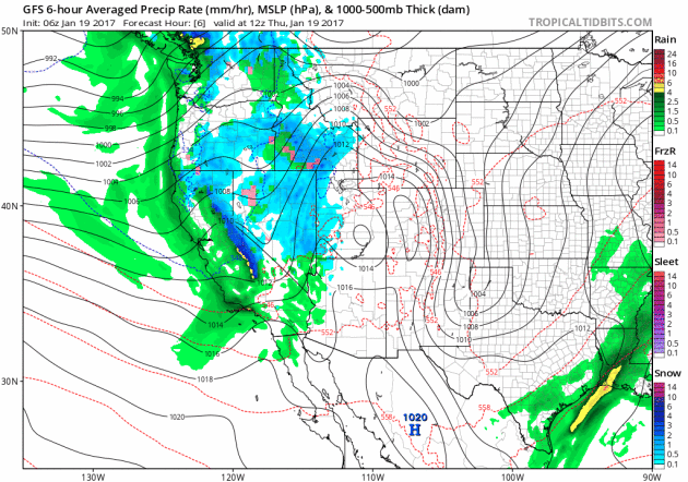
Western Winter Weather Concerns
A number of winter weather headlines continue across the Western U.S. over the next few days with 1ft. to 2ft. possible in some of the most extreme cases. Also note that the mountains near Los Angeles and southern Arizona are under winter storm warnings, where up to 1ft of snowfall will be possible through the weekend.
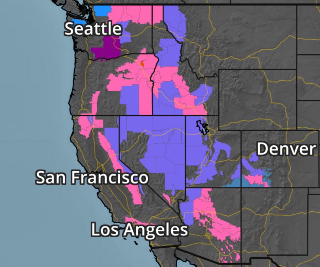
Snowfall Potential
The forecast model loop shows heavy snowfall returning to much of the Western U.S. over the next several days with some fairly hefty tallies across the Sierra Nevada Range once again. Interestingly, the mountains in southern California and Arizona look to get some pretty decent snowfall amounts too!
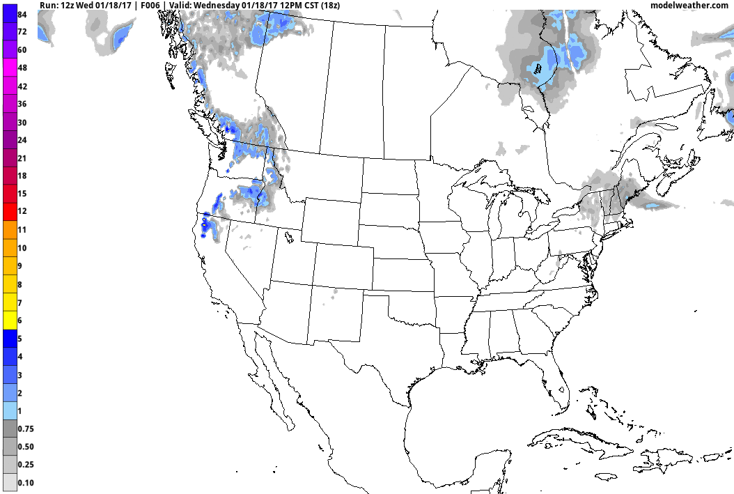
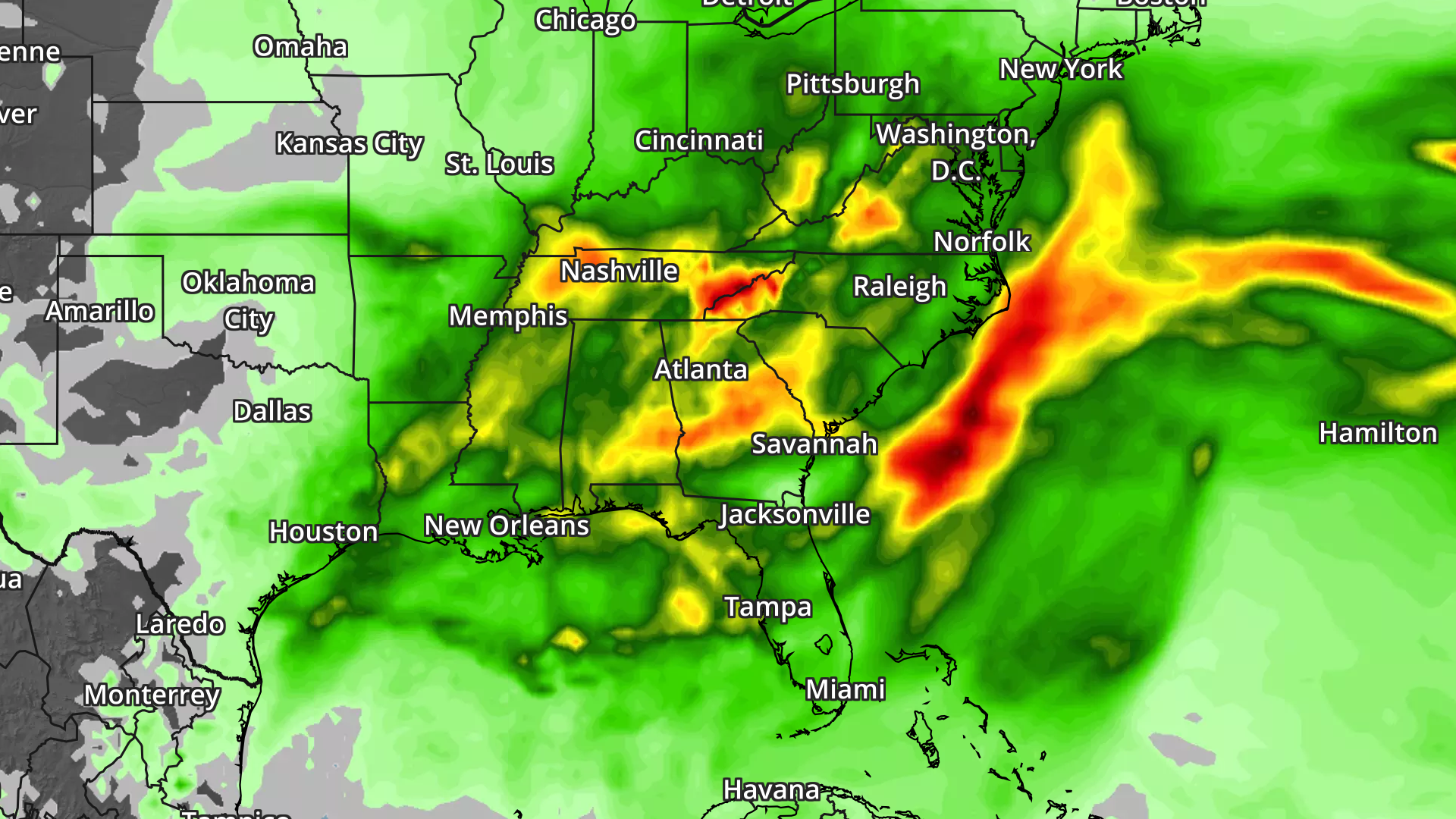
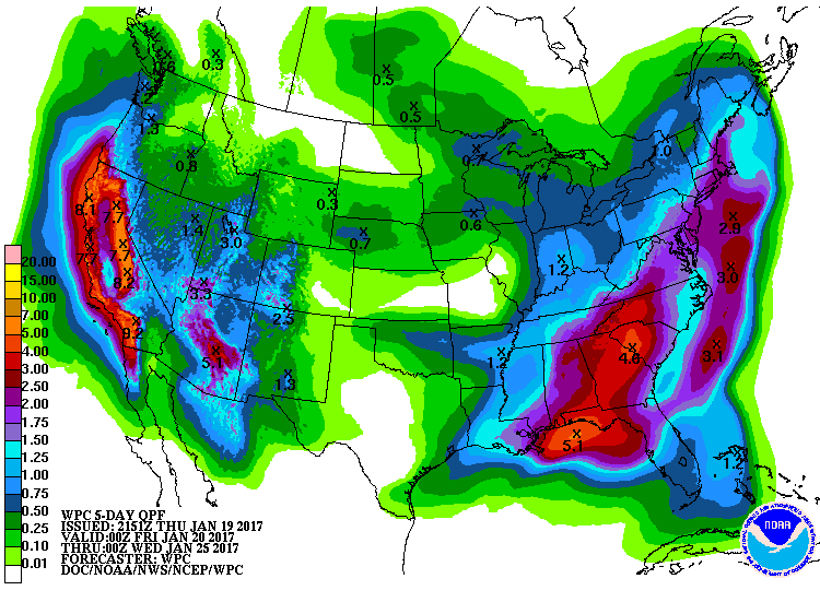
Here's the national weather outlook through the end of the week, which shows scattered storms and locally heavy rainfall continuing and redeveloping across the Gulf Coast States. Note that some of the storms late week and into the weekend could be severe. The Western U.S. will also be inundated with widespread heavy precipitation over the next several days. Heavy rain, flooding and heavy mountain snow will be possible as several rounds of Pacific moisture "Atmospheric Rivers" move through during the end of the week, weekend ahead and into early next week.
The forecast model loop shows heavy snowfall returning to much of the Western U.S. over the next several days with some fairly hefty tallies across the Sierra Nevada Range once again. Interestingly, the mountains in southern California and Arizona look to get some pretty decent snowfall amounts too!
National Weather Outlook
5 Day Precipitation Forecast
According to NOAA's PC, the 5 day precipitation forecast suggests widespread 2" to 4"+ rainfall amounts across the Southern and Eastern U.S.. Also note the heavy moisture moving back into the West U.S., especially along the West Coast. Some 6" to 12"+ liquid tallies can't be ruled out from northern California to western Oregon and western Washington. There may even be some 3" to 6"+ tallies across parts of southern California through early next week.
 _________________________________________________________________________________
"Finding ways to fix the climate before it is too late"
We know that greenhouse gas emissions from burning fossil fuels and other economic activities are warming the Earth and changing the climate.
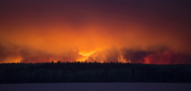
The North Pole provides just the latest disturbing evidence of this fact. Right before New Year's, the International Arctic Buoy Programme recorded temperatures there that were right around freezing, or more than 30 degrees C. warmer than usual.
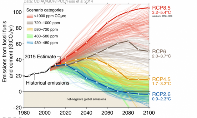
Deciding which large-scale economic and social changes to make so we don't overheat the planet is not easy, however. Researchers around the globe have built complex computer simulations, called Integrated Assessment Models, or IAMs, that give them a view into possible futures. The models predict what would happen to the climate over the next 80 years based on different mixes of government policies and technologies.
(This graphic shows approximately 1200 different future scenarios of what the climate will look like, with each scenario a different mix of technologies and government policies. The Intergovernmental Panel on Climate Change, or IPCC, relies information like this to see how different combinations of technologies and government regulations will affect global climate until 2100. Credit: Global Carbon Project)
"2016 marks three consecutive years of record warmth for the globe"
It's official - the numbers just came in from NOAA and 2016 was in fact THE warmest year on record for the entire globe! Interestingly, this marks 3 consecutive years with record warmth for the globe, which seems a bit unsettling... Here's an excerpt:
"With a boost from El Nino, 2016 began with a bang. For eight consecutive months, January to August, the globe experienced record warm heat. With this as a catalyst, the 2016 globally averaged surface temperature ended as the highest since record keeping began in 1880, according to scientists from NOAA's National Centers for Environmental Information (NCEI). The average temperature across global land and ocean surfaces in 2016 was 58.69 degrees F or 1.69 degrees F above the 20th century average. This surpassed last year’s record by 0.07 degrees F. Since the start of the 21st century, the annual global temperature record has been broken five times (2005, 2010, 2014, 2015, and 2016)."
___________________________________________________________________________________
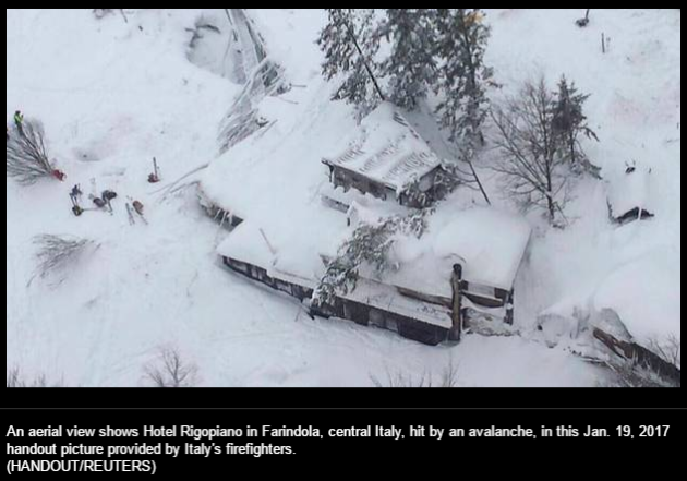
"30 missing in Italy avalanche: 'Help, we're dying of cold'"
"An overnight avalanche possibly triggered by Wednesday’s central Italian earthquakes has buried a mountain hotel, where as many as 30 guests are missing in the snow-filled debris of the collapsed resort. With roads blocked by two metres of snow in the Gran Sasso mountain area, the first alpine rescue teams, using skis, did not reach the Hotel Rigopiano until 4 a.m. local time, several hours after the avalanche. By noon, only two survivors had been found and ambulances could not get any closer than nine kilometres to the site, according to the Italian news agency Ansa."
_______________________________________________________________________________________
"China’s Xi Lectures Trump on Globalization and Climate Change"
"The leader of China's Communist Party lectured the American president-elect on Tuesday about the virtues of globalization, free trade and even green energy — a sign of just how much international politics has changed. Chinese President Xi Jinping didn't need to mention Donald Trump during his speech at the World Economic Forum in Davos, Switzerland — several of his pointed remarks appeared unequivocally aimed at him. With Trump defining his presidential campaign with his outspoken criticism of trade and immigration, the Chinese president appeared to be projecting his country as the world's new bastion of global capitalism."
(Image Credit: Michel Euler / AP - China's President Xi Jinping attends the World Economic Forum in Davos, Switzerland, on Tuesday.)

___________________________________________________________________________________
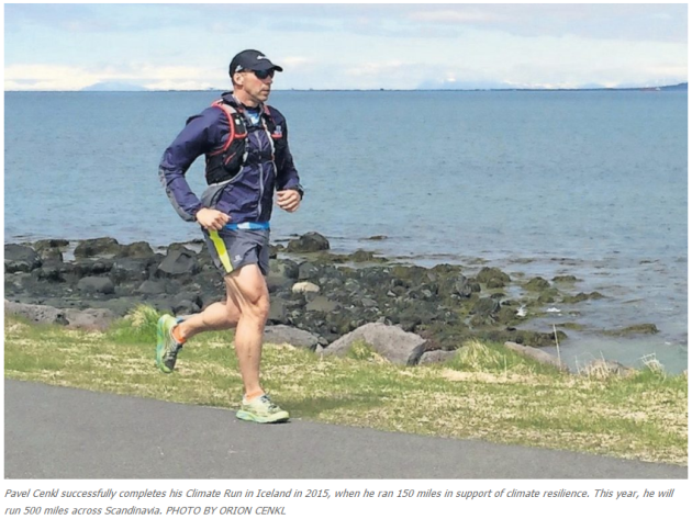
"Climate Run: 500 chilly miles"
"To explore. To push his limits. To experience the world and lay himself bare. These are some of the reasons Pavel Cenkl, of Craftsbury, enjoys endurance running. “I also run because I love to teach, to inspire,” said the associate dean of academics at Sterling College in a recent video he produced. The video explains his newest adventure, Climate Run 2017: Arctic Trail, in which he will set out in August to run the Arctic Trail, a 500-mile trail that traverses remote mountainous terrain between Norway, Sweden and Finland, all above the Arctic Circle. “I want to use this run to bear witness to the rapidly changing climate in the region,” he said, “especially its effects on local Sami communities, and on mountain cultures and environments along the way. The Arctic is among the places on Earth where climate change is most apparent and most pronounced.”"
___________________________________________________________________________________
Thanks for checking in and don't forget to follow me on Twitter @TNelsonWX

No comments:
Post a Comment