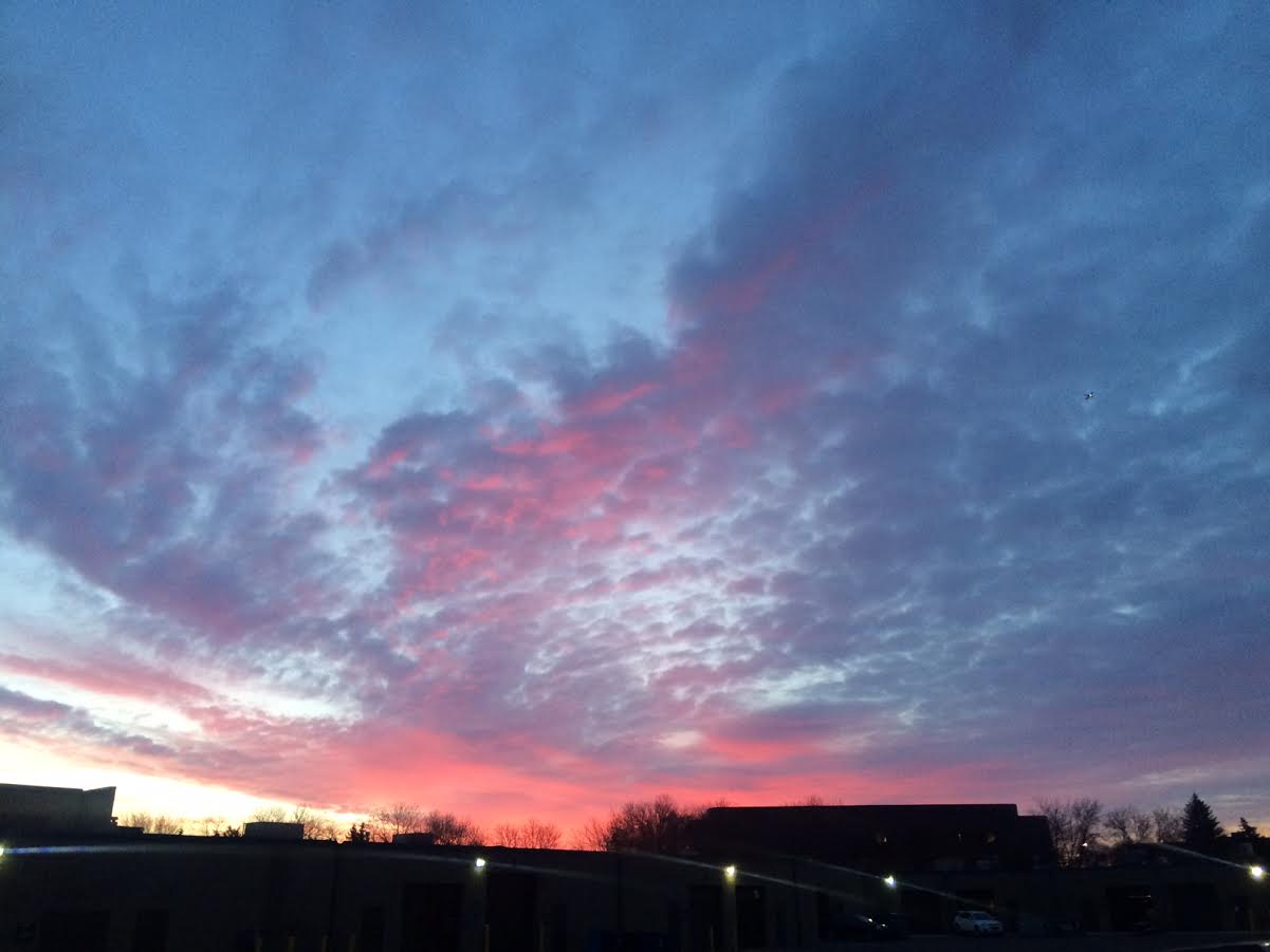
Second Sunrise of Spring 2017
Visible Satellite on Tuesday
Here's the visible satellite from Tuesday, which shows mostly sunny skies across the state as an area of high pressure settled in behind a cold front. This bubble of high pressure will keep weather conditions quiet and cool through midweek, but steady precipitation starts to move in by the end of the week. Interestingly, you can actually see the larger lakes in the northern half of Minnesota are still ice covered, but some of the lakes in the southern half of the state have already seen ice out.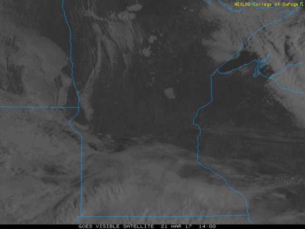
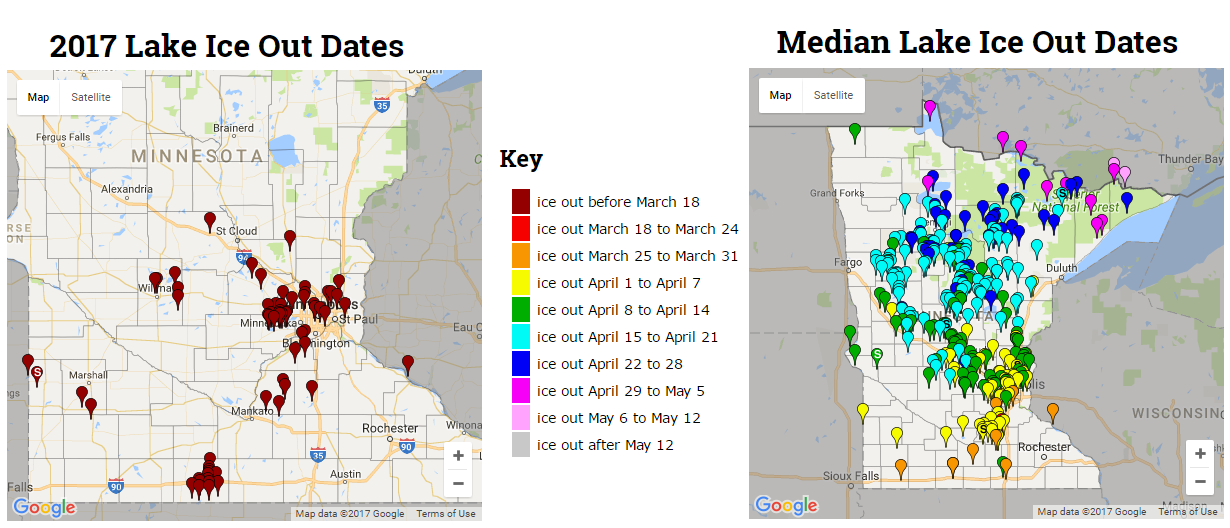
Here's a look at the lakes that have already seen ice out in 2017 vs the average ice out dates. Note that all the lakes that have already seen ice out are well head of average this year. In fact, some have actually seen a record early ice out! Note that Lake Calhoun, Harriet and Nokomis in the Twin Cities had their earliest ice out this year and was set on March 7th!
_____________________________________________________________________
UPDATE: Earliest Minnesota Tornado on Record
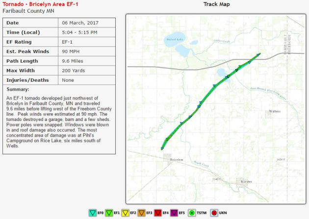
A new damage survey from the Twin Cities National Weather Service revealed another tornado touched down on March 6th, 2017 in Bricelyn, MN located in Faribault county. Interestingly, this tornado becomes the earliest Minnesota tornado on record as it touched down at 5:04PM whereas the other 2 tornadoes that day touched down a little after 5:30PM. Note that this tornado was also rated an EF-1 with winds up to 90MPH.
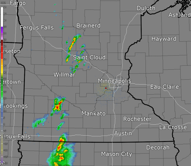
Radar Loop: March 6th, 2016
Here's a replay of the radar from March 6th, 2016 as severe thunderstorms with large hail, damaging winds and tornadoes blew through blew through the state. These thunderstorms produced 3 tornadoes that become the earliest Minnesota tornadoes on record, beating the previous earliest tornado on record set on March 18th, 1968.
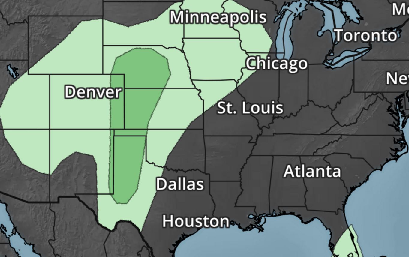
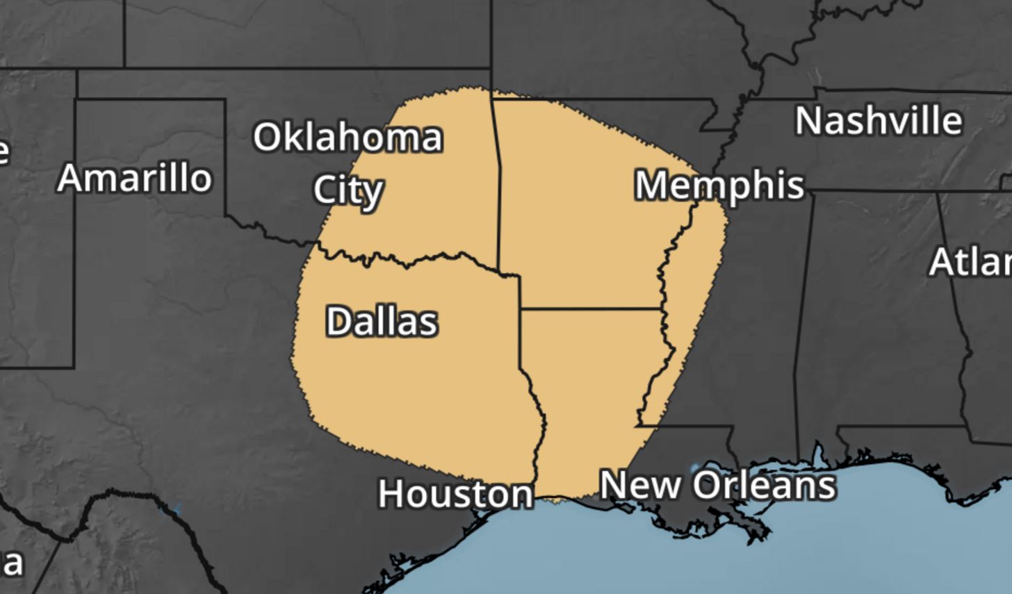
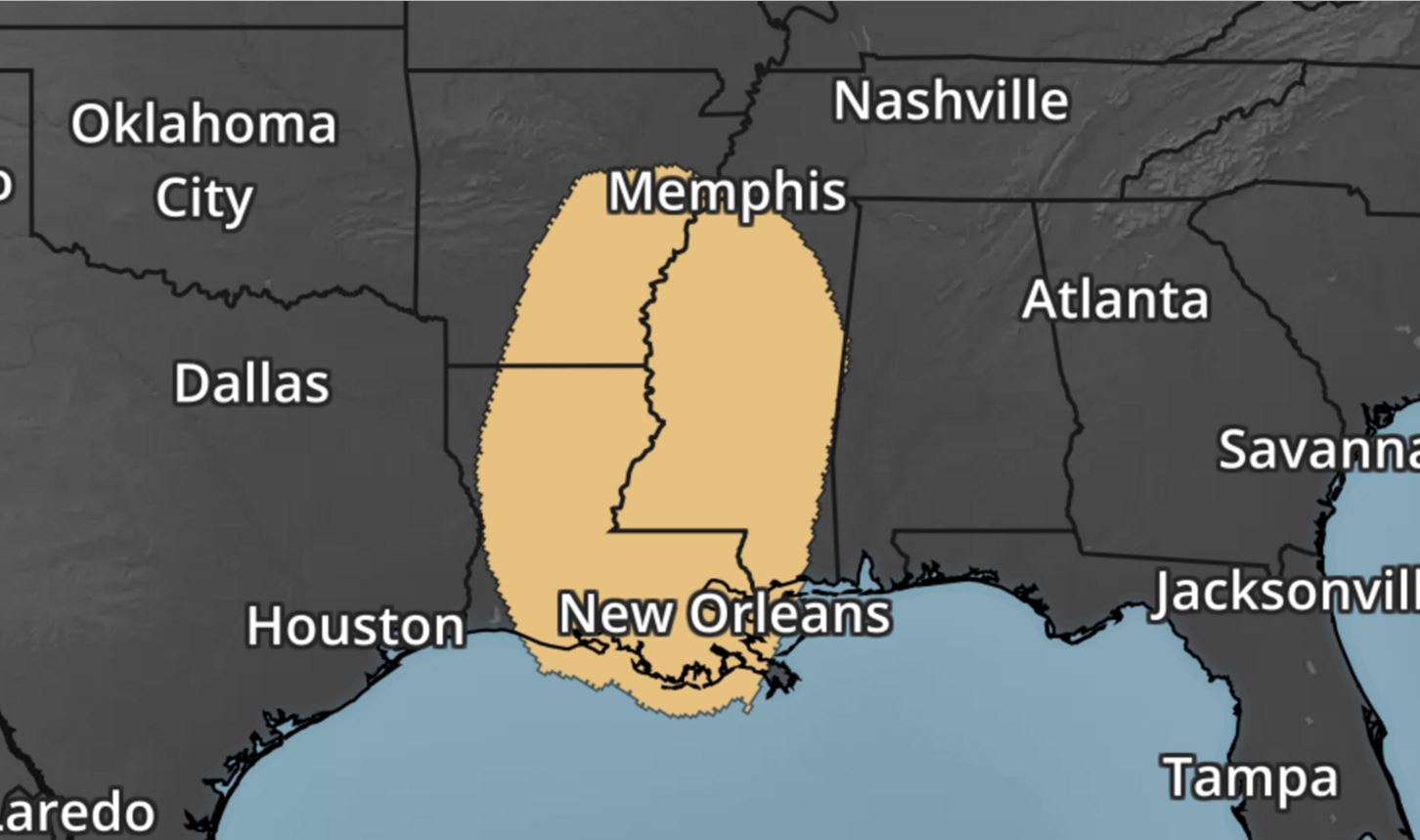
Upcoming Severe Threats
A fairly vigorous area of low pressure moving in from the Pacific will help to kick out a several day severe threat across parts of the Central and Southern US from Thursday to Saturday. Here are the severe weather outlooks from Friday, Saturday and Sunday below from NOAA's SPC.
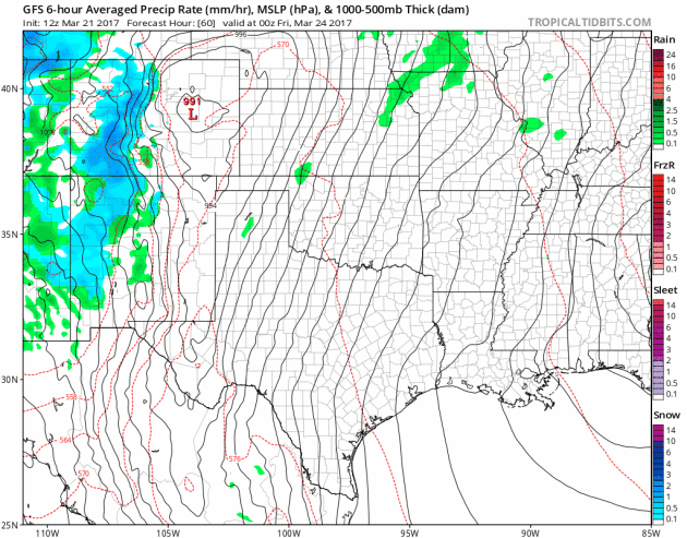
Stormy Friday in the Southern Plains
The extended forecast suggests a fairly stormy PM Thursday to PM Saturday across the Central and Southern US.
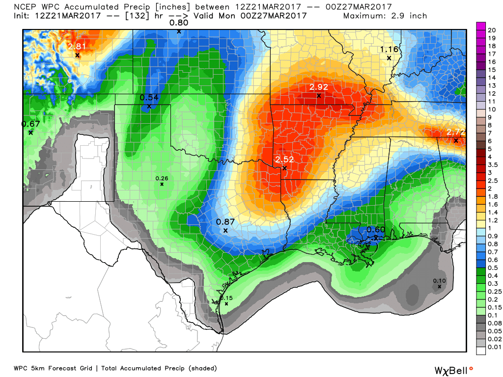
 Southern Rainfall Potential
A strong storm system will work through the central part of the country later this week and weekend ahead with severe thunderstorms and heavy rainfall potential. Note that 1" to near 3" rainfall tallies could be possible through the weekend
Southern Rainfall Potential
A strong storm system will work through the central part of the country later this week and weekend ahead with severe thunderstorms and heavy rainfall potential. Note that 1" to near 3" rainfall tallies could be possible through the weekend
_________________________________________________________________________
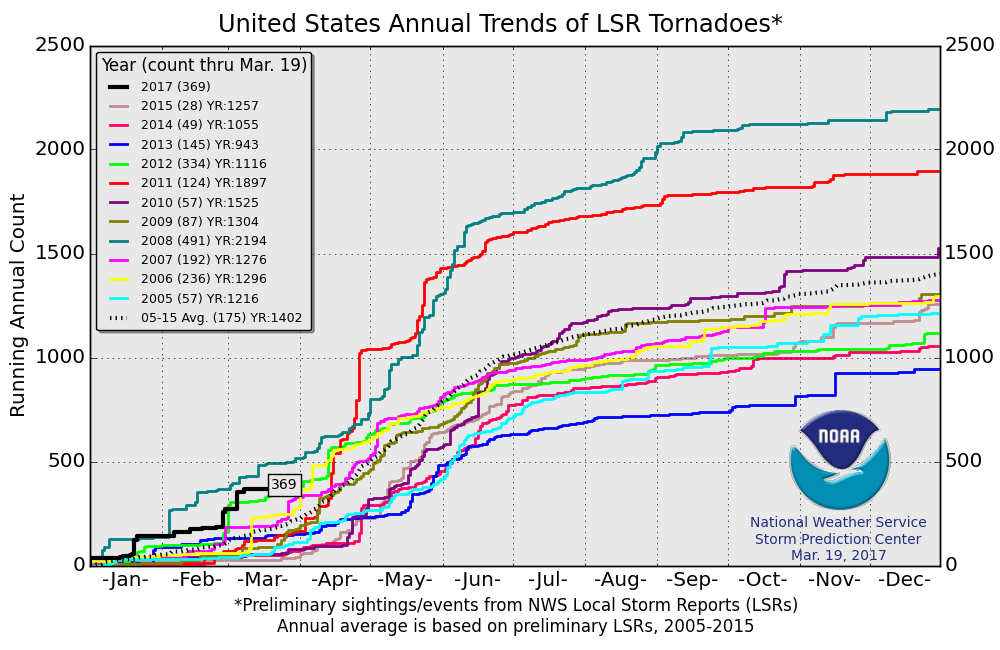
2017 PRELIMINARY Tornado Count
According to NOAA's SPC, the PRELIMINARY tornado count for 2017 is at 369 (thru March 19). Note that this is the most (thru March 19th) since 2008 when nearly 500 tornadoes reported through that time frame. The 2005-2015 average through that time period is 175.
________________________________________________________________
Stormy Friday in the Southern Plains
The extended forecast suggests a fairly stormy PM Thursday to PM Saturday across the Central and Southern US.
_________________________________________________________________________
2017 PRELIMINARY Tornado Count
According to NOAA's SPC, the PRELIMINARY tornado count for 2017 is at 369 (thru March 19). Note that this is the most (thru March 19th) since 2008 when nearly 500 tornadoes reported through that time frame. The 2005-2015 average through that time period is 175.
________________________________________________________________
World Meteorological Day - 23 March 2017
Understanding Clouds is the theme of World Meteorological Day 2017 to highlight the enormous importance of clouds for weather climate and water. Clouds are central to weather observations and forecasts. Clouds are one of the key uncertainties in the study of climate change: we need to better understand how clouds affect the climate and how a changing climate will affect clouds. Clouds play a critical role in the water cycle and shaping the global distribution of water resources.

Sunshine Fire in Boulder Colorado - 100% Contained!
Good news out of Boulder Colorado where fire crews have completely contained the Sunshine Fire! Here's a excerpt from DailyCamera.com about the fire: Residents evacuated Sunday were allowed to return home Monday as firefighters reached full containment on the Sunshine Fire west of Boulder. The fire grew to 74 acres from the 62 acres reported on Sunday, but crews were able to reach 100 percent containment on the fire after 5 p.m., according to the Boulder Office of Emergency Management. The OEM tweeted that firefighters would continue to work overnight on hot spots and flare-ups. The high winds that fire crews were fearing overnight Sunday never materialized, and as a result firefighters were "comfortable" enough with where the fire was on Monday morning that they could lift the evacuations.
(Payton Larson, 11, tries to balance her parents' wedding album as she and her mom Brooke unload the family car after returning to their Boulder home Monday morning after being evacuated due to the Sunshine Fire. Paul Aiken / Staff Photographer / March 20 2017 (Paul Aiken))

__________________________________________________________________________
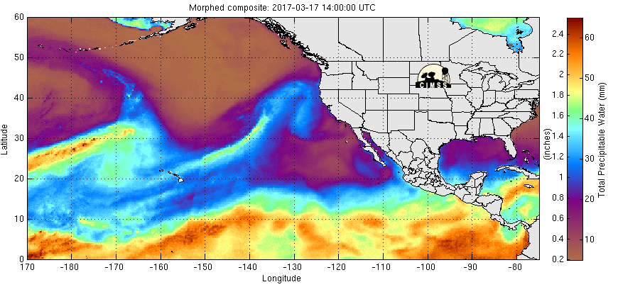
Steady Stream of Pacific Moisture
The precipitable water loop from the Eastern Pacific shows streams of moisture starting to worth their way towards the West Coast once again. This will help to bring fairly significant quantities of moisture to parts of the West Coast with heavy rain along the coast and lower elevations, while snow will be found across the high elevations and mountains.
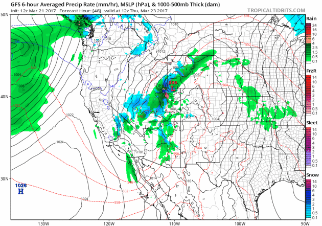
Precipitation Continues in the Western US This Week
Here's the weather outlook from through early next, which shows several round of precipitation working into the Western US. Note that the higher elevations will be dealing with snow, while heavy rainfall will be possible at the lower elevations.
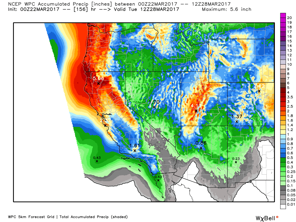
Here's a look at the precipitation potential through the early next week, which shows as much 4" to 8"+ liquid! There certainly could be areas of flooding with snow melt and as much precipitation as there is expected to be.
____________________________________________________________________________
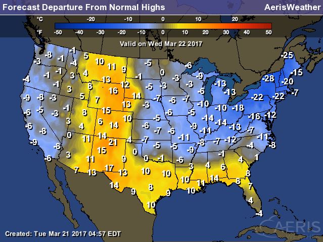
Here's a look at high temperatures from average on Wednesday. Note that temperatures in the Northeast, Midwest and across the western part of the country will be cooler than average, but folks in the Rockies and along the Gulf Coast will be nearly 10F to 15F above average.
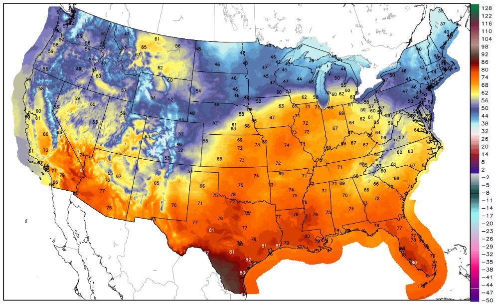
Record Warmth Continues...
With temperatures running nearly 10F to 20F+ above average across the Rockies and Gulf Coast, record high temperatures may be possible there. Take a look at the image below, which show the potential record highs (circled numbers) that could be set on Wednesday.
 ________________________________________________________________________________
Sun fades today. Last dry day for a while
By Todd Nelson, filling in for Douglas.Despite not seeing any blooming flowers or budding trees, signs of spring are starting to pop up, but you have to look close.
It's easy to see that we've gained more daylight, but did you know that we are enjoying an additional 3 hours and 30 minutes since the winter solstice (December 21st)? Additional daylight and the lack of Arctic air have coaxed a few of my favorite feathered friends out of winter hiding. Spring calls from the Northern Cardinal and American Robin are increasing, but I'm still waiting to hear the first Red-winged blackbird. Then it's spring in my book!
Enjoy the last little bit of sunshine while you can today. A water-logged storm system arrives later this week with heavy rainfall tallies up to 1 inch or more across parts of southern Minnesota. The extended forecast suggests a series of Pacific storm systems sliding across the country. Stubborn low clouds and showers look likely into the last week of March with rainfall tallies possibly topping 2 inches in spots to our south.
Keep the umbrella handy!
______________________________________________________________________________
Extended Forecast:
TUESDAY NIGHT: Mostly clear and chilly. Winds: N 5-10. Low: 18.
WEDNESDAY: Increasing clouds. Light mix late? Winds: SE 10-15. High: 40
WEDNESDAY NIGHT: Mostly cloudy. Winds: SE 10. Low: 30.
THURSDAY: Mostly cloudy. Rain showers late. Winds: SSE 5-10. High: 48.
FRIDAY: Breezy. Steady rain in southern Minnesota. Winds: NE 10-20. Wake-up: 37. High: 48.
SATURDAY: Cloudy. Lingering rain showers. Winds: NE 10-15. Wake-up: 35. High: 48.
SUNDAY: Persistent cloud. A few spits of rain. Winds: NNE 10-15. Wake-up: 32. High: 47.
MONDAY: Gray. Scattered showers redevelop. Winds: NE 5-10. Wake-up: 35. High: 52.
TUESDAY: Rain, rain, go away... Winds: NE 5-15. Wake-up: 38. High: 50
_______________________________________________________________________________
_______________________________________________________________________________
This Day in Weather History
March 22nd
March 22nd
1972: Copious amounts of rain fall in parts of Minnesota, with 10.84 inches of rainfall in 24 hours at Ft. Ripley. 14 inches of rain is measured at a farm in Morrison County.
_______________________________________________________________________________
_______________________________________________________________________________
Average High/Low for Minneapolis
March 22nd
March 22nd
Average High: 44F (Record: 71F set in 1945)
Average: Low: 27F (Record: -14F set in 1888)
Average: Low: 27F (Record: -14F set in 1888)
*Record Snowfall: 13.7" set in 1952
_______________________________________________________________________________
_______________________________________________________________________________
Sunrise Sunset Times For Minneapolis
March 22nd
March 22nd
Sunrise: 7:12am
Sunset: 7:28pm
Sunset: 7:28pm
*Daylight Gained Since Yesterday: ~3 minutes & 9 seconds
*Daylight Gained Since Winter Solstice (December 21st): ~3 hours & 30 minutes
________________________________________________________________________________
*Daylight Gained Since Winter Solstice (December 21st): ~3 hours & 30 minutes
________________________________________________________________________________
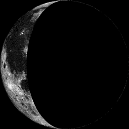
Moon Phase for March 21st at Midnight
1.6 Days After Last Quarter
1.6 Days After Last Quarter
________________________________________________________________________________
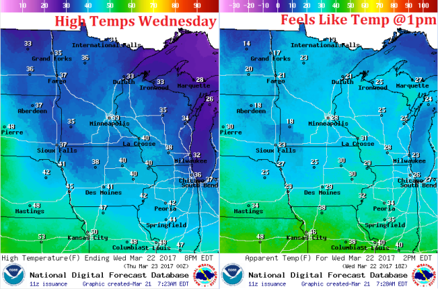
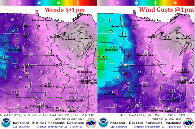
Weather Outlook For Wednesday
Wednesday will be another cool day across the region with readings in the 30s across much of the state. Note that will will once again be a little cooler than average. Winds will pick up a little out of the southeast, feels like temperatures will be in the 10s and 20s around midday.
Weather Outlook For Wednesday
Winds on Wednesday will turn to the southeast in advance of our next storm system that will move in later this week.
Weather conditions on Wednesday will start off fairly quiet, but clouds will be on the increase as moisture start to move into the region. There maybe a little light moisture later Wednesday, but the bulk of the precipitation will move in Thursday and Friday.