69 F. average high on September 18.
80 F. high temperature on September 18, 2016.
September 19, 1998: 1 to 1 3/4 inch hail falls in Meeker, Wright, Todd, and Wilkin Counties. Winds were also estimated over 50 knots / 58 miles per hour.
September 19, 1980: Golfball to baseball sized hail hits St. Paul. One company has 75 to 95 percent of the glass in their greenhouses smashed.
Slight Severe Thunderstorm Risk Western Minnesota
"The sun tires of summer and sighs itself into autumn" wrote Terri Guillemets. I'm a self-confessed September-groupie, enamored of this fleeting glimpse of atmospheric sanity wedged between heat index and first flakes.
Severe storms, floods and tornadoes are rare in September, but a few thunderstorms over far western Minnesota could mutate into severe hail-producers by evening. Tomorrow starts out wet, but skies should quickly dry out as the day goes on.
I refuse to pack away the shorts, T-shirts and flip-flops just yet, and for good reason. A surge of summer returns late in the week with sticky 80s likely on Friday and Saturday, probably the nicer day of the weekend. T-storms will troll northern, central and western counties of Minnesota Saturday, but the MSP metro area may stay on the warm, dry side of the front much of the day. Sunday looks wetter, statewide.
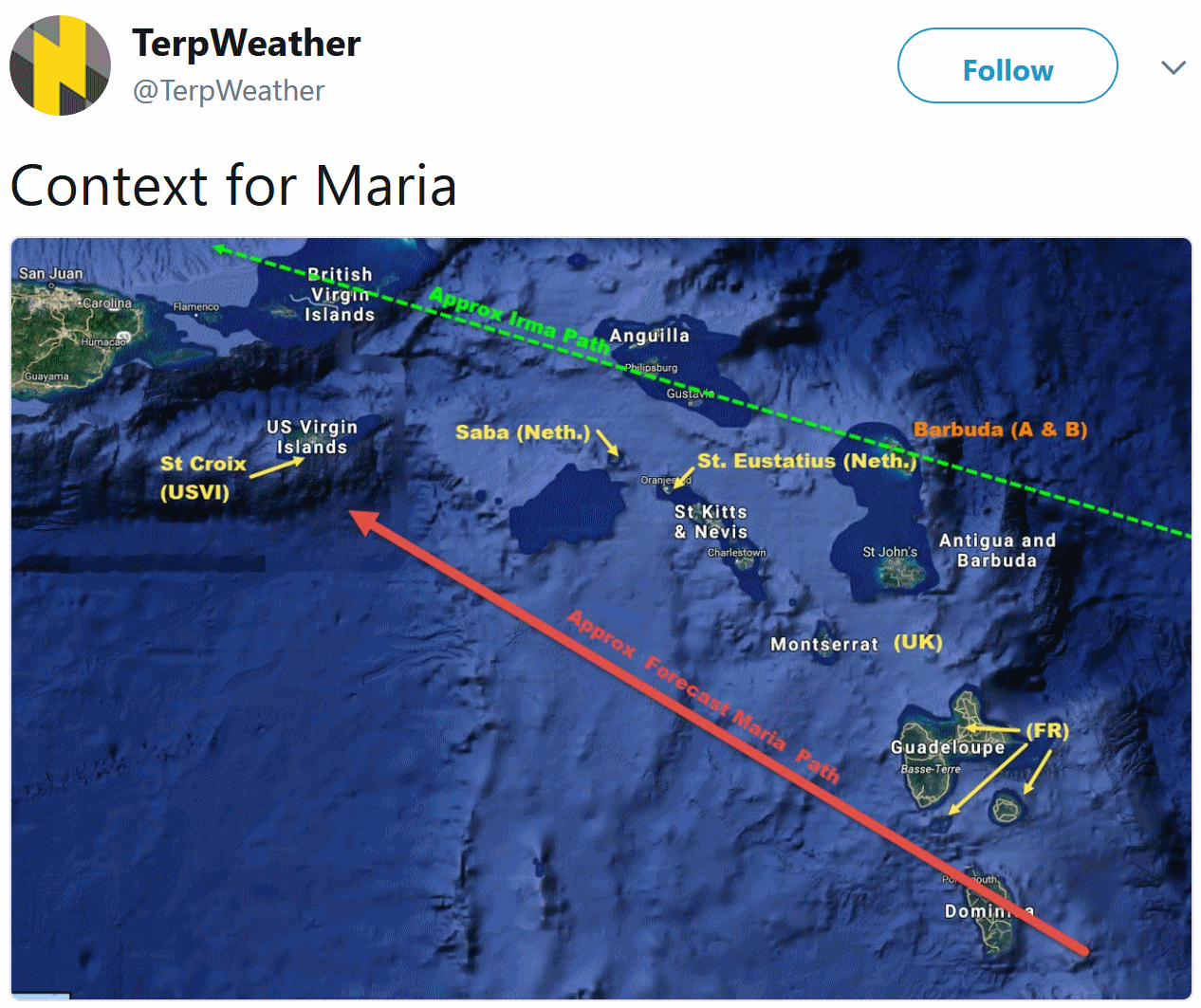
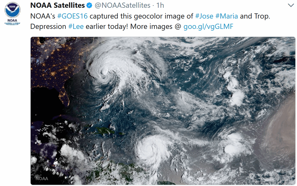
Hurricane Maria should stay out to sea, but Jose is forecast to brush coastal New England with 60 mph winds into Wednesday, then do one big loop and possibly hit New England a second time next week. Surreal.

Praedictix Briefing: Issued Monday, September 18th, 2017:
*Jose is in the slow process of weakening, with sustained winds of 85 mph as of Monday morning.
*While the center of Jose is expected to stay far offshore over the next several days, it will still bring some tropical storm impacts to parts of the eastern Mid-Atlantic and Northeast. This would include gusty winds, heavy rainfall and some minor to moderate coastal flooding.
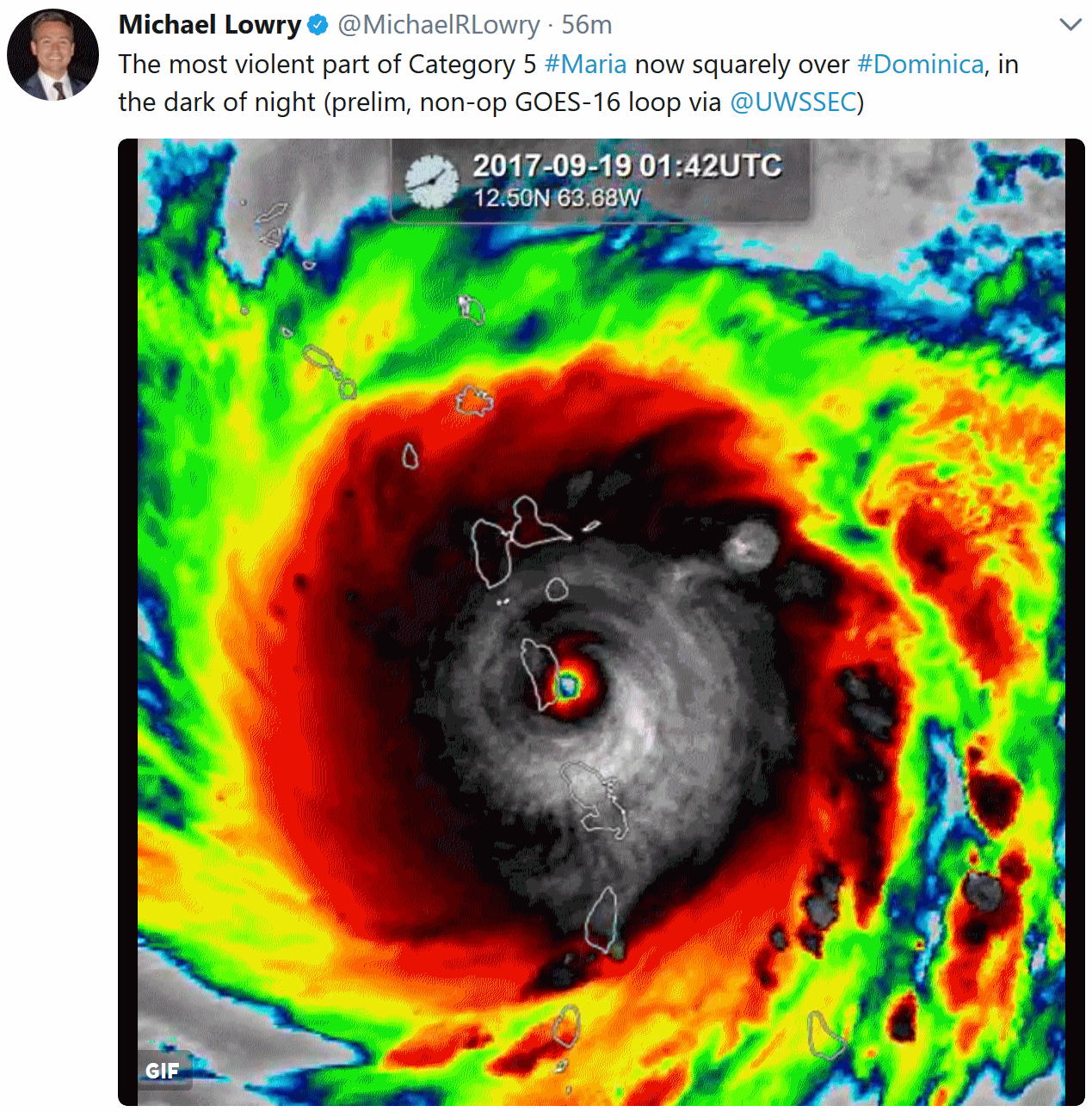
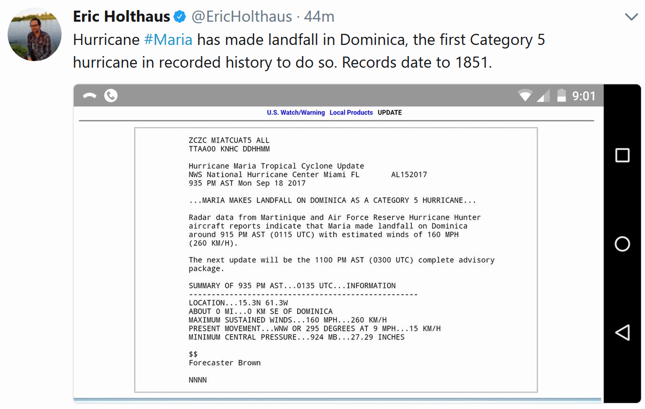
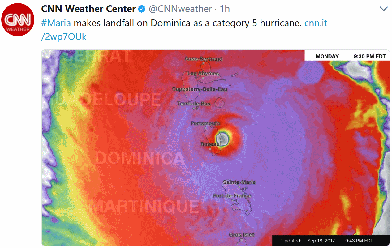
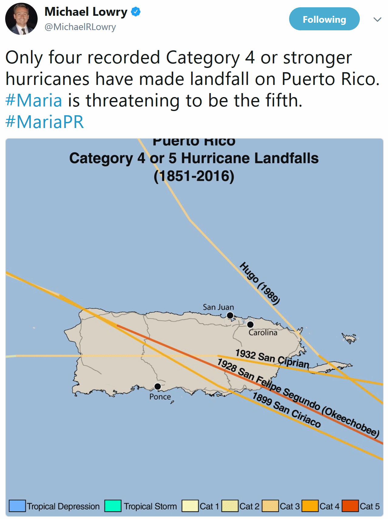
*We are also keeping an eye on Maria, which will impact the Leeward Islands and Puerto Rico through the middle of the week as a major hurricane. What impacts this system could have on the United States by early next week are still unknown.
* There is also an Enhanced Risk of severe weather across parts of the Dakotas and far western Minnesota Tuesday. Damaging winds will be the greatest threat, but hail and isolated tornadoes can’t be ruled out.


* Fenwick Island to Sandy Hook
* Delaware Bay South
* East Rockaway Inlet to Plymouth
* Block Island
* Martha's Vineyard
* Nantucket


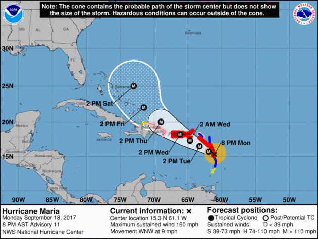

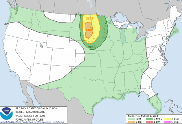
Summary: While Jose will pass far offshore over the next several days, parts of the Northeast and Mid-Atlantic coasts will see tropical storm impacts including strong winds and a 1-3 foot storm surge at high tides. Tropical storm force gusts will be possible in areas like New York City and Boston by Tuesday. Some areas of eastern Long Island to southeastern Massachusetts could receive up to 6” of rain as well, leading to localized flooding. After Jose, we are keeping an eye on Maria, which will impact the Leeward Islands and Puerto Rico through the middle of the week as a major hurricane. It is still too early to determine what impacts Maria could have on the United States into next week. There is also an Enhanced Risk of severe weather across parts of the Dakotas and Minnesota Tuesday, with damaging winds the main threat.
Meteorologist D.J. Kayser, Praedictix

What Are "Wireless Emergency Alerts"? The next time your smart phone emits a high-pitched shriek you'll know why. Here's an explainer from NOAA: "...Wireless Emergency Alerts (WEA) are emergency messages sent by authorized government alerting authorities through your mobile carrier. Government partners include local and state public safety agencies, FEMA, the FCC, the Department of Homeland Security, and the National Weather Service. No signup is required! Alerts are sent automatically to WEA-capable phones during an emergency..."
A New Study Shows that People Forget About Natural Disasters Really Quickly. Quartz explains: "Recently experiencing severe weather events such as floods, storms, and drought can make people more inclined to support policies aimed at adapting to the effects of climate change, but not by much and not for long. The relationship between exposure to extreme weather and support for climate policies is small, a new study finds. And it fades quickly; a month after an extreme weather event, there was no effect. “People respond to recent weather, whether it’s temperature spikes, severe storms, or other events,” says David Konisky, an associate professor in the School of Public and Environmental Affairs at Indiana University and an author of the study. “But the effects are small. Extreme weather is much less significant than other factors when it comes to attitudes about climate...”
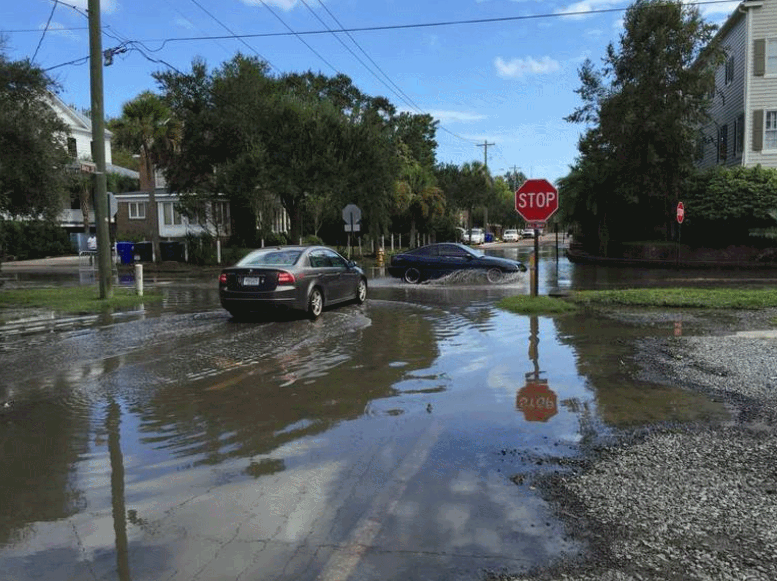
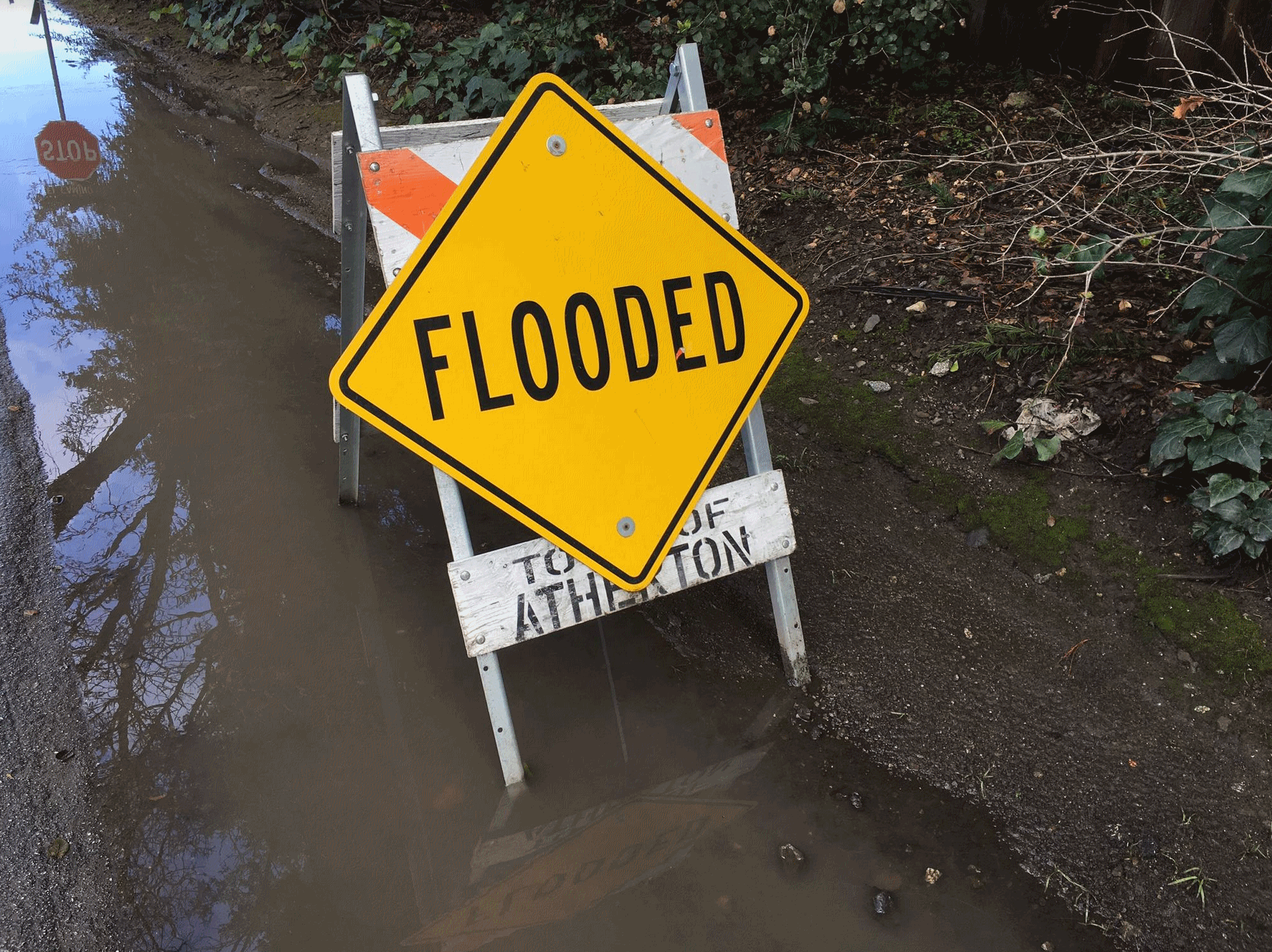
Downtown Charleston is Flooding More, With or Without Hurricanes. Here's a story excerpt from The State: "...Charleston’s flood woes are a prime example of how a coastal community is experiencing the first-hand impacts of climate change and sea level rise, say some city officials, conservationists and federal scientists. “It is certainly becoming more of a topic and more obvious to people,’’ Nature Conservancy climate specialist Liz Fly said of the increased flooding. “Things are just happening more frequently. This really should be in the conversation about how to live with the water.’’ Like other coastal cities, Charleston has flooded for hundreds of years because it lies in a marshy environment. But statistics indicate flooding is worse now than ever. From the late 1950s through 2013, Charleston experienced a 409 percent increase in flooding, much of it from water that pools up periodically during high tides, according to the S.C. Department of Health and Environmental Control and the National Oceanic and Atmospheric Administration..."
Photo credit: "The intersection of Wentworth and Barre streets in Charleston regularly floods. Rising sea levels are blamed for the flooding. Flood waters in this picture rose during high tide on a sunny day. Charleston also has suffered flooding from hurricane driven storms and historic rainfall since 2015." Sammy Fretwell/The State.
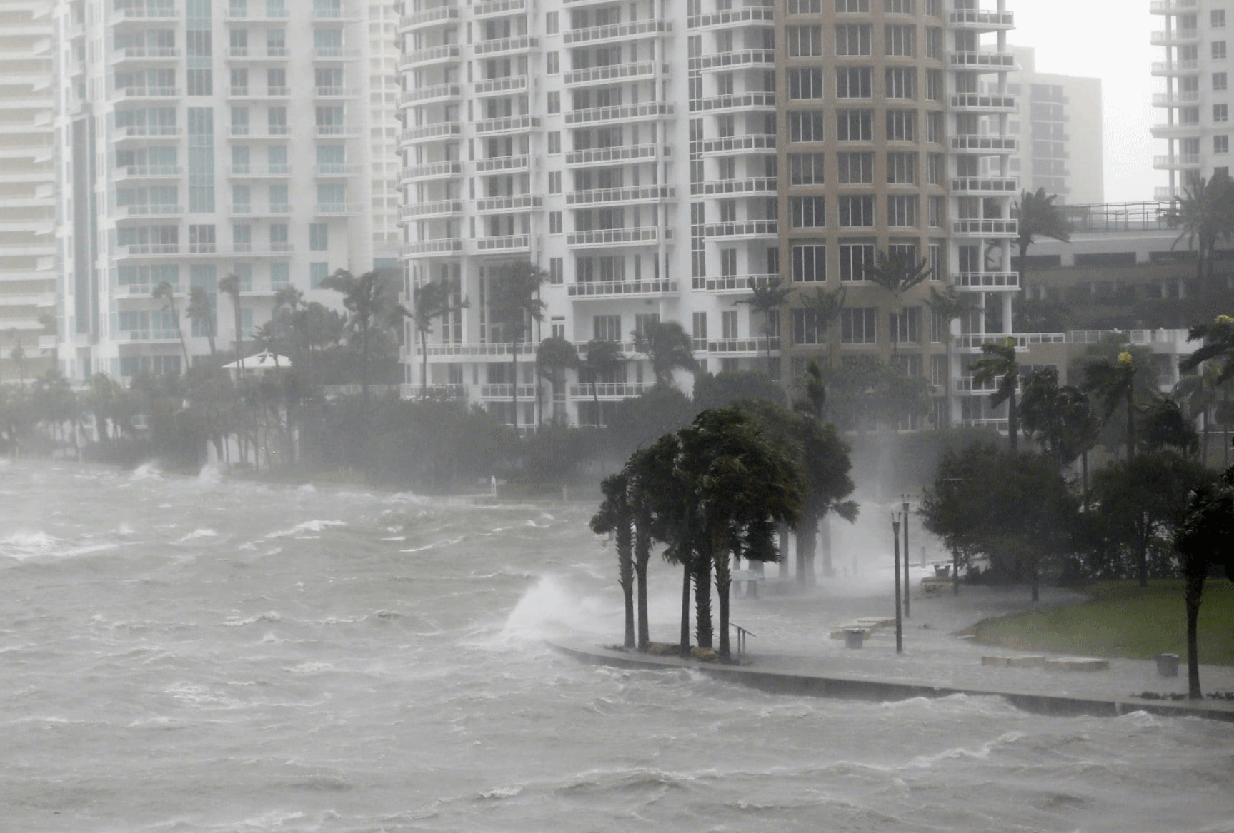
U.S. Coastal Growth Continues Despite Lessons of Past Storms. We continue to flock to the ocean, in spite of rising seas and increasingly damaging storm surges. Here's a clip from The Washington Post: "Rising sea levels and fierce storms have failed to stop relentless population growth along U.S. coasts in recent years, a new Associated Press analysis shows. The latest punishing hurricanes scored bull’s-eyes on two of the country’s fastest growing regions: coastal Texas around Houston and resort areas of southwest Florida. Nothing seems to curb America’s appetite for life near the sea, especially in the warmer climates of the South. Coastal development destroys natural barriers such as islands and wetlands, promotes erosion and flooding, and positions more buildings and people in the path of future destruction, according to researchers and policy advisers who study hurricanes. “History gives us a lesson, but we don’t always learn from it,” said Graham Tobin, a disaster researcher at the University of South Florida in Tampa..."
Photo credit: "In this Sept. 10, 2017, photo, waves crash over a seawall at the mouth of the Miami River from Biscayne Bay, Fla., as Hurricane Irma passes by in Miami. Rising sea levels and fierce storms have failed to stop relentless population growth along U.S. coasts in recent years, a new Associated Press analysis shows. The latest punishing hurricanes scored bull’s-eyes on two of the country’s fastest growing regions: coastal Texas around Houston and resort areas of southwest Florida." (Wilfredo Lee/Associated Press)

"...MIHM: Making insurance mandatory and putting real teeth in evasion of the mandatory requirement would be a great start because that would create what insurance is meant to create - a risk pool where everyone buys it.
SIMON: But let me interject. Wouldn't that make a lot of those homes unaffordable for the people who've been living there?
MIHM: Potentially. Or they would certainly - the value of the homes would be more accurately reflected in the sales price. It depends. If you believe in the wisdom of the free market and that markets should be transparent, then - as many, interestingly, Republicans do in these Gulf states - then it would make sense to have those prices be accurate reflections of the underlying risk of holding the properties..."
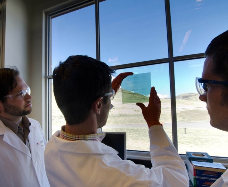
This Liquid Coating Turns Windows into Solar Panels. Seeker has news of emerging technology with great promise: "A
Maryland company has been moving slowly and steadily for 20 years
toward a very ambitious goal — turning windows into transparent solar
panels that harvest energy from the sunlight that passes through.
SolarWindow Technologies is among the many energy companies looking for
ways to harvest solar power on a large scale. But SolarWindow's
proposition is to turn windows into solar panels by way of a thin
transparent coating applied to standard glass and plastic windowpanes.
The coating might not generate much power when slapped on your living
room window, but SolarWindow is aiming higher — quite literally. The
company hopes to eventually deploy the technology onto office buildings
and skyscrapers, generating energy from the acres of glass soaking up
the sun..."
Photo credit: SolarWindows Technologies.

File photo credit: Wikipedia.

TODAY: Mild with some sun. Strong to severe T-storms possible late. Winds: SE 10-15. High: 77
TUESDAY NIGHT: Strong T-storms, locally heavy rain. Low: 60
WEDNESDAY: Wet start, then partly sunny skies. Winds: W 7-12. High: 76
THURSDAY: Some sun, isolated T-shower risk. Winds: SE 10-15. Wake-up: 59. High: 79
FRIDAY: Sticky sunshine, plenty warm. Winds: S 10-15. Wake-up: 70. High: 86
SATURDAY: More clouds, few T-storms around. Winds: S 10-15. Wake-up: 71. High: 83
SUNDAY: Front stalls, more showers and T-storms. Winds: SW 8-13. Wake-up: 68. High: 78
MONDAY: Showers linger, turning cooler. Winds: N 7-12. Wake-up: 63. High: 72
Climate Stories...
Yes, Climate Change Made Harvey and Irma Worse. A consistenly warmer ocean didn't trigger the storms, but there's a high probability it amped them up, juiced them into stronger hurricanes. That, and higher sea levels magnified the storm surge associated with each storm. CNN reports: "The right time to talk climate change is now.It might seem premature when people in the Caribbean, Florida and Texas are still mucking out their flooded homes. And no, changes in our planet's atmosphere did not cause Hurricanes Harvey or Irma. But the consensus among scientists is that the effects of climate change, such as rising sea levels and warmer oceans, made those storms far more destructive than they would have been in previous decades. "The short version is, climate change makes these very bad storms worse," said Sean Sublette, a meteorologist with Climate Central, a nonprofit group that studies climate change. "It's not the approximate cause of the storm, but it makes these bad storms worse. And in the case of a really bad storm, climate change can make it totally disastrous or catastrophic..."
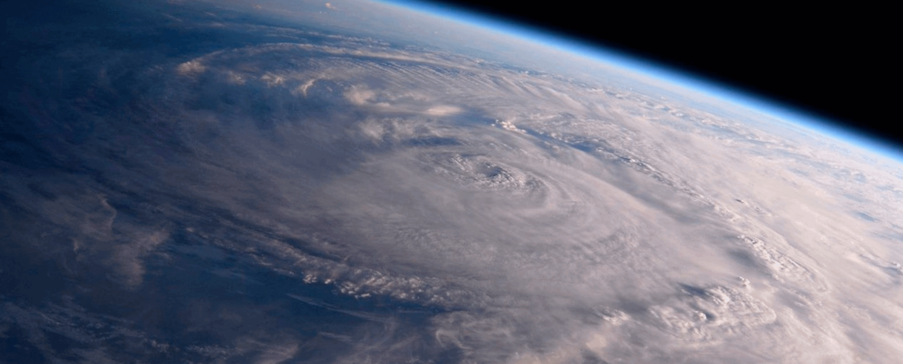
Image credit: "This photo made available by NASA shows Hurricane Harvey over Texas on Saturday, Aug. 26, 2017, seen from the International Space Station. Experts say a combination of unusual factors turned Harvey into a deadly monster. The storm intensified just before it hit land, parked itself over one unfortunate area and dumped a record amount of rain." (Randy Bresnik/NASA via AP)


No comments:
Post a Comment