
Record Heat. 101 F. in the shade Tuesday afternoon in St. Cloud. Yesterday was the hottest day since July 31, 2006, when the mercury soared to 101 F. On average the St. Cloud metro experiences about one 100-degree day every decade. No more sizzling heat in sight, after cooling into the 60s by Thursday we recover into the low 80s early next week.
* Based on a database from the NWS and the MN State Climate Office there have been only 5 days hotter than yesterday since 1871 in the Twin Cities. Really.
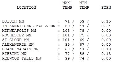
Scottsdale Arizona (with lakes!) Look at the incredible range in temperature: from 68 at Grand Marais (grilling weather up there) to 77 at Hibbing, 101 at St. Cloud and Rochester and a sizzling 103 in the Twin Cities. By the way, the average high for June 7 at MSP is 77.
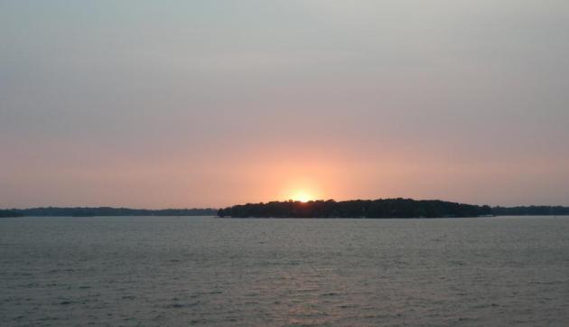
Smoke On The Water. Did you notice how odd the sky looked yesterday evening? Not the (amazing) blue sky we're all accustomed to. The sky had a milky, murky, hazy color with a blood-red sun slipping below the northwestern horizon. It was SMOKE, from wildfires burning out of control about 1200 miles away in Arizona - jet stream winds sweeping this thin canopy of smoke over Minnesota. It was a strange sight. More on the fires (and smoke) below.
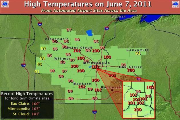
Desert Heat. Low 100s were common from Mankato and Owatonna into the Twin Cities to St. Cloud, as far east as Eau Claire, Wisconsin. Click here to see a full-resolution map from the Chanhassen office of the National Weather Service.


Hot Factoids. Data courtesy of the local NWS office - more more details here.
The high of 101° observed at 4:12 pm on Tuesday at the St. Cloud Airport:
- Breaks the previous June 7th record of 96° in 2004.
- Was the first 100°+ reading and warmest temperature since July 31, 2006 (101°).
- Was the second earliest on record that 101° had occurred, only behind May 31, 1934.
- Fell 1° short of the all-time June record of 102° on June 28th, 1931 and June 24th, 1988.
* The last 100 degree day in STC was also July 31, 2006 -- the high was 101 reached at the 5 PM reading.
* There have been a total of 58 days at/above 100 in STC since records have been kept. The earliest 100 degree day was during the month of May, 1934, when it was reached twice. (via Professor Bob Weisman at http://web.stcloudstate.edu/raweisman/extremes/highsge100.html)
* There have been a total of 58 days at/above 100 in STC since records have been kept. The earliest 100 degree day was during the month of May, 1934, when it was reached twice. (via Professor Bob Weisman at http://web.stcloudstate.edu/raweisman/extremes/highsge100.html)
Hottest June 7 On Record Statewide? Professor Mark Seeley has an early edition of his weekly Friday WeatherTalk blog, where he takes a look at yesterday's historic levels of heat: "On Tuesday, June 7, more new record high temperature values were reported. It was arguably the hottest June 7th in state history, as many locations broke the statewide record high temperature of 100 degrees F (at Lamberton and Madison in 1987). Among those breaking the century mark were Red Wind, MSP, South St Paul, Rochester, Mankato, Owatonna, Blue Earth, Faribault, Mankato, St Peter, St Cloud, Collegeville, Gaylord, and New Prague. The 103 degrees F recorded at MSP will probably stand as the new state record for June 7th. It was the first time the Twin Cities has reached 103 degrees F in the month of June since 1934."

Highest Temperatures Recorded In The Twin Cities Since 1871. Let me put it this way: based on data from the National Weather Service and the MN State Climatology Office there have been only 5 days hotter than yesterday since 1871.
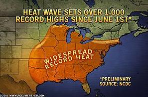
Persistent Heat Wave. AccuWeather reports more than 1,000 record highs since June 1 from the Plains east to the Atlantic.
As of June 6:
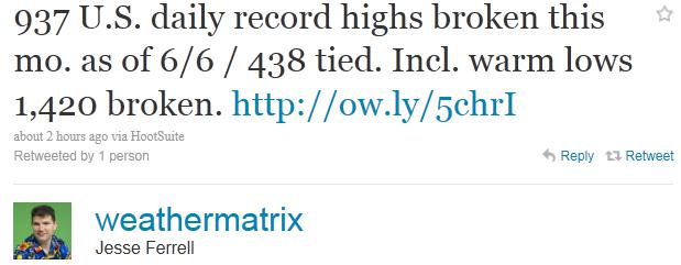
937 U.S. daily record highs broken since June 1
438 record high temperatures tied since June 1
1,420 record lows since June 1 (record warm low temperatures).
* numbers courtesy of Jesse Farrell at WeatherMatrix.
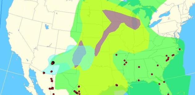
Forecast: Smoke. NOAA's SSD Fire Detection Product showed a plume of smoke (from Arizona wildfires) sweeping across the Plains into Minnesota Tuesday. A cool frontal passage should push most of the smoke and haze to our east later today - but don't be surprised to see unusually red (potentially spectacular) sunsets in the days and weeks ahead. More from Chanhassen National Weather Service: "Fires across eastern Arizona, the southern Plains, and Mexico have created smoke which has been dragged northward since Sunday in southerly flow. This was prevalent in satellite (see below) and even in haze observations across the central and western Plains on Monday. This smoke is likely going to get ushered over Minnesota and parts of Wisconsin into Tuesday, based on increasing southerly winds. With deep atmospheric mixing from extreme heating expected on Tuesday, some of this smoke may very well make it to near the surface. At the very least, a milky white sky is likely on Tuesday afternoon."
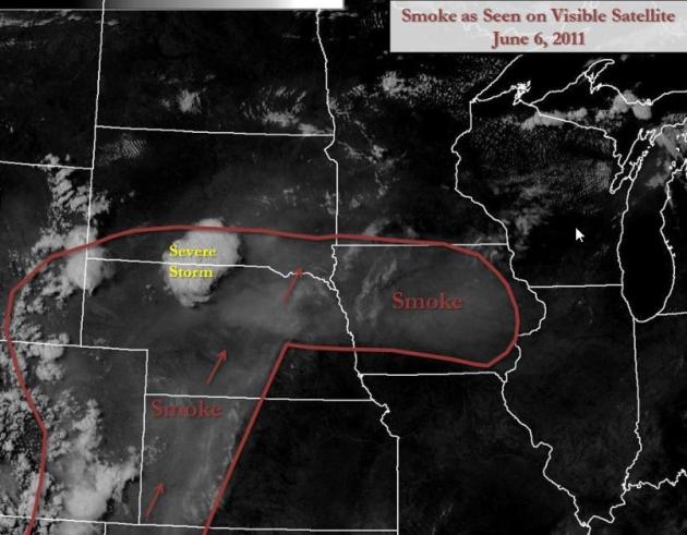
Image Courtesy of NOAA. This visible satellite photo was taken on Monday, June 6, showing a "smoke front" surging north. 350 square miles on the Arizona-New Mexico border has gone up in smoke; jet stream winds sweeping that pall of smoke downwind over much of the USA.

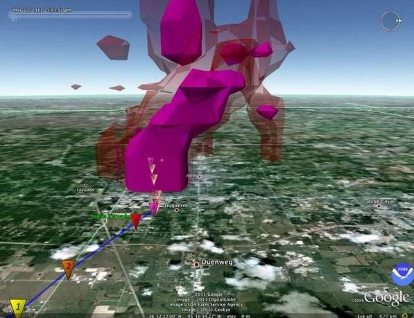
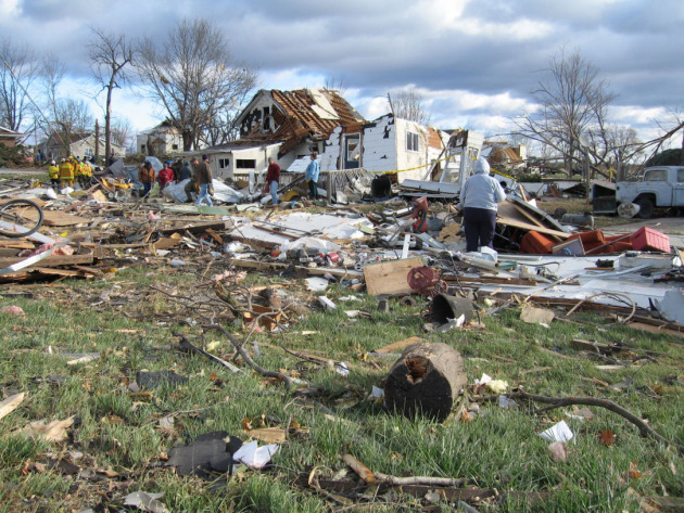
Photo credit: "A vertical composite of radar sweeps created the first 3-D rendering of a tornado laid over a Google Map. The perspective shows the Joplin tornado, looking west along I-44. It can be used to study the composition of the tornado (NOAA)."
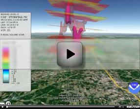
Joplin Tornado. NOAA has a remarkable 3-D movie of the EF-5 tornado that hit Joplin: "The movie shows the vertical composite of radar sweeps from the Springfield, Missouri NEXRAD radar site of the Joplin, Missouri tornado Sunday May 22, 2011, giving a 3-dimensional image of the tornado structure. The Google Earth KMZ file used to create this video can be downloaded here."
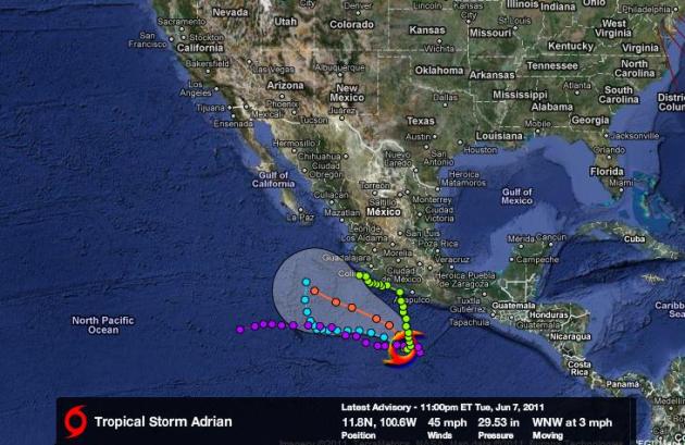
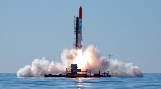
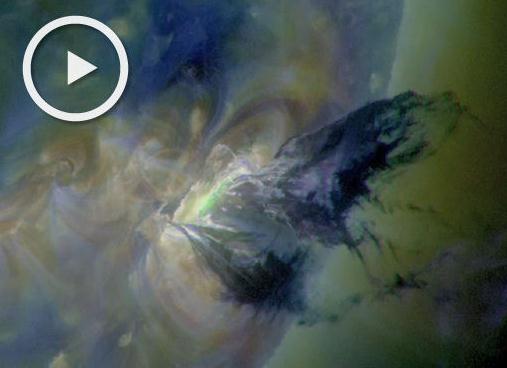
"M-Flare" And Radiation Storm. Spaceweather.com has the story of a massive eruption on the sun early Tuesday - keep an eye out for the Northern Lights the next couple of days: "(Tuesday) morning around 0641 UT, magnetic fields above sunspot complex 1226-1227 became unstable and erupted. The blast produced an M2-class solar flare, an S1-class radiation storm, and a massive CME. A recording of the blast from NASA's Solar Dynamics Observatory ranks as one of the most beautiful and dramatic movies of the SDO era. A video with commentary from solar physicist C. Alex Young of NASA's Goddard Space Flight Center shows material splashing back to the stellar surface. "I've never seen material released this way before," he says in the video. "It looks like someone kicked a clod of dirt in the air--an amazing, amazing event."

Most Taxed States In The USA. Mainstreet.com has the eye-opening story. Where does Minnesota rank? 5th overall: "We’ve crunched the numbers, divided each state’s population by the corresponding state taxes collected in 2009, and come up with a ranking of the most taxed states. This is a per capita calculation of the total tax burden for each state — and isn’t actually what every individual is paying, but what each individual would pay if the taxes were divided equally among everyone, except big corporate interests."
5. Minnesota
$3,038 per capitaState sales taxes of 6.875% are compounded in some cities by another sales tax, making it as high as 9.53%. And, Minnesotans making more than $74,650 must pay 7.85% of their earning to the state. The low tax bracket might account for the substantial state take.

What "Weiner-Gate" Says About Us. More importantly, isn't that Randi Kaye on CNN? Yep, we're very proud of Randi making it to the Big Leagues. Media Bistro has a story about the media's handling of "Weiner-Gate", what it says about us (same reason many of us slow down at the scene of an accident?) A mix of shadenfreude and morbid curiosity. We just can't look away. I'm afraid to see what's going to pop-up next. Story is rated PG: "Only in America would an elected official call a press conference to confirm the identity of his (private parts). And then have that (private part) knock Katie Couric off the news cycle. After 10 consecutive days of ‘Weinergate’ coverage, I am convinced that its importance lies not with what it says about Rep. Anthony Weiner’s genitals but with what is says about us. When the Democrat from New York yesterday manned up and admitted it was his underwear-encased, tumescent penis pictured in the notorious tweet, it gave new meaning to the phrase “member of Congress.” As he walks softly through those corridors of power, he carries a big stick. Shooting fish in a barrel, I admit. But has there ever been such an unfortunate pairing of surname and scandal? How could anyone not gorge on double-entendres when the perp’s name is a euphemism for the very source of the imbroglio? Simple answer: You can’t. Weiner’s fall from grace, while titillating, reeks of pathos. Was anything noble rescued from the rubble? Truth, for one thing, in a surreal mea culpa that was carried live on the cable news networks. Having been lied to for 10 days, the media was after blood."

Paul's SC Times Outlook for St. Cloud and all of central Minnesota:
TODAY: Relief! Partly sunny, breezy and less humid. Winds: W/NW 10-20. High: 77
WEDNESDAY NIGHT: Mostly clear, noticeably cooler. Low: 47
THURSDAY: Mostly cloudy & cool. Light jacket weather up north. High: 65
FRIDAY: Periods of rain likely. Low: 49. High: 64
SATURDAY: Showers taper, slow PM clearing. Getting better as the day goes on. Low: 54. High: 72
SUNDAY: Intervals of sun, feels like summer - probably the better day of the weekend. Low: 58. High: 78
MONDAY: Humid, few showers & T-storms. Low: 62. High: 80
TUESDAY: Partly sunny, seasonably warm. Low: 63. High: 83
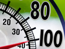
Hot and Bothered
Yesterday was even better than a 1-way ticket to Venus. Record-smashing 101-degree heat sizzled the St. Cloud. Much of southern Minnesota baked above 100 degrees, for the first time since July, 2006. BTW, On average the St. Cloud hits 100 about once a decade.
Positive proof of global warming? Nope - no more so than an unusually cold day in January. No single weather event, storm, front (or even year) can be attributed to long-term climate change. But if the 97% of peer-reviewed climate scientists who believe a 40% spike in greenhouse gas is creating a warmer, wetter, stormier atmosphere are right - future summers may feature more days like yesterday.
Stanford researchers interviewed for MSNBC are predicting a long-term warming trend. "According to our projections, large areas of the globe are likely to warm up so quickly that, by the middle of this century, even the coolest summers will be hotter than the hottest summers of the past 50 years."
Relief arrives today as Canadian air trickles south - expect 60s by tomorrow with light jacket weather up north. A warm frontal passage sparks rain Friday; some sun may peek out from Saturday PM into much of Sunday as the mercury returns to 80. Good news: no more blast-furnace heat is in sight.

Hotter Summers In A Few Decades, Study Warns. Was the record heat the past couple of days a fluke, or a sign of summers to come? MSNBC.com has the story: "Expect extra-toasty summers to be a mainstay if greenhouse gas levels continue to rise, according to a new report suggesting the tropics and the Northern Hemisphere may see an irreversible bump in summer temperatures within the next 20 to 60 years. In the study to be published later this month in the journal Climate Change, Stanford University researchers conclude that many tropical regions in Africa, Asia and South America could see "the permanent emergence of unprecedented summer heat " in the next two decades. The middle latitudes of Europe, China and North America, including the United States, are likely to undergo extreme summer temperature shifts within 60 years, the researchers found. "According to our projections, large areas of the globe are likely to warm up so quickly that, by the middle of this century, even the coolest summers will be hotter than the hottest summers of the past 50 years," said lead study researcher Noah Diffenbaugh, an assistant professor of environmental Earth system science and fellow at the Woods Institute for the Environment at Stanford University. Though no single extreme weather event can be linked to global warming, scientists say that as the planet warms, we should expect more extremes, such as heat waves. Diffenbaugh and Stanford research assistant Martin Scherer wondered whether one extreme pattern — heat waves — would become more normal. "At what point can we expect the coolest seasonal temperatures to always be hotter than the historically highest temperatures for that season?" Diffenbaugh said in a statement."
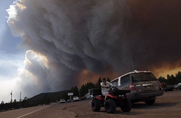
Massive Wallow Blaze Incinerates Arizona Forests, But Climate Change Link Remains Unknown. Record floods, record tornadoes, record snowpack out west, now much of Arizona is on fire. The New York Times has the story. "Arizona's third-largest forest fire in history was fostered by drought conditions tied to La Niña, strong winds and parched soils and vegetation. But experts say its role as an example of the consequences of climate change is tenuous. The Wallow fire in Arizona's Apache-Sitgreaves National Forest has spread throughout the south and west of Alpine, Ariz., incinerating close to 250,000 acres. It began on May 29, and authorities believe it was ignited by human activity. The cost of the damage to date is $7.7 million, with the number expected to rise. The nearby Horseshoe 2 fire in southeastern Arizona, which began on May 3, has caused an estimated $28 million in damages, despite being half the size of Wallow. A strong La Niña pattern -- when cooler Pacific Ocean temperatures cause dry spells in the Southwest and South and heavy rains in the northwestern United States -- set the environment for violent wildfire activity, said Robyn Heffernan, a fire meteorologist with the National Weather Service. Strong winds also contributed to the rapid sweep of the Wallow fire, at one point engulfing almost 50,000 acres in 24 hours."
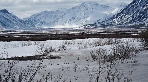
The Dangers Of An Early Spring. The impact of consistently early springs in the Arctic on songbirds is explored in this article in the New York Times: "For these and other reasons, we hypothesize that as Arctic warming continues, consistently early starts to spring are likely to affect migratory songbird communities, because the birds always arrive on the tundra at the same time every year, ready to breed and needing to eat, regardless of snowcover conditions. For example, at the Toolik Field Station where we’re conducting our fieldwork, the main influx of songbirds consistently occurs between May 17 and 30. The reason for such punctuality in tundra arrival time is that these birds are cued to leave our backyards every spring by changes in day length. Because the timing of this “light cue” is not changing in relation to recent climate warming, the birds are very likely to continue to arrive at Toolik at the same time, despite an earlier onset spring in the Arctic. If spring snowmelt begins earlier as the climate continues to warm, will arriving songbirds miss an important pulse of early-season plant and insect food resources? Will earlier onset of plant growth and insect emergence alter the timing of various food resources throughout the songbird breeding season? Here’s an everyday analogy that I heard a colleague of mine, Eric Post, use in an NPR radio interview last year, in which he was talking about the effects of early snowmelt on Arctic caribou. Imagine that you go to the cafeteria for lunch every day from noon to 1 p.m. One day the cafeteria decides to start opening at 11 a.m. and closing at noon, without letting you know. When you show up at noon, you might be lucky enough to score some leftovers, but it’s also possible that you’ll completely miss out on lunch. Will the songbirds be able to adapt to these changes in the timing of food resources? Or will so-called trophic mismatches develop that alter their reproductive success?"
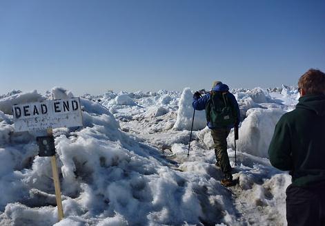
Leaving A Warming Arctic. The New York Times science blog takes a look at changes in whale populations and migrations in the Arctic region: "Things are coming to a slow close on the whale census. The unseasonably warm weather has melted much of the snow, resulting in a sloppy, lake-strewn trail. The sea ice beneath the trail is still thick and strong, but the snow that cemented and smoothed the trail is gone, leaving behind a rutted, bumpy ride and occasional deep puddle that risks swamping the snow machine. Traveling to and from the perch requires considerably more attention than it did earlier in the season, which can be challenging after being out on the ice for 12 hours. Fewer bowheads have been migrating by, perhaps because the lead is tens of kilometers wide, giving the whales plenty of berth in which to migrate, and because the bulk of the population has already passed. After three springs of trying, it looks like this year will result in a population estimate for the Bering-Chukchi-Beaufort population of bowhead whales. This is owed in part to “cooperative” ice conditions, which is to say the lead never closed for more than a few days — it closed for weeks the last two years — but also to the dedication of the visual survey team led by Craig George and Jason Herreman. We had a very successful and safe field season out on the ice. By this time next year, there should be an updated estimate of abundance for the Bering-Chukchi-Beaufort Sea population of bowhead whales."
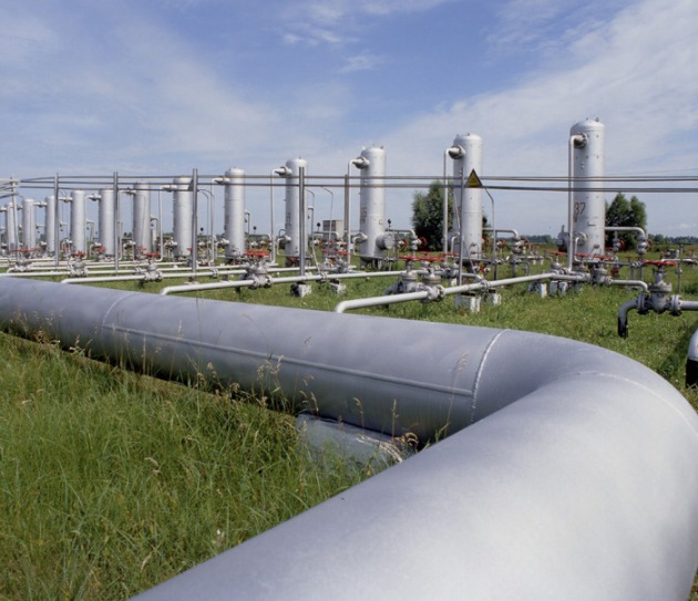
Natural Gas Is No Climate Change Panacea, IEA Warns. The story from The Guardian and eco-business.com: "Natural gas is not the “panacea” to solve climate change that fossil fuel industry lobbyists have been claiming, according to new research from the International Energy Agency (IEA). Gas is likely to make up about one-quarter of the world’s energy supply by 2035, according to the study, but that would lead the world to a 3.5C temperature rise. At such a level, global warming could run out of control, deserts would take over in southern Africa, Australia and the western US, and sea level rises could engulf small island states. Nobuo Tanaka, executive director of the IEA, told a press conference in London: “While natural gas is the cleanest fossil fuel, it is still a fossil fuel. Its increased use could muscle out low-carbon fuels such as renewables and nuclear, particularly in the wake of Fukushima. An expansion of gas use alone is no panacea for climate change.” Governments are likely to come under pressure to reduce support for low-carbon energy and opt for gas instead, as oil and gas companies have been urging, in a move that could imperil the fight against climate change, the IEA warned. Fatih Birol, chief economist of the IEA and one of the world’s foremost authorities on energy and climate, said: “If gas prices come down, that would put a lot of pressure on governments to review their existing renewable energy support policies … We may see many renewable energy projects put on the shelf.” He said some renewable technologies, such as onshore wind, would continue to prosper but the worst affected projects were likely to be offshore wind and solar energy."

Explaining Romney's Climate Sanity. The Atlantic has more on Mitt Romney's (brave) stance on climate change: he's actually accepting the critical mass of climate science suggesting that man does (in fact) have a role in the warming we're seeing all around us: "David Frum is right. Mitt Romney should be getting more credit for stating bluntly that global warming is real and that humans play at least some role in causing it. Here's how Romney responded to a questioner at a townhall meeting in New Hampshire last week when asked about the subject:
"I don't speak for the scientific community, of course, but I believe the world's getting warmer. I can't prove that, but I believe based on what I read that the world is getting warmer. And number two, I believe that humans contribute to that. I don't know how much our contribution is to that, because I know that there have been periods of greater heat and warmth in the past but I believe we contribute to that. And so I think it's important for us to reduce our emissions of pollutants and greenhouse gases that may well be significant contributors to the climate change and the global warming that you're seeing."
Now, on the one hand, Romney is merely repeating the received wisdom of the reality-based community. But on the other hand, that's not nothing! It is commendable both because a large segment of the conservative base angrily disagrees with this wisdom, and therefore stating otherwise carries some political risk; and it is also commendable because one can easily imagine how the circa-2007 full-pander Romney might have responded to the same question had climate-denial been an issue back then (it wasn't).
Frum goes on to suggest that Romney is quietly being rather brave, both for acknowledging global warming and for defending the need to extend health coverage to more Americans."

Romney's batting for the wrong team: "Remind me again: Why is this guy considered the frontrunner for the Republican nomination?" asks Doug Brady at Conservatives4Palin. Romney was already treading on thin ice with conservatives, even before he totally bought into the manmade global warming hoax." If GOP voters pick someone so "simpatico with the Obama administration" now, we might as well "adopt a one-party system such as that in China.
"Romney adopts Obama's position on global warming
Actually, the GOP should applaud Romney: Romney should ignore the "See! He's a RINO" (Republican in Name Only) spitball shooters, says Hugh Hewitt at his blog. The former Massachusetts governor is "just saying what every serious GOP contender will have to say," and should say, to win over a broader general election audience. The "responsible, conservative" line is that global warming is real, we don't know all the answers, but the solution isn't job-killing cap-and-trade laws, or screaming that the world is "headed toward catastrophe.
"The GOP and global warming"
No comments:
Post a Comment