5.09" rain so far in June in the Twin Cities (nearly 2" wetter than normal, to date).
70 F. high in the Twin Cities yesterday.
Normal high is 81. June 22, 2010:
91 at MSP.
June 7:
last time it was hotter than 90 in the Twin Cities (103 F).
Saturday appears to be the sunnier, drier (nicer) day of the weekend. An isolated PM T-shower can't be ruled out, especially south/west of MSP. T-storms may be more widespread Sunday, especially PM hours.
80s return next week, long-range models hinting at highs near 90 from late June into the first week of July.
6 Tornadoes so far in the 7-county metro area in 2011 (source: local NWS).
Metro Area Tornadoes of 2011: "
Within the 7-County Twin Cities Metro and including eastern Wright County....there have already been 6 tornadoes thus far in 2011. The remainder of the 52 counties in the NWS Twin Cities/Chanhassen County Warning Area have seen 5 thus far."
- NWS statement, details below.
"...
the immense flooding set to unfold will become seared into the memories of residents in this area for decades to come." - from an article about historic flooding underway in Minot, North Dakota. Details below.
"....
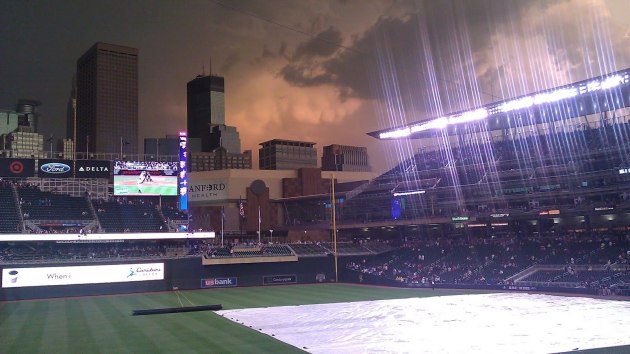
statistically it's only a matter of time before a sports stadium full of people, or a large concert or outdoor venue with thousands of people attending, will be hit by a tornado or violent straight-line winds. Are we prepared for a worst-case scenario?" - More on a close call in Chicago, and what the Twins have put into place to keep you safe at Target Field.
"...
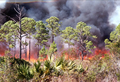
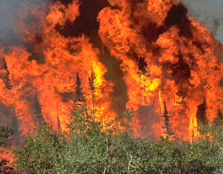
for the first time since 2000, two forest rangers were killed battling brushfires in Florida. Already, this is Florida's 11th worst fire year on record; an average of 31 new fires start up every day." - More on the Florida brushfires below.
"...That is pretty much the role now being played by most of the news media in refereeing the current wrestling match over whether global warming is “real,” and whether it has any connection to the constant dumping of 90 million tons of heat-trapping emissions into the Earth’s thin shell of atmosphere every 24 hours." - Al Gore recently compared the media to Professional Wrestling referees in their attempts to continue controversy over climate change. Details below.
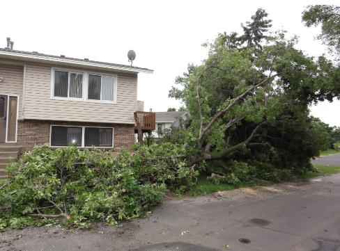
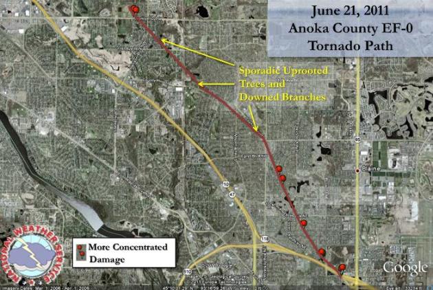
Coon Rapids Tornado On Tuesday Was An EF-0. According to the enhanced Fujita rating scale (which rates tornadoes based on the damage they produce), Tuesday evening's brief tornado probably produced winds of 70-85 mph. What was odd about this funnel: there was no lightning, no hail, none of the usual precursors of a tornado. More
details from the local NWS office in Chanhassen:
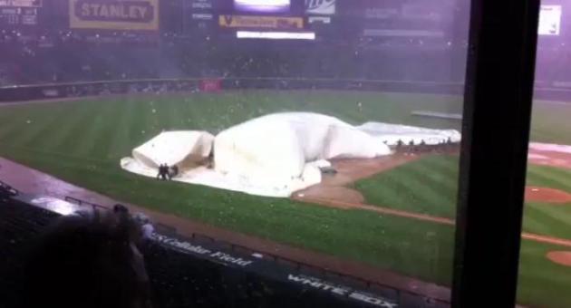
Brush With Disaster. Tuesday night a squall line was approaching Chicago with 80 mph straight-line winds. The local NWS office issued warnings, but baseball continued at U.S. Cellular Field as the White Sox took on the Cubs. Players kept playing, fans remained in their seats, in spite of the fact that severe storms were imminent. It's every meteorologist's worst nightmare: what do you do if a severe storm or tornado is approaching a stadium full of 30,000 to 40,000 people? How can you safely and effectively move people to shelter? Click
here to see YouTube footage of the storm hitting the ballfield and a (last-minute) mad-scramble to safety.
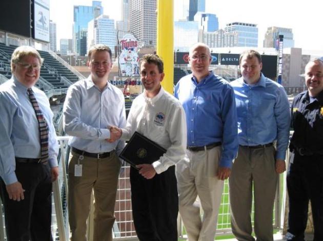
In stark contrast, the Twins have thought this through - they have completed a "StormReady" audit with the local National Weather Service, they've hired a full-time meteorologist (Craig Edwards, former chief of the local NWS office). He's on-site, checking Doppler and other data sources, ready to jump in and provide the time-critical information necessary for the umpire crew to delay or cancel a game, if severe weather is threatening. I give the Twins a lot of credit for thinking this through and coming up with a viable action plan for fans, players and employees. I hate to say it, but one of these days a large, violent tornado is going to hit a stadium or concert event - hundreds, even thousands could perish in a worst-case scenario. Statistically, it's only a matter of time.
What's critical here is situational awareness. Target Field has a good action plan, but personal responsibiility is critical as well.
A few things you can do to lower the potential for disaster:
1).
Situational Awareness. Before heading to a game (or any outdoor event) check the weather. Is there a watch in effect? If so, you'll want to monitor weather from the stands, just to make sure nothing threatening is moving in.
2).
Smartphone apps: one good option for Target Field (or anywhere, for that matter) is to download a couple of weather alerting apps to your Android phone or iPhone. Several allow you to input a "favorite location" and get push alerts if a warning is issued for that location. A few will even use your current GPS location. This is the future of weather warning - getting granular, and pushing personalized warnings via smart phones.
*
personal favorites:
My-Cast (previous company, and no, I don't get a spiff or commission), also
WeatherRadio. Both of these apps allow you to receive customized warnings for any location. WeatherRadio gives you a real-time stream of NOAA Weather Radio when warnings are issued - pretty powerful. Both of these apps have saved my butt on more than one occasion.
3).
Always have a Plan B. Whenever you're outside you should scope out a safe shelter nearby, preferably something concrete and steel-reinforced, where you could ride out any severe storm. At Target Field it might be the interior (concrete-reinforced) rest rooms. It's tougher up at the lake or on a camping trip. Is there a building nearby, any building will offer more protection than a tent.
I don't rely on anyone else for my safety, or the safety of my family. You should feel the same way. The local NWS does an amazing job - when weather is severe local media will be on the air. But they can't catch every storm -
at some point this comes down to personal responsibility - keeping an eye on the elements and making your own decisions. That could mean heading for the basement, even if the sirens aren't sounding. Maybe it's just the Eagle Scout in me. That old adage to "be prepared" is spot-on.
"Storm-Ready." Meteorologist Craig Edwards was in charge of the local Chanhassen office of the National Weather Service for many years. Now he's consulting, and he may just have the best weather-gig in the USA. For every game he is at Target Field, watching Doppler radar, advising the umpires (who make the final decision on whether to suspend or call a game) and grounds-crews. Yesterday he sent me an e-mail highlighting his responsibilities for fan/player safety at Target Field:
Paul,
"
My position with the Minnesota Twins is considered the "Game Day Meteorologist." I provide a short-term forecast to the VP of Operations and the head groundskeeper. This information is then passed along to the Managers of both teams, as well as the umpire crew chief. Once the game begins the decision to suspend play is in the hands of the umpire crew chief. MLB policy states the umpire crew chief will determine when conditions are unsuitable for play.
I am positioned in the Target Field weather facility, under the third base stands. Close proximity to radar and weather data allows me to relay updates promptly to the groundskeeper, and he can focus on supervising his crew as weather begins to move in.
The Twins worked with Todd Krause at Chanhassen to become certified as a StormReady supporter. That information is posted on the MPX website. Here's the release to that press release from the NWS."
Craig Edwards
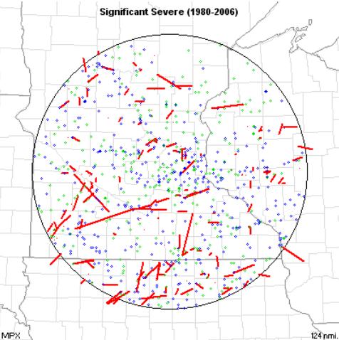 Significant Severe Weather
.
SPC has an overview of extreme weather in Minnesota from 1980 - 2006. The long red lines are (major) tornado tracks. the blue dots are straight line winds, the green dots are large hail reports. More details: "
Significant severe weather reports during the period are plotted. Only tornadoes F2 or stronger, wind gusts of 65 knots or stronger, and hail of 2" diameter or larger
are plotted."
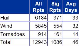 Severe Stats
. Yes, you can prove anything with statistics. But during an "average year" (whatever that is), the MPX warning area (most of central and southern Minnesota) can expect to see 33 days with large (severe) hail of 1" diameter or greater, 32 days with straight-line winds, and 14 days with tornadoes. Somehow I think those numbers will be considerably higher this year.
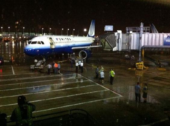
A Very Bad Day At O'Hare. Tuesday evening's 80 mph straight-line winds were strong enough to push a United plane 40 feet away from the jetway. Photo courtesy of
yfrog.com: "
Parked A320 jet dragged 40 feet by storm at H' Hare. I think we're going to be here a while..."
12,000 Ordered To Flee Flooding In Minot, North Dakota. An update from
USA Today: "
North Dakota authorities have ordered the evacuation of about 12,000 people from Minot because of expected record flooding of the Souris River, CNN is reporting. Mayor Curt Zimbelman said all affected residents and businesses must vacate those areas no later than 10 p.m. Wednesday, the Minot Daily News writes. The flooding is on track to swamp the historic 1969 flood."
Thousands Evacuated As Record Flooding Looms.
AccuWeather has more details on the epic flooding underway in Minot: "
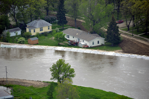
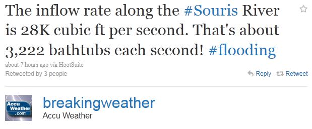
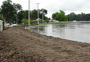
About 12,000 people have been ordered to evacuate their homes by this evening in Minot, N.D., as the Souris River continues to rise. Flood levels are expected to reach record proportions across the area in the next few days. The Souris flows right through Minot, the fourth largest city in the Peace Garden State. Mayor Curt Zimbelman stated on Tuesday that crews are working to secure the town's critical infrastructure, and once those have been secured, they will "start on these other areas trying to protect as many homes and businesses as possible." Massive snowmelt from this past winter already threatened to create significant flooding woes across the northern Plains. Compounded by an unusual streak of wet weather in the same areas this spring, the immense flooding set to unfold will become seared into the memories of residents in this area for decades to come. A whopping 6.22 inches of rain, nearly 4 inches more than normal, doused Minot in May. Another 2.49 inches has already inundated the storm-sogged town so far this month as well."
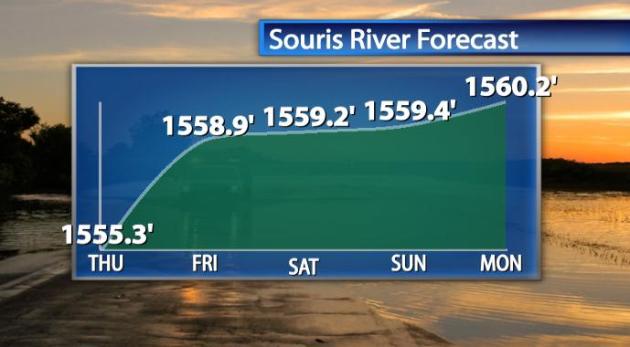
Projected Crest. Right now the Souris River at Minot is expected to crest by Monday of next week, as much as 4-8 feet above the previous high-water mark set in 1969, 10 feet higher than the previous crest on June 1.
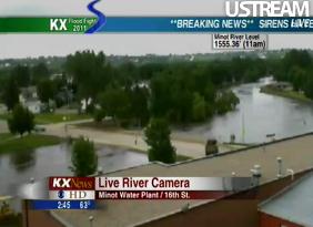
Live Stream Of Minot Flooding. Click
here to see a live stream of continuous coverage from KXMC-TV.
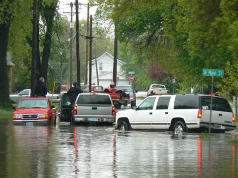
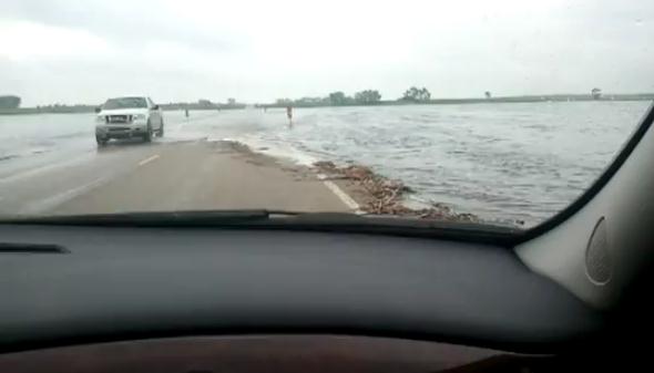
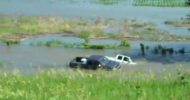
Bad Idea. I'm sharing this clip as a cautionary tale. This is precisely what you DON'T want to do during a flood - attempt to cross a flooded-out road. This
YouTube clip was taken outside of Minot, North Dakota, during Wednesday's evacuation (of 12,000 local residents). The problem: it's impossible to estimate water depth, especially at night. A majority of flood victims meet their Maker doing just this - driving through flooded roads, only to discover that the water is deeper than they thought. Don't try this at home...
River Flooding In Iowa & Nebraska. The Missouri River is forecast to stay above flood stage through SEPTEMBER! Here is another
video clip showing the flooding on either side of the river, flowing between Nebraska and Iowa: "
I took a field trip to the Bob Kerrey pedestrian bridge in Omaha, Nebraska / Iowa on the afternoon of June 12 2011 to see how high the Missouri river had risen. The river had engulfed a lot of the farmlands and forests near by. Also we went to the Missouri river in Blair Nebraska. This is where we saw most of the flooding of the farmlands and forests but the Elkhorn river didn't seem to be to high as seen in the video."
100 Degree Club. Days so far in 2011 above 100 degrees:
Austin, Texas: 13 days
Amarillo, Texas: 11 days
San Antonio, Texas: 9 days
Dallas, Texas: 8 days
Oklahoma City, Oklahoma: 4 days
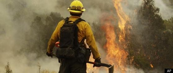
First Forest Ranger Fatalities Since 2000. Information from USA Today:
- Two Florida forest rangers were killed when a small, smoldering wildfire flared up and trapped them, state officials said Tuesday. Two comrades trying to rescue them also were injured.
- It's the first time since 2000 that a forestry division employee has died fighting a wildfire.
- The rangers were plowing with bulldozers Monday to contain a 12-acre blaze on the Georgia line that's among 400 wildfires currently burning. The Blue Ribbon Fire about 85 miles northeast of Tallahassee had previously been declared contained, but it flared back up. He said Florida is running a rainfall deficit this year, and temperatures of up to 104 degrees have made some areas very dry.
- Already, 2011 is the state's 11th-worst year on record for wildfires — with more than 3,600 blazes burning over 190,000 acres. Florida firefighters have been facing an average of more than 31 new wildfires every day.
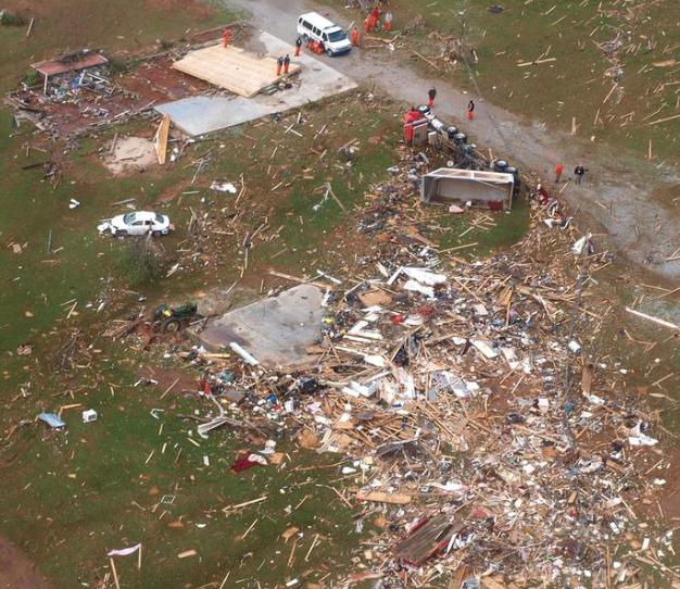
Most Deadly Tornadoes This Year? Alabama. There are a number of factors involved: tornadoes are harder to spot (and track) east of the Mississippi, population density is higher, fewer people have basements or secure shelters, siren coverage is spotty, more mobile homes - a convergence of factors that has resulted in an especially deadly year in "Dixie Alley". Alabama's
News Courier has the details: "
The upgrade of one of the April 27 tornadoes to an EF5 ranking puts Alabama at No. 1 in the nation for the most severe tornadoes. The tornado that hit Fyffe, Rainsville and Sylvania in DeKalb County at about 6 p.m. that fateful day had previously been ranked an EF4, but a new ground survey conducted last week caused meteorologists to increase the ranking to EF5, said Chris Darden, chief meteorologist with the National Weather Service in Huntsville. (See sidebar to learn about the F and EF tornado ranking scales). According to the Storm Prediction Center in Norman, Okla., this upgrade brings Alabama’s total of F5 and EF5 tornadoes to seven. Before the ranking change for the Rainsville tornado, Alabama was tied with six EF5s with Texas, Oklahoma, Iowa and Kansas, said Greg Carbin with the Storm Prediction Center. The official listing — which includes all tornadoes surveyed by NWS since 1950 — can be found at http://www.spc.noaa.gov/faq/tornado/f5torns.html."
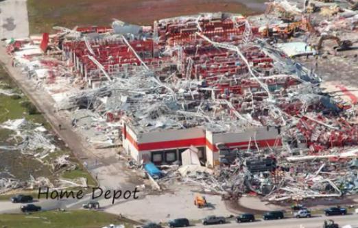
Perspective On The Joplin, Missouri Tornado. Here is a recap of the May 22 EF-5 tornado that swept through Joplin, a remarkable
YouTube slide show. A few comments from the photographer/author: "
This is what happened when an F-5 tornado tore through a town of 50,000 people. Most pictures I took myself, some taken from internet. The music belongs to the artist. I give the photographer and the musicians credit for these. I grew up around this town pretty much my whole life. I went to elementary, middle school & Jr. High here. So many memories and that is exactly what they are now...just memories. My heart goes out to all of you that suffered through this. May God Bless you all."
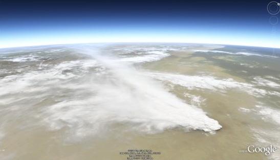
Imagery From The Nabro Volcanic Eruption In Africa. More details:
"10 days ago, the Nabro volcano in the northeast African nation of Eritrea erupted for the first time in recorded history following a series of earthquakes. The ash has since spread more than 60km over the Ethiopian border and the volcano has emitted the highest levels for sulfer dioxide gas ever detected from space. You can view that image on NASA's site, or in Google Earth using this KML file. The volcano has caused some minor disruption to air travel, but nothing on the scale of Eyjafjallajokull eruption in Iceland last year. Even better, the level of ash coming out of the volcano has begun to diminish, as has the level of seismic activity in the region. Be sure to check out the full gallery of images on the NASA Earth Observatory site to see all of the amazing imagery that they've captured so far."

Twitter: The Best (And Worst) Of New Media. Like Twitter? So do I, with a few caveats. I think it's an important information tool (a great way to cover breaking news), but like any tool it can be abused. Twitter is a microcosm of the larger Internet - which shows off the best (and the worst) of what people are capable of. Here's an opinion piece from The Drum, courtesy of the
ABC Network in Australia:
"
When I was doing interviews to promote my new book, Human Headlines - My 50 Years in the Media, I was asked many times about changes to journalism and the whole world of communications. I recalled when we tipped over into this millennium. The question then: What is the greatest advance in the world in the past 1,000 years. To a journo it was easy, and maybe seemed self-centred. The Gutenberg Press. Moving type. Suddenly the world had books. Written information was no longer the domain of monks with quill pens and hand-written books were no longer confined to zealots in churches. Gutenberg didn't only open the world for scholars and fledgling reporters. Without books and manuals and shared knowledge we would never have had the advances in medicine, education, music, the arts, philosophy, politics, you name it. Men would not have had the information or wherewithal to build computers, to fly to the moon, or write and despatch editorials like this one. But if Gutenberg was the greatest advancement of the Millennium, what has been the greatest development in media in my 50 years in it? Twitter. Twitter and other social media like emails and Facebook and YouTube have fomented revolutions throughout the Middle East and put the fear of Confucius up China. We get our news instantly. From the death of bin Laden to Bert Newton in hospital. You still have to be careful because Twitter is mischievous and often poisonous and certainly defamatory."
Saturday: Probably The Better Day. I'm nervous, wary and weary. Weekends (by definition) attract thunderstorms and nasty stares. Yes, when it rains on a Saturday I tend to wear a baseball cap and lay low - Minnesotans aren't amused when it rains on these 12 precious weekends of summer. The 00z NAM model keeps the heaviest T-storms just south to our south, over Iowa, on Saturday. Expect a southeast breeze at 10-15, highs in the upper 70s to near 80 - odds favor dry weather most of the day.
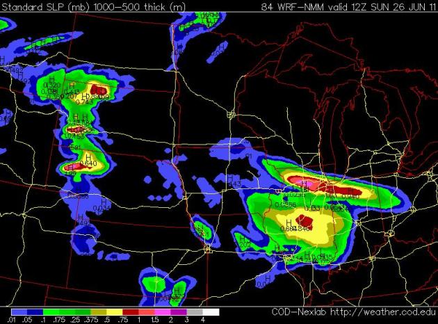 Sunday: Not Bad
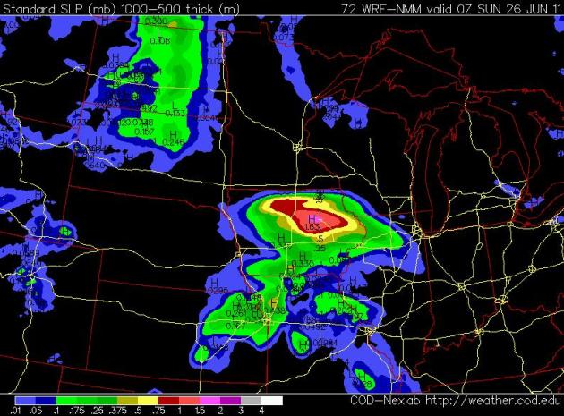
. The NAM
model is predicting severe storms from the Black Hills of South Dakota to Chicago Saturday night and early Sunday. The 12z Sunday prediction shows a few scattered T-storms over the Red River Valley - a growing chance of PM storms Sunday, but much of the day should be dry, with fading sun, a southeast wind at 10-20, a falling barometer, and highs in the upper 70s to low 80s.
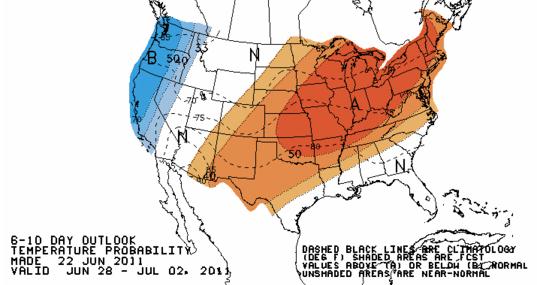
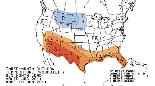
Warming Trend. Yes, we're due for some hot, sweaty weather. CPC, the Climate Prediction Center, is predicting a (big) warming trend from the Upper Midwest and Great Lakes into New England from late June into the first week of July: 80s, even a few 90s. We're due.
Summer Outlook. This is actually good news (if you have an urge to wiggle into shorts and enjoy some true summer weather). There may be a slight cool bias from Montana into the Dakotas, but the area of cooler weather predicted for July, August and September is considerably smaller than predicted last month. Although I'm sticking with my forecast for a "slightly cooler, stormier-than-average summer", we will see some real warm fronts in the weeks to come. Don't despair (yet). Map above courtesy of the Climate Prediction Center.
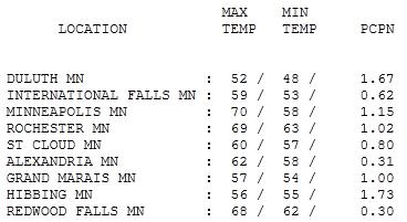
Dreary Wednesday. An unusually intense area of low pressure tracked across Minnesota yesterday, spiral bands of moisture wrapping into the storm center, producing showery rains, even a few T-showers over southern Minnesota (but nothing severe - the atmosphere was too cool & stable for hail or violent winds). Highs ranged from a surreal 52 at Duluth to
60 in St. Cloud, 70 in the Twin Cities, 11 degrees cooler than average. Additional 24-hour rainfall ranged from .30" at Redwood Falls to .8" at St. Cloud, 1.15" in the Twin Cities and 1.73" up at Hibbing.
Paul's SC Times Outlook for St. Cloud and all of central Minnesota:
THURSDAY: Unseasonably cool and windy. Light showers. Winds: NW 10-20+ High: 62
THURSDAY NIGHT: Clouds giving way to partial clearing late - still chilly for late June. Low: 51
FRIDAY: Getting better - partly sunny skies. Light winds. High: 73
SATURDAY: Partly sunny and pleasant - probably the nicer day of the weekend. Winds: SE 10-15.Low: 55. High: 77
SUNDAY: Some morning and midday sun, PM T-storm possible. Winds: SE 10-20. Low: 60. High: near 80
MONDAY: T-storms, some strong/severe? Low: 64. High: 82
TUESDAY: Some sun, feels like summer again. Low: 66. High: 85
WEDNESDAY: High pressure, plenty of warm sun. Low: 67. High: 86
Lessons Learned
We've had a few close calls in recent days: a small Tuesday tornado at Coon Rapids (approaching from the southeast), 2" rain in 45 minutes in St. Cloud with serious flash flooding swamping vehicles in the streets - and a big scare in Chicago Tuesday night. With 80 mph. straight-line winds approaching the Sox-Cubs game... continued. Warnings issued, but no effort to evacuate fans or players. The result: a last-minute frantic scramble to move people to safety.
The Twins have a solid plan in place to protect fans at Target Field. Ex-local NWS chief Craig Edwards is on-site for every game. He writes, "I'm positioned at Target Field's weather facility, under the 3rd base stands. Close proximity to radar & weather data allows me to relay updates promptly to the groundskeeper and he can focus on supervising his crew as weather begins to move in." The umpire crew chief has the final say on when to suspend a game. The Twins are prepared, but I always check Doppler/warnings on my smart phone, in the stands.I know, I'm a geek. A SAFE geek.
Showers taper today; the sun returns Friday and spills over into part of the weekend. A few PM instability T-storms may sprout. The weekend will not be perfect. Are you shocked?
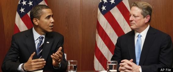
Al Gore Blasts Obama On Climate Change, For Failing To Take "Bold Action". The story is from the
Hufftington Post: "
WASHINGTON (AP) -- Former Vice President Al Gore is going where few environmentalists – and fellow Democrats – have gone before: criticizing President Barack Obama's record on global warming. In a 7,000-word essay for Rolling Stone magazine that will be published Friday, Gore says Obama has failed to stand up for "bold action" on global warming and has made little progress on the problem since the days of Republican President George W. Bush. Bush infuriated environmentalists for resisting mandatory controls on the pollution blamed for climate change, despite overwhelming scientific evidence that the burning of fossil fuels is responsible. While Gore credits Obama's political appointees with making hundreds of changes that have helped move the country "forward slightly" on the climate issue, and acknowledges Obama has been dealing with many other problems, he says the president "has simply not made the case for action." "President Obama has never presented to the American people the magnitude of the climate crisis," Gore says. "He has not defended the science against the ongoing withering and dishonest attacks. Nor has he provided a presidential venue for the scientific community ... to bring the reality of the science before the public." The comments mark a turnaround for the nation's most prominent global warming advocate, whose work on the climate problem has earned him a Nobel Prize and was adapted into an Oscar-winning documentary."
Gore Compares Media To "Pro Wrestling Referees". Wow. Al may have jumped the shark on this one. It's true the media loves a good story, a juicy controversy is good for ratings, no doubt. And it's also true that the media often treats a handful of (professional/paid) skeptics as equals with thousands of PhD climate scientists. Here's more from Joe Romm at
Climate Progress. Recently, Gore wrote:
"...
but whatever the cause, the referee (the media) appears not to notice that the Polluters and Ideologues are trampling all over the “rules” of democratic discourse. They are financing pseudoscientists whose job is to manufacture doubt about what is true and what is false; buying elected officials wholesale with bribes that the politicians themselves have made “legal” and can now be made in secret; spending hundreds of millions of dollars each year on misleading advertisements in the mass media; hiring four anti-climate lobbyists for every member of the U.S. Senate and House of Representatives. (Question: Would Michael Jordan have been a star if he was covered by four defensive players every step he took on the basketball court?) This script, of course, is not entirely new: A half-century ago, when Science and Reason established the linkage between cigarettes and lung diseases, the tobacco industry hired actors, dressed them up as doctors, and paid them to look into television cameras and tell people that the linkage revealed in the Surgeon General’s Report was not real at all. The show went on for decades, with more Americans killed each year by cigarettes than all of the U.S. soldiers killed in all of World War II. This time, the scientific consensus is even stronger. It has been endorsed by every National Academy of science of every major country on the planet, every major professional scientific society related to the study of global warming and 98 percent of climate scientists throughout the world. In the latest and most authoritative study by 3,000 of the very best scientific experts in the world, the evidence was judged “unequivocal.”
Climate Of Denial. Here is the Al Gore article in the Rolling Stone that is causing a firestorm of controversy, especially in the media, who apparently doesn't like being compared to a professional wrestling "referee". An excerpt: "
This script, of course, is not entirely new: A half-century ago, when Science and Reason established the linkage between cigarettes and lung diseases, the tobacco industry hired actors, dressed them up as doctors, and paid them to look into television cameras and tell people that the linkage revealed in the Surgeon General's Report was not real at all. The show went on for decades, with more Americans killed each year by cigarettes than all of the U.S. soldiers killed in all of World War II. This time, the scientific consensus is even stronger. It has been endorsed by every National Academy of science of every major country on the planet, every major professional scientific society related to the study of global warming and 98 percent of climate scientists throughout the world. In the latest and most authoritative study by 3,000 of the very best scientific experts in the world, the evidence was judged "unequivocal." But wait! The good guys transgressed the rules of decorum, as evidenced in their private e-mails that were stolen and put on the Internet. The referee is all over it: Penalty! Go to your corner! And in their 3,000-page report, the scientists made some mistakes! Another penalty! And if more of the audience is left confused about whether the climate crisis is real? Well, the show must go on. After all, it's entertainment. There are tickets to be sold, eyeballs to glue to the screen. Part of the script for this show was leaked to The New York Times as early as 1991. In an internal document, a consortium of the largest global-warming polluters spelled out their principal strategy: "Reposition global warming as theory, rather than fact." Ever since, they have been sowing doubt even more effectively than the tobacco companies before them. To sell their false narrative, the Polluters and Ideologues have found it essential to undermine the public's respect for Science and Reason by attacking the integrity of the climate scientists. That is why the scientists are regularly accused of falsifying evidence and exaggerating its implications in a greedy effort to win more research grants, or secretly pursuing a hidden political agenda to expand the power of government. Such slanderous insults are deeply ironic: extremist ideologues — many financed or employed by carbon polluters — accusing scientists of being greedy extremist ideologues."
Creating A NOAA Climate Service. Here is an overview of a proposal from NOAA, from Jane Lubchenco, Ph.D and Under Secretary of Commerce for Oceans and Atmosphere - on a proposed reorganization to create a Climate Service, before the Committee on Science, Space & Technology in the U.S. House of Representatives:
"
NOAA’s short term weather forecasts of conditions on an hourly basis to about two weeks out are a key component of our mission to protect American lives and property. Likewise, NOAA’s long range weather and seasonal forecasts, also known as climate forecasts, inform advance planning decisions, from weeks to months ahead of time, that allow for a rapid response to the onset of events such as severe storms, droughts, and floods. Although many people think very long term when they hear the word ‘climate,’ climate simply picks up where weather leaves off. “Climate services” refer to forecasts of conditions any time in the future beyond two weeks. For more than a century, NOAA has provided information about the weather, by way of short term forecasts of less than two weeks, and about the climate through long-range forecasts from two weeks to seasons or years out. For example, NOAA’s climate forecasts, including seasonal precipitation and drought outlooks, are helping firefighters in Texas prepare for and respond to this record wildfire season. These data and products are not just critical to Americans when it comes to saving lives and property; NOAA’s information is being used by businesses, industry, and governments to make smart investments in the economy and infrastructure. For example, just one of NOAA’s information tools is helping the U.S. home building industry save an estimated $300 million per year in construction costs alone, by using NOAA’s temperature trend information to design cost-effective building foundations. Americans also depend on NOAA’s climate information to reduce their risk to natural hazards (such as drought and flooding) and to take advantage of opportunities to use scarce resources more efficiently (such as reducing irrigation schedules during periods of above normal precipitation). And they are now demanding more data and increasingly complex products in a timely manner that, in turn, requires advanced scientific study. Appendix A of this testimony provides examples of the impressive growth in demand for NOAA’s climate service, as well as additional examples of the types of services and data requests NOAA receives."
* Click
here to see a full online copy of the testimony (PDF).
Road Map Identifies Immediate Measures To Address Climate Change. Here's an excerpt of a story from the
Miami Herald: "
The United Nations Environment Programme and the World Meteorological Organization reported June 14 that widespread implementation of just 16 measures to reduce emissions of black carbon and ozone (principally the precursors methane and carbon dioxide) can give the world a fighting chance of limiting global temperature rise to 2 degrees or less. These proven measures are already in use in some places around the world and would immediately benefit snow- and ice-covered regions like the Arctic and high mountain glaciers from the Himalayas to the Andes to the Cascades. Ambitious and immediate global action on carbon dioxide remains the backbone of any strategy to limit long-term climate change. But reducing emissions of the so-called "short-lived" climate pollutants black carbon and ground-level ozone can provide fast climate benefit. Why? Because they last in the atmosphere only days or months, compared to a hundred years or more for carbon dioxide. And by giving the world critical time to implement carbon dioxide reductions, there is more room to adapt to inevitable changes. Reducing smog and soot can also help avoid irreversible changes that we are speeding toward now. Think of it as a domino effect:
-The accelerated melting of the Greenland ice sheet,
-Contributes to a projected 5 foot sea-level rise by century's end,
-Then the vicious climate feedbacks, like the release of methane and carbon dioxide as permafrost melts,
-Which accelerates global warming even faster."
McCain Should Blame Climate Change, Not Immigrants, For Arizona Wildfires. Here's a story from the youth climate movement, "
It's Getting Hot In Here": "
Rather than blame undocumented immigrants for the fires ravaging his home state, Sen. John McCain should be educating the public about something he used to profess to know something about: the climate crisis. At a press conference last Saturday, McCain said, “There is substantial evidence that some of these fires have been caused by people who have crossed our border illegally.” This isn’t the first time McCain has talked about seeing the “substantial evidence.” In a 2008 speech at a wind turbine facility in Portland, McCain said of climate change, “No longer do we need to rely on guesswork and computer modeling, because satellite images reveal a dramatic disappearance of glaciers, Antarctic ice shelves and polar ice sheets. And I’ve seen some of this evidence up close.” John McCain’s transformation from climate Dr. Jeckyll to anti-immigrant Mr. Hyde is a challenge for climate and a immigrant rights activists to find common ground. Climate scientists have studied not only how increased global warming exacerbates fires across the western United States, but also how the drought caused by climate disruption drives more and more people in Mexico and across Central America to leave their parched homes and risk their lives to find work in el norte. A 2010 study in the Proceedings of the National Academy of Sciences, concluded that climate change’s impacts on crop yields may force as many as seven million Mexicans to emigrate to the U.S. over the next 70 years. Now, the very immigrants that were driven from their homes by the climate crisis are being blamed for its impacts. As climate disruption continues, it will exacerbate social conflict around the world. As Christian Parenti writes in his new book on climate conflict, Tropic of Chaos, “The United Nations has estimated that all but one of its emergency appeals for humanitarian aid in 2007 were climate related.”
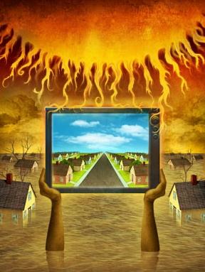
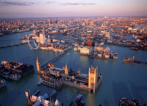
Postcards From The Future. A worst-case scenario? I sure hope so.
This post imagines the potential impact of rising sea levels and a more extreme climate for London:
“
Climate change is central to London’s future. It will affect every aspect of the city, from buildings and public spaces to the way Londoners live and work. What impact will climate change have? A display of 14 arresting images will be on display at the Museum of London from 1 October 2010 to 6 March 2011. Like ‘Postcards From The Future’, familiar views of the capital have been digitally transformed by illustrators Robert Graves and Didier Madoc-Jones.”









No comments:
Post a Comment