By Todd Nelson
Most of the time I feel like Dopey from the Seven Dwarves, but lately I'm feeling a little more like Sneezy. AAACHOOO!
It never fails; right around State Fair time, I get bit by the allergy bug. I don't want to wish ill will on anything, but I hope that ragweed gets blasted by a big cold front in September... not sure how much longer I can take this.
Meteorological Summer will conclude this Sunday, meaning the 3 warmest months (on average) will be behind us. Keep in mind that we've only seen two 90 degree days this summer, which is nearly 8 to 9 days below average! Despite the recent EF-O tornado near Gilman, MN on Sunday, we've only seen 23 tornadoes this year. According to NOAA's NCDC, the annual average number of tornadoes in Minnesota is 45.
Looking ahead, the severe threat may be increasing as a stronger cold front pushes through the state on Sunday. This will bring another round of heavy rain to parts of the Midwest, but drier weather moves in quickly for Labor Day. The early part of September looks to start off on a cooler note with highs in the mid/upper 70s. In a few months we'll all likely forget what 70s felt like, so enjoy it now!
AAACHOO!!
=================
THURSDAY NIGHT: More showers, possible thunder. Low: 63
FRIDAY: Lingering showers. Partly soggy. Skies dry out late. High: 76 Winds: SW 5mph.
FRIDAY NIGHT: Rain/thunder threat continues. Low: 60
SATURDAY: Best day? Patchy fog, then intervals of sun. Dew point: 62. High: 77
SUNDAY: Sticky sun, severe T-storms late? Dew point: 67. Wake-up: 60. High: 82
LABOR DAY: Clearing trend, not as muggy. Wake-up: 61. High: 76
TUESDAY: Back to school. Spotty PM T-Shower. Wake-up: 54. High: 75
WEDNESDAY: Quiet. Cool breeze. Wake-up: 54. High: 77
THURSDAY: Warmer, slightly more humid. Wake-up: 55. High:78
=================
This Day in Weather History
August 29th
1948: An airliner crashed during a thunderstorm near Winona, killing 37 people on board.
1863: A devastating killing frost affected most of Minnesota, killing vines and damaging corn.
===================
Average High/Low for MSP
August 29th
Average High: 78F (Record: 96F set in 1969)
Average Low: 60F (Record: 45F set in 1946)
====================
Sunrise/Sunset Times for MSP
August 29th
Sunrise: 6:31am
Sunset: 7:55pm
=====================
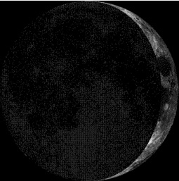
Moon Phase for August 29th at Midnight
3.2 Days Before First Quarter
======================
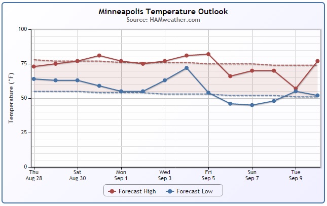
Minneapolis Temperature Trend
Waves of cooler air appear to be rolling in with a little more frequency as we approach September. Note the 2 dips over the next 15 days. 1 occurs early next week with a potentially bigger temperature drop by the first weekend in September. Keep in mind that extended model runs are always as reliable, but if this were to pan out, we could be looking at highs in the 60s and lows in the 40s by the first weekend of September!
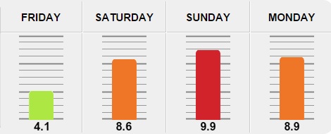
Allergy Alert!!
AAAAACHOOOOOO!! UGH! Not sure about you, but I've been battling the seasonal allergy bug like many others out there. It seems to really set in around the Minnesota State Fair, when ragweed seems to be at it's peak. I generally don't wish any cold spells upon us, but not sure how much longer I can take this sneezing, itching and watering eyes. According to Pollen.com - we're in for a fairly high pollen weekend, especially Sunday.
Get the latest pollen forecast HERE:
Friday: Wetter Weather Keeps Pollen Levels Low
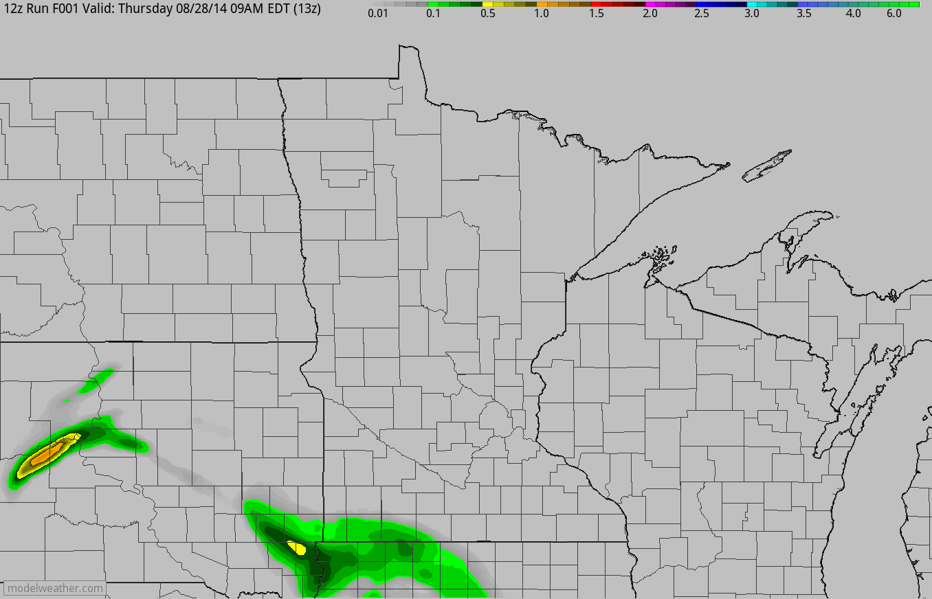
Thanks to an impulse of energy moving through the Midwest on Friday, cloudy and soggy weather will help to keep pollen levels lower. The image below suggests the weather conditions at 5pm Friday.
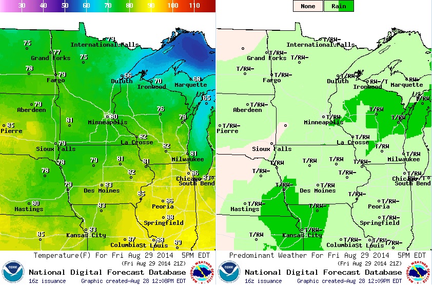
Somewhat Soggy...
A big blob of moisture on a northeast heading toward the U.P. of Michigan through Friday will be responsible for several inches of precipitation, which could lead to some localized areas of flooding.
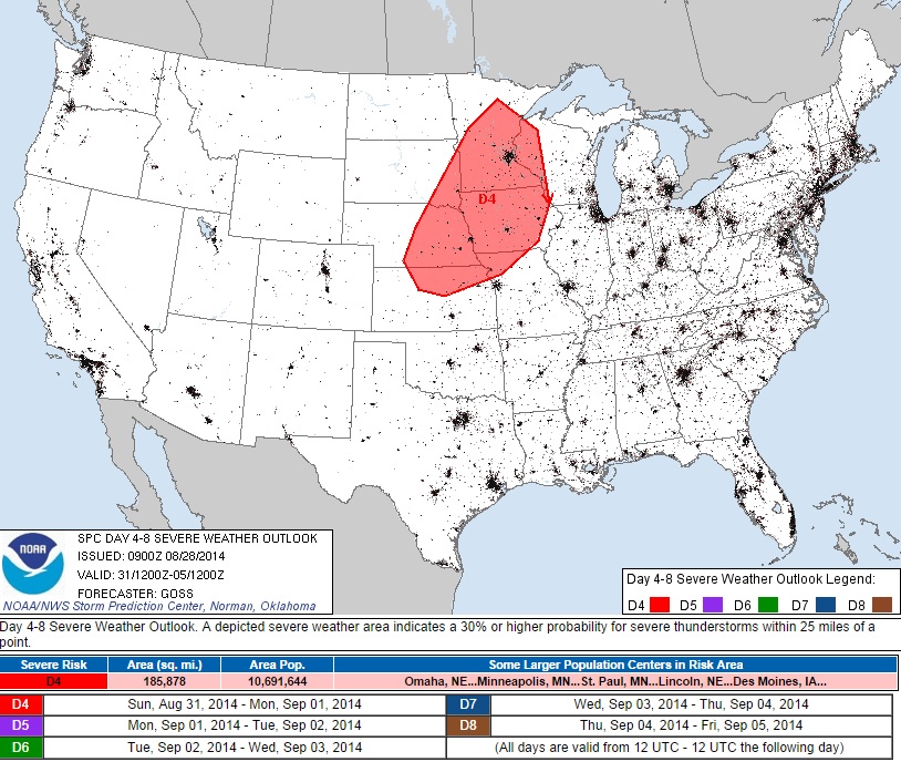
Sunday Severe Threat?
A strong cold front will arrive on Sunday and bring strong to severe thunderstorm chances back to the Upper Midwest. As of now, NOAA's SPC has parts of Minnesota, including the Twin Cities under an enhanced risk of stronger storms. Keep up to date with the latest storm chances for Sunday.
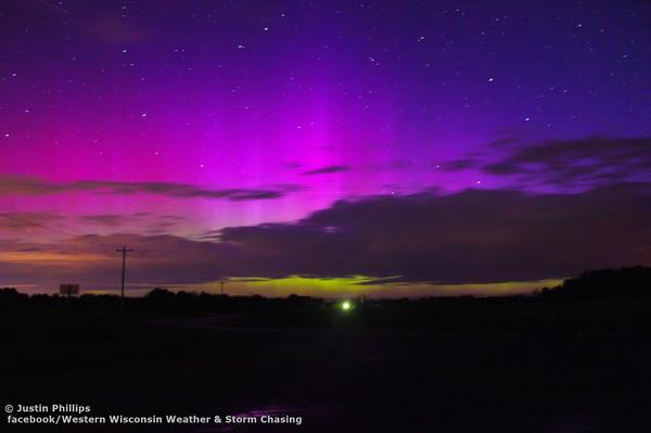
Northern Lights
Thanks to @WIStrmChaser for the picture below out of Aurora, WI !! Amazing colors in the northern lights display from earlier this week thanks to a geomagnetic storm on the sun a few days ago.
"The CMEs that instigated the display were launched toward Earth on Aug. 22nd. As NOAA analysts predicted, the solar wind speed did not change much when the slow-moving CMEs arrived. However, the storm clouds were still effective because they contained a south-pointing magnetic field that opened a crack in Earth's magnetosphere. Solar wind poured in to fuel the show."
Read more from www.SpaceWeather.com HERE:
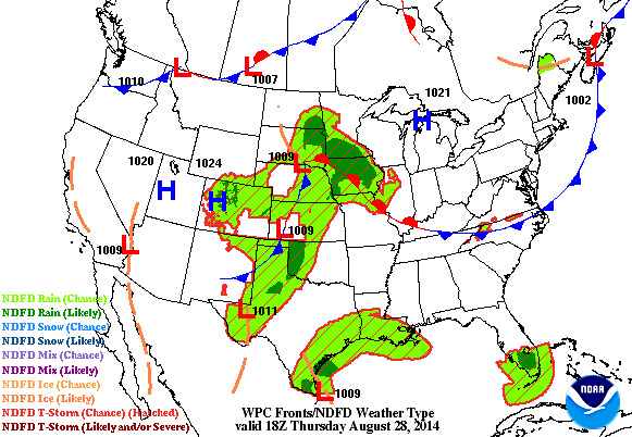
Weather Outlook
2 Different weather features will keep somewhat soggy weather conditions in place through the early weekend. By Saturday, most of the 'heavy' precipitation will shift into the Great Lakes/Ohio Valley Region.
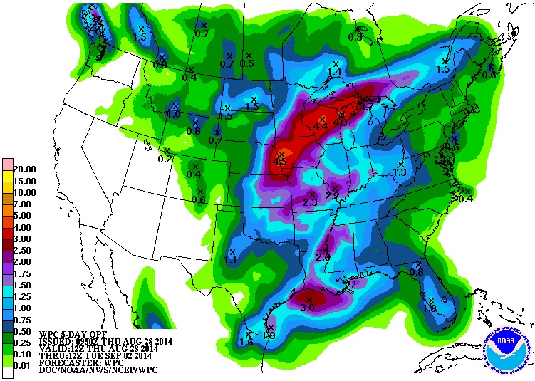
Precipitation Outlook
According to NOAA's HPC, the 5 day rainfall forecast suggests quite a bit of heavy rain potential over parts of the Midwest/Great Lakes through early next week. Note also the heavy rain potential across the Mississippi River Valley, while the Western U.S. looks to remain still very dry.
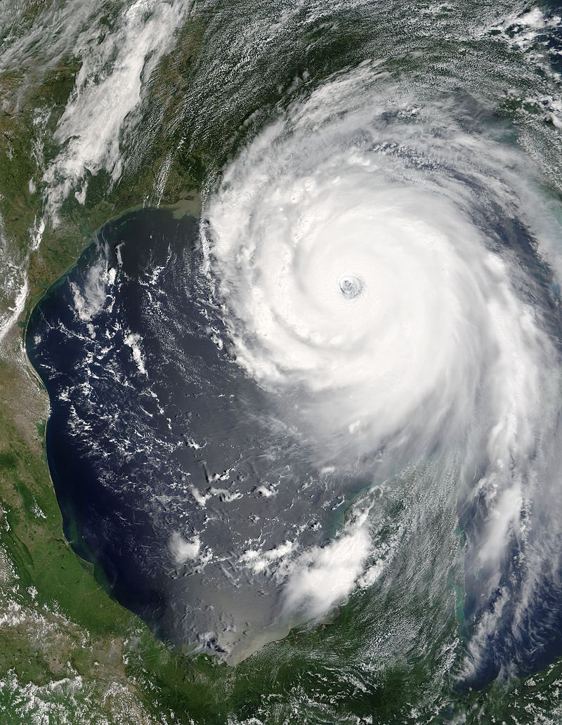
Remembering Katrina
9 years ago (Monday, August 29th) Hurricane Katrina plowed ashore in southeastern Louisianan as a major category 3 storm. A catastrophic levee failure in New Orleans caused much of city to flood. The image below is from August, 28th when Katrina was at it's strongest intensity; Category 5 with 175mph sustained winds!!
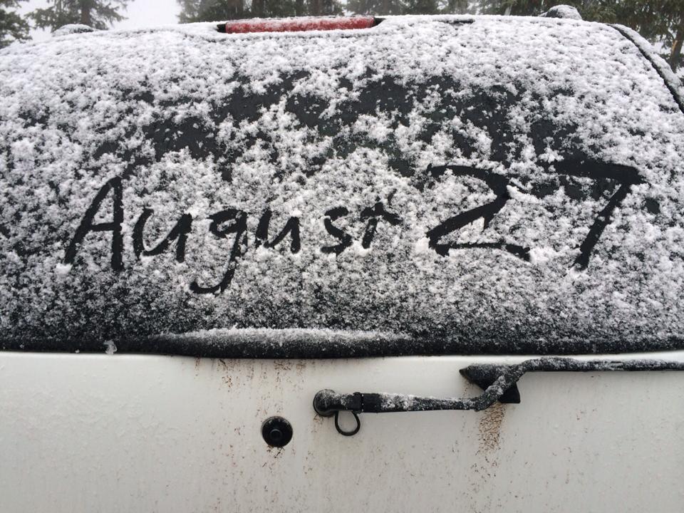
Ski Season Approaches...
Hopefully it'll be a while before we start seeing our first flakes here in Minnesota, but ski season is nearing quickly in the mountains. Thanks to the Telluride Ski Resort for the picture below - they documented snow on the back of this car window earlier this week!
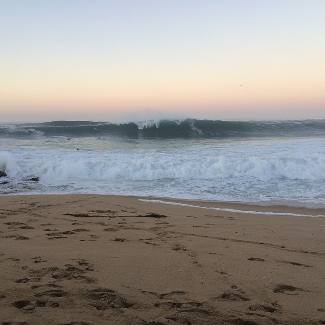
Big Surf Across Southwest California
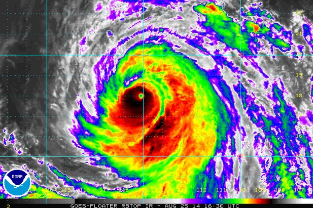
Southwest California was a buzz earlier this week a huge waves moved into the Wedge. There were reports of near +20ft waves that caught the attention of quite a few surfers. These massive breakers were caused by Hurricane Marie in the East Pacific, which was a category 4 storms on Monday with near 150mph winds!
Hurricane Marie Fades...
Hurricane Marie in the East Pacific was a major category 4 hurricane earlier this week with near 150mph winds. The imagery that NASA satellite captured was amazing! The Capital Weather Gang has a nice write-up about it... See more HERE:
Active East Pacific
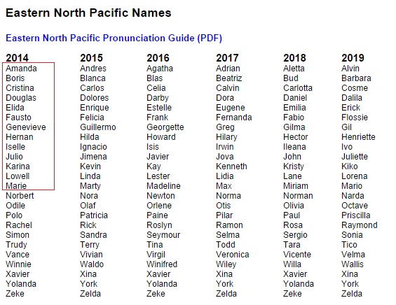
The Eastern Pacific has been very active this season with Marie being the 13th named storm of the 2014 season!
Somewhat Quiet Atlantic
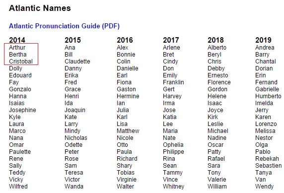
The Atlantic basin has been a lot quieter by comparison... Our latest storm, Cristobal, became the 3rd named storm and 3rd hurricane of the 2014 season. The only storm that made landfall with the U.S. was Arthur, which was briefly a category 2 storm as it made landfall with the Outer Banks of North Carolina on July 3rd. Bertha and Cristobal made similar paths, curving east of the Eastern Seaboard during their life-cycle.
Atlantic Acting Up
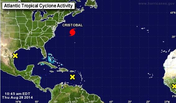
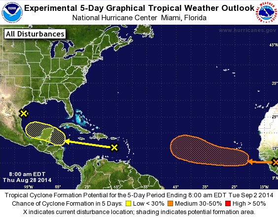
The image below from the National Hurricane Center showed 4 different areas of interest as of Thursday with Hurricane Cristobal on a northeast heading toward Iceland by Labor Day Monday. The 3 " X's " indicate disturbances that the NHC is keeping an eye on.
Atlantic Forecast
According to NOAA's NHC, there are 2 disturbances that will have to be monitored over the next 5 days for further development. #1 in the Caribbean heading west towards the Yucatan Peninsula has a LOW chance of development, while the disturbance moving west off the western tip of Africa has a medium chance of development.
Thanks for checking in and have a great rest of your week! Don't forget to follow me on Twitter @TNelsonWX

No comments:
Post a Comment