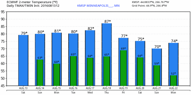
80 F. average high on August 13.
81 F. high in St. Cloud on August 13, 2015.
3.22" rain so far in August.
1.49" average rainfall as of August 13.
1.37" rainfall during the first 13 days of August, 2015.
August 14, 1978: The Boundary Waters area is hit by a strong tornado. Some of the damage could still be seen 10 years later.
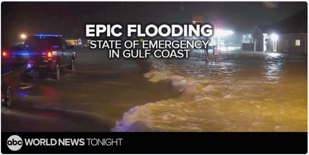
Amazing Sunday - A 500-Year Flood for Louisiana
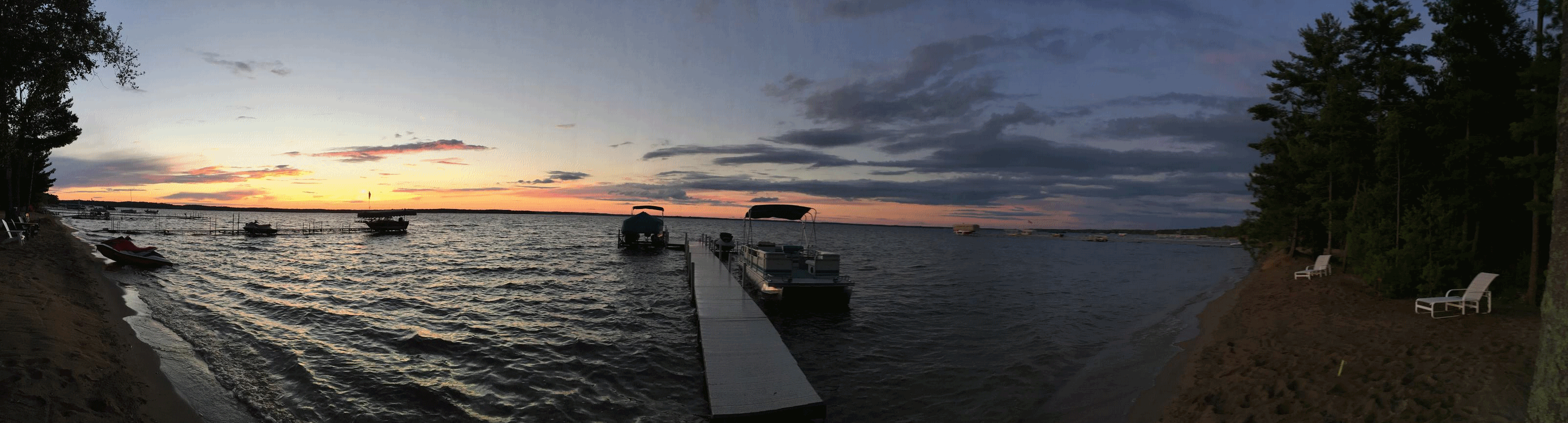
"The red-winged blackbirds in my yard usually fly south in early August" Pete explained at Breezy Point. "This year they left in July. What does it mean?" I shrugged and shook my head. "Too wet?"
Over 4 inches of rain has soaked the metro so far in August; some Minnesota towns have already picked up 2 month's worth of rain this month.
"Phenology" is the study of seasonal changes in animal and plant behavior. But animals and plants react to previous weather patterns - rather than predicting what's to come.
My winter outlook: "changeable". Take it to the bank.
While we savor an amazing Sunday with more sun, lighter winds and a lack of afternoon instability showers, residents of Louisiana are under a State of Emergency; another stalled storm unloading 2 FOOT rainfall amounts and historic flooding. By my count it's the 8th 500-year flood to strike the USA since May of 2015. Probably nothing to worry about.
More T-storms ignite Monday night and Tuesday with highs climbing through the 80s this week. Not as beastly-hot (or wet) as last week, though.
A hefty cool front may be jacket-worthy up north next weekend but summer warmth spills into September.

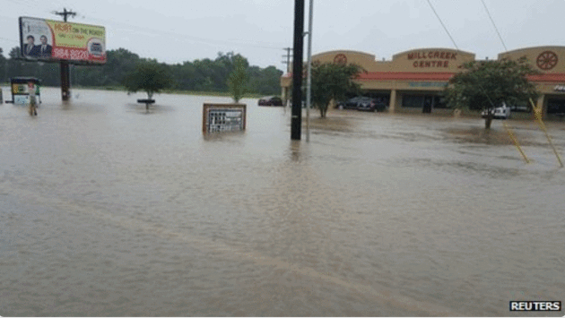
- A State of Emergency for the state of Louisiana has been declared due to ongoing historic flooding.
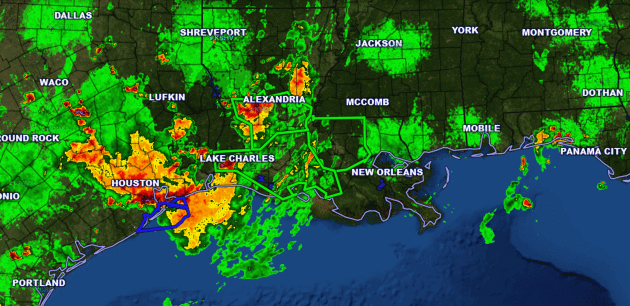
- Numerous areas across parts of southeast Louisiana and southern Mississippi have seen over 10” of rain since Thursday.
- Parts of southern Louisiana and into west Texas could see an additional 4-7”+ of rain throughout the day today, including Baton Rouge, Lafayette, Alexandria and Lake Charles (LA) as well as Beaumont (TX).

The Baton Rouge newspaper The Advocate has put together an interactive map of areas hit the hardest in the region by flooding: http://www.theadvocate.com/


Summary. Major flash flooding continues across parts of the lower Mississippi Valley today, with another 4-7”+ of rain expected. That’s on top of 10-15”+ in some of these areas. Numerous roads have been reported underwater, including parts of I-10 and I-55. Facilities across these areas that normally experience problems during flood scenarios should continue to be on alert for issues over the next few days.
D.J. Kayser, Meteorologist, AerisWeather
WunderBlog. Bob Henson has more perspective and context here.
America's Latest 500-Year Rainstorm is Underway Right Now in Louisiana. Meteorologist Eric Holthaus provides perspective at Pacific Standard; here's an excerpt: "...An instant analysis
from Climate Nexus refers to today’s Louisiana rainstorm as a “classic
signal of climate change.” It’s right. The NWS maintains a statistical database
used to calculate the “annual exceedance probability” of a given
rainfall event — basically, the expected frequency this event would
occur in any given year. Today’s rainstorm in Louisiana is at least the
eighth 500-year rainfall event across America in little more than a
year, including similarly extreme downpours in Oklahoma last May,
central Texas (twice: last May and last October), South Carolina last
October, northern Louisiana this March, West Virginia in June, and
Maryland last month..."
The Times Picayune in New Orleans has live-blogging on the ongoing flooding disaster across Louisiana and Mississippi at NOLA.com.
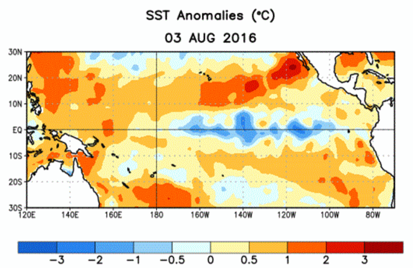
NOAA Maintains La Nina Forecast for Fall or Winter. The observed cooling of Pacific ocean water has been tame, the forecast of official La Nina conditions pushed back, according to Reuters: "A U.S. government weather forecaster on Thursday reduced its outlook that La Nina conditions would develop in next few months but said it still expected the weather phenomenon to occur this fall or winter. The National Weather Service's Climate Prediction Center said in its monthly forecast that La Nina was "slightly favored" to develop through October. That was a small change from July, when it stated the conditions were "favored" to occur. The agency maintained its forecast of a 55 percent to 60 percent chance that La Nina would develop during the fall and winter of 2016/17..."
* More details from NOAA CPC here.

Surveyed Scientists Debunk Chemtrails Conspiracy Theory. Here's the intro to a story at UCI News: "The world’s leading atmospheric scientists overwhelmingly deny the existence of a secret, elite-driven plot to release harmful chemicals into the air from high-flying aircraft, according to the first peer-reviewed journal paper to address the “chemtrails” conspiracy theory. Researchers from the University of California, Irvine, the Carnegie Institution for Science and the nonprofit Near Zero organization asked 77 atmospheric chemists and geochemists if they had come across evidence of such a large-scale spraying program, and 76 responded that they had not. The survey results were published Wednesday in Environmental Research Letters. Heat from aircraft engines produces condensation trails that can be clearly seen from the ground. A small but vocal segment of the population firmly believes that these are composed not merely of condensed water vapor but of chemicals and elements such as strontium, barium and aluminum that powerful, high-level entities have been intentionally and covertly releasing into the atmosphere for decades..."
Photo credit: "A commercial airliner produces a condensation trail in the skies over California." Mick West
The Brave New World of Robots and Lost Jobs.
Here's the debate we should be having. Be less worried about bad trade
deals with China - and more worried about AI and intelligent robots
doing your job within 5-10 years. The Washington Post reports: "...The
“automation bomb” could destroy 45 percent of the work activities
currently performed in the United States, representing about $2 trillion
in annual wages, according to a study last year by the consulting firm McKinsey & Co.
We’ve seen only the beginning of this change, they warned. Currently,
only 5 percent of occupations can be entirely automated, but 60 percent
of occupations could soon see machines doing 30 percent or more of the
work. The McKinsey analysts sharpened their argument in a paper released last month.
Their estimates, based on U.S. Bureau of Labor Statistics data covering
more than 800 occupations, draw a shocking picture of the future...."

Image credit: Flickr CC BY 2.0/Blude.

TODAY: Sunny, nearly perfect. Isolated late PM shower north/east of MSP. Winds: W 5-10. High: 82
SUNDAY NIGHT: Clear and mild. Low: 65
MONDAY: Warm sun, T-storms at night. Winds: S 8-13. High: 85
TUESDAY: Unsettled, few leftover T-storms. Winds: S 8-13. Wake-up: 67. High: 84
WEDNESDAY: Sunnier, odds favor a dry sky. Winds: NW 5-10. Wake-up: 66. High: 86
THURSDAY: Sticky sunshine, T-storms late? Winds: S 10-15. Wake-up: 69. High: 88
FRIDAY: Showers and T-storms, some heavy. Winds: S/SW 10-15. Wake-up: 70. High: 83
SATURDAY: Partly sunny, cool hints of September. Winds: NW 10-20. Wake-up: 64. High: 75
Climate Stories...
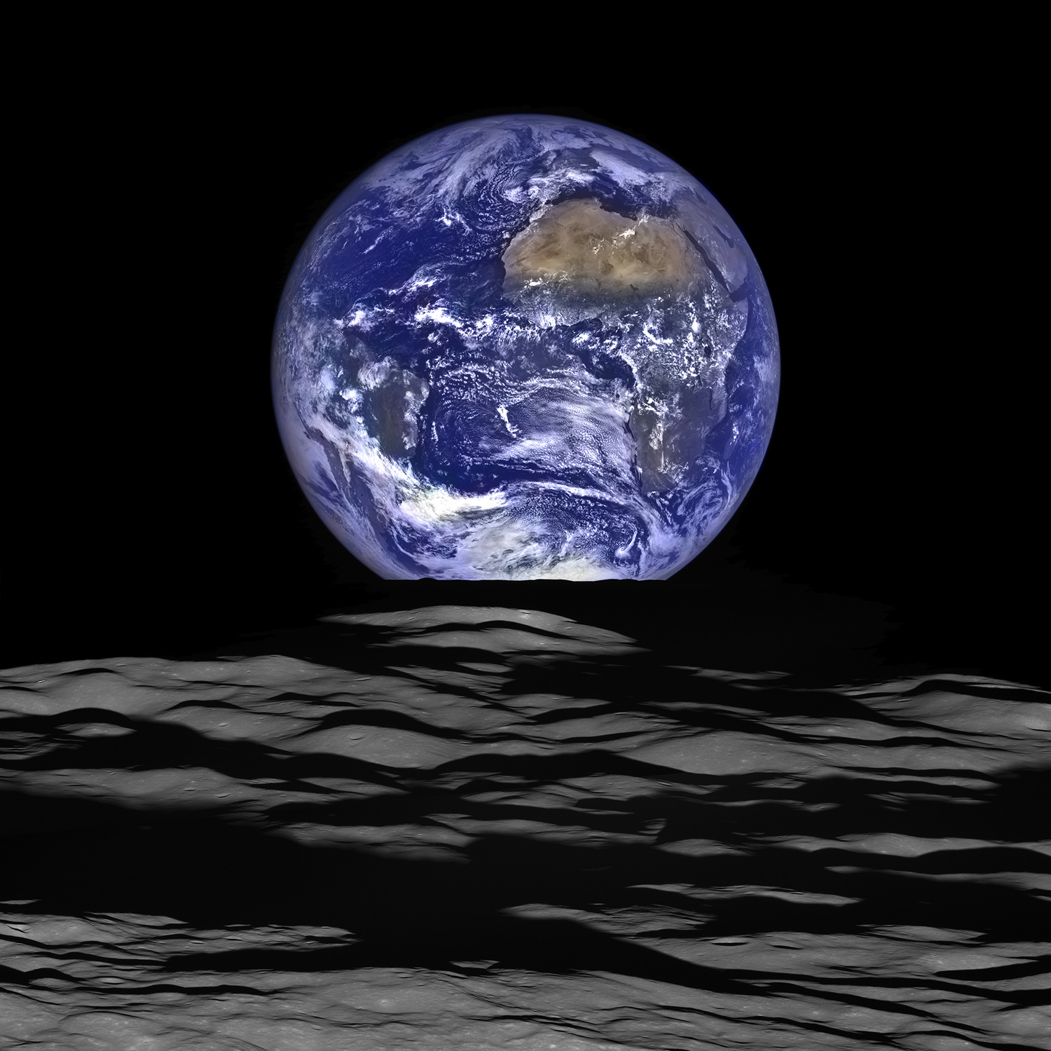
A Court Ruling That Could Save the Planet. Bloomberg View has the story: "A federal court this week upheld the approach that the government uses to calculate the social cost of carbon when it issues regulations -- and not just the cost imposed on Americans, but on people worldwide. It’s technical stuff, but also one of the most important climate change rulings ever. The social cost of carbon is meant to capture the economic damage of a ton of carbon emissions. The assumptions that go into the analysis, and the resulting number, matter a lot, because they play a key role in the cost-benefit analysis for countless regulations -- not only the Obama Administration’s Clean Power Plan, but also fuel economy rules for automobiles and trucks and energy efficiency rules for appliances, including refrigerators, microwave ovens, clothes washers, small motors, and clothes driers..." (Image credit: NASA).
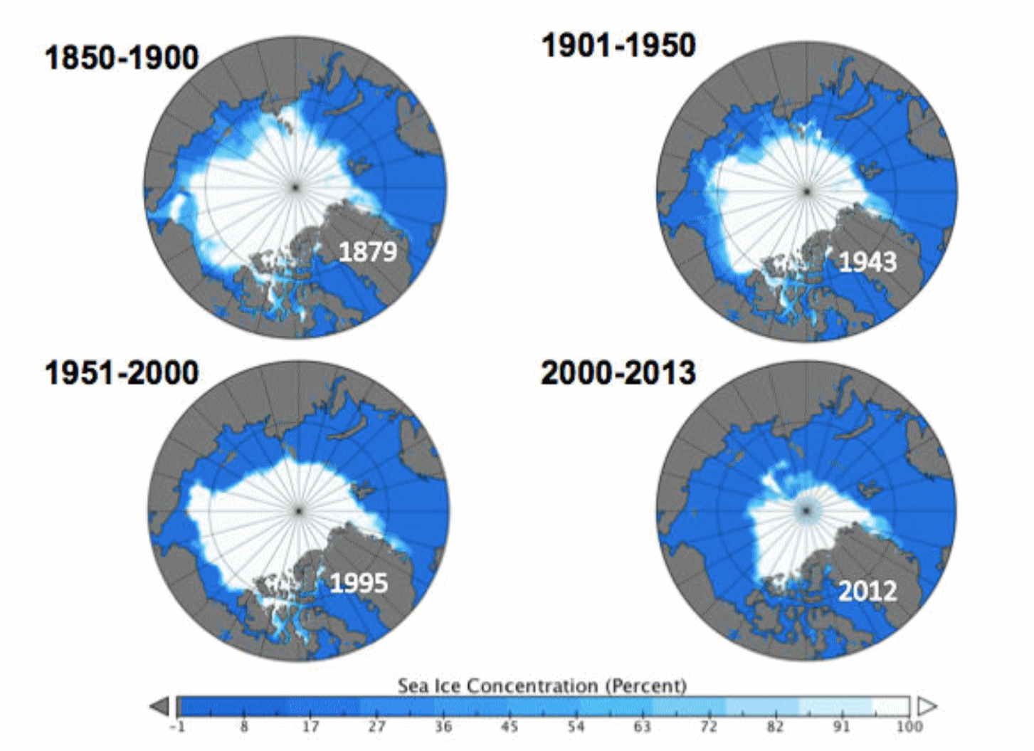
Guest Post: Piecing Together the Arctic's Sea Ice History Back to 1850. Here's an excerpt of an interesting post at Carbon Brief: "...Most fundamentally of all, the new dataset allows us to answer the three questions we posed at the beginning of this article. First, there is no point in the past 150 years where sea ice extent is as small as it has been in recent years. Second, the rate of sea ice retreat in recent years is also unprecedented in the historical record. And, third, the natural fluctuations in sea ice over multiple decades are generally smaller than the year-to-year variability..."
Image credit: "Sea ice cover maps for the annual minimum in September, for the periods 1850-1900, 1901-1950, 1951-2000, and 2001-2013. The maps show the sea ice extent in the lowest minimum during each period, which are in years: 1879, 1943, 1995, and 2012."
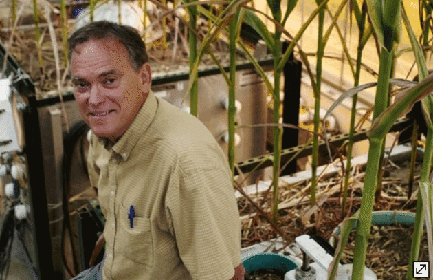
Growing Corn Like It's 2065 To Study Climate Change Effects. The Star Tribune reports: "At
the University of Minnesota, researchers are growing corn in
greenhouses like it’s the year 2065. The effort is part of a long-term
plan to study how corn will grow under weather conditions considerably
different from today’s, predicted in climate change models for a
half-century out. “Many models show that with increasing temperatures we
could be seeing a reduction in corn yields, so that’s something we
would like to investigate under controlled conditions,” said Tim
Griffis, University of Minnesota professor of biometeorology and one of
several researchers directing projects..."
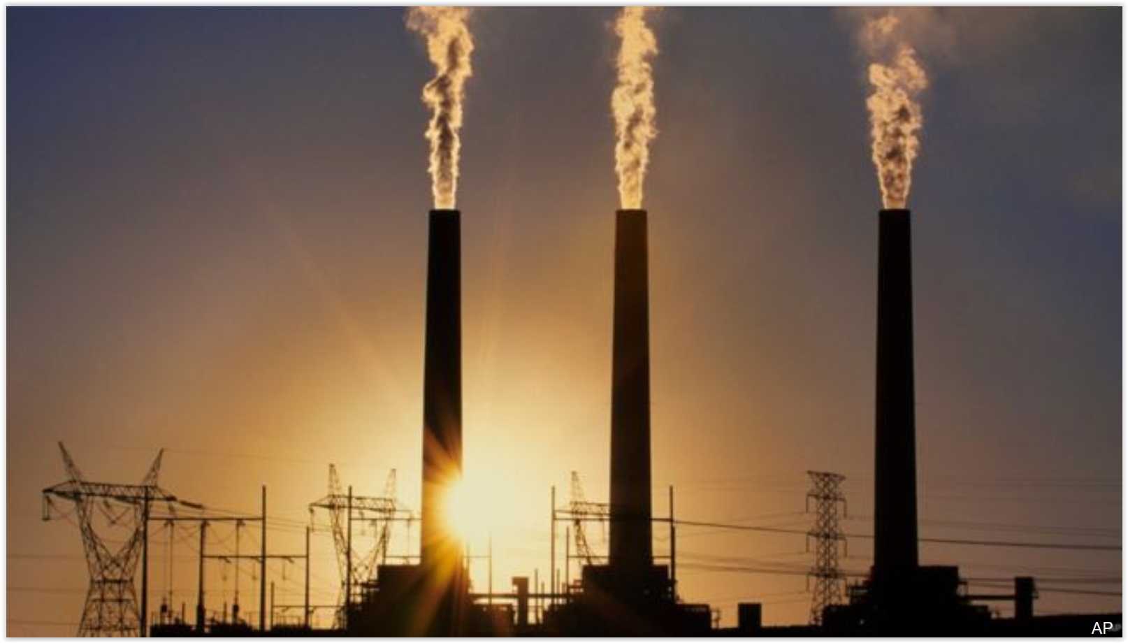
As Earth Swelters, Global Warming Target In Danger of Being Missed. Here's the intro to an update at Reuters: "The Earth is so hot this year that a limit for global warming agreed by world leaders at a climate summit in Paris just a few months ago is in danger of being breached. In December, almost 200 nations agreed a radical shift away from fossil fuels with a goal of limiting a rise in average global temperatures to well below 2 degrees Celsius (3.6 Fahrenheit) above pre-industrial times while "pursuing efforts" for 1.5C (2.7F). But 2016 is on track to be the hottest year on record, also buoyed by a natural El Nino event warming the Pacific, according to the U.N.'s World Meteorological Organization. The first six months were a sweltering 1.3C above pre-industrial times..." (File photo: AP).

Photo credit: "Iraqis jump off the ruins of an old building into the Tigris River to beat the heat in Baghdad this month. The temperature in Baghdad reached 47 degrees." Photo: AP.
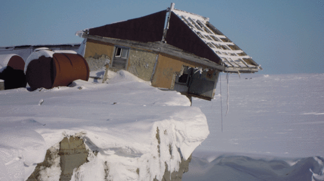
Photo credit: "Vize island weather station on the edge." (Pic: WWF Russia).
No comments:
Post a Comment