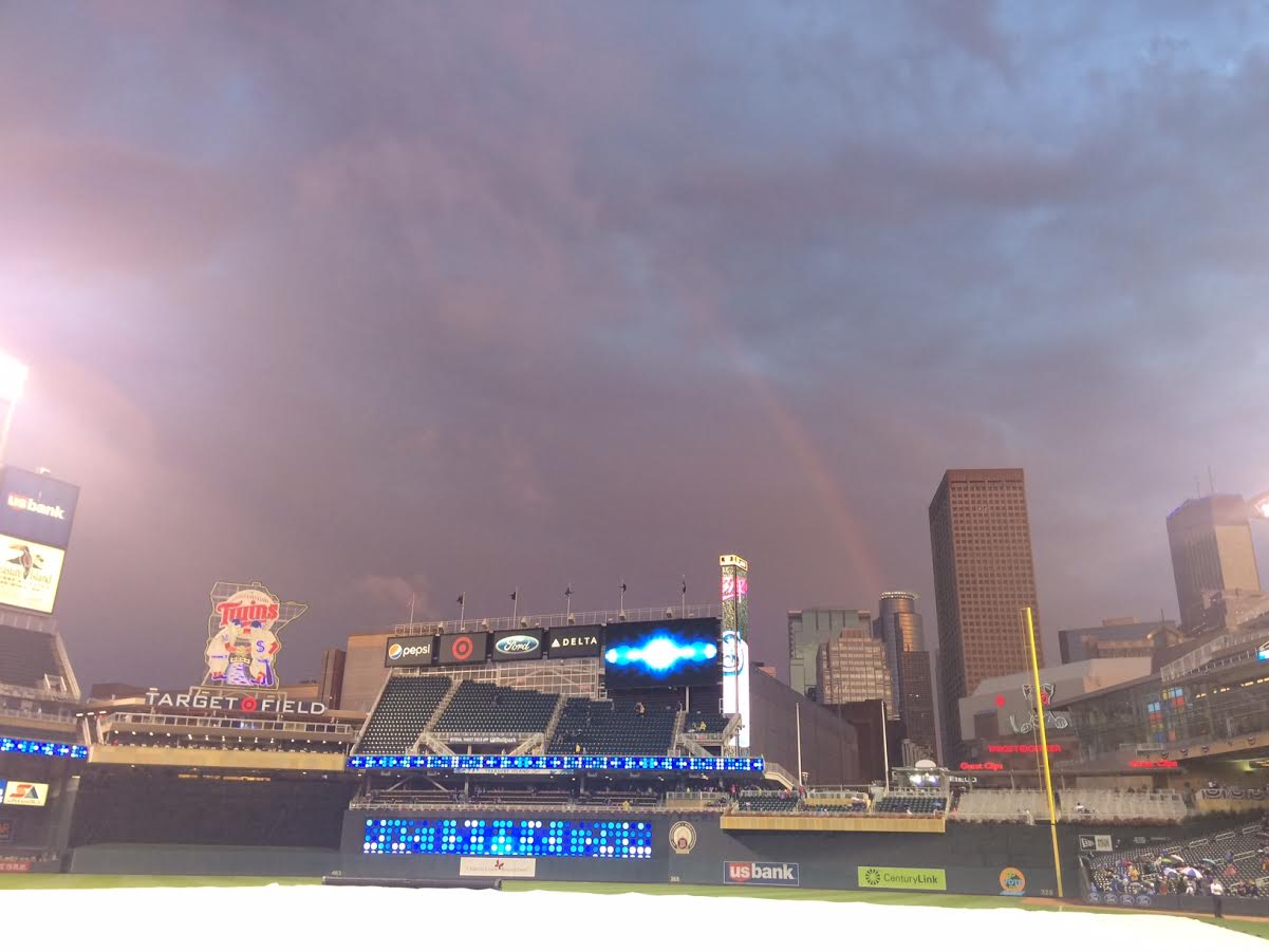
Soggy Baseball Weather This Year
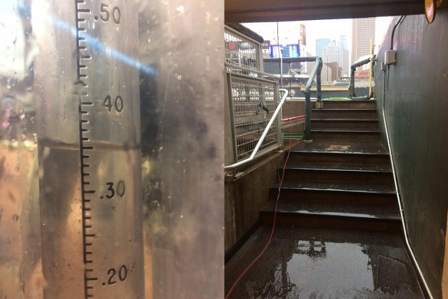
It was another soggy day at Target Field leading up to the 3rd to last home game of the season. Interestingly, there have been nearly a dozen rain delays/postponements this season, which speaks to the number of soggy days we've had this summer. Al Kuehner, the official Target Field co-op weather observer, has measured a staggering 29.62" of rain so far at Target Field since the Twins' season started back in April! Here's how the months tallied up:
April: 3.96"
May: 1.92"
June: 4.75"
July: 5.18"
August: 8.63"
September (So far): 5.22"
May: 1.92"
June: 4.75"
July: 5.18"
August: 8.63"
September (So far): 5.22"
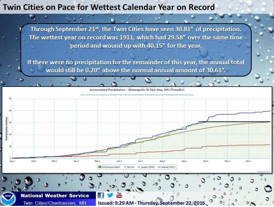
Wettest Start to the Year on Record for Minneapolis
According to the Twin Cities National Weather Service, through September 21st, Minneapolis has seen 30.81" of precipitation, which is the wettest such period on record! Through September 23rd, Minneapolis has seen nearly 31.50" of rain with more rain expected later Saturday!
__________________________________
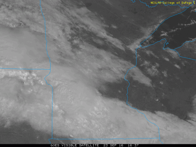
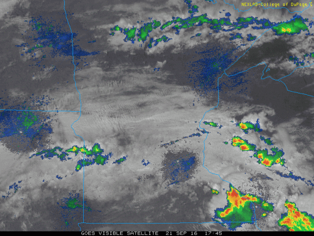
Friday's Rain...
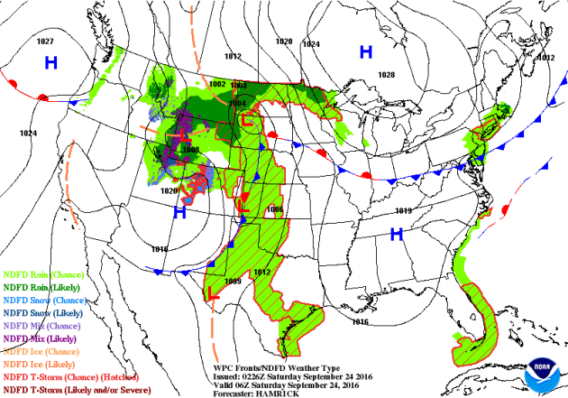
When it rains, it pours. This is getting to be a little ridiculous now. Just when you think we've had enough rain, we get more. Another batch of steady rain fell across the region on Friday, which helped to snarl traffic for the evening commute. Here's the satellite and radar loop below from PM Friday.
.gif)
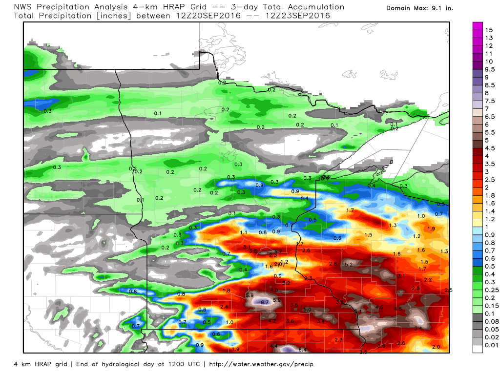
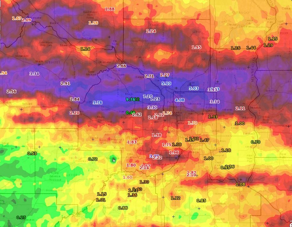
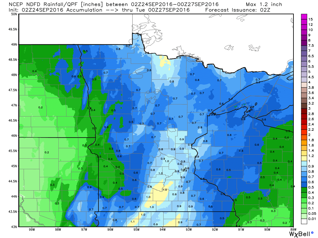
3 Day Rainfall Estimates
Take a look at some of the rainfall estimates from over the last 3 days across parts of southern Minnesota and central Wisconsin. Note the pockets of near double digit tallies near the northern Twin Cities metro and across parts of southern Minnesota. In some cases, this is 2 to near 3 months of rain in just a few days!
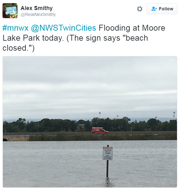
Still Under Water in Southern Minnesota
Amazing pictures continue to surface of high water from the extreme rainfall event from earlier this week. While most of the big puddles the fields and neighborhoods near you will begin to subside, folks along rivers in the southern part of the state will have to remain on high alert as significant flooding continues in some areas.

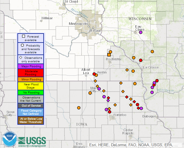
Rivers in Flood Stage
Keep in mind that not all the rivers that are experiencing flooding are shown below, but those with river gauges that are currently registering flood stage are. Note that quite a few are in Major Flood stage across parts of northeast Iowa and across western Wisconsin.
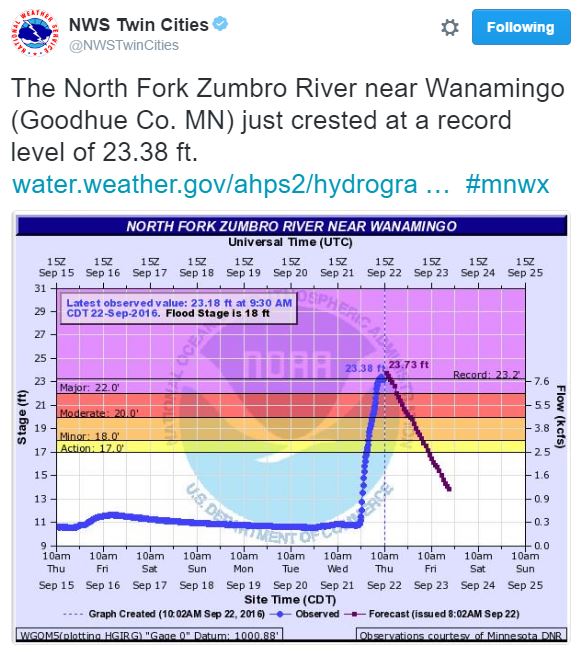
Record Flood Stage at the North Fork Zumbro River Near Wanamingo
So much rain fell that the Zumbro River near Wanamingo saw a record flood stage at 10am Thursday! Interestingly, note how quickly the river came up! In about 12 hours, the river jumped nearly 12 feet, which is pretty incredible! It also poses major safety concerns as well.
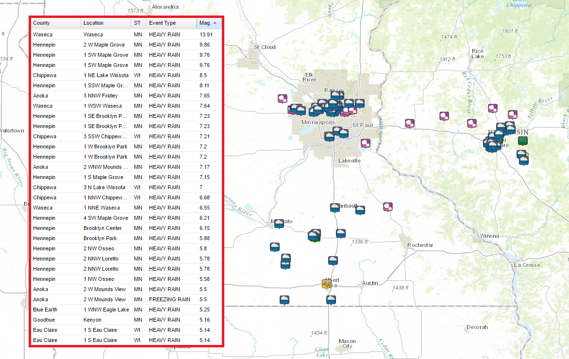
How Much Rain Fell?
Take a look at the impressive rainfall tallies from the event earlier this week. Note the near 14" tally in Waseca and the near 10" tally in Maple Grove!
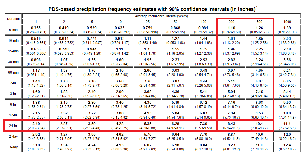
200 to 500 Year Flood?
According to NOAA's ATLAS, the 9.86" of rain that fell in Maple grove within a 24 hour period may be a 200 to near 500 year flood event. Regardless of how many year flood event it is, to see near 10" of rain within that short amount of time, it's pretty impressive!
Radar Estimated Rainfall
This is the radar estimated rainfall, which shows the heaviest rainfall across parts of the northern Twin Cities Metro and also across southern Minnesota and western Wisconsin.
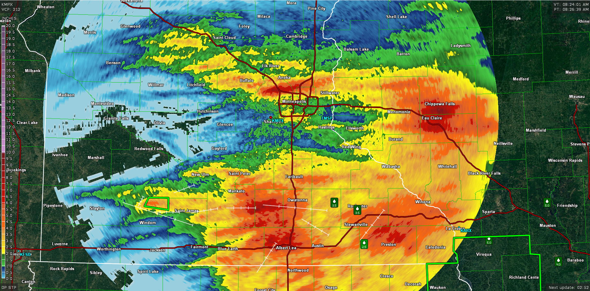
A closer view of the Twin Cities shows a fairly large band of 6" to near 10" amounts on the north and northwest side of the Twin Cities. This is where numerous reports of flooded roads, stranded motorists and flooded basements were reported.
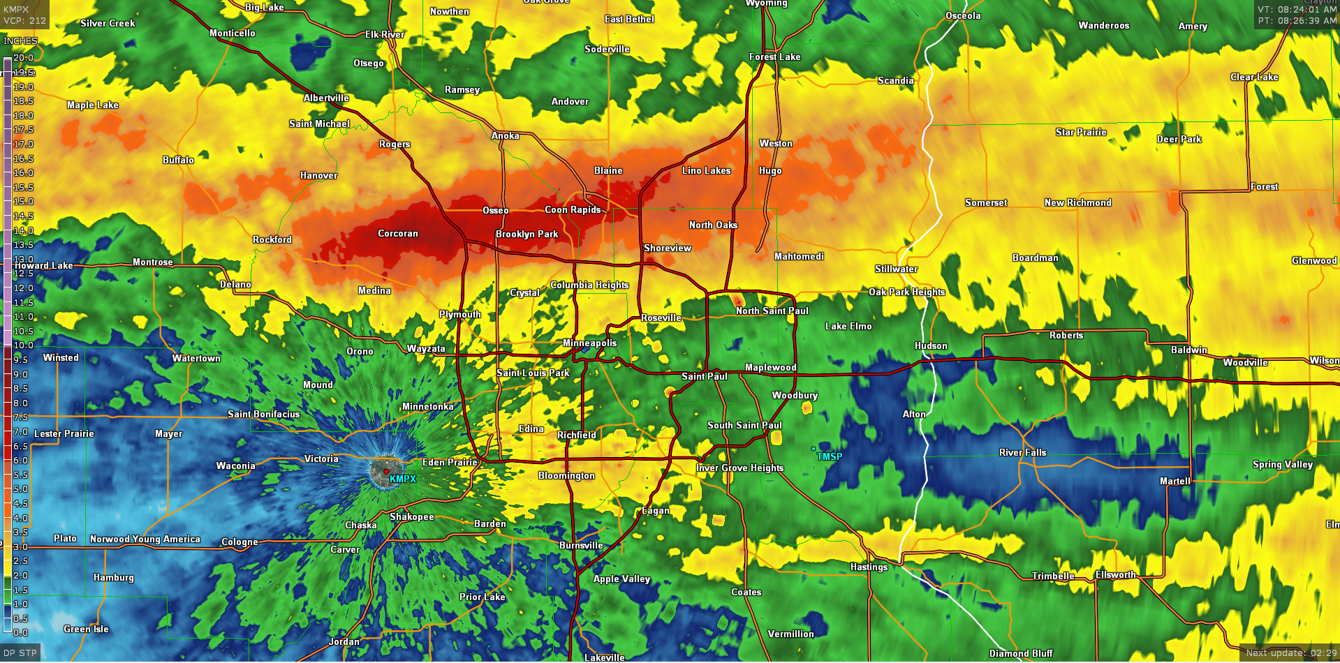
An even closer look across the northern Twin Cities metro shows some or the amounts that fells during the heavy rain earlier this week. Note the 9.76" tally in north-central Hennepin county near the I-94/694 split.
Radar of Flooding Rain Event Earlier This Week
This is the same loop as above, but now shows the composite radar. Note the line of intense thunderstorms that developed on the northern side the Twin Cities metro. This is the band that produced widespread 6" to near 10" amounts in the areas mentioned above!
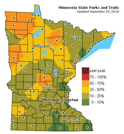
Fall Color Update
According to the MN DNR, we are well on our way in the fall color department with some 50% to 75% color being reported across parts of Central and Northwestern Minnesota. Keep in mind that the average peak for the Twin Cities is generally late September to mid October.
___________________________________________________
Hints of August Saturday. Storms develop late
I know the calendar says September, but it certainly doesn't feel like it. Other than a few dim fall colors, recent summertime soakers have kept most of us on our toes.
A recent headline from the National Weather Service stated that through mid September, Minneapolis has had its wettest year on record. So far, we're besting the wettest year on record (1911) by 1.25 inches!
Saturday starts off nice with sunshine and temperatures more reminiscent of August. A few strong storms develop in western Minnesota later today along a cool front that will push across the rest of the state through the evening hours. Heavy downpours will be possible. Go figure.
Sunday calls for lingering clouds and perhaps a few spits of rain, which will taper through early next week.
Sweaters and light coats return Monday as an Octoberish wind develops. High temperatures struggle to get to 60 degrees across northern Minnesota through Tuesday with lows possibly even dipping into the 30s in some of the normal cool spots.
Mother Nature is in no rush for Fall.
___________________________________________________
___________________________________________________
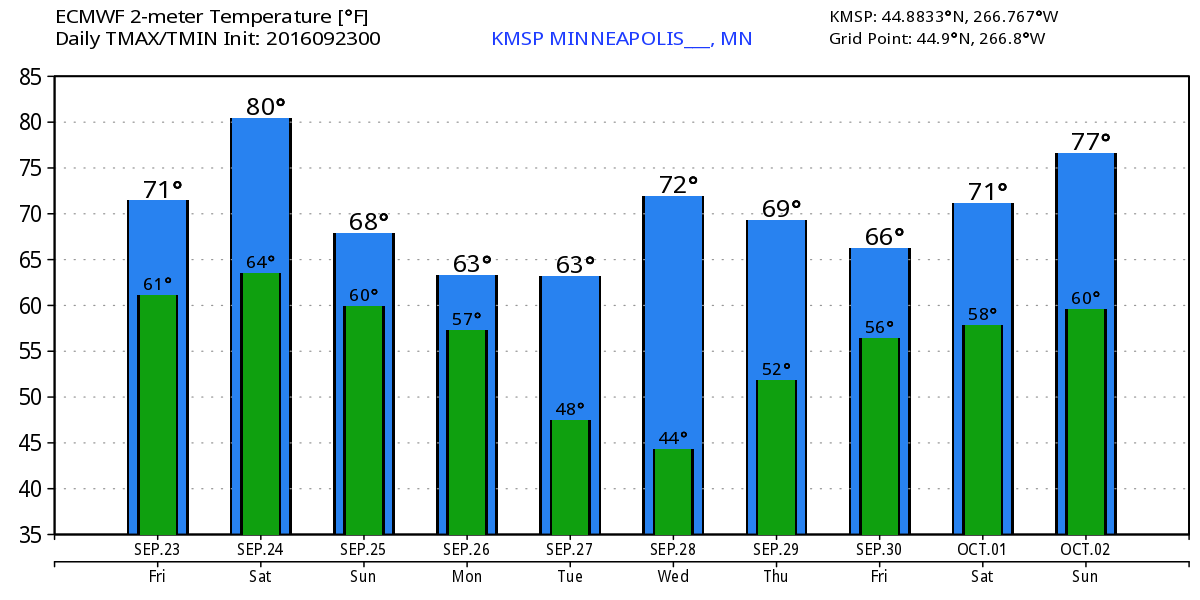
Extended Weather Outlook
FRIDAY NIGHT: Showers and storms end early. Winds: ESE 5-10. Low: 61
SATURDAY: Warmer. Clouds thicken with T-storms developing late. Winds: SE 10-15. High: 75
SATURDAY NIGHT: Scattered storms, locally heavy rain. Winds: SE 10. Low: 60
SUNDAY: Breezy. More PM clouds and a few spits of rain. Winds: WSW 10-20. High: 70
MONDAY: An Octoberish wind. Showers taper. Winds: NW 10-20. Wake-up: 51. High: 61
TUESDAY: Cool sunshine, not as breezy. Winds: NW 5-10. Wake-up: 49. High: 65
WEDNESDAY: Bright sunshine and warmer. Winds: S 5-10. Wake-up: 50. High: 73
THURSDAY: Dry start, stray t-storms overnight. Winds: SSE 5-10. Wake-up: 54. High: 74.
FRIDAY: Random rumble, otherwise mostly dry. Winds: SSE 5-10. Wake-up: 54. High: 74.
_______________________________
_______________________________
This Day in Weather History
September 24th
September 24th
1985: 0.4 inches of snow falls in the Minneapolis area.
1982: Tropical air moves north into Minnesota. The Twin Cities have a low of 71.
1869: Heavy rain dumps nearly 10 inches on the White Earth Reservation.
________________________________
________________________________
Average High/Low for Minneapolis
September 24th
September 24th
Average High: 68F (Record: 89F set in 1935)
Average Low: 49F (Record: 30F set in 1942)
_________________________________
Average Low: 49F (Record: 30F set in 1942)
_________________________________
Sunrise/Sunset Times for Minneapolis
September 24th
September 24th
Sunrise: 7:03am
Sunset: 7:06pm
Sunset: 7:06pm
*Daylight Lost Since Yesterday: ~3mins & 6sec
*Daylight Lost Since Summer Solstice: ~3hours and 35mins
__________________________________
*Daylight Lost Since Summer Solstice: ~3hours and 35mins
__________________________________
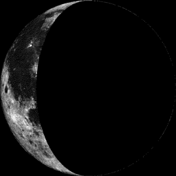
Moon Phase for September 24th
1.9 Days After Last Quarter
1.9 Days After Last Quarter
___________________________________
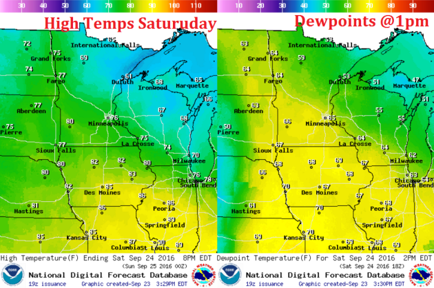
Weather Outlook Saturday
A warm front the kicked off showers and storms across central Minnesota on Friday will lift farther north on Saturday allowing warmer temperatures to settle in across the southern part of the state. Note that temperatures in southern Minnesota could sneak up close to 80F, while folks north of the warm front in northern Minnesota will be stuck in the 60s! Dewpoints will also creep up into the 'muggier' zone across southern Minnesota with some spots getting into the mid/upper 60s.
Weather Outlook Saturday
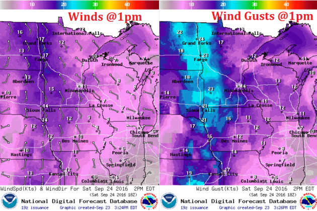
An approaching storm system will help to kick up a breezy southeasterly wind during the days. Winds look to be around 10-20mph with gusts approaching 25mph across western Minnesota.
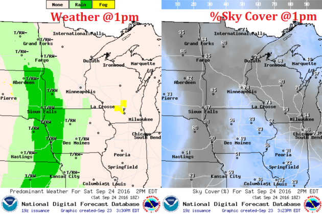
Weather Outlook Saturday
The storm system will generate a few strong storms along the cold front across the Minnesota/Dakotas border by the afternoon hours. This line of storms will then track across the rest of the state will locally heavy downpours through the rest of the evening/overnight time frame.
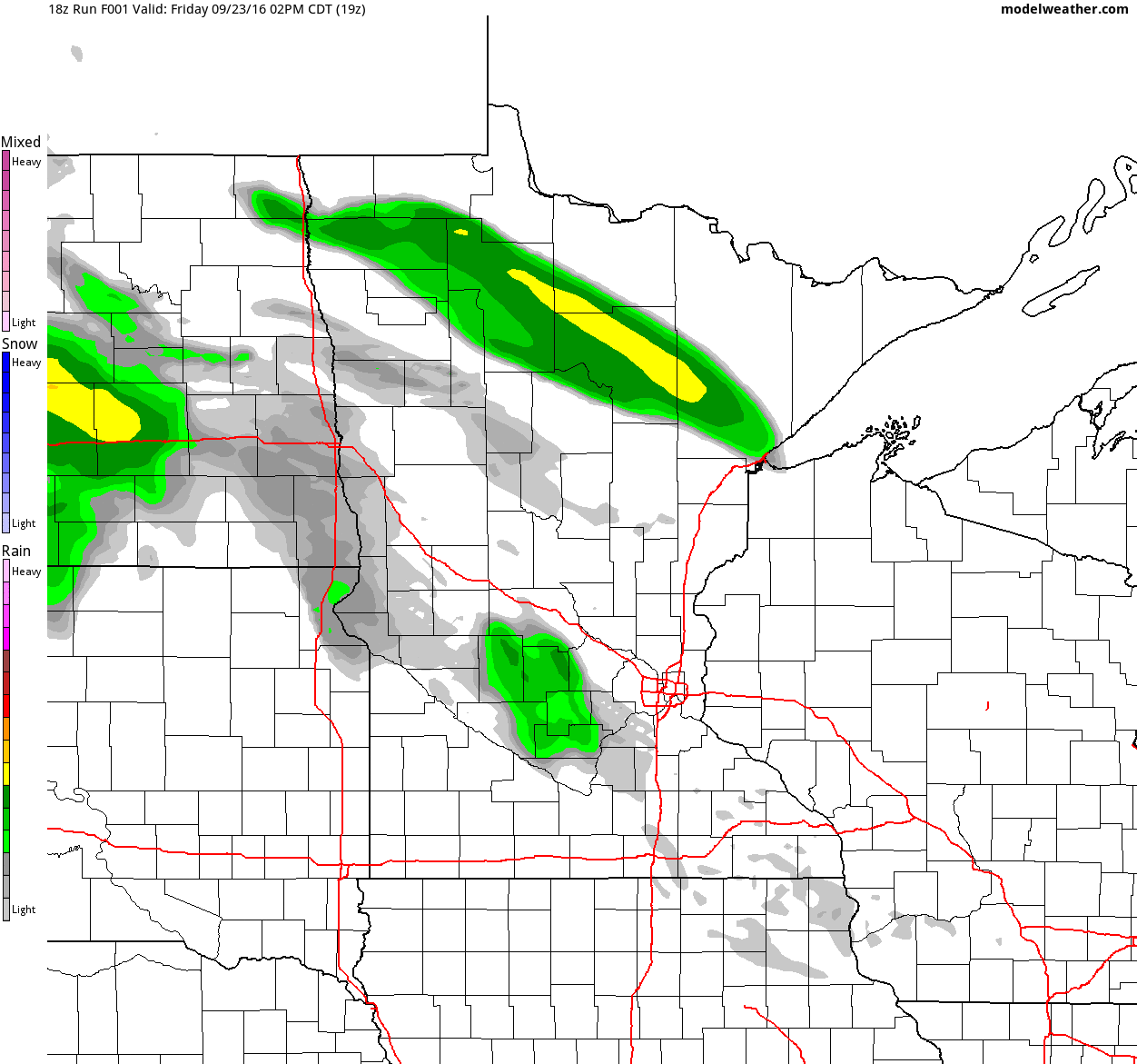
Simulated Radar
The simulated radar from PM Friday to Monday shows the band of precipitation that moved through central Minnesota on Friday moving northeast through early Saturday morning. We should have a nice break for much of the Saturday before our next line of storms pushes through late Saturday afternoon/evening. Some of the storms could be strong to severe across the eastern Dakotas and perhaps even into western Minnesota.
Rainfall Potential
Rainfall potential through PM Monday suggests another round of potentially heavy rain across central and eastern Minnesota as our next cold front sweeps through late Saturday. Keep in mind that the ground is extremely saturated, so any additional heavy rain could lead to more flash flooding.
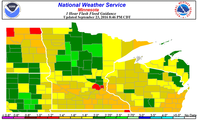
Flash Flood Guidance
According to NOAA's 1 hour flash flood guidance, it would only take about 1" of rainfall around the Twin Cities to create additional flash flooding.
__________________________________________
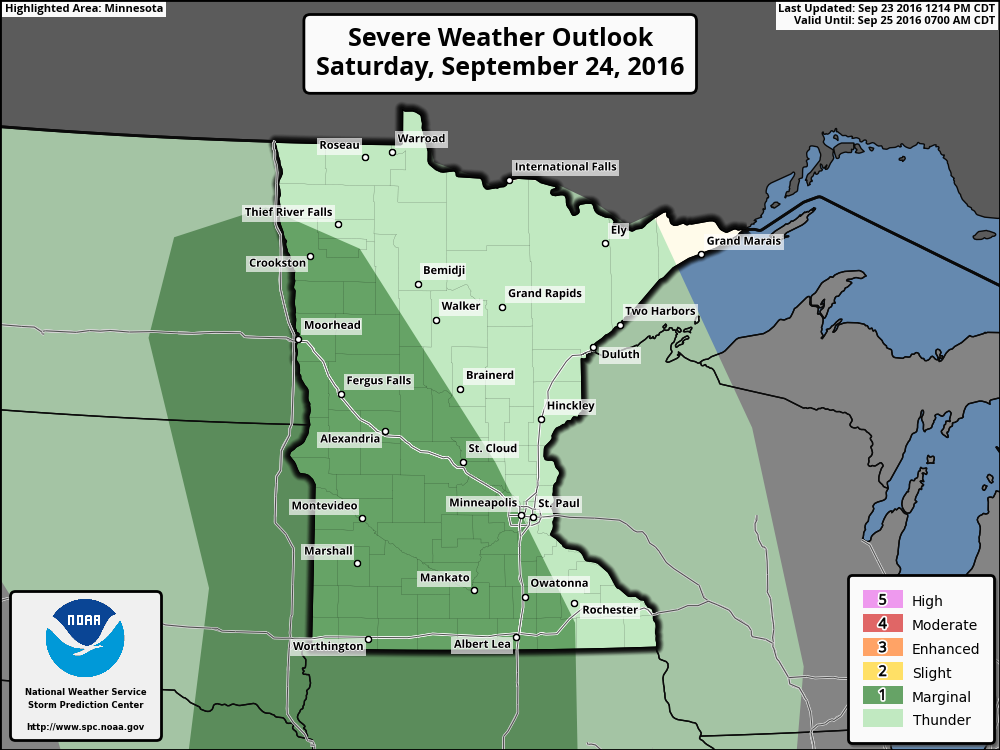
Severe Threat Saturday
...SOUTHERN PLAINS TO UPPER MISSISSIPPI VALLEY... LATEST SHORT-RANGE MODEL GUIDANCE SUGGESTS STRONG MID-LEVEL HEIGHT FALLS WILL DEVELOP ACROSS THE NRN HIGH PLAINS DURING THE DAY AS 60KT 500MB SPEED MAX LIFTS NNEWD ACROSS THE DAKOTAS. THIS FEATURE APPEARS TO BE EJECTED BY A SECONDARY DISTURBANCE THAT IS EXPECTED TO DIG INTO THE DESERT SW LATER SATURDAY. OVERALL...LARGE-SCALE HEIGHT FALLS ARE EXPECTED TO SPREAD ACROSS MUCH OF THE NRN/CNTRL PLAINS WHICH SHOULD ENCOURAGE FRONTAL CONVECTION MUCH OF THE PERIOD. AT SUNRISE SATURDAY MORNING...SCT CONVECTION MAY BE ONGOING ALONG THE FRONT ACROSS ERN NEB INTO THE ERN DAKOTAS...ALONG NOSE OF 40KT LLJ. THIS FRONTAL CONVECTION SHOULD GRADUALLY EXPAND IN AREAL COVERAGE ALONG THE WIND SHIFT AS DIURNAL HEATING CONTRIBUTES TO DESTABILIZATION IN THE ABSENCE OF MEANINGFUL INHIBITION. AT THIS TIME IT DOES NOT APPEAR THAT STRONG INSTABILITY WILL BE PRESENT FOR WIDESPREAD SEVERE THUNDERSTORMS AS BUOYANCY MAY BE BLED OFF EARLY IN THE CONVECTIVE CYCLE DUE TO THE ABSENCE OF A STRONGER CAP. EVEN SO...SUFFICIENT BULK SHEAR WILL EXIST FOR ORGANIZED MULTI-CELL STORMS AND PERHAPS ISOLATED SUPERCELLS WHERE BUOYANCY IS GREATER. LOCALLY DAMAGING WINDS AND MARGINALLY SEVERE HAIL ARE THE PRIMARY THREATS. ORGANIZED TSTMS MAY ADVANCE ACROSS THE UPPER MS VALLEY TOWARD THE MS RIVER BY LATE IN THE PERIOD AS THE COLD FRONT IS EXPECTED TO SURGE ACROSS MUCH OF MN/IA BY DAYBREAK SUNDAY.
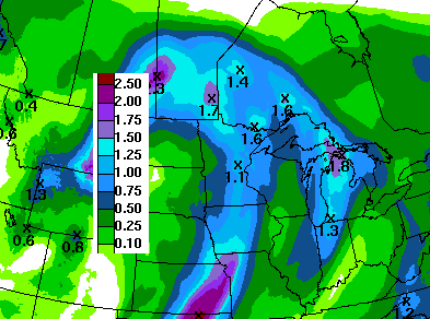
7 Day Rainfall Outlook
According to NOAA's HPC, the 7 day rainfall forecast through the end of next week suggests more heavy rain across parts of the Upper Midwest. Note that much of this rain would come on Saturday/Saturday night as the cold front plows through. Lingering light showers will stick around parts the Upper Midwest on Sunday and early next week.
Extended Weather Outlook
The extended temperature outlook over the next 10 days suggests a nice mild day on tap Saturday ahead of a cold front that will bring scattered thunderstorms to the region with locally heavy rain. Note how the temperatures dip to Octoberish levels early next week before leveling back off to near normal levels by next weekend.
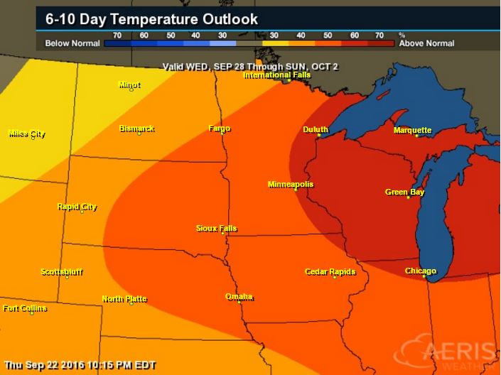
6 to 10 Day Temp Outlook
According to NOAA's Climate Prediction Center, warmer than average temperatures may sneak back into the Upper Midwest has we get closer to the end of the month/early part of October. However, next week looks a littler cooler and could require some longer sleeves, especially Monday and Tuesday!
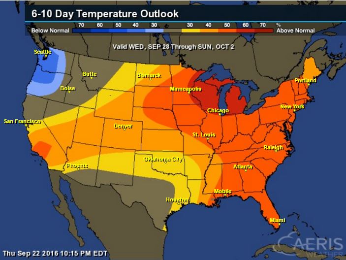
6 to 10 Day Temp Outlook
Here's the national temperature outlook from September 28th to October 2nd, which shows warmer than average conditions across much of the nation, especially across the eastern half of the nation.
__________________________________________
National Weather Outlook
This has been a notably wet week across the Upper Midwest with several bouts of heavy rainfall and significant flooding. Take a look at the next storm system as it moves through the central U.S.. Scattered showers and storms will develop from Minnesota to Texas on Saturday as a cold front sweeps east toward the Mississippi Valley. A cold breeze develops on the back side of the cold front, which will drop temps to below average levels through early next week.
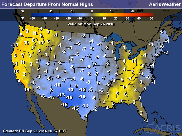
High Temperatures from Average Monday
In the wake of the cold front, temperatures will drop to 5F to near 20F below average in the Central U.S., especially across the Southern Plains. Temperatures on Monday will feel very reminiscent of October!
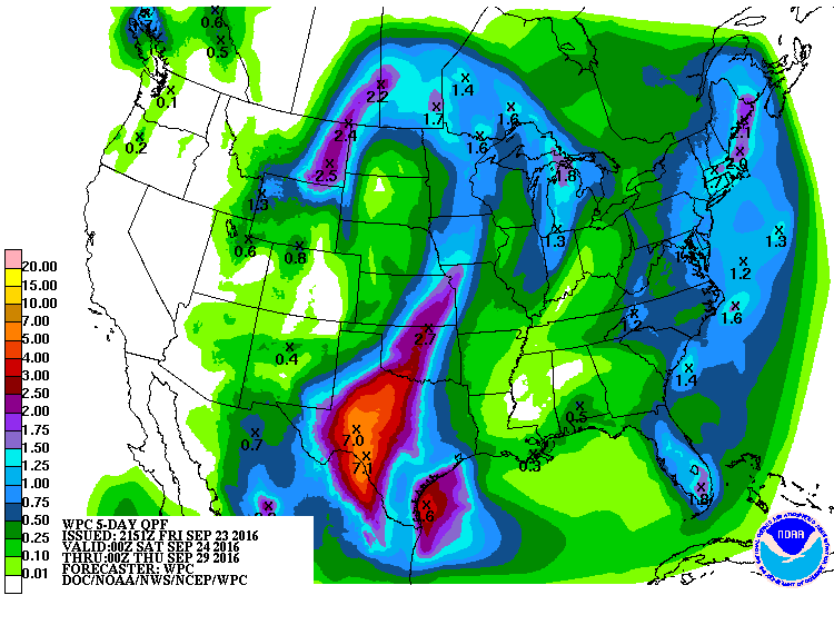
Precipitation Outlook
According to NOAA's WPC, the 5 day precipitation forecast shows more heavy rain potential across the Central U.S. once again. The heaviest will be found across the Southern Plains and Texas, where some 5" to 7" amounts can't be ruled out.
__________________________________________
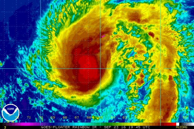
KARL
This was the view of Tropical Storm Karl from Friday evening. Karl regained tropical storm status after being downgraded to a depression earlier this week. The good news is that Karl poses no threat to the Lower 48, but brushed Bermuda with tropical weather conditions.
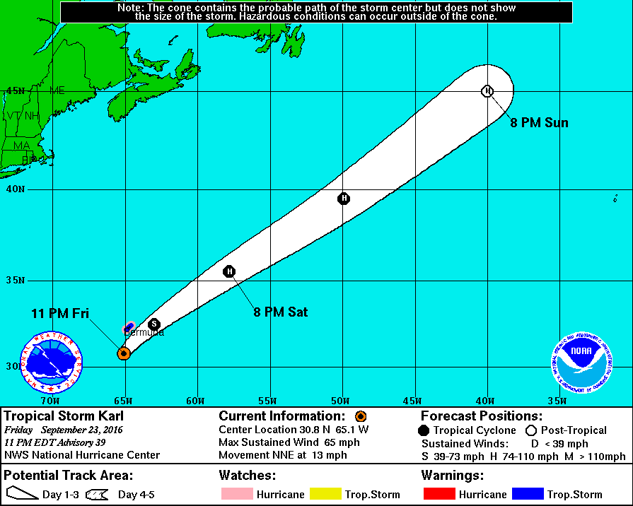
Tracking KARL in the Atlantic
After a close call with Bermuda on Friday night/early Saturday morning, Karl will track quickly off to the northeast and perhaps even become a hurricane in the north-central Atlantic this weekend.
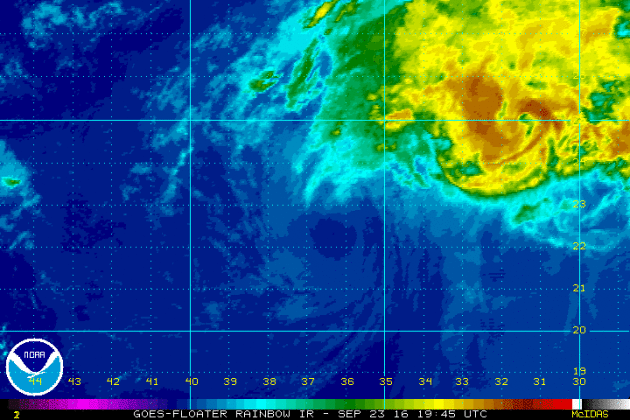
LISA in the Atlantic
As of PM Friday, Lisa was downgraded to a tropical depression. The infrared satellite loop below showed very few thunderstorms in association with Lisa as it continued to move north.
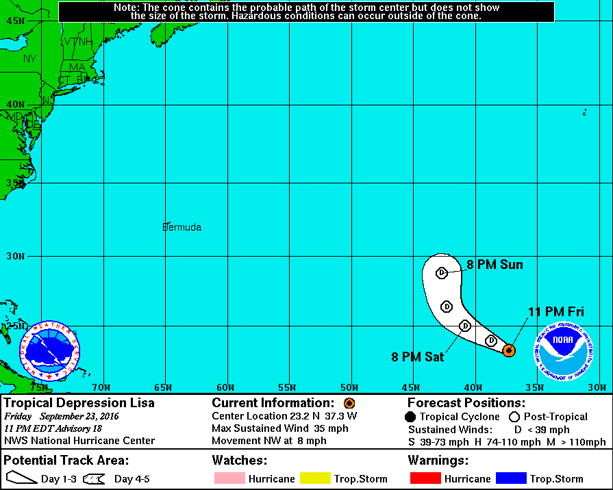
Tracking Lisa
Lisa was downgraded to a tropical depression and looks to remain a tropical depression through the weekend.
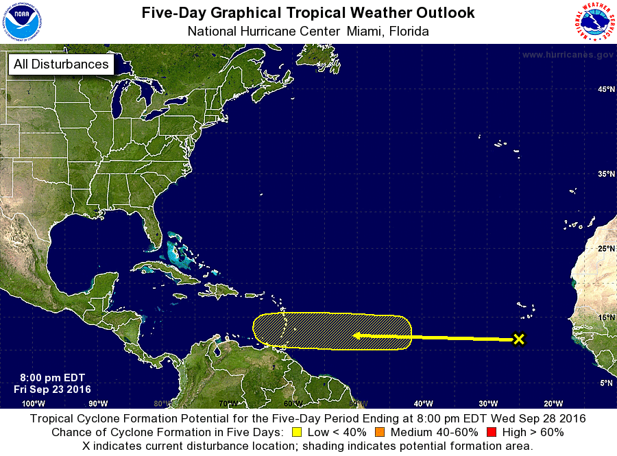
Atlantic 5 Day Outlook
According to NOAA's NHC, the 5 day outlook suggests a low chance of tropical formation with a wave of energy just west of the African coast. Note that the trajectory takes it into the Caribbean, so this may be a storm to watch... Stay tuned.
"Climate Change Threatens World’s Coffee Supply, Report Says"
"A report examining the many ways climate change threatens coffee and coffee farmers has alarmed people who are now imagining what it would be like getting through the day without their caffeine fix. The report, released this month by the Climate Institute, a nonprofit organization in Australia, was commissioned by Fairtrade Australia and New Zealand, the regional hub of the global Fairtrade system. Though it contains little new research, it has made waves by collating an array of available literature indicating that climate change will have a stark effect on the world’s coffee supply. The report emphasizes the threat warming temperatures pose to farmland, citing a study from the March 2015 issue of the journal Climatic Change that found climate change “will reduce the global area suitable for coffee by about 50 percent across emission scenarios.” In addition to the disappearing land on which to grow coffee, the report highlights the way warmer weather is exacerbating the threat of diseases like coffee rust and pests like the coffee berry borer, a type of beetle that a 2011 report said caused annual losses of hundreds of millions of dollars in coffee beans."
See more from the NYTimes.com HERE:

_____________________________________
Thanks for checking in and have a great end of the week and weekend ahead!
Don't forget to follow me on Twitter @TNelsonWX
Don't forget to follow me on Twitter @TNelsonWX

No comments:
Post a Comment