54 F. high in the Twin Cities Thursday, after waking up to
29 F.
58 F. average high on October 14.
59 F. high on October 14, 2015.
October 14, 1966:
An enormous hailstone crashes through the windshield of a truck near
Claremont in Dodge County. It was reported to be 16 inches in
circumference.
 La Nina Watch - When Will Growing Season End?
So
much for an end to mosquito and ragweed season. Most of Minnesota has
experienced fall's first frost, but not the close-in suburbs. KARE-11
reports 2016's growing season is now 22 days longer than average, to
date. Some communities could wind up with a growing season a MONTH
longer than average. Whatever 'average' is these days.
As much as I
enjoy our warming trend - on some subliminal level it's hard not to
mourn the slow calcification of winter. No, the snow, ice and cold isn't
what it used to be. These aren't your grandfather's winters.
NOAA
has reissued a La Nina Watch for the winter; colder water in the
Pacific may prevent the upcoming winter from being as toasty as last
year. It'll snow, we'll see a parade of cold fronts - but odds favor
another abbreviated, "compressed" winter.
We could hit 70F
Saturday - 80F not entirely out of the question
Monday before a cooler slap arrives by midweek. A stray shower may pop
on Saturday; again
Sunday PM.
Not perfect, but count your blessings. On this date in 1820 settlers at Fort Snelling were shoveling 11 inches of new snow.
Peaking Fall Color.
This may be the weekend to pile into the car and take a nice, long
drive. Maybe bring your "camera"? You remember cameras, don't you.
Before you could do everything but make toast on little, pocket-size
supercomputers called "smartphones"? The next 2 weekends bring peak
color around the metro. Source:
Minnesota DNR.
La Nina Watch. The on-again, off-again La Nina Watch is on again, according to
NOAA CPC,
calling for a cooling of Pacific Ocean water into the winter months.
Will this result in a colder, harsher winter for North America? It's
still too early to tell, but the way the trends are going I wouldn't bet
on it.
Temperatures Mellow into Monday.
Temperatures run well above average for the next 4-5 days before a
correction by the middle of next week. Suburbs and towns that haven't
yet experienced frost may remain frost-free through at least the end of
next week. ECMWF guidance: WeatherBell.
 Wild Winds - Soaking Rains
.
The Pacific Northwest was roughed up by hurricane force wind gusts
along the coast overnight; a series of storms may drop as much as 4-6"
of rain from Portland into Seattle in the coming days.
A Guide to Frost. Thanks to Aeris meteorologist Susie Martin for putting together a
great primer on frost; here's the intro: "
As
chilly temperatures begin to unfold, we often get to experience of one
of nature’s most beautiful phenomena: frost. Frost is also a defining
highlight of the Fall season. During the warm Summer months, we often
see dew covering the grass in the morning. However, when surface
temperatures hit freezing or below, we start to notice frost and there
are various types of frost that you may notice throughout the cold
weather season. This is due to a process called “deposition,” which is
when water vapor molecules turn from gas directly to a solid. Deposition
is the reason for the coating of ice we see during a chilly morning. We
put together this list to help you identify the type of frost you see
and perhaps generate an appreciation for the science behind what you’re
seeing!..." (Image: Wikipedia).
Hurricane Nicole.
Dangerous Category 4 Hurricane Nicole's eye passed just east of
Hamilton, Bermuda on Thursday, but the formidable storm provided a 1-2
punch of damaging winds and severe storm surge.
Animation credit: NOAA and AerisWeather AMP.
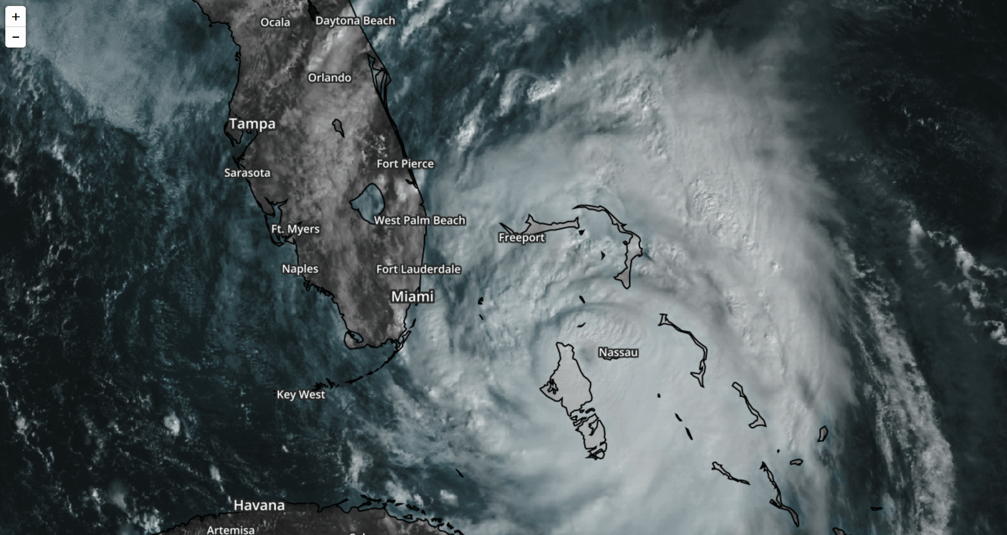 Hurricane Matthew Brought 1,000 Year Record Rainstorms to North Carolina
.
This would be the 6th thousand-year flood to strike the USA since
October of 2015 (Texas, South Carolina, West Virginia, Maryland,
Louisiana - now North Carolina). Here's an excerpt from
Pacific Standard: "
The
storm swept in by Hurricane Matthew has produced rainfall that exceeds
the level expected about once every 1,000 years, according to a statistical analysis
using National Oceanic and Atmospheric Administration data. Matthew
broke numerous rainfall records in some of North Carolina’s toughest-hit
towns, marking another spike in this year’s extreme weather. The new
rainfall records were enabled by warming in the ocean and coastal atmospheres, which hold more water as temperatures increase — with a few cities across the Southeast reporting record levels of air moisture during the storm..." (October 6 file image: NOAA and AerisWeather).
Hurricane Matthew Was Deceptively Powerful. Here's an excerpt from
NexusMedia that got my attention: "...
Even
a mild-mannered Category 1 or 2 hurricane can prove catastrophic if it
produces enough rain. Hurricane Matthew dumped 18 inches on parts of
North Carolina — more rain than Louisiana and Mississippi saw during Hurricane Katrina. Floods in the Tar Heel State destroyed 7,000 homes.
More than 2,000 people needed to be rescued. Time and again, we see
that water — not wind — wreaks the greatest havoc during severe storms.
Just ask New York. Hurricane Sandy registered as a Category 1 storm, but
it proved the second-costliest
hurricane in U.S. history. Hurricane Matthew followed a similar
pattern, prompting weather experts to criticize the wind-based system of
classification..." (Image credit: NOAA).
Hurricane Matthew: Before and After.
NOAA's National Ocean Service has the story and interactive graphics: "
From October 7-10, 2016, the National Geodetic Survey (NGS) collected damage assessment imagery for more than 1,200 square miles in the aftermath of Hurricane Matthew. The aerial imagery was collected in specific areas identified by FEMA and the National Weather Service.
Select the round icon with directional arrows using your mouse (or your
finger) and slide back and forth to view a "before and after"
comparison. "Before" images are provided by Mapbox, Digital Globe, and OpenStreeMap; "After" images were captured by NOAA's National Geodetic Survey in the aftermath of Hurricane Matthew..."
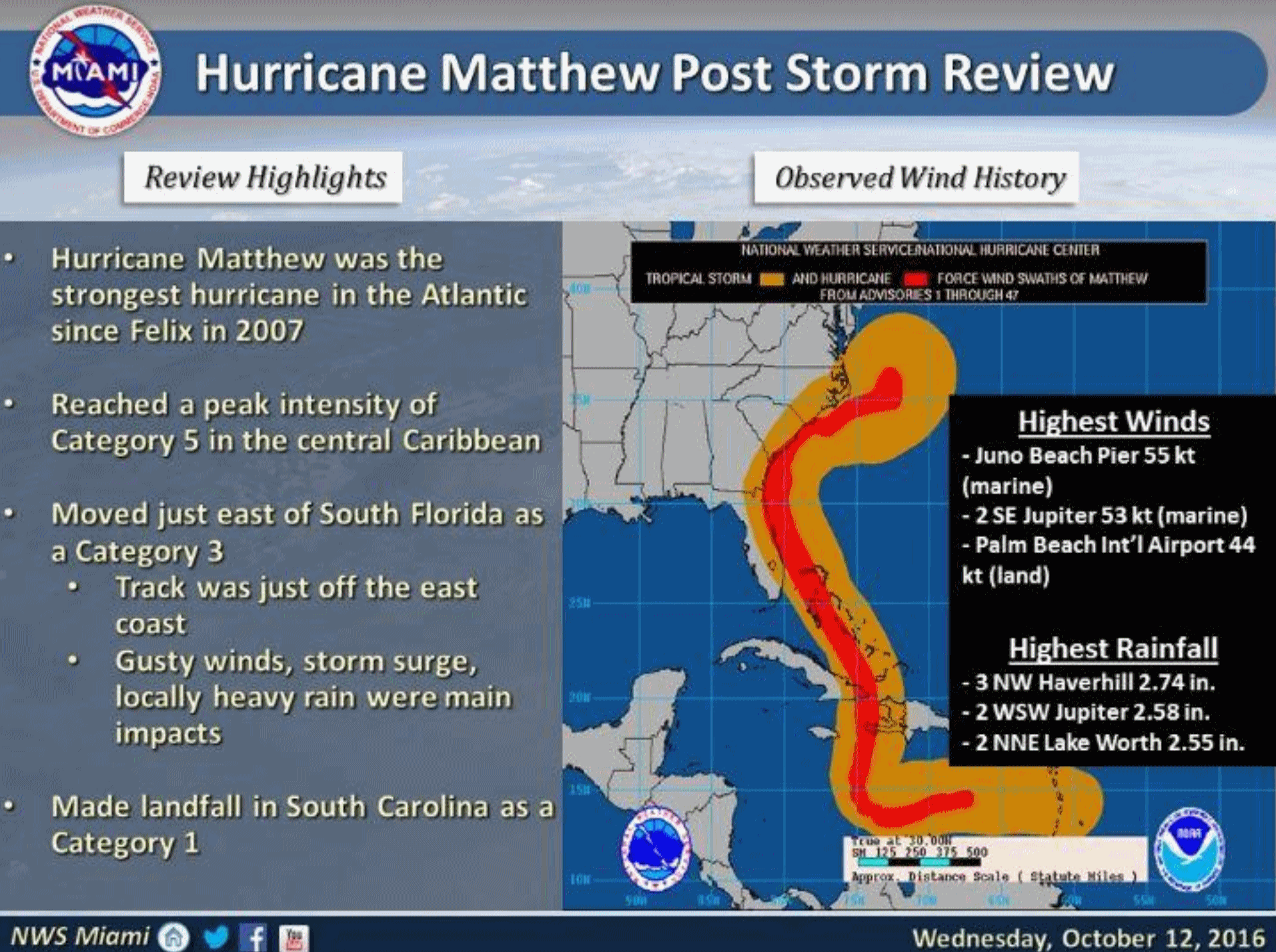 Horrific Rains and Ocean Surge: Hurricane Matthew By The Numbers
. Here's a clip from The Washington Post
Capital Weather Gang: "...
In
the United States, record-setting amounts of rain have inflicted the
greatest amount of hardship, with the Tarheel state at ground zero. 15 inches of rain in eastern North Carolina has resulted in catastrophic inundation. Emergency officials have conducted 2,000 rescues of people stranded in high water in North Carolina alone. Nearly half of the state’s 100 counties were in a state of emergency, and 52 shelters housed more than 4,300 displaced people. Lumber River in North Carolina reached a record 24 feet above its usual level, while the Tar River at Rocky Mount crested seven feet above flood stage..."
Hurricane Matthew's Water Footprint. Here's a link to an amazing interactive web site from
USGS: "
Hurricane
Matthew approached the southeastern U.S. coast on October 7, 2016. In
the map above, the hurricane’s impact on precipitation and streamflow
are shown. Normalized discharge (cubic feet per second) at US Geological
Survey gaging stations within ~150 km of the eye of the hurricane is
shown in the right panel. Variation in the shape of the hydrographs
(right panel) is due to stream size, storm-surge, reservoir closures,
and other local conditions, which can impact the effect of precipitation
on flow. Gages shown do not include the US Geological Survey Short-Term
Network gages deployed to capture more detailed effects of the
hurricane."
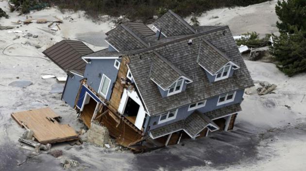
New York Is Going To Get A Lot More Hurricanes Like Sandy. The incidence of major flooding in New York has tripled since 1800 - the trends are troubling. Here's a clip from a story at Pacific Standard: "...When Hurricane Sandy
reached the Mid-Atlantic four years ago, it brought with it some of the
most severe flooding the region has ever seen. It also took a financial
toll, with damages totaling more than $71 billion—second only to
Hurricane Katrina among damage in the United States. And here comes more
bad news: Researchers report
that New York City is likely to get hit by many more floods on par with
Sandy in the future. “[T]he frequency of Hurricane Sandy-like extreme
flood events has increased significantly over the past two centuries and
is very likely to increase more sharply over the 21st century, due to
the compound effects of sea level rise and storm climatology change,” Ning Lin, an assistant professor of civil and environmental engineering at Princeton University, and her colleagues write today in Proceedings of the National Academy of Sciences..." (File image: Mike Groll, AP).
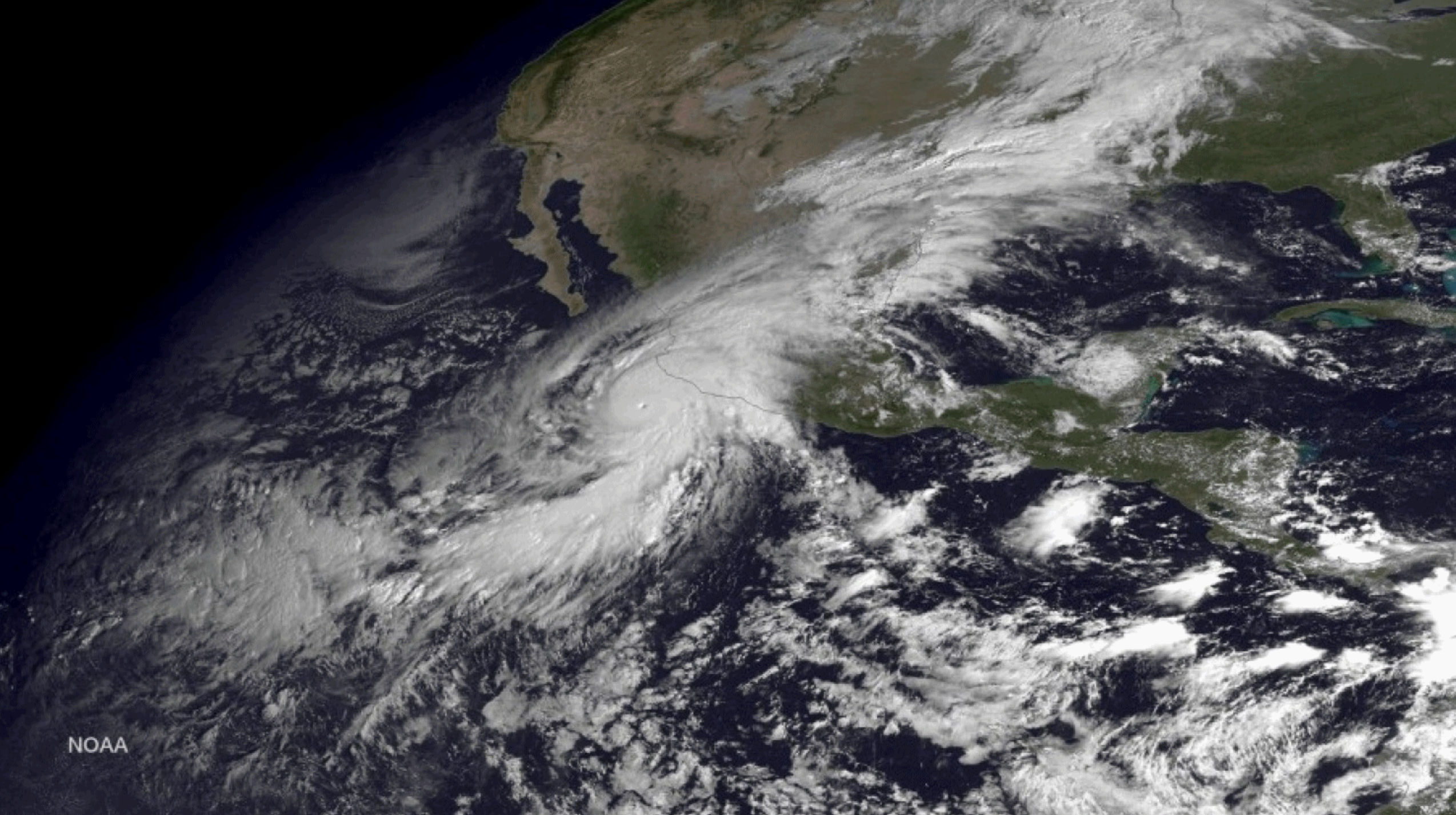
This Is How You Create a Record-Breaking Hurricane.
Little or no wind shear aloft and a deep layer of unusually warm water
creates conditions for a super-storm. Here's an excerpt from Chris
Mooney at
The Washington Post: "
It may very well be the strongest hurricane,
for wind speeds, that human beings have ever been able to measure. In
October of last year, Hurricane Patricia spun up south of Mexico and
briefly attained a wind speed intensity of 185 knots, or 213 miles per
hour, on Oc. 23, based on an analysis by the U.S. National Hurricane Center. As I wrote earlier this year,
there is one hurricane in the record books (a typhoon, actually) that
was also claimed to have had winds of 185 knots, but that was back in
the 1960s when researchers are no longer fully confident in the way wind
speeds were estimated..."
Image credit: "
A
satellite image from October 2015 shows Hurricane Patricia (L) as it
approaches the coastline of Mexico from the Eastern Pacific." (EPA/NOAA).
How To Reduce Risks from Mega-Storms.
Deutsche Welle has the story: "
Climate
change is increasing storm frequency and intensity, while sea level
rise has made storm surge more dangerous. What solutions exist for
reducing the risk of disaster? Hurricane Matthew provides recent
lessons. "Hurricane Matthew has been a surprise for the disaster risk
community," Reimund Schwarze, chairman of the Scientific Advisory Board
for the German Committee for Disaster Reduction (DKKV) told DW. This
bitter surprise has left some 2 million people affected in Haiti alone.
Cropland and homes have been ravaged, potable water is barely available, children cannot go to school and cholera is spreading quickly in affected areas..."
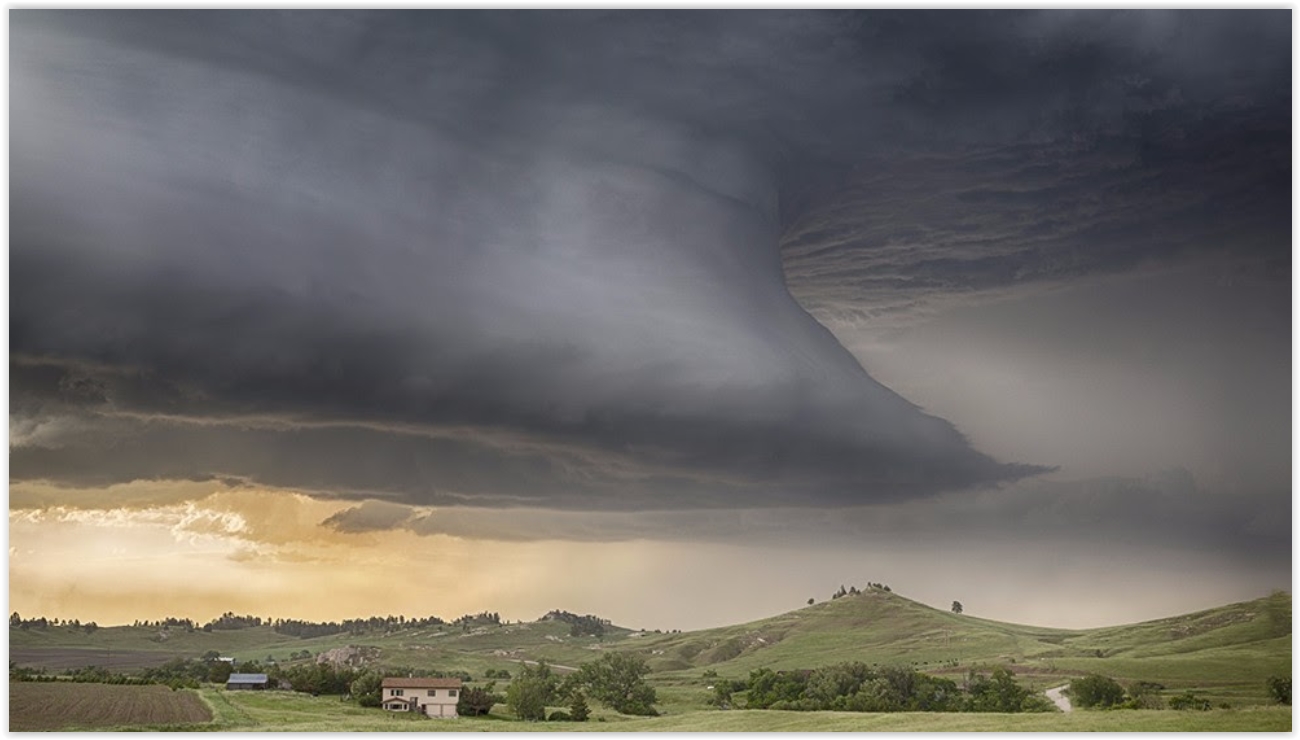 Wind Patterns In The Lowest Layers of Supercell Storms Key Tornadoes
. Here's an excerpt of an interesting press release at
EurekAlert! Science News: "...
We
noticed that the biggest difference between tornadic and nontornadic
storms was the wind in the lowest 500 meters near the storm," Coffer
says. "Specifically, it was the difference in the way the air rotated
into the storm in the updraft." All storms have an updraft, in which air
is drawn upward into the storm, feeding it. In supercells, the rising
air also rotates due to wind shear, which is how much the wind changes
in speed and direction as you go higher in the atmosphere. Coffer's
simulations demonstrated that if wind shear conditions are right in the
lowest 500 meters, then the air entering the updraft spirals like a
perfectly thrown football. This leads to a supercell that is configured
to be particularly favorable for producing a tornado, as broad rotation
at the ground is stretched by the updraft's lift, increasing the speed
of the spin and resulting in a tornado..."
File photo credit: Caryn Hill.
Minnesota Regulators Set to Decide Sherco's Future.
Midwest Energy News has details: "
Minnesota
regulators appear set today to approve a 15-year plan by Xcel Energy
that will close two of state’s biggest coal-burning units and develop a
large portfolio of renewable energy. The plan calls for Xcel to retire
1,500 megawatts (MW) of coal at Sherburne County Generating Station,
better known as Sherco, while adding 1,800 MW of wind and 1,400 MW of
solar by 2030, according to a staff report from the Minnesota Public Utility Commission..."
Clean Power Just Turned Back the Clock on Global Warming Gases. Here's an excerpt from
Bloomberg: "
It looks as if all those wind and solar farms in the U.S. are making a dent in greenhouse gases that cause global warming.
During the first six months of the year, carbon dioxide emissions from
America’s energy industry dropped to the lowest point since 1991,
according to a statement
Wednesday from the U.S. Energy Information Administration. That’s in
part because warmer-than-average temperatures in the first quarter
prompted fewer people to crank up their thermostats, lowering energy
consumption. It’s also because clean energy installations increased 9
percent during the first half compared to a year earlier, reducing the
need for power generated by burning coal and natural gas..."
World's Largest Solar Project Would Generate Electricity 24 Hours a Day, Power 1 Million U.S. Home. Here's a clip from
EcoWatch: "
The race to build the world's largest solar power plant is heating up. California-based energy company SolarReserve announced plans for a massive concentrated solar power (CSP) plant in Nevada that claims to be the largest of its kind once built. SolarReserve CEO Kevin Smith told the Las Vegas Review-Journal
that the $5 billion endeavor would generate between 1,500 and 2,000
megawatts of power, enough to power about 1 million homes. That amount
of power is as much as a nuclear power plant, or the 2,000-megawatt Hoover Dam and far bigger than any other existing solar facility on Earth, the Review-Journal pointed out..."
Photo credit: "
The
110 MW Crescent Dunes Solar Energy Plant near Tonopah, Nevada was the
first utility-scale facility in the world to feature advanced molten
salt power tower technology. The developer wants to build 10 more of
these at an undisclosed location in Nevada." SolarReserve.
Cities Could See $45 Billion in Benefits from Electric, Shared and Autonomous Cars.
Greentech Media has the details: "
Vehicles
and the ways they are used are expected to change more over the next
two decades than in the last 100 years, propelled by the new mobility
trends of vehicle electrification, shared mobility and autonomous
driving. Additional factors, such as access to public transit, air
quality concerns, urbanization and the decentralization of the energy
system are also triggering changes in the mobility sector. A new report
from Bloomberg New Energy Finance and McKinsey & Company examines
the effects these trends and new technologies will have on transport in
50 of the world’s cities, representing some 500 million people. The
report lays out three possible trajectories for the future of mobility
in metropolitan areas..." (Image credit:
Venngage).
Why Insurance Companies Want to Subsidize Your Smart Home. Here's the intro to a story at
MIT Technology Review: "
Insurers such
USAA and American Family have lately begun offering to strike a
high-tech bargain: wire your home with Internet-connected devices such
as a new thermostat, and get a discount on your home insurance policy in
return. Offers like that could speed up the adoption of smart gadgets,
revamp the insurance business, and transform how we manage our homes. In
the future, your insurer might call a plumber before a pipe bursts, for
example. But the data needed to help prevent leaks or burglaries will
also introduce new risks, such as vulnerabilities to data loss or
ransomware..."
Image credit:
arizonaehomes.com.
TODAY: Sunny, windy, milder. Winds: S 15-30. High: 67
FRIDAY NIGHT: Partly cloudy and dry. Unusually mild for mid-October. Low: 61
SATURDAY: Clouds increase, stray shower possible late. Winds: SW 10-15. High: 72
SUNDAY: Dry start, then few PM showers. Winds: SE 10-15. Wake-up: 54. High: 64
MONDAY: Some sun, windy and warmer. Winds: SE 10-20. Wake-up: 56. High: 78
TUESDAY: Mostly cloudy, windy and cooler. Winds: NW 15-25. Wake-up: 54. High: 58
WEDNESDAY: Intervals of cool sunshine. Winds: W 8-13. Wake-up: 40. High: 54
THURSDAY: Frosty start in the 'burbs. Some sunshine. Winds: NW 7-12. Wake-up: 37. High: 53
Climate Stories....
Here's Why Many Young Voters See Climate Change as THE Issue in 2016. Public Radio International has the story: "...
Climate change has intensified the drought in California, which has left many wells in California’s agricultural Central Valley without water.
Communities vulnerable to flooding have the opposite problem, as we saw
in Louisiana last month when 7.1 trillion gallons of rain fell in one
week. Worldwide, average temperature records are broken month after
month, with increasingly adverse effects the world over. And rising sea
levels are already causing more destructive and dangerous storm surges,
as we witnessed with Hurricane Matthew last week. Climate change will
affect my career, my family, my community, my everything. For my
generation, millennials, it is so much more than the “environmental”
issue previous generations understood it to be..."
Photo credit: "
Michaela
Sumpter and Cameron Wiltz, 3, evacuate the Forestwood Apartments in the
Olde Towne area after Hurricane Isaac passed through Slidell,
Louisiana, August 30, 2012."
Credit: Michael Spooneybarger/Reuters.
The "Climate Change Election" That Never Came. Here's an excerpt from
New Republic: "...
But there may also be a deeper, psychological reason for the short shrift given to climate change.
“It’s human nature to prioritize immediate problems over future
problems,” said Rebecca Leber, an editor at Grist. “Politicians often
frame climate change as a future problem, and of course it rates lower
on your priorities if you think it’s something that doesn’t need to
immediately be addressed.” And when climate change is framed as an
immediate problem by politicians and journalists alike, it’s often by
linking it—sometimes spuriously—to headline-grabbing natural disasters such as hurricanes and floods..."
Coffee and Climate Change: In Brazil, A Disaster is Brewing. Not the coffee. Anything but the coffee, please! Here's an excerpt from
NPR: "
Coffee lovers, alert! A new report
says that the world's coffee supply may be in danger owing to climate
change. In the world's biggest coffee-producing nation, Brazil, the
effects of warming temperatures are already being felt in some
communities. You can see the effects in places like Naygney Assu's farm,
tucked on a quiet hillside in Espirito Santo state in eastern Brazil.
Walking over his coffee field is a noisy experience, because it's
desiccated. The leaves from the plants are curled up all over the floor,
in rust-colored piles. The plants themselves are completely denuded..."
The Collapse of Arctic Sea Ice. Here's an excerpt from a
Greg Laden post: "...
This
is ice VOLUME, not the oft cited surface area. Surface ice will always
reform and melt in the Arctic, but long term there used to be a lot of
thick ice that never melted during the summer. This long term thick ice
would survive the summer melt, and allow new winter time surface ice to
form more easily each year. As that ice disappears from various coastal
areas in the high Arctic, new winter surface ice takes longer to get
going..."
Greenland Is Melting From Above and Below - And Scientists Say They're Connected. Here's an excerpt at
The Washington Post: "...
As
a result, what is coming into focus is that there appears to be a
crucial interaction between ice melting on an ice sheet’s surface,
forming into pools and lakes, and ice falling directly into the ocean
where glaciers, extending out from the ice sheet’s center, terminate in
often extremely deep waters. But precisely how they work together — and
how much they could speed Greenland’s melt — is only beginning to reveal
itself. Two recent studies
in Geophysical Research Letters each home in on different aspects of
this linkage. And they do so by studying two apparently connected
phenomena: The formation of sometimes vast lakes of meltwater on the ice
sheet’s surface, and the release of huge “plumes” of meltwater beneath
outlet glaciers that themselves are mostly submerged in the ocean..."
Photo credit: "
A
crew sets out to retrieve a measurement device in a Greenland fjord and
passes by a small hanging glacier on its side wall that is unleashing a
stream of water into the ocean." (Dustin Carroll)
Why Climate Change Divides Us. The Christian Science Monitor reports: "...
Polls
show that the partisan divide is wider on climate change than any other
issue. In 2001, the gap between Republicans and Democrats on whether
climate change is real and human-caused was 17 percentage points. This
year, the gap stands at 41 points. Just 43 percent of Republicans now
believe climate change is human-caused, compared with 53 percent back
then. What has happened? How has public opinion become more fractured
even as scientists have moved toward consensus? Views of science play a
role, as does the willingness to take an economic hit to affect the
global temperature a degree or two. But Colorado shows how the divide on
climate has become as tribal as politics itself..." (File image: Shutterstock).
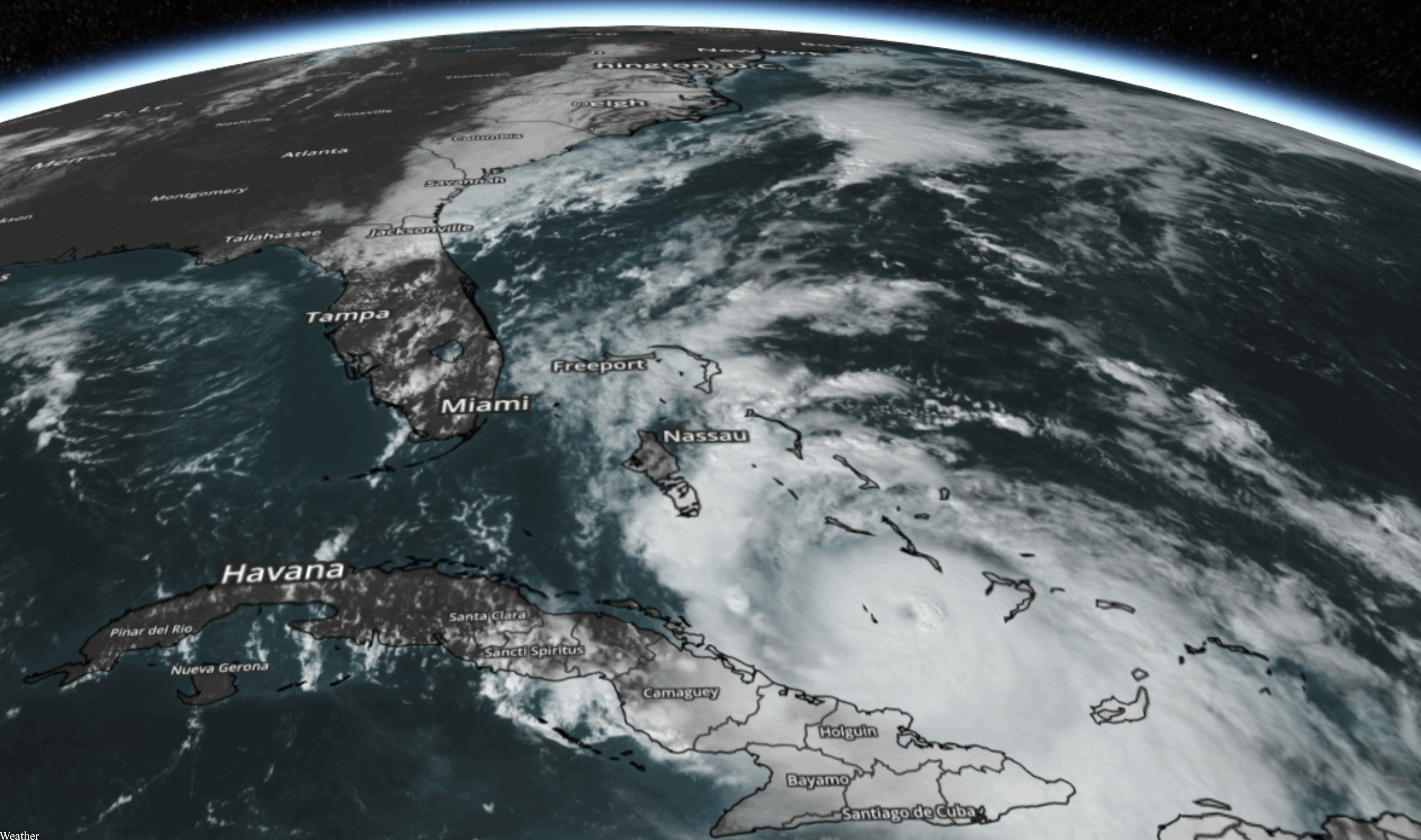 Did Climate Change Turbocharge Hurricane Matthew?
 You could certainly make the case, especially for Haiti and Cuba. here's an excerpt from
Climate Signals: "...
Unusually
warm seas also fueled Matthew's rapid intensification and sustained the
hurricane which broke the record for maintaining Cat 4/5 strength in
October. Matthew first spun up into a hurricane on September 29, surging
from a tropical storm into a Category 5 hurricane in just 36 hours, a
stunning development consistent with the observed trend toward rapidly
intensifying tropical cyclones..." (October 5 file image: NOAA and AerisWeather).
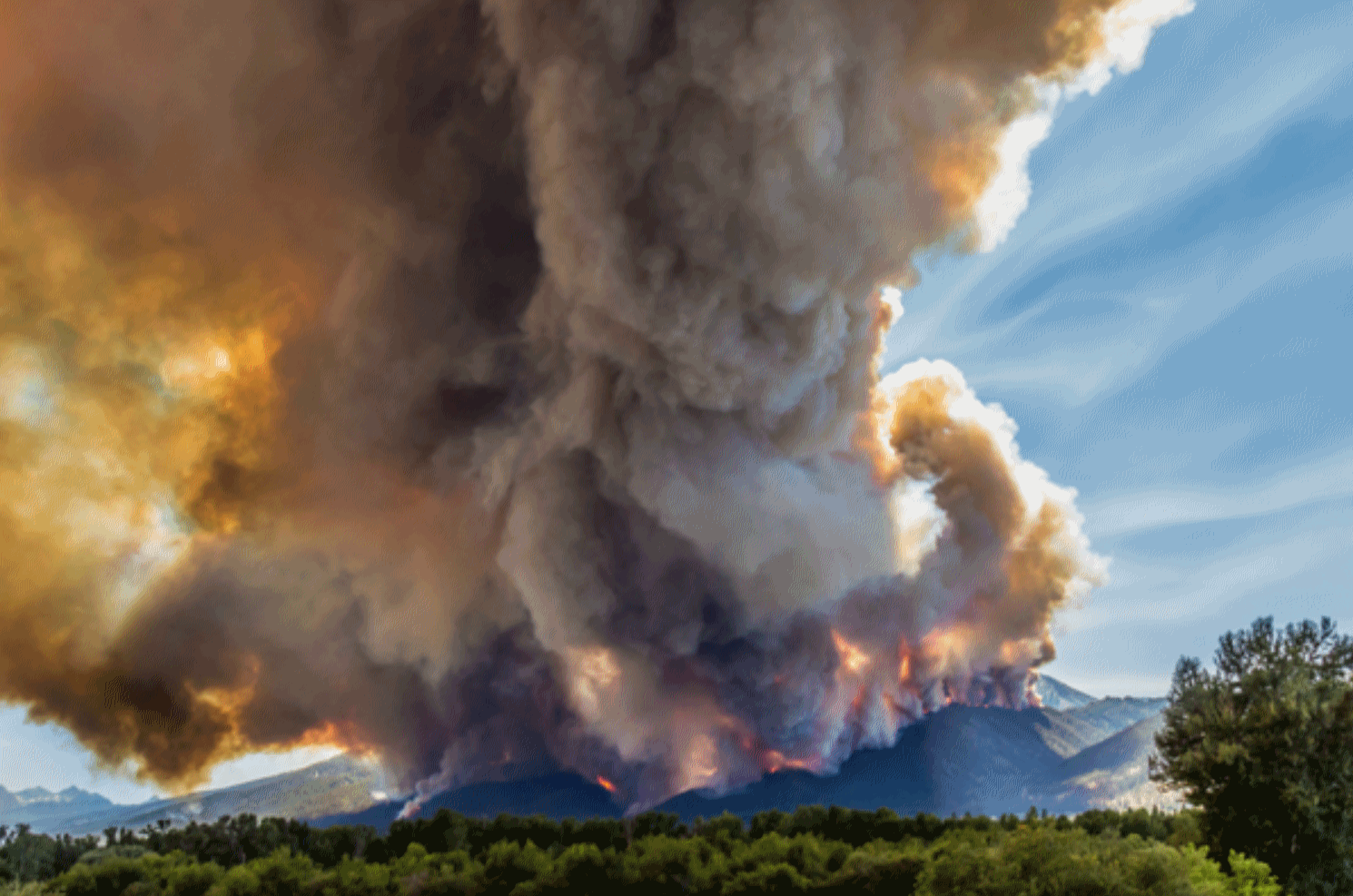 Climate Studies: New York City Flood Risk Will Triple, Western Wildfires Have Doubled
. Here's the intro to a summary at
Christian Science Monitor: "
Expect
more natural disasters as climate change goes unchecked, say
scientists. Already wildfires across the Western United States have doubled during the past three decades
as a result of human-induced climate change, according to a study
published Monday in the journal Proceedings of the National Academy of
Sciences. And that study coincides with another published in the same
journal predicting more dramatic flooding with rising global
temperatures..."
Photo credit: "
In July and
August, the Roaring Lion fire devoured more than 8,000 acres of forest,
along with over 60 homes and outbuildings in eastern Montana's
Bitterroot Range. Here, the fire burns through dense conifers, July 31,
2016.
" Courtesy of Mike Daniels/Columbia University.



No comments:
Post a Comment