50 F. high temperature in St. Cloud Thursday.
38 F. average high on November 17.
51 F. high on November 17, 2015.
November 18, 1979: A heat wave continues in Southwest Minnesota. The temperature hits 70 degrees at Browns Valley.
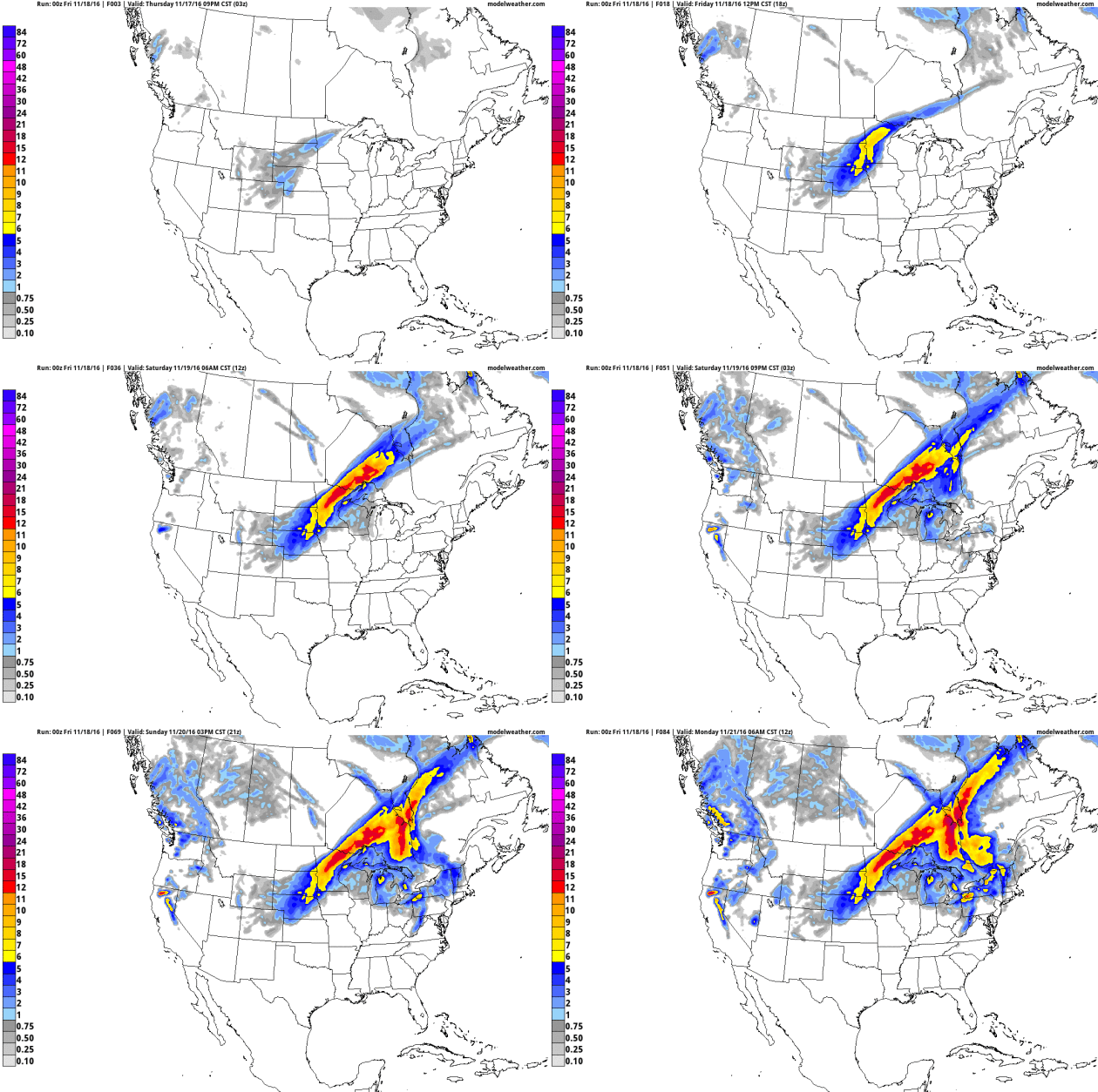
Slushy Possibilities - Blizzard Potential West of MSP
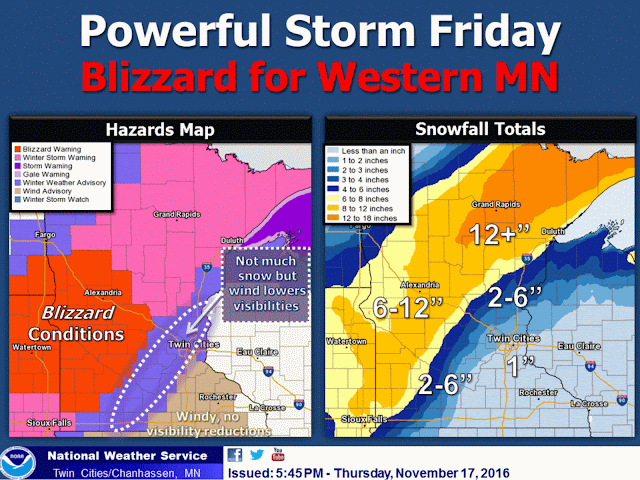
Maybe if I put the parka on over my shorts I'll be OK? Wednesday's 60-degree warmth seems like a meteorological mirage. Blame a low sun angle. The northern hemisphere has caught a cold - the first real sneeze of Canadian air spinning up an intense storm today.
A tight pressure gradient causes air to accelerate into a partial vacuum (the center of low pressure) at speeds as high as 50-55 mph over western Minnesota, creating white-out conditions. I'd think twice about driving toward the Dakotas, unless you're a fan of white-knuckle driving.
The axis of heaviest snow, 8-12 inches or more, runs from Windom to Wadena to Walker - into the Minnesota Arrowhead. ECMWF guidance prints out 5-10" inches or so for St. Cloud, Brainerd and Duluth; maybe a sloppy inch or two for the Twin Cities, where snow will melt on contact until late afternoon today. Consider this payback for the warmest start to November on record, statewide.
Skies clear over the weekend with a little rain next Tuesday, but dry weather on Thanksgiving with highs in the low 40s.
That's "average" for late November, remember?
A BLIZZARD WARNING IS IN EFFECT FRIDAY FOR MUCH OF WEST CENTRAL MINNESOTA...MAINLY WEST OF REDWOOD FALLS TO WILLMAR AND ALEXANDRIA. THIS AREA WILL SEE THE DEVELOPMENT OF BLIZZARD CONDITIONS FRIDAY MORNING AS NORTHWEST WINDS OF 30 TO 40 MPH WITH GUSTS T0 50 MPH COMBINE WITH HEAVY SNOW. THIS WILL CAUSE CONSIDERABLE BLOWING SNOW AND WHITEOUT CONDITIONS WITH TRAVEL
BECOMING VERY DIFFICULT OR IMPOSSIBLE ACROSS WEST CENTRAL MINNESOTA.

TO THE EAST OF THE BLIZZARD AREA...WINTER STORM WARNINGS AND ADVISORIES ARE IN EFFECT WHERE WINDS ARE NOT EXPECTED TO BE QUITE AS STRONG AND SNOW AMOUNTS WILL BE LESSER. THE WINTER STORM WARNING INCLUDES AREAS NEAR ST CLOUD...LITTLE FALLS...AND LONG PRAIRIE. THE WINTER WEATHER ADVISORY IS IN EFFECT FOR MUCH OF
SOUTH CENTRAL AND EAST CENTRAL MINNESOTA...INCLUDING THE MAJORITY OF THE TWIN CITIES METRO AREA AND MANKATO.

RAIN WILL CHANGE TO SNOW ACROSS WESTERN MINNESOTA BY EARLY FRIDAY MORNING AND BECOME HEAVY AT TIMES INTO EARLY AFTERNOON BEFORE TAPERING OFF BY EVENING. ACROSS CENTRAL AND EASTERN MINNESOTA RAIN WILL CHANGE TO SNOW FRIDAY AFTERNOON. SNOW ACCUMULATIONS OF 6 TO 12 INCHES ARE EXPECTED WEST OF A LINE FROM REDWOOD FALLS TO ST CLOUD AND LAKE MILLE LACS WITH THE HEAVIEST AMOUNTS OVER DOUGLAS...TODD...AND MORRISON CONTINUES. AMOUNTS WILL TAPER OFF
QUICKLY TO THE EAST...WITH AROUND ONE INCH EXPECTED IN EASTERN PARTS OF THE ADVISORY AREA INCLUDING THE TWIN CITIES METRO.
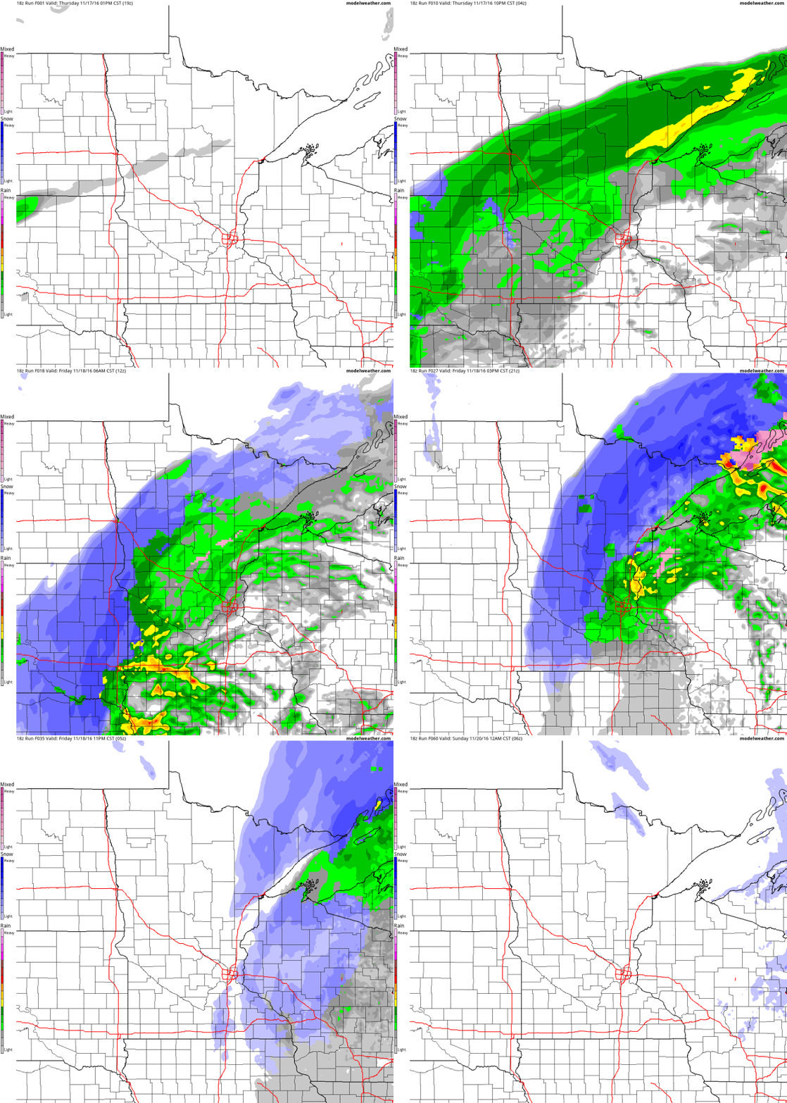
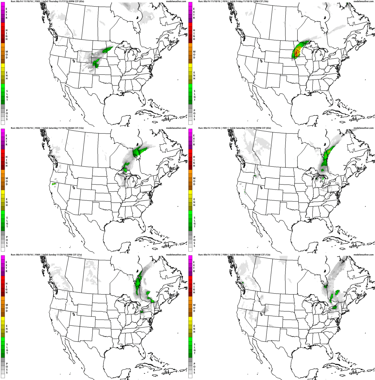
Thanksgiving Day: GFS. NOAA's GFS model is predicting a cold rain for much of New England next Thursday with snow showers for upstate New York and the mountains of northwest Colorado. The next Pacific storm pushes rain into the Portland and Seattle; otherwise the rest of America looks dry and relatively mild for late November. Source: WSI.
Thanksgiving Day: ECMWF. The European model suggests light showers of rain and wet snow for New England; heavier rain over the eastern Carolinas and Mid Atlantic as well as the Pacific Northwest. Dry weather prevails across most of America with unusually mild weather from the Plains into the southwestern USA. Source: WSI.
Graphic credit: "The year-to-date temperature anomaly (through September) using the 1891-1910 baseline."
A Heartbreaking Hurricane. Hurricane Katrina is linked to heart attacks many years after the storm, according to an analysis at Nexus Media: "...Irimpen
and his colleagues also found that patients were significantly more
likely to have other risk factors for heart attack post-Katrina than
before the hurricane, including coronary artery disease, diabetes, high
blood pressure and high cholesterol. They were also more likely to be
smokers. The researchers found that these patients were more than twice
as likely to abuse drugs, or suffer from a psychiatric disease as their
pre-Katrina counterparts. Moreover, unemployment and lack of health
insurance were significantly more frequent among the post-Katrina
patients, he says. Post-Katrina patients also were more likely to
receive prescriptions for medications to treat heart disease,
cholesterol and hypertension, but were only half as likely to take them
compared to the pre-Katrina group, he says..." (Image credit: "New Orleans after Hurricane Katrina". Source: United States Navy).
King Tide Flooding a Preview of the Daily Norm We Can Expect. The Boston Globe reports: "Did
the king tides give us a glimpse into the future? The flooding caused
recently by the tides in coastal communities around the world, including here in Massachusetts,
may be far more normal in just a few decades, thanks to climate change.
Experts warn that eventually sea levels will have risen to the point
where such flooding will be routine. “King tides preview how sea level
rise will affect coastal places,” the Environmental Protection Agency says.
“As time goes by, the water level reached now during a king tide will
be the water level reached at high tide on an average day..."
Photo credit: Lane Turner/Globe staff. "Lynda DeBiccari waded in the rising waters during the king tides Tuesday at the Long Wharf in Boston."
Intensified by Climate Change, "King Tides" Change Ways of Life in Florida. The New York Times
provides more perspective on the increasingly "routine" tidal flooding,
and how rising seas are making that flooding more problematic: "...Monday’s planetary dance was particularly notable: The moon
was both full and at its closest distance to the Earth since 1948. The
closer the moon, the stronger the gravitational tug on the oceans, the
higher the tide. Rising sea levels exacerbate the flooding, scientists
said. In much of South Florida, including Broward County and Fort
Lauderdale, finding short- and long-term fixes to the challenges of
flooding caused by rising seas is a priority. A new position now exists
to deal with it: resiliency chief or sustainability director. Pumps and
backflow valves have been put in place. Roads will be or have been
elevated (most famously in Miami Beach, which invested $400 million to
deal with flooding). Sea walls are being raised. Counties are also
beginning to rethink building codes. Taken together, the costs will be
enormous..."
Photo credit: "Monday’s supermoon, with its strong gravitational pull, created high tides that flooded some South Florida coastal towns." Publish Date November 17, 2016. Photo by Scott McIntyre for The New York Times.
Six Reasons Why NOAA's GOES-R Satellite Matters. Phys.org
has a story with context and perspective, why the launch of GOES-R
(soon to be GOES-16) is a very big deal for weather forecasting: "...The
primary instrument on the new GOES-R satellite will collect three times
more data and provide four times better resolution and more than five
times faster coverage than current satellites. This means the satellite
can scan Earth's Western Hemisphere every five minutes and as often as
every 30 seconds in areas where severe weather forms, as compared to
approximately every 30 minutes with the current GOES satellites..."
Image credit:
"Major Hurricane Joaquin is shown at the far eastern periphery of the
GOES West (GOES-15) satellite's full disk extent, taken at 1200z on
October 1, 2015." Credit: NOAA.
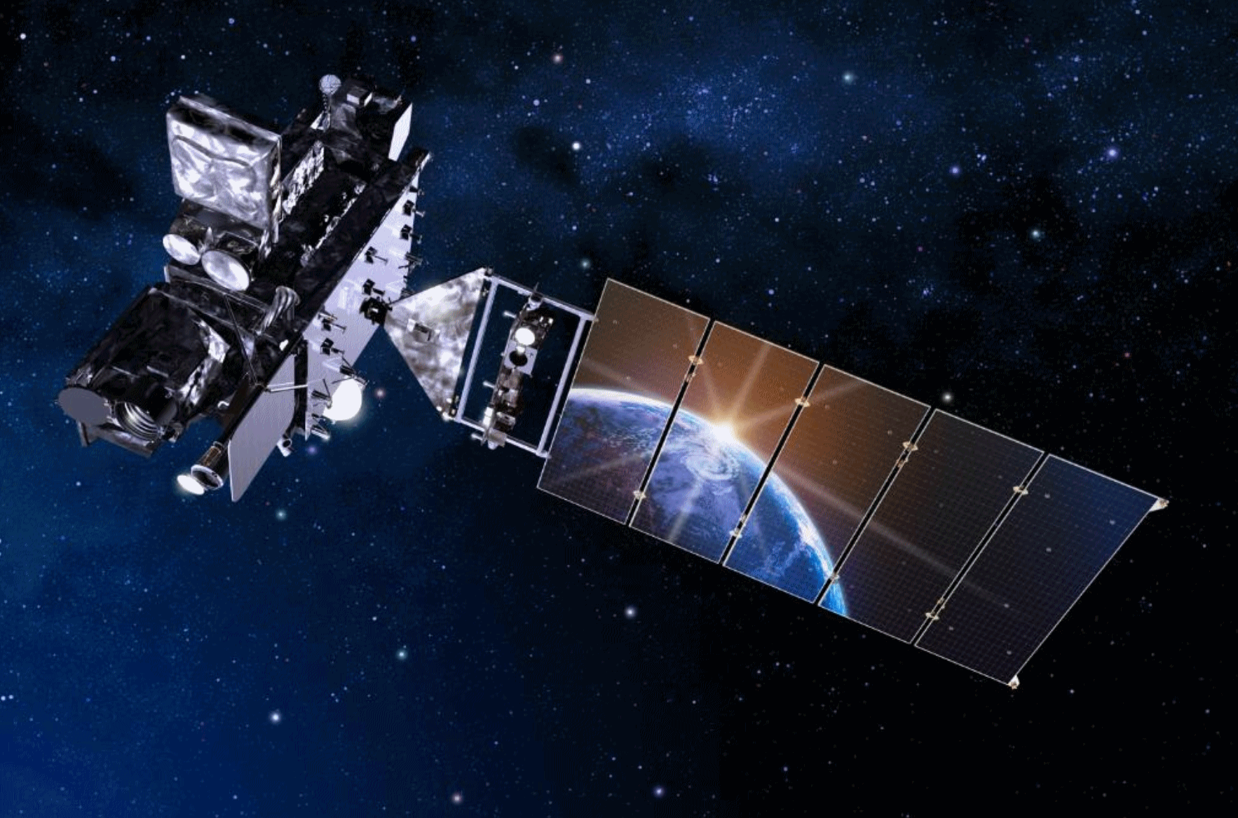
Weather Satellite Revolution. Here's more detail from NOAA: "Included in the advanced equipment on the satellite is the new Geostationary Lightning Mapper. In addition to providing forecaster with information on the potential for severe storm development this new technology will allow NOAA to provide real-time observations of lightning data directly to the public. This will allow the public to track lightning activity throughout the country, monitor nearby storms, and curtail outdoor activities early to avoid the lightning threat.
This year there have been 36 lightning deaths in the U.S., the most since 2007 when there were 45 fatalities. On average there have been about 30 lightning deaths in the U.S. in recent years.
More information on the Geostationary Lightning Mapper can be found at:
More information on the GOES-R satellite can be found here:
Major
Hurricane Joaquin is shown at the far eastern periphery of the GOES
West (GOES-15) satellite’s full disk extent, taken at 1200Z on October
1, 2015. Credit: NOAA
Read more at: http://phys.org/news/2016-11-noaa-goes-r-satellite.html#jCp
Read more at: http://phys.org/news/2016-11-noaa-goes-r-satellite.html#jCp
The Extraordinary Effects of Dust on Global Weather. Pacific Standard has a fascinating story - here's an excerpt: "...So
what effect will all that extra dust have on Earth’s weather and
climate in the future? No one really knows — at least not yet. “One of
the greatest sources of uncertainty in global climate models is
aerosol-cloud interactions,” says Charlotte Beall, a researcher and
graduate student at Scripps. “And that uncertainty impedes our progress
with these models, which are our predictive, diagnostic tool for
understanding what is going to happen in a changing climate...” (Photo: NOAA AOML).
Protecting Your Digital Life in 7 Easy Steps. The New York Times has some good advice: "There are more reasons than ever to understand how to protect your personal information. Major hacks seem ever more frequent. Investigators believe that a set of top-secret National Security Agency hacking tools were offered to online bidders this summer. And many of those worried about expanded government surveillance by the N.S.A. and other agencies have taken steps to secure their communication..."
Image credit: Kacper Pempel/Reuters.

Watch What Camp Life Is Like for Children Who Are Allergic To The Sun. Atlas Obscura has the story: "Summer
camp is a great American tradition. And one completely out of reach for
the so-called “children of the night”—the name given to kids who are
allergic to the sun. This rare condition, xeroderma pigmentosum,
makes summer camp, or any daytime outdoors activity, painful and even
fatally dangerous. Luckily, there is a place that seeks to reclaim the
tradition for children afflicted with XP: Camp Sundown. Opened
in 1995, the camp is celebrating its 21st anniversary this year, as it
continues to grow in attendance and in its efforts to bring attention to
the condition..."
TODAY: Blizzard Warning west of St. Cloud. High winds with snow, as much as 5-10" by evening with severe drifting. Travel ranges from treacherous to impassable.
Winds: NW 20-40. High: 40, falling to 30 by late afternoon.
FRIDAY NIGHT: Snow tapers to flurries - icy roads and difficult travel. First freeze. Low: 22
SATURDAY: Slow clearing, feels like teens. Winds: NW 10-15. High: 33
SUNDAY: Cold start, plenty of sunshine. Winds: SE 8-13. Wake-up: 21. High: 38
MONDAY: Partly sunny, average temps. Winds: SE 10-15. Wake-up: 24. High: 42
TUESDAY: A little light rain, wet roads. Winds: SE 10-15. Wake-up: 32. High: 43
WEDNESDAY: Light mix tapers, slow PM clearing. Wake-up: 36. High: 42
THURSDAY: Sunny peeks, dry on Thanksgiving Day. Wake-up: 29. High: 41
Climate Stories
Trump Win Opens Way for China To Take Climate Leadership Role. Reuters reports: "The election of climate change skeptic Donald Trump as president is likely to end the U.S. leadership role in the international fight against global warming and may lead to the emergence of a new and unlikely champion: China. China worked closely with the administration of outgoing President Barack Obama to build momentum ahead of the 2015 Paris Agreement on climate change. The partnership of the two biggest greenhouse gas emitters helped get nearly 200 countries to support the pact at the historic meet in France's capital..."
Photo credit: "U.S. President-elect Donald Trump gestures as he speaks at election night rally in Manhattan, New York, U.S., November 9, 2016." REUTERS/Mike Segar.
Climate Change, Hurricanes and Floods: An LSU Dialogue. Louisiana will be one of the first states to be impacted by rising seas and heavier summer rains; here's an excerpt from NOLA.com: "Climate change, hurricanes and floods were hot topics Wednesday (Nov. 16) during the Louisiana State University International Programs' intercultural dialogue on weather, water and climate. Whatever the extent of climate change, one speaker said, Louisiana will be in the crosshairs. Jay Grymes, chief meteorologist at WAFB television, opened the presentations with a focus on the state's wet climate and the potential effects of climate change. He warned that of the lower 48 states, Louisiana might be the most severely affected..."
Photo credit: Max Becherer, AP.
Tracking Effects of Climate Change on Human Health. Here's an excerpt from Huffington Post: "...It is vital that progress on limiting emissions of carbon dioxide and short-lived climate pollutants, such as methane and black carbon, is monitored. Governments must be held accountable for meeting their nationally determined contributions towards global cuts in emissions, and incentivised to go further. Climate change poses major threats to human health but policies to reduce emissions have great potential to improve health in the near-term, including by reducing air pollution and encouraging dietary changes. A new international initiative aims to provide more crucial information on the relationship between climate change and health..."

DC Prepares For Heat Emergencies To Nearly Double by 2020, Among Other Climate Change Effects. Here's a clip from DCist: "...D.C. currently experiences around 11 heat emergency days per year, which could almost double to 20 days by 2020 and spike up to 75 days by 2080, according to the report. Washingtonians should also expect much warmer average temperatures; longer, hotter, and more frequent heat waves; and more frequent and intense heavy rain and flooding. The city has already begun to see record-breaking heat waves and snowstorms as well as flooding caused by rising sea levels and high rainfall. Climate Ready DC, the city's readiness plan, looks at current weather patterns and predicts how they will change by 2080. The report, which was developed by consulting with experts inside and outside of District government, then outlines the city's strategies to adapt..." Photo credit: SweetJen34
No comments:
Post a Comment