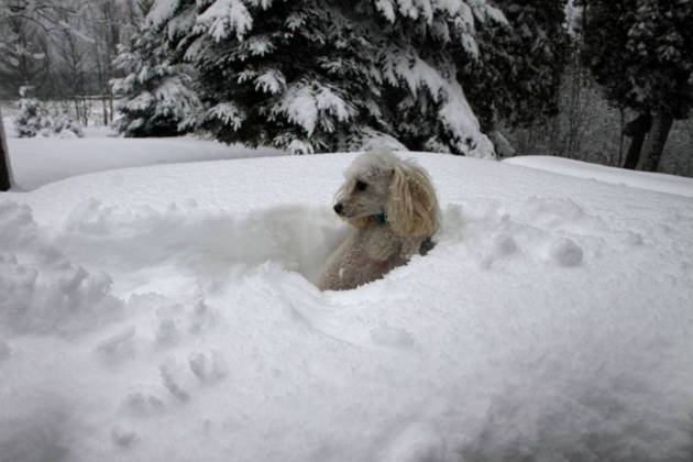
4" snow on the ground at St. Cloud.
9 F. high temperature yesterday in St. Cloud.
25 F. average high on December 14.
36 F. high on December 14, 2015.
December 15, 1971: A snowstorm hits Duluth with 10 inches.
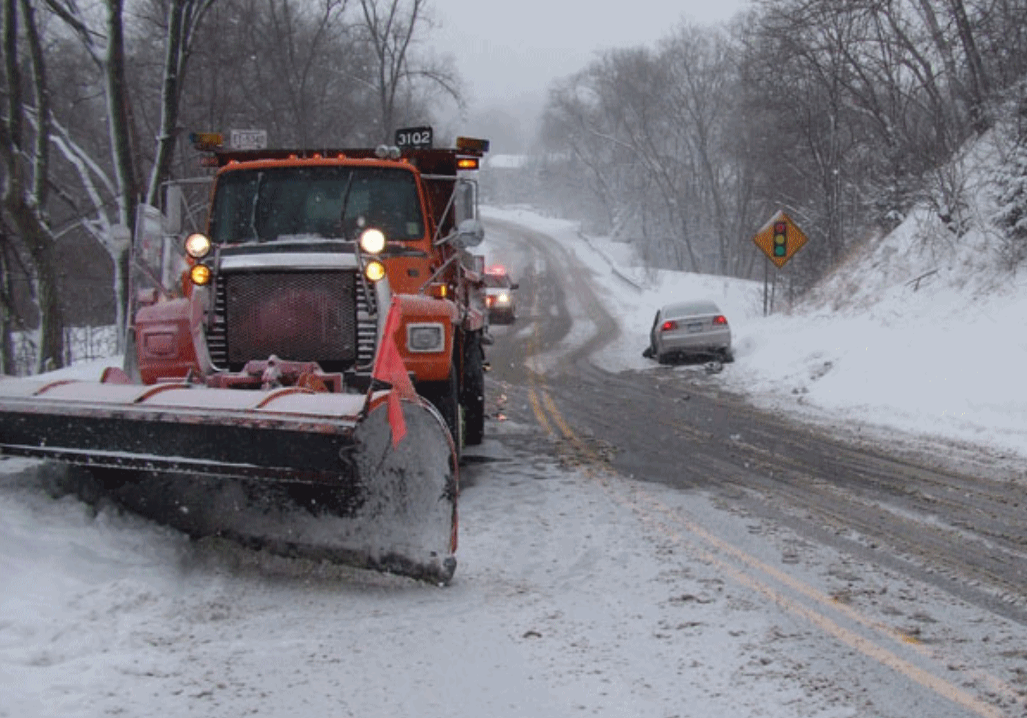 Why Cold Storms Are More Dangerous On The Roads - Record Cold Possible Sunday
I
like snow - especially on snowmen, trails, fields and trees limbs. But
snow on the highways is an acquired taste. Rush hour is a mess on a good
day. Add a few inches of snow and your commute can mutate into what
Stephen King might describe as a carnival of nightmare and death.
Tomorrow's
Hassle Factor should be off the scale, because cold storms are much
more dangerous on the roads than milder storms near freezing.
Temperatures will rise into the teens
Friday,
meaning a light, fluffy, powdery snowfall. Easy to shovel off the
driveway, but out on the highways the result may be "wheel track
glazing".
Repeated traffic compresses and warms the snow, which melts and immediately refreezes into black ice.
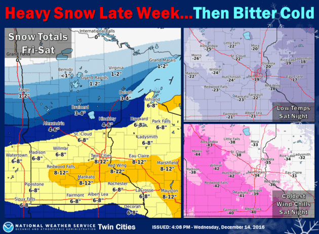
The worst travel comes
Friday afternoon into midday
Saturday, as we dig out from 5-8 inches of new snow. Flurries taper
Saturday afternoon with minor blowing & drifting; by
Sunday morning air temperatures fall into the -15 to -25F range with a chill factor as low as -40F.
Before you suffer heart palpitations, any pain will be brief. 20s and 30s (above zero) return next week!
File photo credit: MnDOT.
Ice dams are causing flooding on the Mississippi River near Fort Ripley, according to
Brainerd Dispatch.
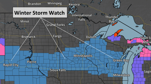
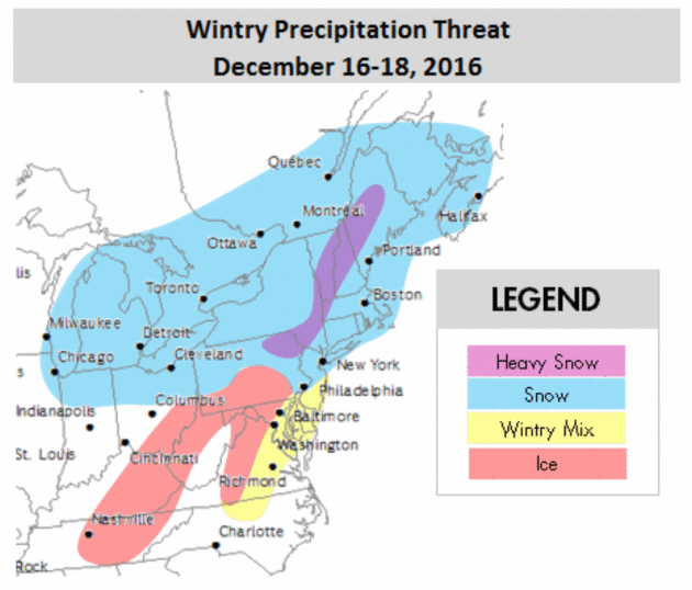
Winter Storm Watch.
Fresh outbreaks of bitter, arctic air are often preceded by big storms,
and a formidable snow and ice-maker is setting up for Friday and
Saturday from the Dakotas into Minnesota and Wisconsin. This looks
plowable, and although I don't expect blizzard conditions Saturday on
the backside of this storm, considerable blowing and drifting will make
for tricky to treacherous travel. Map: AerisWeather AMP.
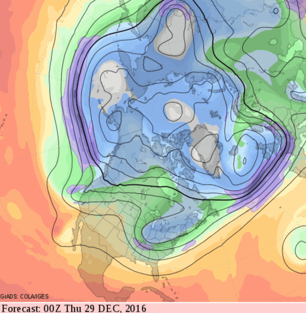
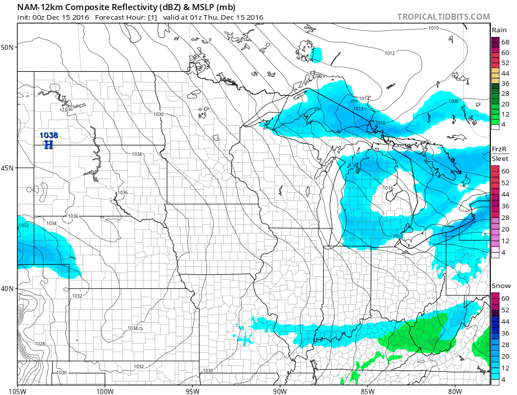 NAM Surface Forecast
.
NOAA's 84-hour NAM gives an hour-by-hour blow of the snow forecast to
push across the Plains and Midwest Friday into Saturday; an icy mix
forecast for Missouri and the Ohio Valley. It should be a long-duration
snow event with snow ratios as high as 20:1 or 25:1, meaning plowable
snow for much of the northern tier of the USA into the weekend. Map:
Tropicaltidbits.com.
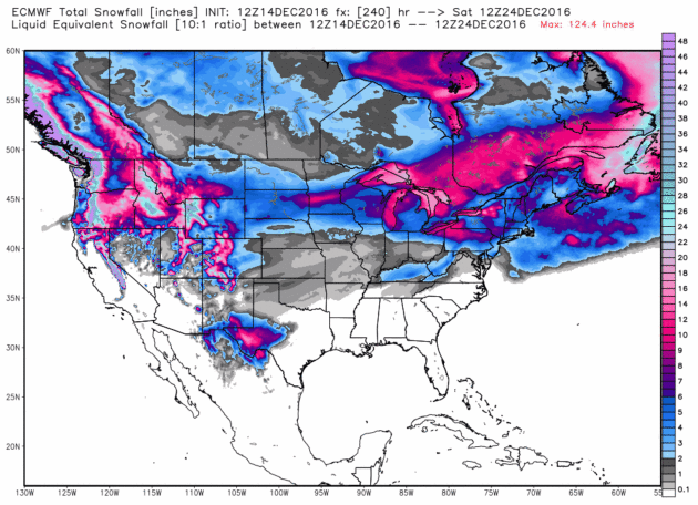
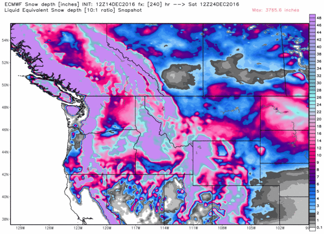
Additional Snowfall by Christmas Eve.
This is ECMWF (European) guidance, showing 2 separate snow events for
Minnesota with a band of 8-12" by late next week for central counties.
Expect very heavy snows downwind of the Great Lakes with a 30-40 degree
plus temperature differential between air and lake water temperatures.
More heavy snonw piles up from the Rockies of Colorado to the Cascades
of Washington State. Map: WeatherBell.
Snow On The Ground Christmas Morning.
It's just a model, and models are wrong much of the time, but I suspect
ECMWF has the right idea, with a very white Christmas from Minnesota,
Wisconsin and northern Iowa to Chicago, Michigan and much of
Pennsylvania, upstate New York and interior New England.
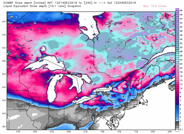
Snow Depth on Christmas Eve.
Extreme amounts of (new) snow are forecast for the highest elevations
of the western USA and skiers west of Denver won't be complaining with a
very significant pile of fresh powder.
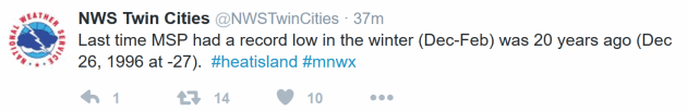
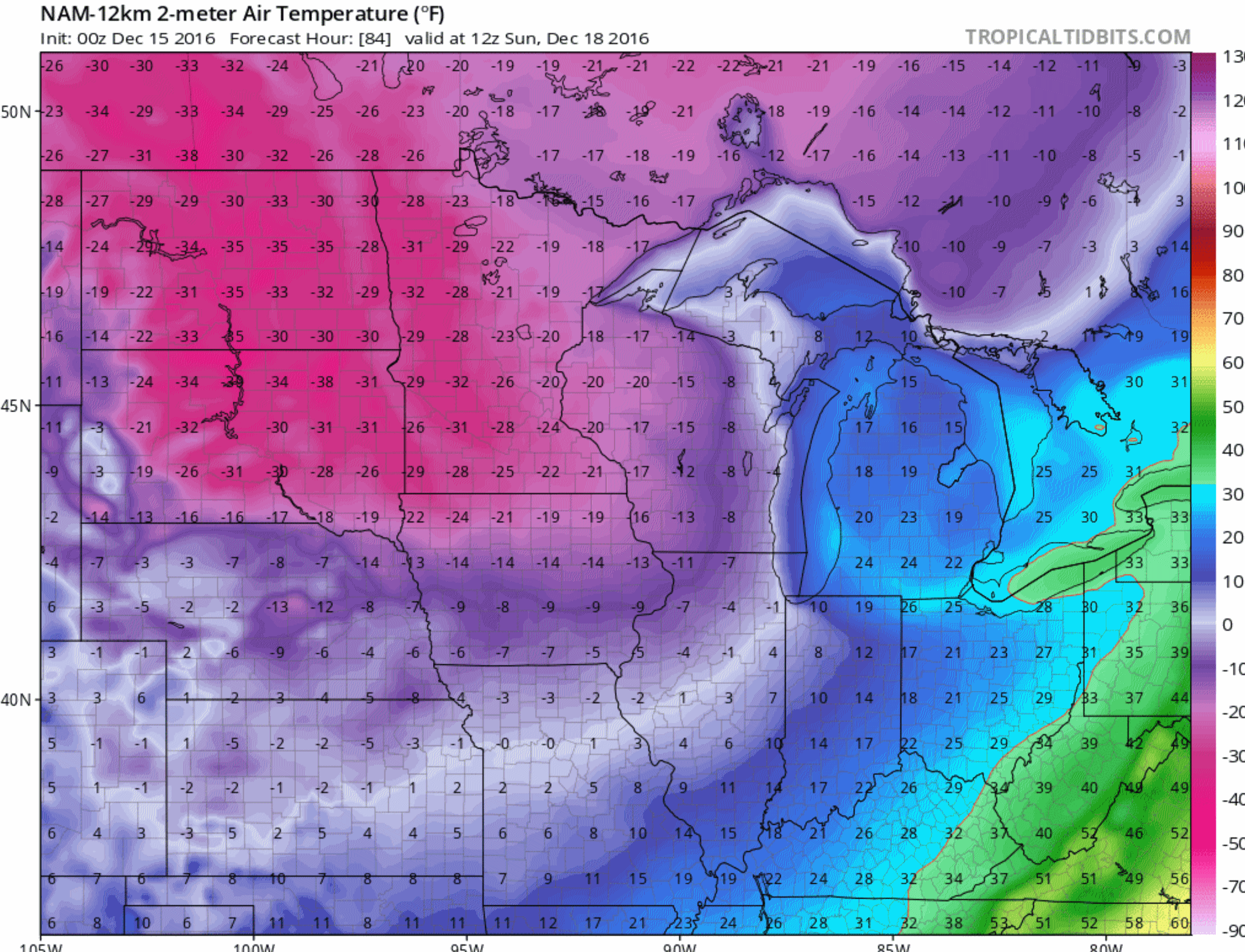 Near-Record Low Sunday?
Both NAM and GFS guidance suggest a wake-up temperature colder than
-20F in the Twin Cities, in spite of a meager urban heat island.
Ironically the last record low in the Twin Cities was nearly 20 years
ago; -27F on December 26, 1996.
The all-time record low for Sunday morning, December 18, is -24F in 1983. We may come close.
Winter Isn't Coming - It's Here! No kidding. Here's an excerpt from a
Planalytics report: "
Consumers
have been bundling up across much of the country during December as
temperatures have trended colder than normal and much colder than LY.
Moving into this weekend (December 16-18),
the last full weekend before the Christmas holiday, major markets in
the East are expecting to see their first measurable snowfall of the
season. While the cold and snow will continue to drive seasonal
merchandise into shoppers’ baskets, anticipate disruptions to store
traffic and travel to start the weekend..."
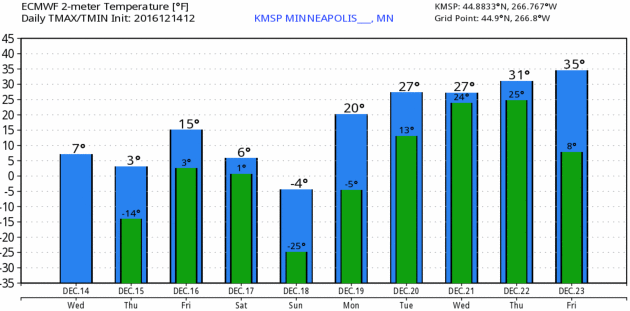
Putting the cold into longer-term perspective:

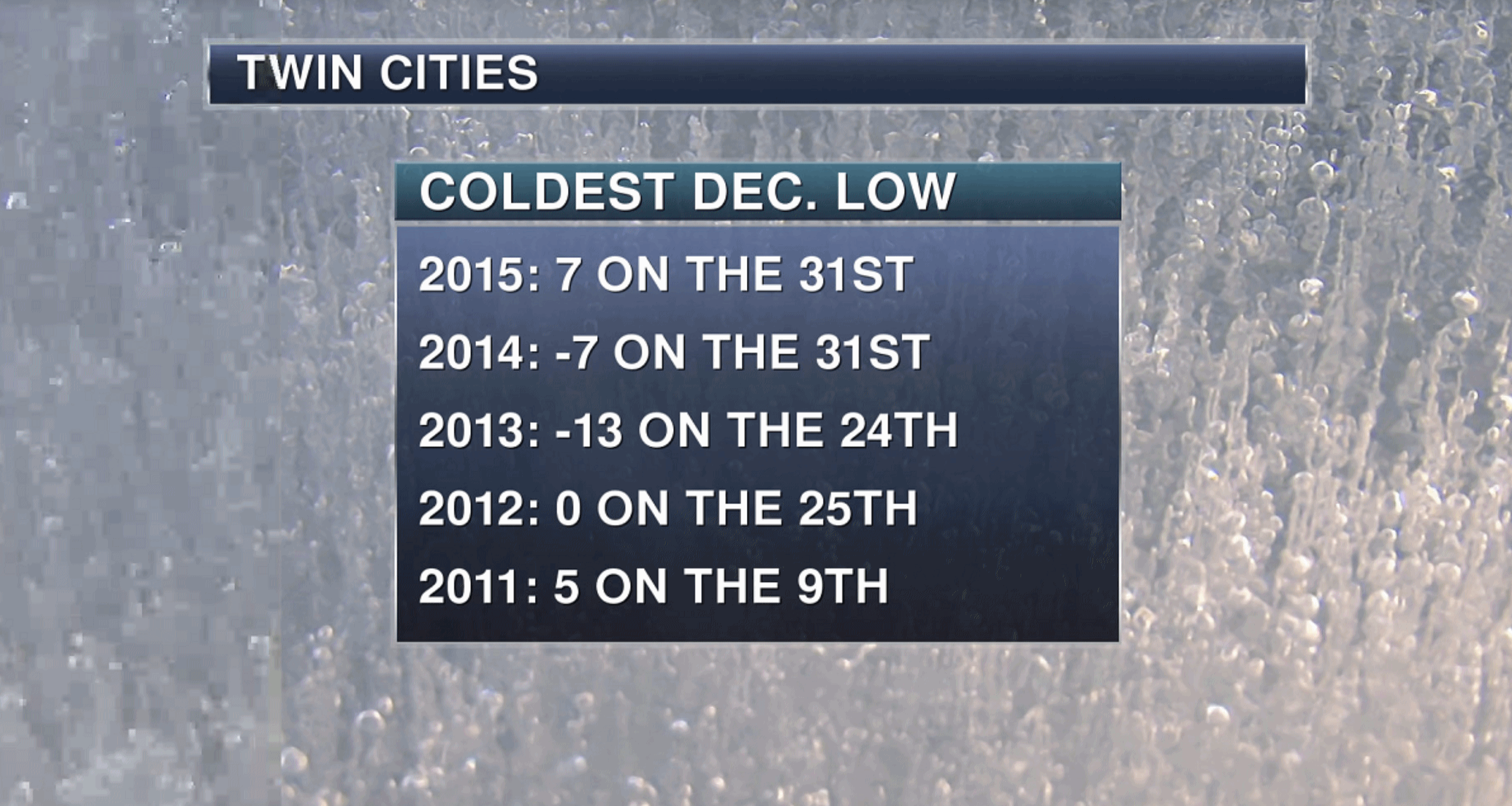 Tracking Decembers The Last 5 Years
.
The winter 3 years ago was the one that was like something out of the
1970s, a harsh "polar vortex" winter. Which is an oversimplification of
what really happened. Sunday may bring the coldest daytime highs and
lows in 20+ years for parts of Minnesota. MSP graphics: AerisWeather
meteorologist D.J. Kayser.
Spring Fling Next Week.
Did you hear, sunsets start to get later again starting today! Woo hoo!
You won't see much of a difference in daylight for another month or so,
but once we get past the solstice on December 21 it's all uphill in the
sunshine department. ECMWF numbers for MSP show 20s and 30s next week,
which will feel miraculously good after what we're going to slow through
over the next 4 days. Graphihc: WeatherBell.
Late
Month Moderation? Successive GFS runs are fairly consistent, pulling
milder Pacific air into much of the USA after Christmas. Not exactly a
January Thaw, but no major snow or ice storms are brewing between
Christmas and New Year's Day - we all get a chance to catch our breath.
How To Protect Your Heart In A Season When It's Especially In Danger. The Dallas News has a must-read story: "
Not
to be the downer (which of course is precisely what it'll sound like),
but heart-related deaths rise 5 percent over the holidays. The reasons
vary. Research has shown that cold weather causes blood vessels to
constrict, which raises blood pressure, according to this story on webmd.com. Blood clots also form more easily, too. Plus, says Dr. Rafic Berbarie, assistant professor of cardiology at the University of Texas Medical Branch
at Galveston, people experience increased emotional stress, tend to
delay seeking medical care and overindulge in food and alcohol...
Brain Freeze: Is Winter Actually Good For You? Is this positive spin or is there really something to this? Here's a snippet from
Psychology Today: "...
Related research challenges
the notion that our brains slow down in the winter and that we aren’t
as mentally sharp. In fact, there is reason to believe that brain
function is enhanced during the winter. As we well know, expectations
shape reality. All those times I ascribed a patient’s sluggishness or
sadness to Seasonal Affective Disorder, what was I missing? What else
was going on in their lives that might have been affecting their mood or
energy level? It was so easy to chalk it up to SAD, which may just be a
“well-entrenched folk theory...”
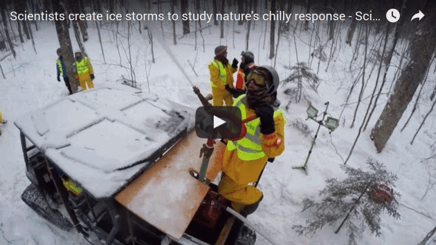
Scientists Are Making Artificial Ice Storms. Here's another excerpt of an article that made me do a double-take, courtesy of
Vice Media: "...
Syracuse
University bio-geochemist Charley Driscoll and US Department of
Agriculture (USDA) Forest Service ecologist Lindsey Rustad are trying to
understand the ways that ice storms—winter hazards of the Northeast and
Midwest United States—damage forest environments, and how those
environments recover from such a devastating blow. Rather than waiting
around for nature to deliver an ice storm, however, they created their
own. The National Science Foundation, who funded the research, released a
video that documents the storm brewing action..."
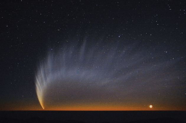
Earth Is Probably Unprepared for a Comet Strike. A story at
The Atlantic had me checking the skies above my house. Still comet-free, for now. Here's a clip: "...
This
means that while NASA might have years or decades to plan for a
close-call with an asteroid, a comet could side-swipe Earth only 18
months after it was detected. So Nuth had a recommendation: The United
States should build two comet-destroying spacecraft ahead of time. The
first, an “observer” craft, could be launched as soon as a threat is
identified. The second, an “interceptor” craft, could dislodge the
asteroid or comet from its orbit or blow it up. Both spacecraft would
sit in storage until such a time as they were needed. Doing this
advanced work, he said, would reduce the U.S. government’s “response
time” to any hazardous object from about five years to less than 12
months..." (File photo credit:
NASA).
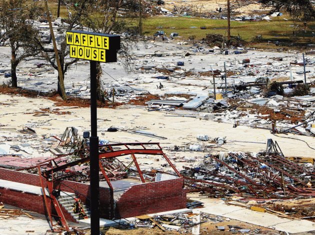
If Waffle House is Closed, It's Time to Panic.
FiveThirtyEight has a fascinating story (that made me hungry for waffles). Here's an excerpt: "...
The
concept of restaurant operations as an indicator of storm impact
percolated slowly into emergency-management culture — the magazine
Environment Health Safety Today wrote about it in July 2011 — and broke out into the open around the time of Hurricane Irene in August 2011 (when, according to The Wall Street Journal, 22 Waffle Houses lost power but only one stayed closed longer than a day).
But the so-called index isn’t actually an official metric. FEMA doesn’t
publish it anywhere; no one, except for Waffle House itself, counts how
many restaurants are running lean or forced to close. But the company
does give that count to the agency, and FEMA uses it — along with wind
speeds and power outages and other objective measures — to judge a
storm’s impact, and to figure out where its own crews and other
emergency responders can get fed..."
File photo credit: "A Waffle House on the beach in Gulfport, Mississippi, after Hurricane Katrina passed through the area." AP.
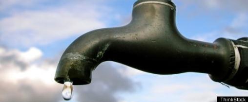
4 Million Americans Could Be Drinking Toxic Water And Would Never Know. USA TODAY has researched the topic and has a harrowing report; here's an excerpt: "...
USA
TODAY Network journalists spent 2016 reviewing millions of records from
the Environmental Protection Agency and all 50 states, visiting small
communities across the country and interviewing more than 120 people
stuck using untested or lead-tainted tap water. The investigation found:
- About
100,000 people get their drinking water from utilities that discovered
high lead but failed to treat the water to remove it. Dozens of
utilities took more than a year to formulate a treatment plan and even
longer to begin treatment.
- Some 4 million Americans get
water from small operators who skipped required tests or did not
conduct the tests properly, violating a cornerstone of federal safe
drinking water laws. The testing is required because, without it,
utilities, regulators and people drinking the water can't know if it's
safe..." (File photo: ThinkStock).
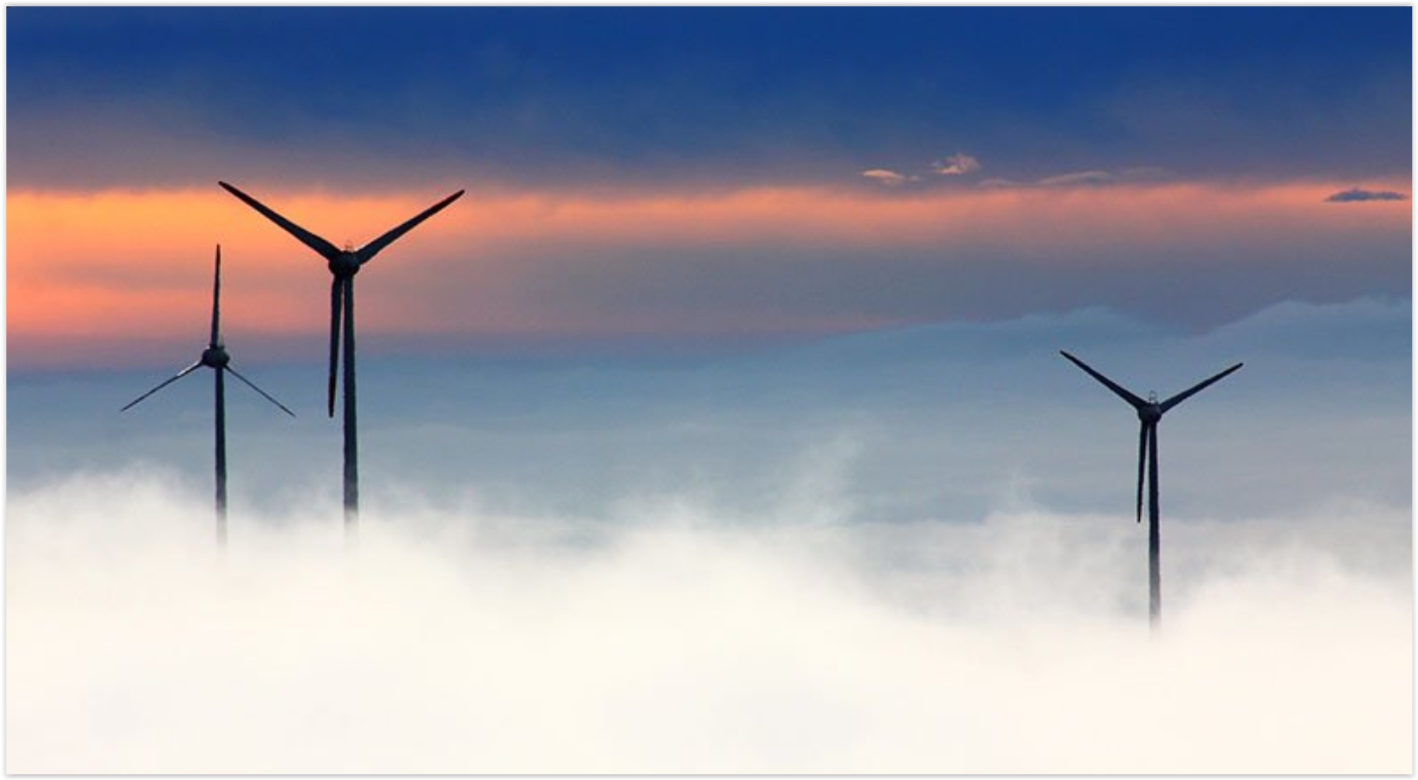
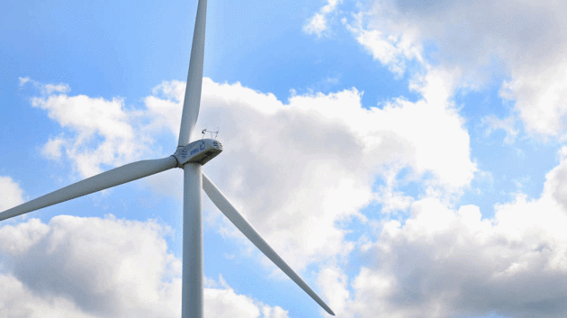
Nearly a Quarter of Willmar's Power is Renewable.
West Central Tribune has the story: "
While
the Willmar Municipal Utilities wind turbines are the most visible
example of renewable energy in town, in fact nearly a quarter of the
city's power comes from different renewable sources. "We're a little bit
ahead of the curve," Utilities General Manager John Harren
said.Renewable energy sources, which include wind, solar and
hydroelectric, account for 22 percent of Willmar's power load. The
largest portion of that comes from the utilities' many power supply
contracts with different energy generators. This includes solar and wind
power..."
Photo credit: "
Renewable
energy sources, which include wind, solar and hydroelectric, account
for 22 percent of Willmar’s power load. Wind turbines produce just a
small portion of that." Briana Sanchez / Tribune file photo.
 U.S. Wind Generation Sets New Records Throughout 2016. The trends are accelerating, according to Forbes: "
...
More than a dozen wind integration studies
by US grid operators and others have found that wind energy can
reliably supply at least 20%-30% of the nation’s electricity, with some
studies analyzing wind providing 40% of total electricity on an annual
basis. The National Renewable Energy Laboratory’s Renewable Energy Futures study
found no reliability problems for a case in which wind and solar
provide nearly 50% of total electricity. If the recent records are any
indication, these levels are a real possibility in the future..." (File photo: CCL).
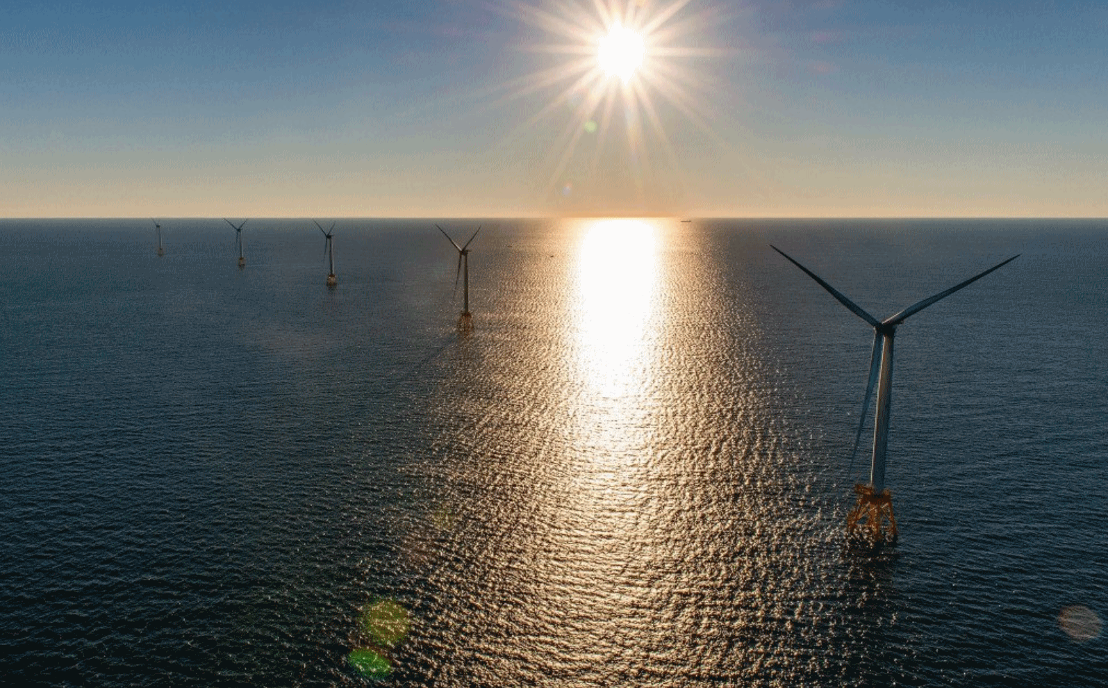 First U.S. Offshore Wind Farm Starts Operating Off Rhode Island. Here's an excerpt from The Portland Press: "The
Block Island Wind Farm, a 30 megawatt (or million watt) installment off
the Rhode Island coast, went into regular operation Monday – marking
the beginning of a bonafide new source of electricity in the United
States. Although countries like Britain and China have many of them,
this is the first fully operational U.S. offshore wind farm installment.
It comes just after the election of Donald Trump, who has tried to stop
an offshore wind farm that he said obscured the view from one of his
Scottish golf courses, and even as the Trump transition team at the
Department of Energy posed a controversial list of 74 questions to the
agency, including the following: “What is the Department’s role with
respect to the development of offshore wind?...
First U.S. Offshore Wind Farm Starts Operating Off Rhode Island. Here's an excerpt from The Portland Press: "The
Block Island Wind Farm, a 30 megawatt (or million watt) installment off
the Rhode Island coast, went into regular operation Monday – marking
the beginning of a bonafide new source of electricity in the United
States. Although countries like Britain and China have many of them,
this is the first fully operational U.S. offshore wind farm installment.
It comes just after the election of Donald Trump, who has tried to stop
an offshore wind farm that he said obscured the view from one of his
Scottish golf courses, and even as the Trump transition team at the
Department of Energy posed a controversial list of 74 questions to the
agency, including the following: “What is the Department’s role with
respect to the development of offshore wind?...”
Photo credit: "
The Deepwater Wind project, which sits off the coast of Rhode Island’s Block Island, went into regular operation on Monday." Photo courtesy of Deepwater Wind.
TODAY: Windchill Advisory. Bright, ineffective sunshine. Feels like -25 early. Winds: SW 5-10. High: 5
THURSDAY NIGHT: Clouds increase, light snow by morning. Low: 0
FRIDAY: Winter Storm Watch. Snow increases in intensity - roads become icy. Winds: SE 10-15. High: 15
SATURDAY: Snow slowly tapers. 5-8" new powder. Winds: NW 10-20+ Wake-up: 5. High: 6 (falling)
SUNDAY: One of the coldest days of winter. Some sun, W.C. near -40F early Wake-up: -20. High: -3
MONDAY: Mostly cloudy, not as harsh. Wake-up: -8. High: near 20
TUESDAY: Patchy clouds, risk of a thaw. Wake-up: 14. High: 31
WEDNESDAY: Chance of light snow or flurries. Wake-up: 19. High: 30
Climate Stories...
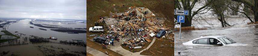 Climate Change Brewing More Extreme Weather, Shifting Breaking Points
.
Ars Technica has the article; here's an excerpt: "...
As
for what's ahead, the researchers wanted to use their model to
understand the environment's “breaking point”—the temperature above
which the precipitation rate stops increasing and starts to decline. The
concept was not well understood before, but the researchers wanted to
know whether global warming may shift this breaking point. According to
their model—which assumes that future weather patterns look more or less
like current and past weather patterns—extreme precipitation events in
the future “are projected to significantly increase in almost all North
American land regions,” the authors write in their
paper. That’s because climate change creates warmer and moister
environments, which in turn produce more extreme precipitation
events—shifting the “breaking point...”
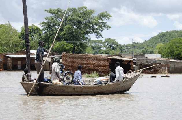
Climate Change Forced Over 1 Million Africans From Their Homes in 2015. Here's an excerpt from ThinkProgress: "At
least 12 million people lived in ongoing displacement caused by
conflict, violence, and other disasters across the African continent in
2015. And in the future, climate change may be the lead driver of even
greater displacement. In the Africa Report on Internal Displacement — a
new report by the Internal Displacement Monitoring Centre that focused
on internal displacement across the entire African
continent — researchers found that “disasters triggered by rapid-onset
natural hazards” forced 1.1 million people from their homes across 33
African countries last year. What’s more, disaster-induced displacement
makes people more vulnerable from one year to the next and more
susceptible to food insecurity since planting and harvesting become
disrupted when farmers are absent..."
Photo credit: "Fishermen transport villagers with their belongings across floodwaters in Phaloni, southern Malawi, Jan 22, 2015." CREDIT: AP Photo/Shiraaz Mohamed.
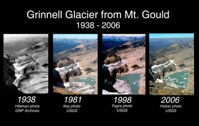
Shrinking Mountain Glaciers Are "Categorical Evidence" of Climate Change, Scientists Say. Here's the intro to a story at
The Washington Post: "
From
the rapidly melting Greenland ice sheet to increasing instability of
West Antarctica, the world’s glaciers have become the dramatic face of
climate change. But while ice loss at the poles often garners the most
attention (thanks to its hefty potential contributions to global
sea-level rise), other smaller glaciers all over the
world are also steadily shrinking — and scientists say they constitute
some of the clearest signals of climate change on the planet. A new study,
published Monday in the journal Nature Geoscience, uses a new
statistical method to analyze the retreat of mountain glaciers all over
the world, from Russia to South America. It concludes that their
shrinking represents “categorical evidence of climate change...” (Image credit: USGS).
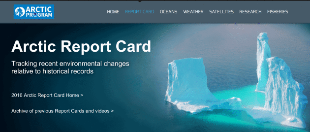
The Arctic Just Received Its Annual Report Card, And It's Not Good. USA TODAY reports: "The
world’s air conditioner is on the fritz. Unprecedented, record-breaking
warmth in the Arctic this year triggered declines in sea ice, snow, the
Greenland ice sheet and a remarkable delay in the annual freeze of sea
ice in the fall. “Rarely have we seen the Arctic show a clearer,
stronger or more pronounced signal of persistent warming and its
cascading effects on the environment than this year,” said Jeremy
Mathis, director of NOAA’s Arctic research program, which released
its annual Arctic Report Card on Tuesday. Even more worrisome: The
trends are deepening and show no signs of letting up anytime soon. "All
signs point to continuing on this trajectory," Mathis said..."
The report from NOAA is available
here.
Scientists Want To Give The Atmosphere an Antacid to Relieve Climate Change. Eric Roston explains at Bloomberg: "...A
group of Harvard researchers led by David Keith, a professor of applied
physics and public policy, just proposed a different solution in the
Proceedings of the National Academy of Sciences. An aerosol of calcium
carbonate would have a similar cooling effect as sulfur dioxide on the
upper atmosphere and help protect the ozone layer as a bonus. The
approach is akin to giving the atmosphere a handful of antacid tablets.
The aerosol would block some incoming solar energy and neutralize
airborne acid particles that are bad for the ozone..." (File photo: NASA).

No comments:
Post a Comment