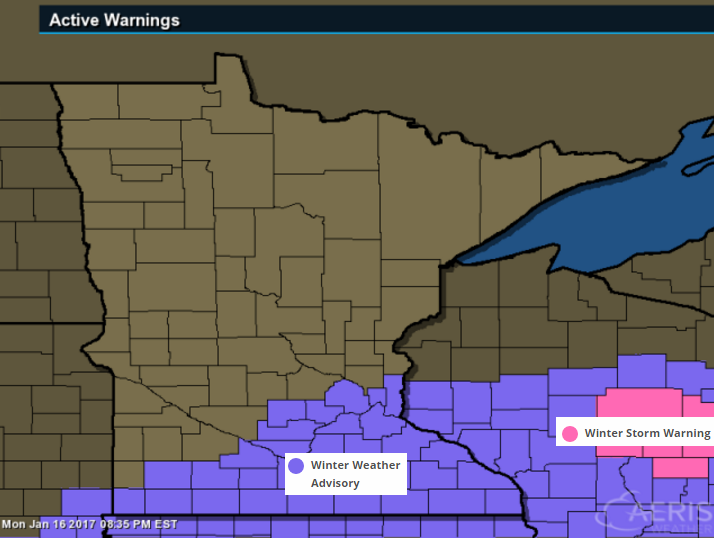
Winter Weather Advisory Until 6am Tuesday
The same storm system responsible for major icing conditions across the central part of the country this weekend will continue to clip the southeastern part of the state through early Tuesday morning. A light ice glaze of ice and up to a slushy 1" of snow will be possible.
...WINTER WEATHER ADVISORY REMAINS IN EFFECT UNTIL 6 AM CST TUESDAY...
* FREEZING RAIN AND SLEET INTO THIS EVENING WITH A CHANGEOVER TO SNOW DURING THE LATE EVENING. LIGHT FREEZING DRIZZLE POSSIBLE LATE IN THE NIGHT.
* ICE ACCUMULATIONS OF A GLAZE ARE EXPECTED ALONG WITH WET SNOW ACCUMULATIONS OF UP TO 1 INCH.
* LOOK FOR REDUCED VISIBILITIES AT TIMES.
* PLAN ON SLIPPERY ROAD CONDITIONS.
Simulated Radar
Here's the simulated radar through midday Tuesday, which shows a period of freezing rain and drizzle changing over to a wintry mix and snow through the night before moving out of the region by AM Tuesday. Travel conditions through the night will be poor across southeastern MN and into western WI as this wintry mix moves through.
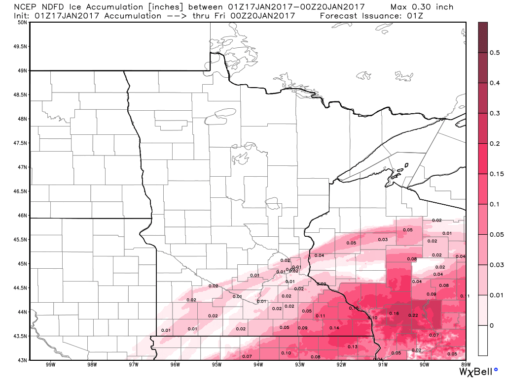
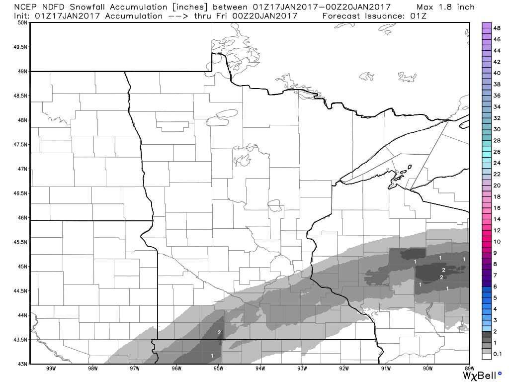
Snow & Ice Potential
Here's the ice and snow potential thru the overnight hours as the storm system pushes through the southeastern part of the state. A light glaze of ice and up to 1" of snow may be possible, which could create difficult driving conditions through early Tuesday morning.
Visible Satellite Loop Monday
The same storm system that brought a crippling ice event over the Central U.S. over the weekend and early week time frame also brought clouds and areas of freezing rain across far southern MN and Wisconsin. Note that much of northern Minnesota stayed sunny as the storm just clipped our area.
Great Lakes Ships Arrive For Winter Layup
Thanks to the @NWSDuluth for capturing this image from the Lake Superior Maritime Visitor Center webcam, which shows the Roger Blough arriving early Monday morning as one of the last few ships to arrive in the Duluth port this season. The Paul R. Tregurtha arrives Monday after and is the last ship of the season to pass under the Aerial Lift Bridge this season as the Soo Locks in Sault Ste. Marie Mich., close on Friday and won't reopen until March 25th.

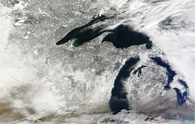
Visible Satellite Sunday, January 15th
Sunday was an incredibly nice day across the Upper Midwest and Great Lakes region with mild temperatures and plenty of sun. Clear skies allowed for a fairly decent view of of the Great Lakes. Note the lack of ice cover across the Great Lakes and also note the snow cover on the ground across the region.
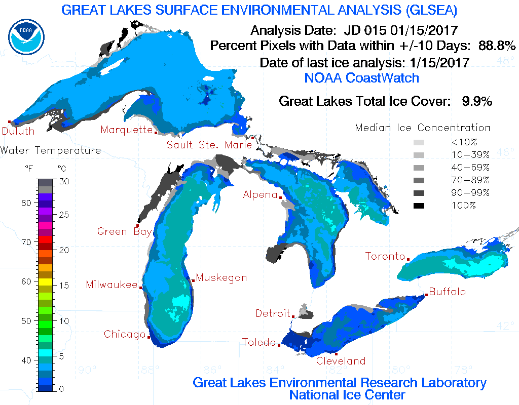
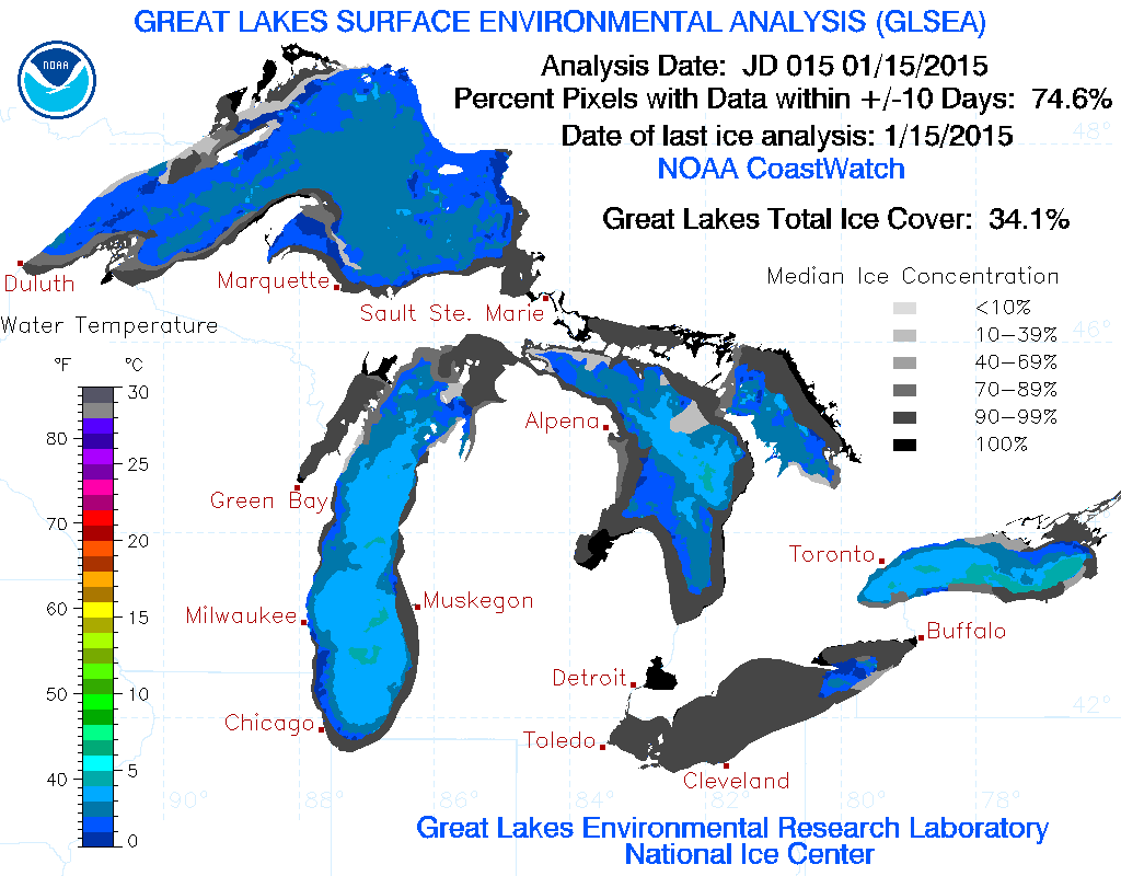
Great Lakes Ice Coverage
According to NOAA's GLERL, the Great Lakes ice coverage as of January 15th, 2017 was nearly 10%. Interestingly, at this time in 2015, nearly 34%
________________________________________________________________________________
Let the Melt Begin. Mid-Winter Rain This Weekend
Not sure about you, but I actually like Winter. I am not a big fan of the face-numbing cold, but I like the snow! Give me a bunch of snow (minus the rotten commutes) and I would be a happy camper.
With that said, I feel a bit cheated. We've had a few bouts of snow and cold weather, but we've also had these weird warm spells. This has led to more wintry wintry mixed precipitation and rain events rather than just good old fashioned snow! What gives? If you thought thunderstorms and 1 inch rainfall tallies on Christmas Day was weird, well, the weirdness continues.
Weather maps look more March- like heading into the second half of January as the mercury tops 40 degrees later this week. Stillwater is host to Hockey Day in Minnesota this Saturday. The current forecast calls for a high temperature in the low/mid 40s with light rain. Come on man! Mother Nature should know better not to mess with Minnesota's outdoor hockey plans.
In meantime, enjoy the fact that we have feeling back in our extremities. We'll see what Feb. cooks up.
___________________________________________________________________________
___________________________________________________________________________
Extended Forecast:
MONDAY NIGHT: Chance of freezing drizzle. Slushy/icy coating of snow possible across far southeastern MN. Winds: ENE 5. Low: 24.
TUESDAY: Partly sunny and mild. Winds: WSW 5. High: 32
TUESDAY NIGHT: Partly cloudy and quiet. Winds: SSW 5. Low: 19.
WEDNESDAY: Sunny and mild. Lots of drips. Winds: SW 5. High: 39
THURSDAY: Clouds thicken. Afternoon sprinkles. Winds: S 5. Wake-up: 27. High: 43
FRIDAY: Mostly cloudy. Spotty light rain. Winds: ESE 5. Wake-up: 33. High: 42
SATURDAY: Scattered light rain showers. Winds: E 5-10. Wake-up: 33. High: 39.
SUNDAY: Cloudy, more light rain. Mix late? Winds: NNE 5-15. Wake-up: 34. High: 39.
MONDAY: Light wintry mix possible. Winds: N 5-10. Wake-up: 28. High: 34.
_______________________________________________________________________________
_______________________________________________________________________________
This Day in Weather History
January 17th
January 17th
1996: A severe ice storm hits the western and northern Twin Cities with accumulations between a half an inch and an inch. A foot of snow fell over central Minnesota.
1982: The citizens of Tower wake up to a frigid low of -52 degrees F.
_______________________________________________________________________________
_______________________________________________________________________________
Average High/Low for Minneapolis
January 17th
January 17th
Average High: 23F (Record: 44F set in 1894)
Average: Low: 7F (Record: -29F6set in 1967)
Average: Low: 7F (Record: -29F6set in 1967)
*Record Snowfall: 5.1" set in 1932
_______________________________________________________________________________
_______________________________________________________________________________
Sunrise Sunset Times For Minneapolis
January 17th
January 17th
Sunrise: 7:46am
Sunset: 5:01pm
Sunset: 5:01pm
*Daylight Gained Since Yesterday: ~1 minute 55 seconds
*Daylight Gained Since Winter Solstice (December 21st): ~29 minutes
________________________________________________________________________________
*Daylight Gained Since Winter Solstice (December 21st): ~29 minutes
________________________________________________________________________________
Moon Phase for January 16th at Midnight
2.6 Days Before Last Quarter
2.6 Days Before Last Quarter
__________________________________________________________________________________
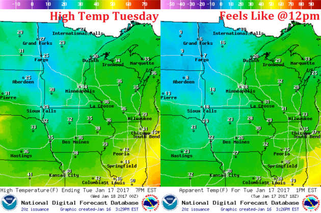
Weather Outlook For Tuesday
High temperatures on Tuesday will once again be warmer than average, but we really start to settle into our warm spell starting Tuesday. Note that much of the region, including the Twin Cities will likely warm into the low to mid 30s. This will begin the several day melting process.
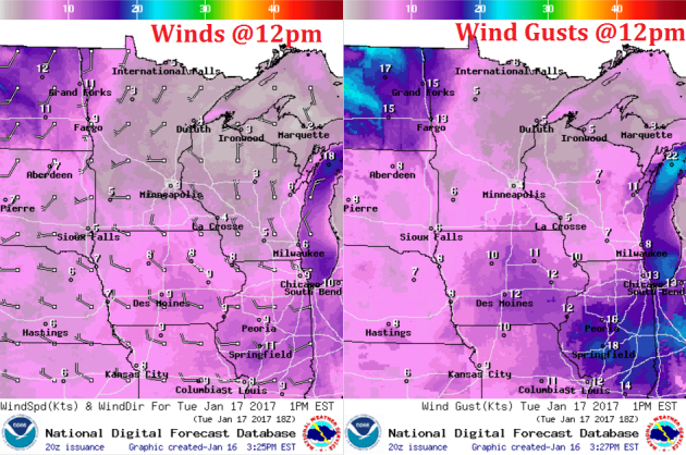
Weather Outlook For Tuesday
Winds will be very light on Tuesday and will also start turning more westerly/southwesterly late in the day. Later in the week, they will become more southerly, which will help to move temperatures up into the 40s!
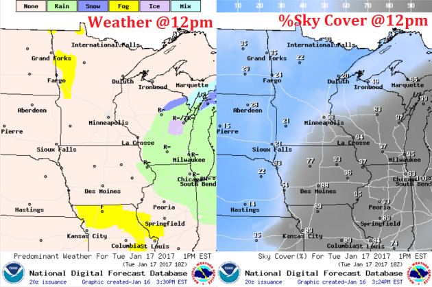
Weather Outlook For Tuesday
After a cloudier day across southern MN on Monday, clouds will linger across southeastern MN through the day. Much of the rest of the state will break out into sunshine, which will continue to build into the region through Wednesday.
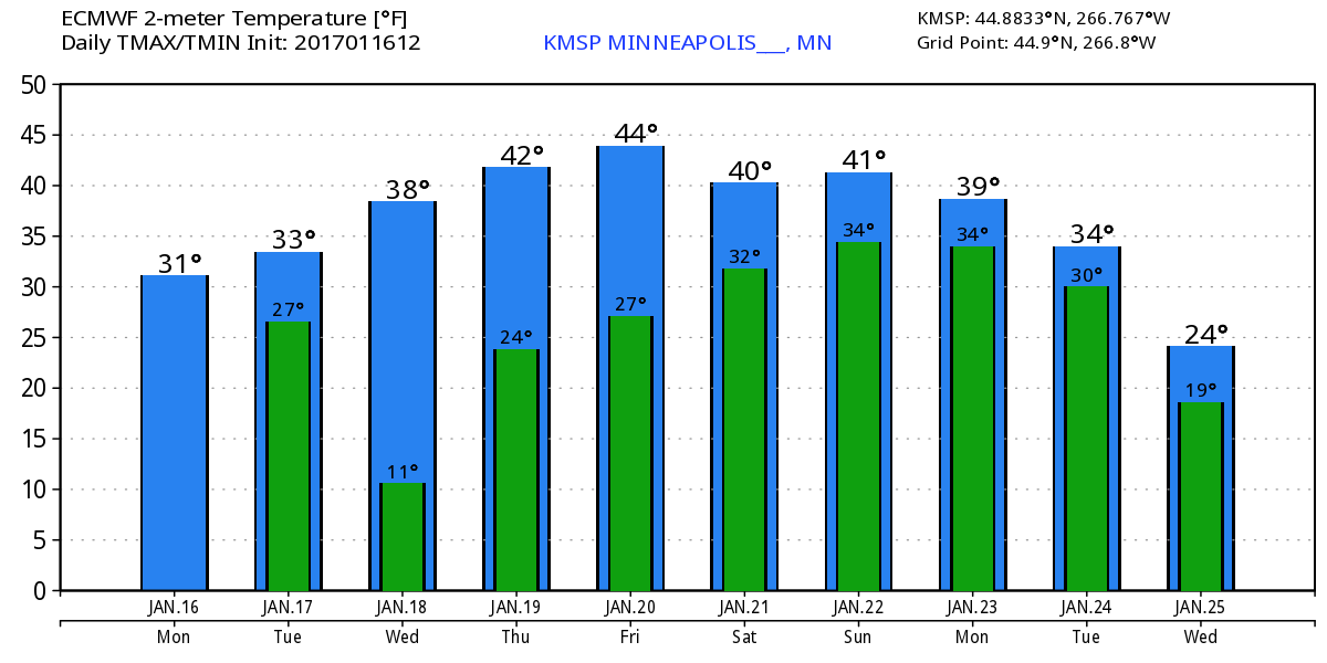
Extended Temperature Outlook for Minneapolis
Here's the temperature outlook through January 25th, which shows a VERY mild trend heading into the week ahead with highs in the 30s and even 40s by next weekend! With several days above freezing, our snow pack will likely take a big hit... we may also have a fog concerns with melting snow and added moisture in the lower levels of the atmosphere.
___________________________________________________________________________________
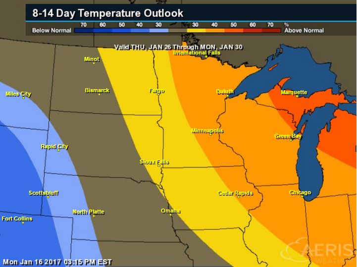
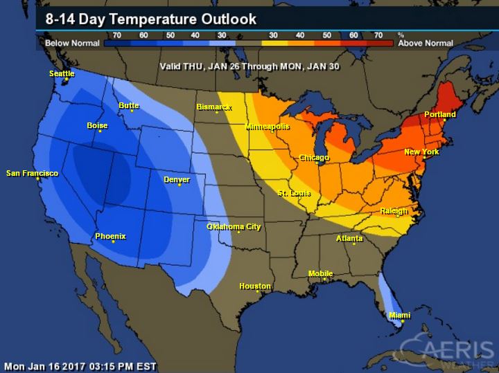
6 to 10 Day Temperature Outlook
According to NOAA's CPC, the 8 to 14 day temperature outlook suggests warmer than average temperatures continuing across much of the Upper Midwest from January 26th to January 30th. With that said, extended models are suggesting temperatures returning to near normal levels by the end of the month. Looking ahead, there doesn't appear to be any major cold snaps brewing over the next couple of weeks.
_________________________________________________________________________________
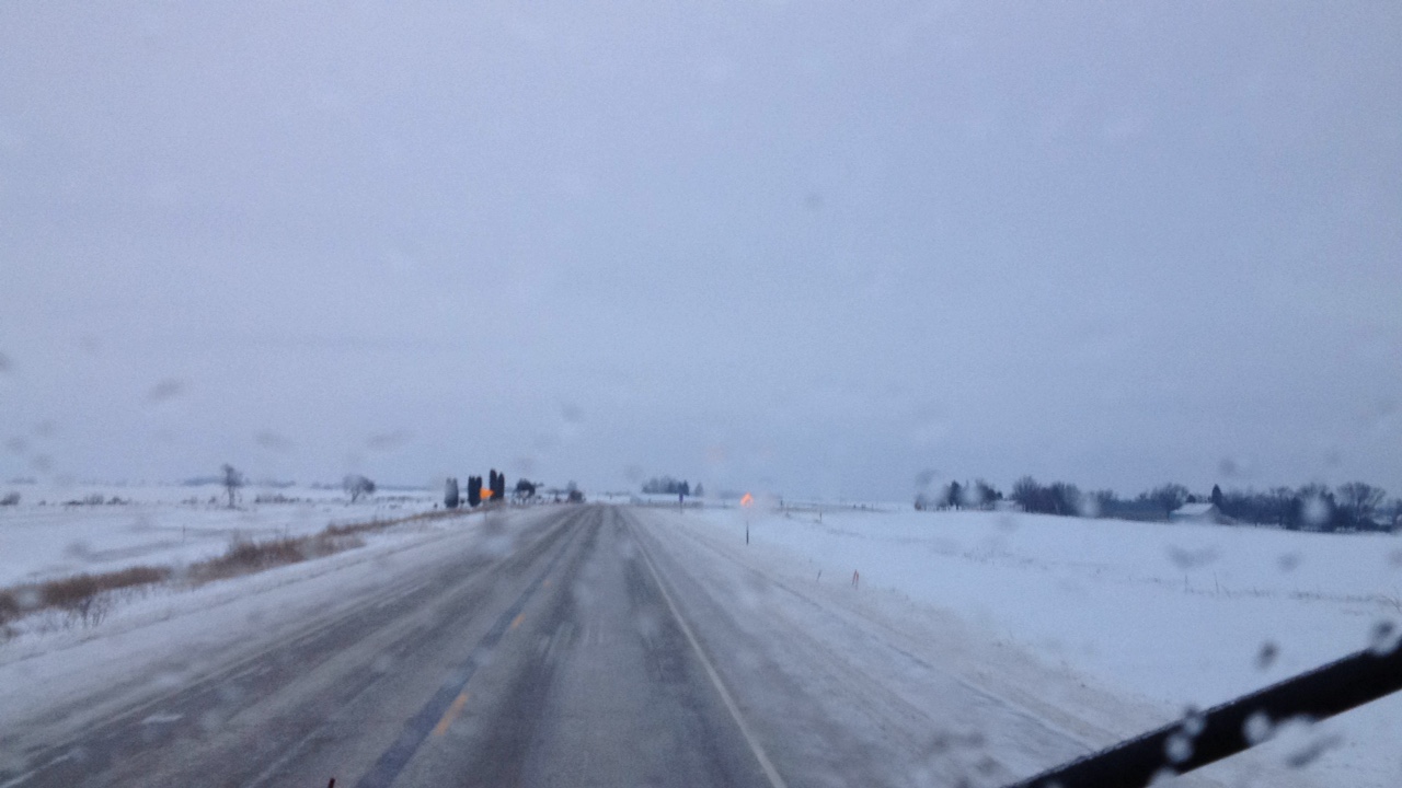
Iowa Plow Cams
Did you know that IowaDOT equips their plow trucks with webcams? A network a frequently updating plowcams is a wonderful resource to see what conditions are like across the state. This was the view from near Waukon, IA from early Monday morning where travel was not advised, where freezing rain left area roadways covered in ice.
Track a plow from IowaDOT HERE:
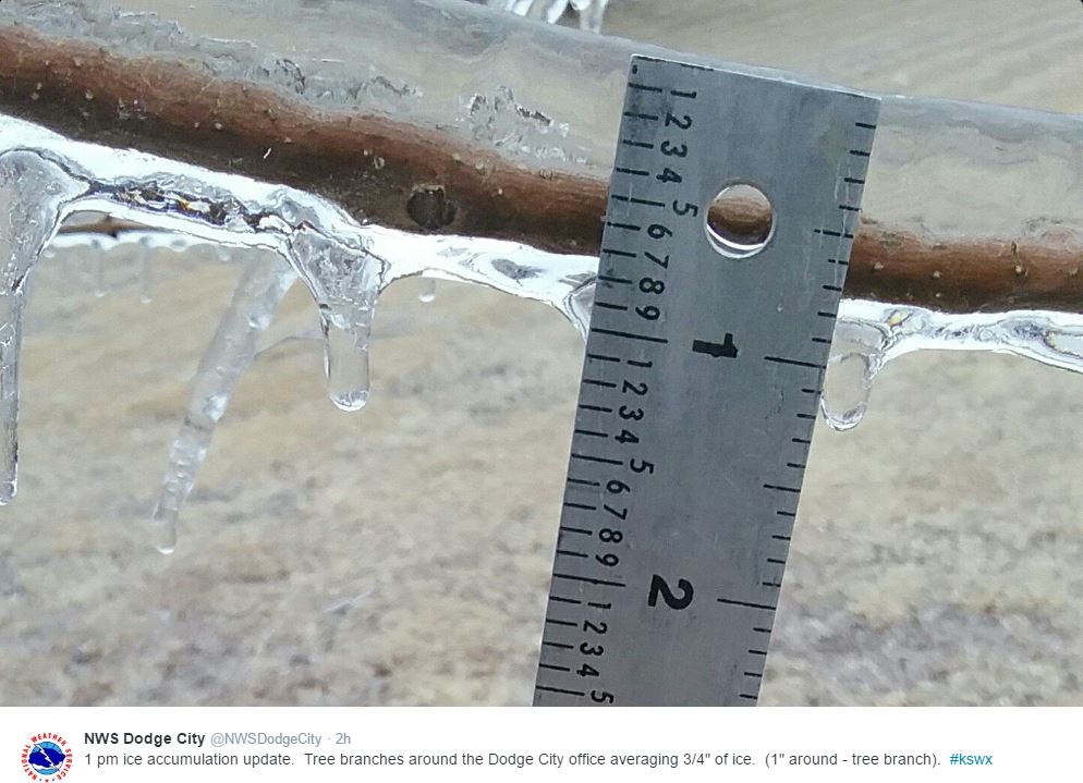
Major Ice Event Central US Wraps UpTrack a plow from IowaDOT HERE:
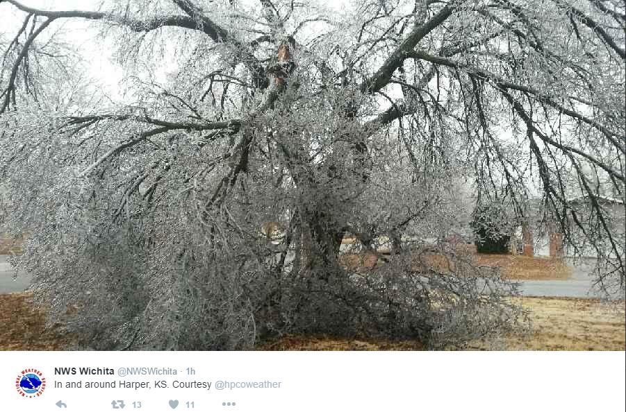
Thanks to the National Weather Service out of Dodge City and Wichita, KS for the pictures below, which shows the icing that took place there through the weekend. This was a crippling event for some folks in the Central Plains with widespread power outages and even some fatalities. Note that just 1/4" of ice can add 500 lbs. of weight to a span of power lines... this additional weight is what causes trees and power lines to come down. Many locations will be cleaning up and fixing power issues over the next several days if not weeks.
Ice Accumulations
Here's a look at the ice accumulations across the region from Saturday into Sunday. Note that there were two reports of 1" ice accumulations; one in Oklahoma and one in Nebraska!

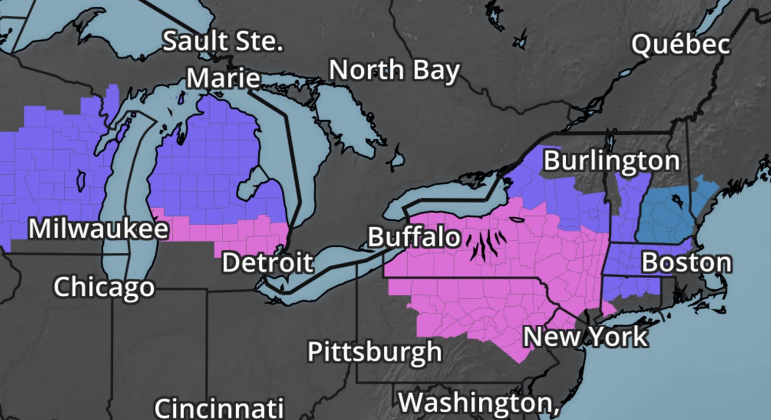
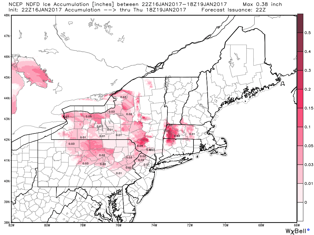
Icing Potential
Here's the icing potential through midweek, which suggests light ice accumulations across parts of the Northeast. Although there won't be as much ice as what the Central U.S. saw this weekend, there will still be enough icing to create issues on area roads.
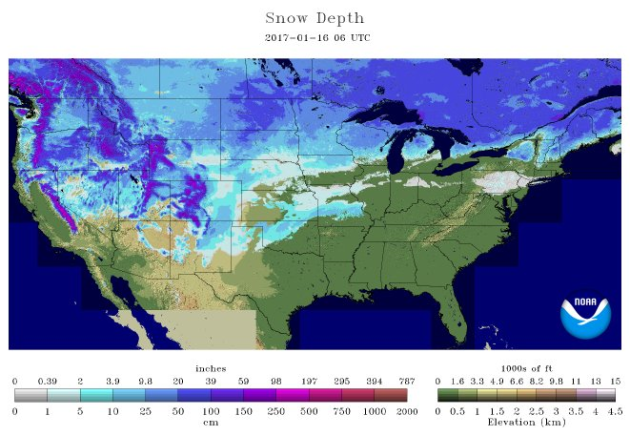
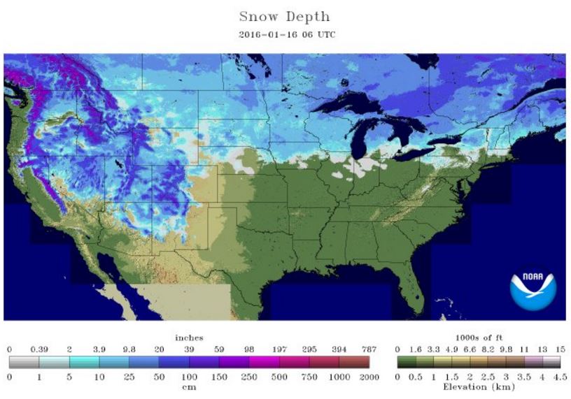
National Snow Coverage
According to NOAA's NOHRSC, the national snow coverage was nearly 50% as of Monday, January 16th. The images below compare the national snow cover from January 16th 2017 vs 2016. At this time last year, 43% of the nation was covered in snow. With temperatures expected to be as warm as they will be over the next several days, I expect a major snow melt across the eastern half of the nation over the next couple of weeks.
________________________________________________________________________
________________________________________________________________________
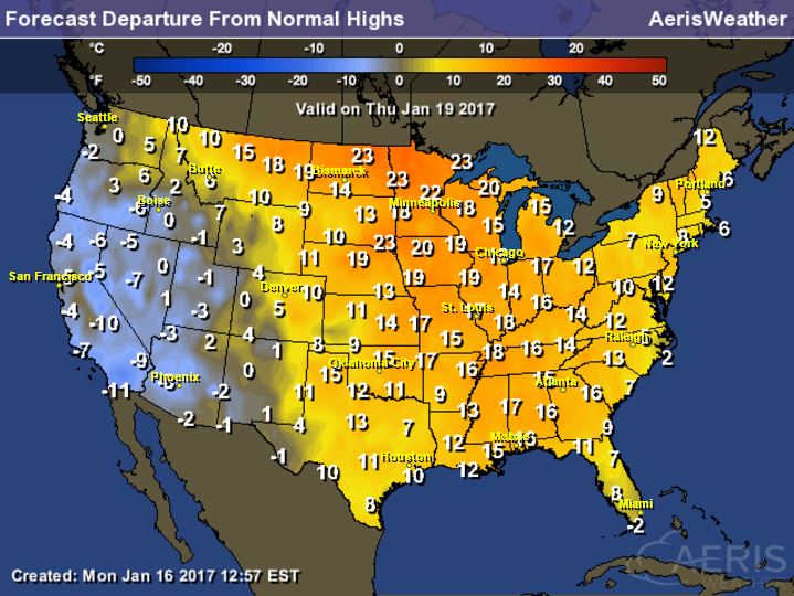
Highs From Average Thursday
Take a look at how much warmer than average much of the nation will be on Thursday. Just about everyone from the Front Range of the Rockies to the Eastern Seaboard will be at least 10F to near 20F above average!
National Temp Outlook
Take a look at the temperature anomaly through Tuesday, January 24th. Note that the Eastern half of the country looks to stay warmer than average through the entire time period. Late January appears to host colder than average weather across the western half of the country.
 Temperature Outlook
Take a look at the temperature anomaly through Tuesday, January 24th. Note that the Eastern half of the country looks to stay warmer than average through the entire time period. Late January appears to host colder than average weather across the western half of the country.
Here's the 8 to 14 day temperature outlook, which takes us into the end of January. Note that warmer than average temperatures continue across the Eastern U.S., while cold than average temperatures will move into the Western U.S.
 ________________________________________________________________________________
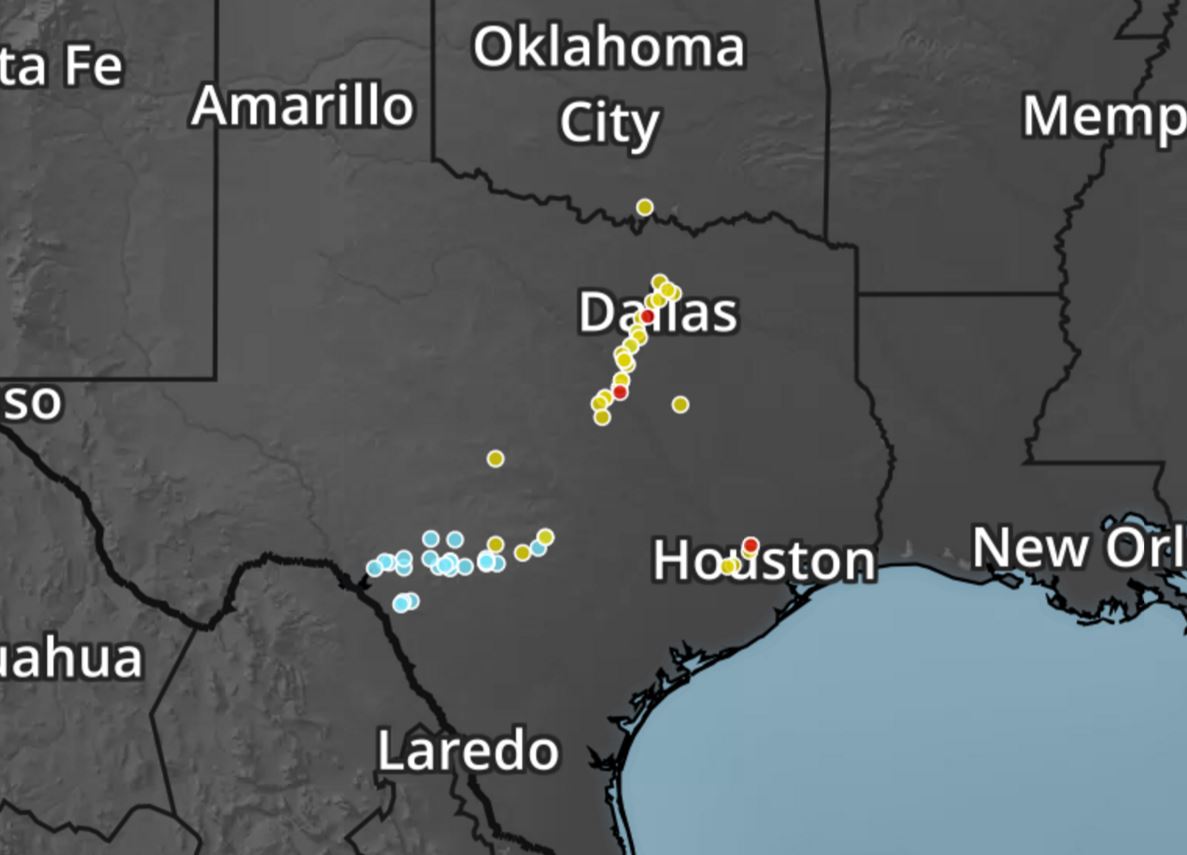
Southern Severe Storms
Strong to severe storms were reported across parts of Texas on Sunday and Monday, including a few tornadoes. The red dots near Dallas, Waco and Houston were confirmed tornado reports that caused some damage.
Simulate Radar
Heres' the simulated radar from Tuesday to AM Wednesday, which shows ongoing showers and storms across parts of the Southern U.S.. There may even be a few isolated strong to severe storms near the Coastal Bend of Texas on Tuesday afternoon with gusty winds and an isolated, brief tornado being the main threat
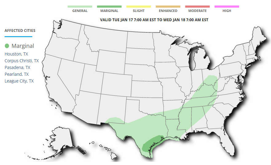
As the storm system slowly moves northeast through the Central U.S., strong to severe storms will also develop on the southern flank of this storm system. Below is the severe storm outlook for Tuesday. Note that there is a MARGINAL Risk of severe weather across the Coastal Bend of Texas, where gusty winds and an isolated tornado is possible.
_____________________________________________________________________________
Big Alaska Storm
Thanks to @NWSJuneau for sharing this satellite loop of the strong storm system impacting parts of southeast Alaska with strong winds, heavy rain and high elevation snowfall.
National Weather Outlook
Here's the national weather outlook through the middle part of the week, which shows the large storm system responsible for major icing the Central U.S. over the weekend finally moving out of the country by Wednesday. The trailing cold front will turn stationary across the Southern U.S. with lingering showers and storms and locally heavy rainfall. The next Pacific storm will move into the Western U.S. with widespread wintry weather and heavy rain along the coast.
Winter Weather Headlines
Winter weather headlines have been posted across parts of the Western U.S. in advance of another surge of Pacific moisture that will impact the region through midweek. Some locations will see sleet and ice, while other may see up to 12" of snow in the higher elevations.
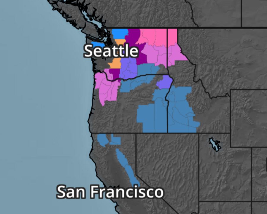
According to NOAA's PC, the 7 day precipitation forecast suggests widespread 2" to 4"+ rainfall amounts across the Southern U.S.. Also note the heavy moisture moving back into the West U.S., especially along the West Coast. Some 6" to 12"+ liquid tallies can't be ruled out from northern California to western Oregon and western Washington. There may even be some 2" to 4" tallies across parts of southern California through early next week.
 Snowfall Potential
The extended forecast calls for additional heavy moisture in the Western U.S. with heavy snow in the high elevations. Note that widespread heavy snow looks to fall from the Cascades to the Sierra Nevada Range to parts of the Rockies. The additional heavy snow in the Sierra Nevada Range is wonderful news for the upcoming water supply during the summer months for parts of California.
_________________________________________________________________________________
"Japan’s Biggest Coral Reef Devastated by Bleaching"
Almost three-quarters of Japan’s biggest coral reef has died, according to a report that blames its demise on rising sea temperatures caused by global warming. The Japanese environment ministry said that 70 percent of the Sekisei lagoon in Okinawa had been killed by a phenomenon known as bleaching. Bleaching occurs when unusually warm water causes coral to expel the algae living in their tissues, causing the coral to turn completely white. Unless water temperatures quickly return to normal, the coral eventually dies from lack of nutrition. The plight of the reef, located in Japan’s southernmost reaches, has become “extremely serious” in recent years, according to the ministry, whose survey of 35 locations in the lagoon last November and December found that 70.1% percent of the coral had died.
(The white tips on this coral are a reflection of "bleaching" and declining coral health.
Credit: Oregon State University/flickr)
Credit: Oregon State University/flickr)

____________________________________________________________________________
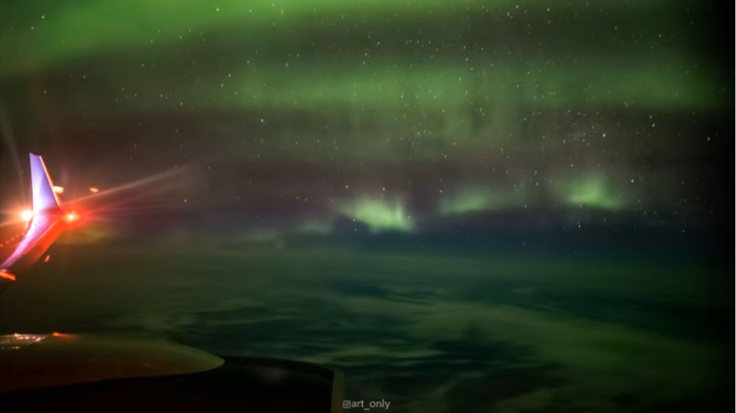
"Man Captures Northern Lights At 35,000 Feet After Finding Himself Sitting Alone On Flight"
With more and more of us flying on budget airlines, the idea of having space to spread out seems a little alien. Even extending your legs below the knee can prove troublesome. But now one man has shown the full potential of having a little more room to breathe, as he used an empty flight to set up his tripod and camera in the window seat and capture the Northern Lights.
_____________________________________________________________________________
Thanks for checking in and don't forget to follow me on Twitter @TNelsonWX

No comments:
Post a Comment