
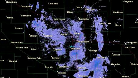
Time Warp. NWS Doppler radar at 9:36 am. Is it really April 20? As far as the atmosphere is concerned it's the first week of March. A wrinkle of cold air aloft will keep light snow in the forecast through midday, flurries taper this afternoon - we may get a peek at the setting sun by evening with a partly-springy Thursday on tap.

Partly-Redeemed. I went to bed last night wondering if MSP would pick up ANY snow. At last report Clear Lake and Plymouth both reported 3" of slushy snow, 2.4" at Sauk Rapids and 2" at St. Cloud. Some spots may pick up an additional 1/2" - no more than that through midday. Click here for more snowfall amounts, courtesy of the NWS.
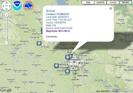
More Snow Reports. Click here to see an interactive Google map with the latest snow reports (and the ability to plot additional storm reports from around the USA). The NWS office in San Diego put this together - pretty slick.
No comments:
Post a Comment