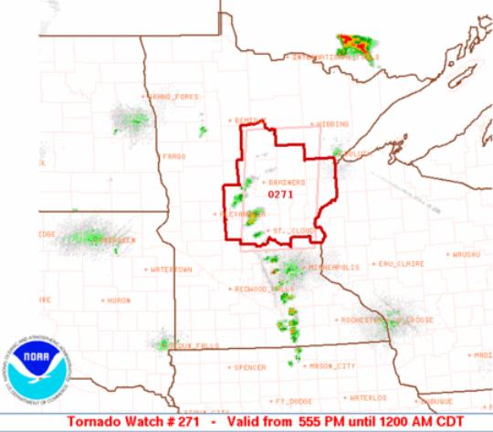
Tornado Watch Until Midnight. SPC has issued a tornado watch for a big chunk of central Minnesota until midnight. All the ingredients are present for a few "supercell" thunderstorms capable of large hail, even an isolated tornado or two. Wind shear, extreme instability, low-level moisture, and enough of a "trigger" to overcome the cap, an inversion layer of warm, dry air aloft. The bottom line: most of us will see a few generic thunderstorms this evening, but a few cells from St. Cloud to Brainerd to Grand Rapids and Taylor's Falls could go severe, with damaging hail and potentially damaging winds.
Tornado Watch. SPC has issued a watch box valid until midnight, it includes St. Cloud, Brainerd, the Mille Lacs area and Taylors Falls, as well as the far northern suburbs of the Twin Cities. MSP is close enough to the watch box that local metro residents should stay alert and be ready to move to a safe shelter if threatening weather approaches. More on the tornado watch
here.
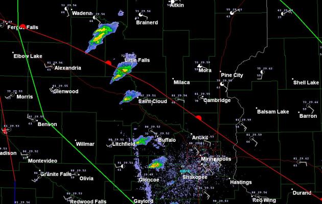
Starting To Pop. Doppler radar at 6:30 pm shows the first stages of a developing squall line, stretching from near Wadena to Little Falls to just west of St. Cloud into the western suburbs of the Twin Cities.
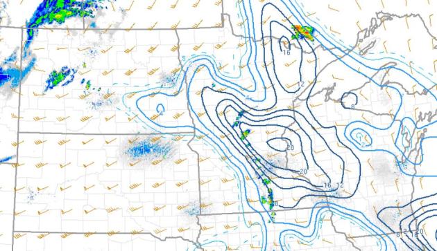
"Significant Tornado" Index. A tool from SPC, the greatest potential for isolated tornadoes this evening is forecast to be near St. Cloud and Little Falls.
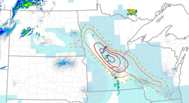
Supercell Index. Another factor we look at is the supercell composite, showing regions ripe for supercellular development. The 6 pm surface and upper air data shows a bullseye close to Taylors Falls, extending westward to Foley and St. Cloud.
No comments:
Post a Comment