Still Numb - Slow Warming Trend - Worst of Winter Behind Us?
-18 F. low Sunday morning in St. Cloud. -4 F. afternoon "high" yesterday. 21 F. average high on January 17. 36 F. high on January 17, 2015.
January 18, 1996:
A blizzard begins across the upper midwest. The Twin Cities Airport was
spared the heavy snow, but received nearly one inch of rain. Heavy ice
coating in the northwest metro area caused thousands of power outages.
Wind chills were as low as -88 (on the old windchill scale) at
Crookston. Snow totals were 18 inches at Ely and 12 inches at St. Cloud.
Mail delivery was stopped for the day in Duluth and I-94 was closed all
day from Rothsay and Moorhead. Flooding problems were caused in the
Twin Cities due to backed up water. January 18, 1994:
Governor Arne Carlson orders all Minnesota public schools closed due to
the extreme cold and severe winter weather. Morning readings were in
the 30-below-zero range. The biggest problem was from high winds that
came with the cold.
The Good News: Temperatures Can Only Go Up
I'm
having my annual (fleeting) "where the heck am I living?" moment. It
will pass, along with the core of the coldest air. Temperatures return
to "average" by midweek; approaching freezing next weekend.
We
shouldn't be too surprised or indignant about this latest cold sting.
The coldest weather of the year comes, on average, the third week of
January. Which is counter-intuitive. Why not on December 21, the Winter
Solstice? A higher sun angle doesn't compensate for long nights and
Canadian snow cover until today, when long-term averages begin to rise
again - for the first time since late July.
No, spring is not
right around the corner, but the odds of extended subzero streaks drop
off fairly rapidly during February. We'll see more cold frontal
passages, but odds are what we just muddled through was the coldest of
winter.
A snowy coating is possible Tuesday
night, but an El Nino-spiked pattern whisks the biggest, wettest storms
well south of Minnesota. The GFS model prints out 40s and rain (or ice)
as we sail into February.
Winter is about half over. At least on paper.
Morning Lows.
Air temperatures will be comparable early this morning, but wind chills
may not be quite as intense. Source: Twin Cities National Weather
Service.
Trending Milder.
After another numbing start air temperatures may brush 0F by
mid-afternoon, dipping below zero again tonight. We finally rise above
0F Tuesday morning, returning to "average" Tuesday; European guidance
hinting at 30F by Sunday. Not exactly a warm front but you may be
amazed how good 30F feels. A little snow is possible Tuesday night,
another chance late in the weekend. Source: WeatherSpark.
Probably a Nuisance Snowfall Tuesday PM.
The heaviest amounts will slide off south of Minnesota, according to
NOAA's NAM model, possibly an inch of fluff into the metro,
considerably more from Omaha to Des Moines. Animation: AerisWeather.
Ski Iowa.
NAM models vary on amounts, a few printing out as much as 6" of snow
west of Des Moines late Tuesday, maybe a couple inches south of the
Minnesota River.
Trending Milder.
Take a bow. Historically, the coldest weather of the winter is behind
us. In the coming weeks a higher sun angle will start to tug at the
mercury in your thermometer, compensating for long nights and lingering
snow, nudging average temperatures milder. GFS guidance shows a few
shots at freezing next week. Source: Aeris Enterprise.
Mild Start to February?
Temperatures should be averaging a few degrees above average the last
week of January; a storm sliding to our south at the very end of the
month capable of wet snow or a mix. Too early to tell. 500 mb winds
valid Sunday evening, January 31.
Did a Meteorological Tsunami Just Hit Southwest Florida? Marshall Shepherd takes a look at a fascinating and vaguely terrifying phenomenon at Forbes; here's an excerpt: "...As reported by NBC-2.com,
this particular squall line (with 80 mph wind) arrived at high tide and
raised water levels significantly. The National Weather Service
believes that this event was a meteotsunami because water levels
coincided with storms moving inland. The water levels were nearly 6 feet
higher than a normal high tide at over 7 feet. A meteotsunami is also
suspected because periodic “peaks and valleys” in the levels, indicative
of an oscillatory wave, were observed..."
Graphic credit: "Water levels at Naples, FL. January 17th, 2016." Courtesy of National Weather Service via www.nbc29.com Website.
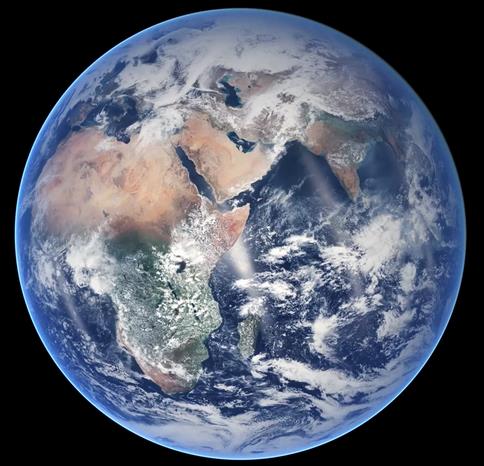
Jason-3 Reaches Orbit, Will Monitor Global Sea-Level Rise, Hurricane Intensity. Here's an excerpt from a press release from NOAA: "...While
flying in a low orbit, 830 miles above the Earth, Jason-3 will use a
radar altimeter instrument to monitor 95 percent of the world’s ice-free
oceans every 10 days. Since the Topex/Poseidon, and Jason satellite
missions started in 1992, researchers have observed global sea-level
rise occurring at a rate of 3 mm a year, resulting in a total change of
70 mm — or 2.8 inches — in 23 years..."
Upward Trend in Heaviest Downpours.
Basic physics: a warmer atmsophere holds more water vapor, loading the
dice in favor of more extreme rainfall events; here's more information
from WXshift: "Climate
scientists tell us that when April showers arrive, they may come with
heavier downpours as the planet warms. It’s not just April: more water
can evaporate into a warmer atmosphere at all times of the year, and
what goes up must eventually come down. (Thank you, Clausius-Clapeyron.)
The data in these graphics come from 207 airports across the
continental U.S. where records have been reliable and continuous since
at least 1950. And the data show very clearly that there’s been an
upward trend in rainfalls of 1”+, 2”+, and 3”+ nationwide with respect
to the average from 1950 to 2014..."
Brrr. It's Colder Here Than in Alaska. No kidding. But MSP is colder than Anchorage an average of 50 days a year? Here's some perspective in an excerpt of a WXshift article: "Whenever the mercury plummets to particularly bitter temps anywhere in the U.S., an oft-heard refrain is, “It’s colder here than it is in Alaska!”
But just how often is that actually the case, for, say New York City,
or Chicago, or Atlanta? The answer turns out to be more days than you
might think. A climatologist — who happens to be based in Alaska —
created a set of maps that shows how often cities in the lower 48 have
winter days with temperatures colder than those in Anchorage or
Fairbanks. Virtually all saw at least one day a winter with temps lower
than those in Anchorage, which given its more southerly and coastal
location than Fairbanks has a comparatively mild climate. Even parts of
Florida have between 1 and 5 days a winter that are colder than
Anchorage..."
Map credit: "The typical number of winter days with low temperatures below those in Anchorage, Alaska, across the U.S." Credit: Brian Brettschneider
AO Turns Positive Again.
By January 20-25 the Arctic Oscillation creeps back up into positive
territory, which means a more compact, less "wandering" polar vortex,
with the coldest polar air staying well north of Minnesota. Could there
be another relapse in February? Possibly - but odds are it wouldn't be
as cold as this one, coming during what is historically the coldest week
of the year in Minnesota. Source: NOAA CPC.
Methane Gas Crisis: How California's Porter Ranch Became a Ghost Town.
It's really a remarkable story; an invisible, slow-motion disaster that
(some) are comparing to the BP oil spill in the Gulf of Mexico a few
years ago. Here's an excerpt of an excellent and unsettling update at Newsweek: "...Methane,
or CH4, traps about 85 times more heat radiation than carbon dioxide,
when effects of the two are compared over a 20-year span, making it a
much more potent contributor to climate change; according to the Environmental Defense Fund,
the Porter Ranch methane leak was equal in mid-December to emissions of
six coal-burning plants or 7 million new cars on the road. Despite its
green image, California is second only to Texas in its contribution to
the United States’ carbon footprint, and the Porter Ranch leak is
believed to be adding 25 percent to the state’s daily methane output...
Photo credit above: "Signage
directs prospective buyers to new housing developments under
construction in the Porter Ranch neighborhood, January 3. Methane gas
leaks from the SoCalGas Aliso Canyon Storage Facility well SS-25 in
Porter Ranch have forced many residents to abandon their homes. SoCalGas
is currently drilling a relief well that is expected to take months to
complete and plug the leak." Patrick T. Fallon for Newsweek.
An Oligarchy Has Broken our Democracy. It Must Be Dislodged. Have things really gotten this bad? Here's an excerpt of an Op-Ed at The Guardian: "....I
define the American Deep State as a hybrid association of elements of
government and top-level finance and industry that is able, through
campaign financing of elected officials, influence networks and
co-option via the promise of lucrative post-government careers, to
govern the United States in spite of elections and without reference to
the consent of the governed. These operatives use their proximity to
power and ability to offer high-paying jobs to government officials to
achieve outcomes foreclosed to ordinary citizens..."
Image credit above: "The calculus of the Deep State has been upset by Donald Trump and Bernie Sanders." Photograph: Jim Bourg/Reuters.
How Real is Reality? This NPR story gave me a headache, now I'm just passing it along. Here's an excerpt: "Each
day when you wake up, the world is, for the most part, unchanged from
the day before. The sun rises again in the east. Your underwear falls if
you drop it. The water in the sink spirals down the drain like always.
Just as important, your mattress won't turn into a sports car and you
can't jump into the air and fly like Superman. Reality, in other words,
seems pretty stubborn, pretty fixed — and pretty much independent of
whatever is going on in your head. But is it? Is it really all those
things?..."
TODAY: Wind Chill Advisory. Sunny, feels like -30F. Winds: NW 7-12. High: near 0
MONDAY NIGHT: Mostly clear, still too cold. Low: -11
TUESDAY: Sunny start, snowy coating late? High: 8
WEDNESDAY: Mostly cloudy, average temps. Wake-up: 7. High: 23
THURSDAY: Partly sunny, not bad. Wake-up: 17. High: 22
FRIDAY: Sunny skies, almost pleasant. Winds: NE 3-8. Wake-up: 11. High: 21
SATURDAY: Dim sun, breezy and milder. Winds: S 10-15. Wake-up: 12. High: 29
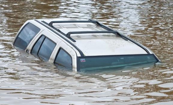
In Evangelical Country, an Apocalypse of Rising Seas. InsideClimate News has a fascinating article at ground zero of rising seas, a close #2 after Miami Beach - here's an excerpt: "...Conservative
estimates predict a further rise of 1½ to 3 feet in the next century,
accelerated by climate change. Those estimates are used by many local
city planners. Even a 1½-foot rise would reshape floodplains and
threaten neighborhoods. But those estimates are probably too low. “We
tend to think that higher scenarios—three feet or more—are likely,” said
Larry Atkinson, who directs the Climate Change and Sea Level Rise
Initiative at Old Dominion University in Norfolk. The Navy has prepared
reports that analyze the effects of local sea level rise of up to
6½ feet. It is possible that the change will be even greater in the 22nd
century..."
They Live at Ground Zero, but Jeb Bush and Marco Rubio Say Climate Change is a Distant Threat. Here's the intro to a Miami Herald story: "Not 15 miles from the homes of Marco Rubio and Jeb Bush on the mainland, Miami Beach work crews elevate the streets,
turning ground floors effectively into windowed basements, to try to
stave off the implacable rise of sea water. Up comes the powerful ocean,
threatening people, property and the underground freshwater supply.
Can’t control nature, Rubio quips with a smile. Got bigger problems,
Bush insists with exasperation. “I don’t have a plan to influence the
weather,” Rubio said dismissively at a town-hall style meeting in New
Hampshire last month..."
Photo credit above: "Oakley and Casey Jones, tourists from Idaho Falls, navigate the flooded streets of Miami Beach during a king tide in September." EMILY MICHOTMIAMI HERALD STAFF. Why Climate Change is a Moral Concern for the Religious Community. An Op-Ed at NJ.com resonated; here's a clip: "...This
is to say that our current commitments to reduce carbon emissions fall
short, and we continue to accelerate our consumption of natural
resources. God calls his people to be stewards of all natural creation.
Therefore, we must protect the Earth in any way we can and push towards a
more sustainable future. As humans, we are deeply interconnected and
dependent on the Earth. Climate change is not an isolated phenomenon and
is more than rising sea levels or droughts. Climate change has social,
health, urban, and agricultural implications. Thus, it is crucial for
everyone to play a part in tackling this for the well-being of others
and of the world..."
Read more here: http://www.miamiherald.com/news/politics-government/elections-2016/article54945660.html#storylink=cpy
Read more here: http://www.miamiherald.com/news/politics-government/elections-2016/article54945660.html#storylink=cpy
Read more here: http://www.miamiherald.com/news/politics-government/elections-2016/article54945660.html#storylink=cpy
The Next Threat from Climate Change?Mosquito-Borne "Zika". Here's the intro to an Op-Ed at The Salt Lake Tribune: "A
hotter, more humid world is already becoming a world of more serious
virulent infectious diseases. West Nile, dengue fever, chagas, Lyme
disease, yellow fever, chikungunya, Rocky Mountain Spotted Fever, Rift
Valley fever, Japanese encephalitis and malaria are just a few of the
many infectious diseases spreading far beyond their previous geographic
confines. Global temperatures aren't the only things that broke records
in 2015. The number of victims of dengue fever in Brazil reached 1.58
million, an all time high, 20 times more than in 1990. Heat,
precipitation and humidity augment the life cycle, reproduction and even
biting activity of mosquitoes and other insects that carry these
diseases..."
Mother Nature's Invisible Hand Strikes Back Against the Carbon Economy. Truthout has the story; here's the intro: "Is the hydrocarbon economy too big to fail? If the woefully inadequate outcome of the Paris climate conference is any indication, the answer is still a resounding "Yes!" That's because the overly optimistic agreement
conspicuously ignored the core issue driving up the earth's temperature
and warping the world's already misshaped markets. The problem is Big
Oil. Simply put, Big Oil is a bad investment fueled by irrational
exuberance, chronic cronyism and an increasingly indefensible
misallocation of capital..."
Image credit above: Lauren Walker/Truthout.
Yes, Arctic Ice Is Still in Decline. Hot Whopper takes a look at some of the gibberish invading the interweb.
Farmers Hold the Key to Climate Change Action in the United States. Turns
out many of the farming practices that encourage resilience to drought
and flood may also help to soak up excess CO2. Here's an excerpt of an
interesting interview at Grist: "...But
you do see more people in agriculture talking about it in different
ways. Greg Page, chairman of Cargill, is talking about the business
imperative of making some changes [see Grist’s story on Cargill and General Mills]. Just the other day Monsanto announced
that it was pushing on its supply chain to create a carbon-neutral
environment for the company. You have the retailers and food companies
demanding changes in the carbon footprint as well, demanding changes in
fertilizer practices. During cap and trade, Monsanto and all these major
ag companies largely stayed back. They had statements on their websites
about their concerns about climate change, but they were not
politically engaged. Now here they are out there making public
commitments. Hopefully, long-term, we’ll see these industry demands
leading to some shift in the politics..." (Image credit: Shutterstock).
Influence of Climate Change on Record U.K. December Rains. El Nino was a factor, but it may have been dwarfed by a warmer, wetter climate. Here's an excerpt from climateprediction.net: "Applying
three independent methodologies of extreme event attribution, we show
that temperatures and precipitation in the UK in December 2015 were
extremely unlikely even in a warming world with observed SST patterns,
including El Niño, as an additional driver. This indicates that random
weather noise played a very large role in December’s weather. At the
same time, the event was much less likely in the representations of a
climate without human influence, showing that climate change greatly
affected the odds of such a month occurring. The observed temperature
anomaly is so far outside the expected distribution that the odds are
difficult to determine. We find that anthropogenic climate change
approximately doubled the occurrence probability of the event for lower
return times..."


No comments:
Post a Comment